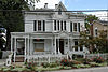
[3] Name on the Register [4] Image Date listed [5] Location City or town Description 1 Administration Building, Lake Erie College Administration Building, Lake Erie College March 20, 1973 (# 73001486 391 W. Washington St. 41°43′03″N 81°15′06″W / 41.7175°N 81.2517°W / 41.7175; -81.2517 (Administration Building, Lake Erie College ) Painesville 2 Julia F. Boyce Country Estate Julia F. Boyce Country Estate July 24, 2023 (# 100009151 37813-19 Euclid Ave. 41°38′02″N 81°24′40″W / 41.6338°N 81.4110°W / 41.6338; -81.4110 (Julia F. Boyce Country Estate ) Willoughby 3 Brick Vernacular House No. 1 Brick Vernacular House No. 1 October 20, 1980 (# 80003108 98 Lake St. 41°46′24″N 81°02′50″W / 41.7733°N 81.0472°W / 41.7733; -81.0472 (Brick Vernacular House No. 1 ) Madison 4 Brick Vernacular House No. 2 Brick Vernacular House No. 2 October 20, 1980 (# 80003109 120 N. Lake St. 41°46′26″N 81°02′50″W / 41.7739°N 81.0472°W / 41.7739; -81.0472 (Brick Vernacular House No. 2 ) Madison 5 Casement House Casement House July 30, 1975 (# 75001454 436 Casement Ave. 41°44′11″N 81°13′39″W / 41.7364°N 81.2275°W / 41.7364; -81.2275 (Casement House ) Painesville Township 6 Cheese-vat Factory Cheese-vat Factory October 20, 1980 (# 80003110 16 Eagle St. 41°46′18″N 81°03′05″W / 41.7717°N 81.0514°W / 41.7717; -81.0514 (Cheese-vat Factory ) Madison 7 Alpha Charles Childs House Alpha Charles Childs House October 20, 1980 (# 80003111 319 W. Main St. 41°46′14″N 81°03′17″W / 41.7706°N 81.0547°W / 41.7706; -81.0547 (Alpha Charles Childs House ) Madison 8 Robertus W. Childs House Robertus W. Childs House October 20, 1980 (# 80003112 307 W. Main St. 41°46′14″N 81°03′16″W / 41.7706°N 81.0544°W / 41.7706; -81.0544 (Robertus W. Childs House ) Madison 9 Connecticut Land Company Office Connecticut Land Company Office August 14, 1973 (# 73001491 7877 E. Main St. in Unionville 41°46′48″N 81°00′18″W / 41.7801°N 81.0049°W / 41.7801; -81.0049 (Connecticut Land Company Office ) Madison Township 10 Corning-White House Corning-White House November 7, 1972 (# 72001027 8353 Mentor Ave. 41°39′58″N 81°20′31″W / 41.6661°N 81.3419°W / 41.6661; -81.3419 (Corning-White House ) Mentor 11 Harry Coulby Mansion Harry Coulby Mansion August 24, 1979 (# 79001875 28730 Ridge Rd. 41°35′43″N 81°28′41″W / 41.5953°N 81.4781°W / 41.5953; -81.4781 (Harry Coulby Mansion ) Wickliffe Named for Harry Coulby 12 George Damon House George Damon House October 20, 1980 (# 80003113 841 W. Main St. 41°46′08″N 81°03′54″W / 41.7689°N 81.065°W / 41.7689; -81.065 (George Damon House ) Madison 13 James Dayton House James Dayton House October 20, 1980 (# 80003114 939 W. Main St. 41°46′08″N 81°03′15″W / 41.7689°N 81.0542°W / 41.7689; -81.0542 (James Dayton House ) Madison 14 James Dayton House II James Dayton House II October 20, 1980 (# 80003115 417 W. Main St. 41°46′12″N 81°03′24″W / 41.77°N 81.0567°W / 41.77; -81.0567 (James Dayton House II ) Madison 15 Albert DeHeck House Albert DeHeck House October 20, 1980 (# 80003116 431 W. Main St. 41°46′12″N 81°03′26″W / 41.77°N 81.0572°W / 41.77; -81.0572 (Albert DeHeck House ) Madison 16 Downtown Painesville Historic District Downtown Painesville Historic District June 29, 2020 (# 100005323 Veterans Park, 22 Liberty St., 7 Richmond St., 7-71 North Park Pl., 30-100 South Park Pl., 15-34 South Saint Clair St., 105-270 Main St., excluding 177 Main St., 8-124 North State St., 1-83 South State St., excluding 54 South State St., 41°43′30″N 81°14′37″W / 41.7250°N 81.2435°W / 41.7250; -81.2435 (Downtown Painesville Historic District ) Painesville 17 Downtown Willoughby Historic District Downtown Willoughby Historic District November 29, 1995 (# 95001362 Approximately nine blocks centered around the junction of Erie and River Sts. and Euclid Ave. 41°38′21″N 81°24′25″W / 41.639167°N 81.406944°W / 41.639167; -81.406944 (Downtown Willoughby Historic District ) Willoughby 18 Fairport Harbor West Breakwater Light Fairport Harbor West Breakwater Light April 10, 1992 (# 92000242 Western breakwater pierhead at harbor entrance, northeast of Fairport Harbor 41°46′02″N 81°16′53″W / 41.767222°N 81.281389°W / 41.767222; -81.281389 (Fairport Harbor West Breakwater Light ) Painesville Township 19 Fairport Marine Museum Fairport Marine Museum November 5, 1971 (# 71000642 129 2nd St. 41°45′25″N 81°16′39″W / 41.756944°N 81.2775°W / 41.756944; -81.2775 (Fairport Marine Museum ) Fairport Harbor 20 Claud Foster House Claud Foster House June 16, 2004 (# 04000611 30333 Lakeshore Boulevard 41°38′21″N 81°28′37″W / 41.639167°N 81.476944°W / 41.639167; -81.476944 (Claud Foster House ) Willowick 21 Frances Ensign Fuller House Frances Ensign Fuller House October 20, 1980 (# 80003117 790 W. Main St. 41°46′11″N 81°03′57″W / 41.769722°N 81.065833°W / 41.769722; -81.065833 (Frances Ensign Fuller House ) Madison 22 Garfield Library Garfield Library February 23, 1979 (# 79001872 7300 Center St. 41°40′19″N 81°20′25″W / 41.671944°N 81.340278°W / 41.671944; -81.340278 (Garfield Library ) Mentor 23 Jane Gilbert House Jane Gilbert House October 20, 1980 (# 80003118 189-195 W. Main St. 41°46′15″N 81°03′06″W / 41.770833°N 81.051667°W / 41.770833; -81.051667 (Jane Gilbert House ) Madison 24 H. Gill House H. Gill House October 20, 1980 (# 80003119 232 River St. 41°46′01″N 81°02′58″W / 41.766944°N 81.049444°W / 41.766944; -81.049444 (H. Gill House ) Madison 25 Norma Grantham Site (33-La-139) Norma Grantham Site (33-La-139) May 31, 1984 (# 84003757 600 metres (2,000 ft) south of the Fairport Harbor Village Site, [6] along East Street about 0.75 miles (1.21 km) south of Lake Erie [7] 41°44′27″N 81°16′08″W / 41.740833°N 81.268889°W / 41.740833; -81.268889 (Norma Grantham Site (33-La-139) ) Fairport Harbor 26 Gray-Coulton House Gray-Coulton House December 3, 1975 (# 75001452 8607-8617 Mentor Ave. 41°40′11″N 81°19′56″W / 41.669722°N 81.332222°W / 41.669722; -81.332222 (Gray-Coulton House ) Mentor 27 Lucius Green House Lucius Green House July 12, 1976 (# 76001462 4160 Main St. 41°45′31″N 81°08′21″W / 41.758611°N 81.139167°W / 41.758611; -81.139167 (Lucius Green House ) Perry 28 Leonard C. Hanna, Jr., Estate Leonard C. Hanna, Jr., Estate March 12, 1979 (# 79001870 Little Mountain Rd. 41°38′25″N 81°19′02″W / 41.640278°N 81.317222°W / 41.640278; -81.317222 (Leonard C. Hanna, Jr., Estate ) Kirtland Hills 29 Francis Hendry House Francis Hendry House October 20, 1980 (# 80003120 239-243 W. Main St. 41°46′15″N 81°03′10″W / 41.770833°N 81.052778°W / 41.770833; -81.052778 (Francis Hendry House ) Madison 30 Indian Point Fort Indian Point Fort July 30, 1974 (# 74001543 East of Painesville 41°43′13″N 81°10′17″W / 41.720278°N 81.171389°W / 41.720278; -81.171389 (Indian Point Fort ) LeRoy Township 31 Cyrus J. Ingersoll House Cyrus J. Ingersoll House October 20, 1980 (# 80003121 249 W. Main St. 41°46′14″N 81°03′11″W / 41.770556°N 81.053056°W / 41.770556; -81.053056 (Cyrus J. Ingersoll House ) Madison 32 John J. Jones House John J. Jones House October 20, 1980 (# 80003122 298 Lake St. 41°46′37″N 81°02′50″W / 41.776944°N 81.047222°W / 41.776944; -81.047222 (John J. Jones House ) Madison 33 John Kellogg House and Barn John Kellogg House and Barn October 20, 1980 (# 80003123 30 E. Main St. 41°46′14″N 81°02′46″W / 41.770433°N 81.046111°W / 41.770433; -81.046111 (John Kellogg House and Barn ) Madison 34 Addison Kimball House Addison Kimball House March 27, 1975 (# 75001449 390 W. Main St. 41°46′15″N 81°03′23″W / 41.770833°N 81.056389°W / 41.770833; -81.056389 (Addison Kimball House ) Madison 35 Lemuel Kimball, II, House Lemuel Kimball, II, House October 15, 1974 (# 74001540 467 W. Main St. 41°46′12″N 81°03′29″W / 41.77°N 81.058056°W / 41.77; -81.058056 (Lemuel Kimball, II, House ) Madison 36 Solomon Kimball House Solomon Kimball House October 20, 1980 (# 80003124 391 W. Main St. 41°46′13″N 81°03′23″W / 41.770278°N 81.056389°W / 41.770278; -81.056389 (Solomon Kimball House ) Madison 37 Kirtland Temple Kirtland Temple June 4, 1969 (# 69000145 9020 Chillicothe Rd. 41°37′31″N 81°21′44″W / 41.625278°N 81.362222°W / 41.625278; -81.362222 (Kirtland Temple ) Kirtland 38 Ladd's Tavern Ladd's Tavern May 22, 1978 (# 78002091 5466 S. Ridge Rd. 41°45′46″N 81°05′36″W / 41.762778°N 81.093333°W / 41.762778; -81.093333 (Ladd's Tavern ) Madison Township 39 Lake Shore and Michigan Southern RR Depot and Freight House Lake Shore and Michigan Southern RR Depot and Freight House January 31, 1978 (# 78002092 8445 Station St. 41°40′44″N 81°20′18″W / 41.678889°N 81.338333°W / 41.678889; -81.338333 (Lake Shore and Michigan Southern RR Depot and Freight House ) Mentor 40 Lawnfield-James A. Garfield Estate Lawnfield-James A. Garfield Estate October 15, 1966 (# 66000613 8095 Mentor Ave. 41°39′44″N 81°20′50″W / 41.662222°N 81.347222°W / 41.662222; -81.347222 (Lawnfield-James A. Garfield Estate ) Mentor Also designated a National Historic Landmark 41 Lutz's Tavern Lutz's Tavern April 23, 1973 (# 73001487 792 Mentor Ave. 41°42′47″N 81°15′37″W / 41.713056°N 81.260278°W / 41.713056; -81.260278 (Lutz's Tavern ) Painesville 42 William Lyman House William Lyman House October 20, 1980 (# 80003125 734 W. Main St. 41°46′11″N 81°03′50″W / 41.769722°N 81.063889°W / 41.769722; -81.063889 (William Lyman House ) Madison 43 Madison Fort Madison Fort July 30, 1974 (# 74001541 On a ridge between the Grand River and Mill Creek, southeast of Madison [8] 41°44′42″N 81°01′20″W / 41.745000°N 81.022222°W / 41.745000; -81.022222 (Madison Fort ) Madison Township 44 Madison Seminary and Home Madison Seminary and Home February 22, 1979 (# 79001871 North of central Madison at 6769 Middle Ridge Rd. 41°47′25″N 81°02′45″W / 41.790278°N 81.045833°W / 41.790278; -81.045833 (Madison Seminary and Home ) Madison 45 James Mason House James Mason House September 18, 1975 (# 75001453 8125 Mentor Ave. 41°39′52″N 81°20′57″W / 41.664444°N 81.349167°W / 41.664444; -81.349167 (James Mason House ) Mentor 46 Mathews House Mathews House April 23, 1973 (# 73001488 309 W. Washington St. 41°43′09″N 81°14′59″W / 41.719167°N 81.249722°W / 41.719167; -81.249722 (Mathews House ) Painesville 47 Mentor Avenue District Mentor Avenue District August 3, 1978 (# 78002093 Wood St. and Mentor Ave. from Liberty to Washington St. 41°43′17″N 81°14′56″W / 41.721389°N 81.248889°W / 41.721389; -81.248889 (Mentor Avenue District ) Painesville 48 Mentor Village Hall Mentor Village Hall September 10, 2014 (# 14000591 8383 Mentor Ave. 41°40′00″N 81°20′26″W / 41.666667°N 81.340694°W / 41.666667; -81.340694 (Mentor Village Hall ) Mentor Renovated 2015– 2017 [9] 49 Mentor Village School Mentor Village School February 9, 2005 (# 05000026 7482 Center St. 41°40′01″N 81°20′26″W / 41.666944°N 81.340556°W / 41.666944; -81.340556 (Mentor Village School ) Mentor 50 Rev. Harlan Metcalf House Rev. Harlan Metcalf House October 20, 1980 (# 80003126 275 W. Main St. 41°46′14″N 81°03′14″W / 41.770556°N 81.053889°W / 41.770556; -81.053889 (Rev. Harlan Metcalf House ) Madison 51 Methodist Episcopal Church of Painesville Methodist Episcopal Church of Painesville January 30, 1998 (# 98000043 71 N. Park Place 41°43′31″N 81°14′40″W / 41.725278°N 81.244444°W / 41.725278; -81.244444 (Methodist Episcopal Church of Painesville ) Painesville 52 Edward W. and Louise C. Moore Estate Edward W. and Louise C. Moore Estate March 10, 1988 (# 88000209 7960 Garfield Rd. 41°38′19″N 81°21′24″W / 41.638611°N 81.356667°W / 41.638611; -81.356667 (Edward W. and Louise C. Moore Estate ) Kirtland 53 Lewis Morley House Lewis Morley House March 30, 1978 (# 78002094 231 N. State St. 41°43′47″N 81°14′40″W / 41.729722°N 81.244444°W / 41.729722; -81.244444 (Lewis Morley House ) Painesville 54 Norfolk and Western Freight Station Norfolk and Western Freight Station October 20, 1980 (# 80003127 Lake St. 41°46′29″N 81°02′48″W / 41.774722°N 81.046667°W / 41.774722; -81.046667 (Norfolk and Western Freight Station ) Madison 55 Old South Church Old South Church September 20, 1973 (# 73001485 9802 Chillicothe Rd. 41°36′16″N 81°21′01″W / 41.604444°N 81.350278°W / 41.604444; -81.350278 (Old South Church ) Kirtland 56 John G. Oliver House John G. Oliver House October 1, 1981 (# 81000444 7645 Little Mountain Rd. 41°39′40″N 81°19′30″W / 41.661111°N 81.325°W / 41.661111; -81.325 (John G. Oliver House ) Mentor 57 David R. Paige House David R. Paige House December 23, 1975 (# 75001450 21-29 W. Main St. 41°46′16″N 81°02′53″W / 41.771111°N 81.048056°W / 41.771111; -81.048056 (David R. Paige House ) Madison 58 Painesville City Hall Painesville City Hall July 24, 1972 (# 72001028 7 Richmond St. 41°43′27″N 81°14′45″W / 41.724167°N 81.245833°W / 41.724167; -81.245833 (Painesville City Hall ) Painesville 59 George Pease House George Pease House October 20, 1980 (# 80003128 553 W. Main St. 41°46′11″N 81°03′34″W / 41.769722°N 81.059444°W / 41.769722; -81.059444 (George Pease House ) Madison 60 Louis A. Penfield House Louis A. Penfield House February 7, 1997 (# 96001622 2203 River Rd. 41°37′09″N 81°24′31″W / 41.619167°N 81.408611°W / 41.619167; -81.408611 (Louis A. Penfield House ) Willoughby Hills 61 St. James Episcopal Church St. James Episcopal Church July 7, 1975 (# 75001455 141 N. State St. 41°43′41″N 81°14′36″W / 41.728056°N 81.243333°W / 41.728056; -81.243333 (St. James Episcopal Church ) Painesville 62 Sawyer-Wayside House Sawyer-Wayside House October 29, 1974 (# 74001542 9470 Mentor Ave. 41°40′50″N 81°18′01″W / 41.680556°N 81.300278°W / 41.680556; -81.300278 (Sawyer-Wayside House ) Mentor Demolished April 2021 [10] 63 Uri Seeley House Uri Seeley House August 14, 1973 (# 73001489 969 Riverside Dr. 41°42′54″N 81°12′30″W / 41.715°N 81.208333°W / 41.715; -81.208333 (Uri Seeley House ) Painesville Township 64 Orland Selby House Orland Selby House October 20, 1980 (# 80003129 564 E. Main St. 41°46′27″N 81°02′05″W / 41.774167°N 81.034722°W / 41.774167; -81.034722 (Orland Selby House ) Madison 65 Sessions House Sessions House August 14, 1973 (# 73001490 157 Mentor Ave. 41°42′45″N 81°14′55″W / 41.7125°N 81.248611°W / 41.7125; -81.248611 (Sessions House ) Painesville 66 Smart Building Smart Building September 29, 1983 (# 83001989 4143-4145 Erie St. 41°38′22″N 81°24′24″W / 41.639444°N 81.406667°W / 41.639444; -81.406667 (Smart Building ) Willoughby 67 Smead House Smead House November 21, 1974 (# 74001544 187 Mentor Ave. 41°43′15″N 81°15′01″W / 41.720833°N 81.250278°W / 41.720833; -81.250278 (Smead House ) Painesville 68 David Smead House David Smead House October 20, 1980 (# 80003130 269 E. Main St. 41°46′24″N 81°02′28″W / 41.773333°N 81.041111°W / 41.773333; -81.041111 (David Smead House ) Madison 69 South Leroy Meetinghouse South Leroy Meetinghouse May 8, 1979 (# 79001873 Southeast of Painesville at State Route 86 and Brakeman Rd. 41°39′51″N 81°08′48″W / 41.664028°N 81.146667°W / 41.664028; -81.146667 (South Leroy Meetinghouse ) LeRoy Township 70 Mr. and Mrs. Karl A. Staley House Mr. and Mrs. Karl A. Staley House March 4, 2014 (# 14000042 6363 Lake Rd., W., north of Madison 41°49′53″N 81°03′40″W / 41.831250°N 81.061111°W / 41.831250; -81.061111 (Mr. and Mrs. Karl A. Staley House ) Madison Township 71 Joseph Talcott House Joseph Talcott House October 20, 1980 (# 80003131 354 River St. 41°45′55″N 81°02′55″W / 41.765278°N 81.048611°W / 41.765278; -81.048611 (Joseph Talcott House ) Madison 72 Judge Abraham Tappan House Judge Abraham Tappan House May 8, 1979 (# 79001874 7855 S. Ridge Rd. in Unionville 41°46′48″N 81°00′15″W / 41.78°N 81.004167°W / 41.78; -81.004167 (Judge Abraham Tappan House ) Madison Township 73 Town Center District Town Center District October 20, 1980 (# 80004247 Main St. between River and Lake Sts. 41°46′16″N 81°02′56″W / 41.771111°N 81.048889°W / 41.771111; -81.048889 (Town Center District ) Madison 74 Unionville District School Unionville District School December 29, 1978 (# 78002095 3480 West St. in Unionville 41°46′45″N 81°00′24″W / 41.779028°N 81.006667°W / 41.779028; -81.006667 (Unionville District School ) Madison Township 75 Unionville Tavern Unionville Tavern July 26, 1973 (# 73001492 On State Route 84 in Unionville 41°46′49″N 81°00′11″W / 41.780278°N 81.003056°W / 41.780278; -81.003056 (Unionville Tavern ) Madison Township 76 Edwin L. Ware House Edwin L. Ware House October 20, 1980 (# 80003132 293 W. Main St. 41°46′14″N 81°03′15″W / 41.770556°N 81.054167°W / 41.770556; -81.054167 (Edwin L. Ware House ) Madison 77 Newel K. Whitney Store Newel K. Whitney Store August 30, 1984 (# 84003759 8881 Chillicothe Rd. 41°37′46″N 81°21′42″W / 41.629444°N 81.361667°W / 41.629444; -81.361667 (Newel K. Whitney Store ) Kirtland 78 George D. Wilson House George D. Wilson House October 20, 1980 (# 80003133 367 River St. 41°45′54″N 81°02′53″W / 41.765°N 81.048056°W / 41.765; -81.048056 (George D. Wilson House ) Madison 79 Dr. J. C. Winans House Dr. J. C. Winans House April 26, 1976 (# 76001461 143 River St. 41°46′07″N 81°02′58″W / 41.768611°N 81.049444°W / 41.768611; -81.049444 (Dr. J. C. Winans House ) Madison 80 John and Carrie Yager House John and Carrie Yager House March 17, 1994 (# 94000240 7612 S. Center St. 41°39′51″N 81°20′25″W / 41.664167°N 81.340278°W / 41.664167; -81.340278 (John and Carrie Yager House ) Mentor 81 Benjamin and Mary Young House Benjamin and Mary Young House August 8, 1996 (# 96000867 7597 S. Center St. 41°39′52″N 81°20′24″W / 41.664444°N 81.34°W / 41.664444; -81.34 (Benjamin and Mary Young House ) Mentor