National Register of Historic Places listings in Lancaster County, South Carolina

Last updated

Location of Lancaster County in South Carolina Map of South Carolina highlighting Lancaster County.svg
Location of Lancaster County in South Carolina

This is a list of the National Register of Historic Places listings in Lancaster County, South Carolina.

Contents

This is intended to be a complete list of the properties and districts on the National Register of Historic Places in Lancaster County, South Carolina, United States. The locations of National Register properties and districts for which the latitude and longitude coordinates are included below, may be seen in a map. [1]

There are 28 properties and districts listed on the National Register in the county, including 2 National Historic Landmarks. Another 2 properties were once listed but have been removed.


    This National Park Service list is complete through NPS recent listings posted February 3, 2023. [2]

Map all coordinates using: OpenStreetMap  
Download coordinates as: KML

Current listings

[3] Name on the Register [4] ImageDate listed [5] Location City or townDescription
1 Robert Barnwell Allison House
Robert Barnwell Allison House Robert Barnwell Allison Site.jpg
Robert Barnwell Allison House
January 4, 1990
(#89002148)
404 Chesterfield Ave.
34°43′02″N80°45′43″W / 34.717222°N 80.761944°W / 34.717222; -80.761944 (Robert Barnwell Allison House)
Lancaster
2 Battle of Hanging Rock Historic Site December 31, 1974
(#74001860)
About 3.5 miles south of Heath Springs off U.S. Route 521
34°33′31″N80°39′54″W / 34.558611°N 80.665°W / 34.558611; -80.665 (Battle of Hanging Rock Historic Site)
Heath Springs
3 Buford's Massacre Site
Buford's Massacre Site Waxhaw Massacre Monument.jpg
Buford's Massacre Site
February 15, 1990
(#90000091)
South Carolina Highway 522, 0.25 miles south of South Carolina Highway 9
34°44′26″N80°37′35″W / 34.740556°N 80.626389°W / 34.740556; -80.626389 (Buford's Massacre Site)
Tradesville
4 Dr. William Columbus Cauthen House
Dr. William Columbus Cauthen House William Columbus Cauthen House.jpg
Dr. William Columbus Cauthen House
June 28, 1982
(#82003872)
South Carolina Highway 75
34°33′19″N80°38′30″W / 34.555278°N 80.641667°W / 34.555278; -80.641667 (Dr. William Columbus Cauthen House)
Kershaw
5 Clinton AME Zion Church
Clinton AME Zion Church Clinton AME Zion Church.jpg
Clinton AME Zion Church
February 16, 1990
(#90000092)
Johnson and Church Sts.
34°32′57″N80°35′14″W / 34.549167°N 80.587222°W / 34.549167; -80.587222 (Clinton AME Zion Church)
Kershaw
6 Craig House
Craig House Craig House.jpg
Craig House
February 16, 1990
(#90000093)
South Carolina Highway 185/Craig Dr.
34°45′28″N80°46′01″W / 34.757778°N 80.766944°W / 34.757778; -80.766944 (Craig House)
Lancaster
7 Cureton House
Cureton House Cureton House.jpg
Cureton House
September 4, 1990
(#90000094)
County Road 29, south of County Road 39
34°48′29″N80°51′02″W / 34.808056°N 80.850556°W / 34.808056; -80.850556 (Cureton House)
Lancaster
8 Ellen Dean Hotel June 13, 2022
(#100007778)
113-141 North White St.
34°43′16″N80°46′12″W / 34.7210°N 80.7699°W / 34.7210; -80.7699 (Ellen Dean Hotel)
Lancaster
9 East Richland Street-East Church Street Historic District
East Richland Street-East Church Street Historic District East Richland Street.jpg
East Richland Street-East Church Street Historic District
January 4, 1990
(#89002142)
Roughly bounded by E. Church St., Ingram St., E. Richland St., and Hart St.
34°33′03″N80°34′47″W / 34.550833°N 80.579722°W / 34.550833; -80.579722 (East Richland Street-East Church Street Historic District)
Kershaw
10 Heath Springs Depot
Heath Springs Depot Heath Springs Depot.jpg
Heath Springs Depot
January 4, 1990
(#89002147)
E. Railroad Ave.
34°35′39″N80°40′30″W / 34.594167°N 80.675°W / 34.594167; -80.675 (Heath Springs Depot)
Heath Springs
11 Thomas Walker Huey House
Thomas Walker Huey House Thomas Walker Huey House.jpg
Thomas Walker Huey House
January 4, 1990
(#89002146)
Junction of South Carolina Highways 200 and 285
34°48′54″N80°43′01″W / 34.815°N 80.716944°W / 34.815; -80.716944 (Thomas Walker Huey House)
Lancaster
12 Adam Ivy House September 4, 1990
(#89002144)
South Carolina Highway 55, 1.5 miles southwest of its junction with County Road 2109
34°53′25″N80°51′37″W / 34.890278°N 80.860278°W / 34.890278; -80.860278 (Adam Ivy House)
Van Wyck
13 Kershaw Depot
Kershaw Depot Kershaw Depot.jpg
Kershaw Depot
February 16, 1990
(#90000096)
Cleveland St.
34°32′49″N80°34′58″W / 34.546944°N 80.582778°W / 34.546944; -80.582778 (Kershaw Depot)
Kershaw
14 Lancaster Cotton Oil Company
Lancaster Cotton Oil Company Lancaster County Oil.jpg
Lancaster Cotton Oil Company
February 6, 1990
(#89002145)
S. Main St. at the Lancaster and Chester railroad tracks
34°42′51″N80°46′01″W / 34.714167°N 80.766944°W / 34.714167; -80.766944 (Lancaster Cotton Oil Company)
Lancaster
15 Lancaster County Courthouse
Lancaster County Courthouse Lancaster County Courthouse (Built 1828), Lancaster, South Carolina.jpg
Lancaster County Courthouse
February 24, 1971
(#71000788)
104 N. Main St.
34°43′09″N80°46′27″W / 34.719167°N 80.774167°W / 34.719167; -80.774167 (Lancaster County Courthouse)
Lancaster
16 Lancaster County Jail
Lancaster County Jail Lancaster County (South Carolina) Jail.jpg
Lancaster County Jail
August 9, 1971
(#71000789)
208 W. Gay St.
34°43′09″N80°46′19″W / 34.719167°N 80.771944°W / 34.719167; -80.771944 (Lancaster County Jail)
Lancaster
17 Lancaster Downtown Historic District
Lancaster Downtown Historic District American Flag.jpg
Lancaster Downtown Historic District
August 9, 1984
(#84002048)
S. Main, Gay, and Catawba Sts.
34°43′05″N80°46′12″W / 34.718056°N 80.77°W / 34.718056; -80.77 (Lancaster Downtown Historic District)
Lancaster
18 Lancaster Presbyterian Church
Lancaster Presbyterian Church Lancaster Presbyterian Church.jpg
Lancaster Presbyterian Church
December 16, 1977
(#77001228)
W. Gay St.
34°43′02″N80°46′25″W / 34.717222°N 80.773611°W / 34.717222; -80.773611 (Lancaster Presbyterian Church)
Lancaster
19 Massey-Doby-Nisbet House
Massey-Doby-Nisbet House Massey Doby Nisbet House.jpg
Massey-Doby-Nisbet House
February 16, 1990
(#90000095)
South Carolina Highway 55, southwest of County Road 2109
34°52′51″N80°51′47″W / 34.880833°N 80.863056°W / 34.880833; -80.863056 (Massey-Doby-Nisbet House)
Van Wyck
20 Matson Street Historic District
Matson Street Historic District Kershaw Matson Street HD.jpg
Matson Street Historic District
September 4, 1990
(#89002143)
Matson St. from Hilton to Pine Sts.
34°32′53″N80°35′08″W / 34.548056°N 80.585556°W / 34.548056; -80.585556 (Matson Street Historic District)
Kershaw
21 Mount Carmel A.M.E. Zion Campground
Mount Carmel A.M.E. Zion Campground Mount Carmel AME Zion Campground.jpg
Mount Carmel A.M.E. Zion Campground
May 10, 1979
(#79002386)
South of Lancaster
34°35′47″N80°46′45″W / 34.596389°N 80.779167°W / 34.596389; -80.779167 (Mount Carmel A.M.E. Zion Campground)
Lancaster
22 North Carolina-South Carolina Cornerstone
North Carolina-South Carolina Cornerstone North Carolina South Carolina Cornerstone.jpg
North Carolina-South Carolina Cornerstone
December 20, 1984
(#84001115)
Off U.S. Route 521
34°49′10″N80°47′51″W / 34.819444°N 80.7975°W / 34.819444; -80.7975 (North Carolina-South Carolina Cornerstone)
Lancaster
23 Perry-McIlwain-McDow House
Perry-McIlwain-McDow House Perry Mcllwain.jpg
Perry-McIlwain-McDow House
September 8, 2011
(#11000650)
2297 Douglas Rd.
34°39′31″N80°46′25″W / 34.658611°N 80.773611°W / 34.658611; -80.773611 (Perry-McIlwain-McDow House)
Lancaster vicinity
24 William Harrison Sapp House
William Harrison Sapp House William Harrison Sapp House.jpg
William Harrison Sapp House
January 4, 1990
(#89002141)
South Carolina Highways 51 and 522
34°47′53″N80°38′01″W / 34.798056°N 80.633611°W / 34.798056; -80.633611 (William Harrison Sapp House)
Tradesville
25 Leroy Springs House
Leroy Springs House Leron Springs House.jpg
Leroy Springs House
March 20, 1986
(#86000467)
Catawba and Gay Sts.
34°43′05″N80°45′37″W / 34.718056°N 80.760278°W / 34.718056; -80.760278 (Leroy Springs House)
Lancaster
26 Unity Baptist Church
Unity Baptist Church Unity Baptist Church.jpg
Unity Baptist Church
February 16, 1990
(#90000098)
Sumter and Hart Sts.
34°32′49″N80°34′50″W / 34.546944°N 80.580556°W / 34.546944; -80.580556 (Unity Baptist Church)
Kershaw
27 Wade-Beckham House
Wade-Beckham House Wade-Beckham House.jpg
Wade-Beckham House
June 17, 1988
(#88000669)
South Carolina Highway 200
34°39′33″N80°49′54″W / 34.659167°N 80.831667°W / 34.659167; -80.831667 (Wade-Beckham House)
Lancaster
28 Waxhaw Presbyterian Church Cemetery
Waxhaw Presbyterian Church Cemetery Waxhaw Cemetery.jpg
Waxhaw Presbyterian Church Cemetery
September 11, 1975
(#75001701)
8 miles north of Lancaster off U.S. Route 521
34°47′20″N80°50′52″W / 34.788889°N 80.847778°W / 34.788889; -80.847778 (Waxhaw Presbyterian Church Cemetery)
Lancaster

Former listings

[3] Name on the RegisterImageDate listedDate removedLocationCity or townDescription
1 Kilburnie April 24, 1979
(#79002385)
December 8, 2005204 North White Street
Lancaster Delisted after being moved [6]
2 Stewart-Sapp House February 16, 1990
(#90000097)
March 15, 2005South Carolina Highway 522 and South Carolina Highway 28
Tradesville Burned down [7]

See also

Related Research Articles

<span class="mw-page-title-main">National Register of Historic Places listings in Charleston County, South Carolina</span>

This is a list of the National Register of Historic Places listings in Charleston County, South Carolina.

<span class="mw-page-title-main">National Register of Historic Places listings in Richland County, South Carolina</span>

This is a list of the National Register of Historic Places listings in Richland County, South Carolina.

<span class="mw-page-title-main">National Register of Historic Places listings in Sumter County, South Carolina</span>

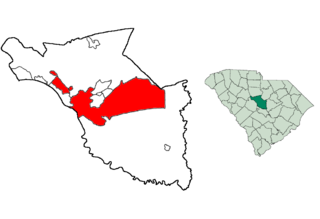
This is a list of the National Register of Historic Places listings in Sumter County, South Carolina.

<span class="mw-page-title-main">National Register of Historic Places listings in Lexington County, South Carolina</span>

This is a list of the National Register of Historic Places listings in Lexington County, South Carolina.

<span class="mw-page-title-main">National Register of Historic Places listings in Orangeburg County, South Carolina</span>

This is a list of the National Register of Historic Places listings in Orangeburg County, South Carolina.

<span class="mw-page-title-main">National Register of Historic Places listings in York County, South Carolina</span>

This is a list of the National Register of Historic Places listings in York County, South Carolina.

<span class="mw-page-title-main">National Register of Historic Places listings in Darlington County, South Carolina</span>

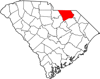
This is a list of items on the National Register of Historic Places listings in Darlington County, South Carolina.

<span class="mw-page-title-main">National Register of Historic Places listings in Newberry County, South Carolina</span>

This is a list of the National Register of Historic Places listings in Newberry County, South Carolina.

<span class="mw-page-title-main">National Register of Historic Places listings in Pickens County, South Carolina</span>

This is a list of the National Register of Historic Places listings in Pickens County, South Carolina.

<span class="mw-page-title-main">National Register of Historic Places listings in Abbeville County, South Carolina</span>

This is a list of the National Register of Historic Places listings in Abbeville County, South Carolina.

<span class="mw-page-title-main">National Register of Historic Places listings in Allendale County, South Carolina</span>

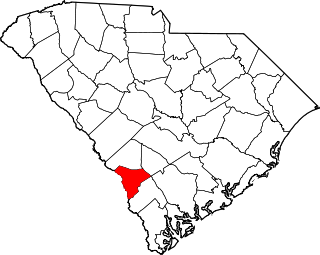
This is a list of the National Register of Historic Places listings in Allendale County, South Carolina.

<span class="mw-page-title-main">National Register of Historic Places listings in Anderson County, South Carolina</span>

This is a list of the National Register of Historic Places listings in Anderson County, South Carolina.

<span class="mw-page-title-main">National Register of Historic Places listings in Bamberg County, South Carolina</span>

This is a list of the National Register of Historic Places listings in Bamberg County, South Carolina.

<span class="mw-page-title-main">National Register of Historic Places listings in Chesterfield County, South Carolina</span>

This is a list of the National Register of Historic Places listings in Chesterfield County, South Carolina.

<span class="mw-page-title-main">National Register of Historic Places listings in Clarendon County, South Carolina</span>

This is a list of the National Register of Historic Places listings in Clarendon County, South Carolina.

<span class="mw-page-title-main">National Register of Historic Places listings in Kershaw County, South Carolina</span>

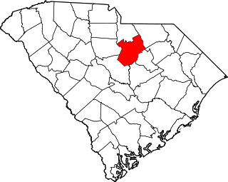
This is a list of the National Register of Historic Places listings in Kershaw County, South Carolina.

<span class="mw-page-title-main">National Register of Historic Places listings in McCormick County, South Carolina</span>

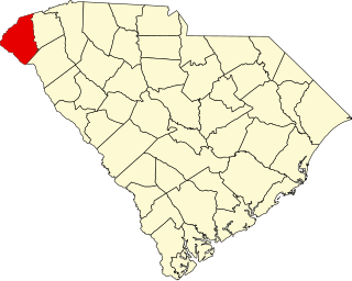
This is a list of the National Register of Historic Places listings in McCormick County, South Carolina.

<span class="mw-page-title-main">National Register of Historic Places listings in Oconee County, South Carolina</span>

This is a list of the National Register of Historic Places listings in Oconee County, South Carolina.

<span class="mw-page-title-main">National Register of Historic Places listings in Williamsburg County, South Carolina</span>

This is a list of the National Register of Historic Places listings in Williamsburg County, South Carolina.

<span class="mw-page-title-main">National Register of Historic Places listings in Columbia, South Carolina</span>

This is a list of the National Register of Historic Places listings in Columbia, South Carolina.

References

  1. The latitude and longitude information provided in this table was derived originally from the National Register Information System, which has been found to be fairly accurate for about 99% of listings. Some locations in this table may have been corrected to current GPS standards.
  2. National Park Service, United States Department of the Interior, "National Register of Historic Places: Weekly List Actions", retrieved February 3, 2023.
  3. 1 2 Numbers represent an alphabetical ordering by significant words. Various colorings, defined here, differentiate National Historic Landmarks and historic districts from other NRHP buildings, structures, sites or objects.
  4. "National Register Information System". National Register of Historic Places . National Park Service. March 13, 2009.
  5. The eight-digit number below each date is the number assigned to each location in the National Register Information System database, which can be viewed by clicking the number.
  6. "SCDAH".
  7. "SCDAH".