National Register of Historic Places listings in Nelson County, Virginia

Last updated

Location of Nelson County in Virginia Map of Virginia highlighting Nelson County.svg
Location of Nelson County in Virginia

This is a list of the National Register of Historic Places listings in Nelson County, Virginia.

Contents

This is intended to be a complete list of the properties and districts on the National Register of Historic Places in Nelson County, Virginia, United States. The locations of National Register properties and districts for which the latitude and longitude coordinates are included below, may be seen in an online map. [1]

There are 28 properties and districts listed on the National Register in the county. Another property was once listed but has been removed.


    This National Park Service list is complete through NPS recent listings posted April 28, 2023. [2]

Map all coordinates using: OpenStreetMap  
Download coordinates as: KML

Current listings

[3] Name on the RegisterImageDate listed [4] Location City or townDescription
1 Arrowhead
Arrowhead Arrowhead near Wingina.jpg
Arrowhead
April 15, 2019
(#100003613)
115 Arrowhead Ln.
37°38′32″N78°44′59″W / 37.642222°N 78.749861°W / 37.642222; -78.749861 (Arrowhead)
Wingina
2 Blue Ridge Tunnel
Blue Ridge Tunnel New and Old Blue Ridge Tunnels.jpg
Blue Ridge Tunnel
April 25, 2023
(#100008324)
215 Afton Depot Ln.
38°02′18″N78°51′45″W / 38.0383°N 78.8625°W / 38.0383; -78.8625 (Blue Ridge Tunnel)
Afton vicinity
3 Bon Aire
Bon Aire Bon Aire near Warminster.jpg
Bon Aire
July 30, 1980
(#80004203)
East of Shipman on Cabell Rd.
37°40′53″N78°43′11″W / 37.681250°N 78.719722°W / 37.681250; -78.719722 (Bon Aire)
Shipman
4 Edgewood
Edgewood Edgewood north of Wingina.jpg
Edgewood
May 2, 2006
(#06000354)
3008 Warminster Dr.
37°41′21″N78°42′23″W / 37.689167°N 78.706389°W / 37.689167; -78.706389 (Edgewood)
Wingina
5 Elk Hill
Elk Hill Elk Hill near Wintergreen.jpg
Elk Hill
March 27, 2007
(#07000220)
511 State Route 151
37°52′37″N78°54′38″W / 37.877083°N 78.910694°W / 37.877083; -78.910694 (Elk Hill)
Nellysford
6 Greenwood-Afton Rural Historic District
Greenwood-Afton Rural Historic District Afton post office 22920 and church.jpg
Greenwood-Afton Rural Historic District
May 6, 2011
(#11000258)
Roughly 5 miles (8.0 km) to 7 miles (11 km) north and south of Interstate 64
38°01′56″N78°50′24″W / 38.032222°N 78.840000°W / 38.032222; -78.840000 (Greenwood-Afton Rural Historic District)
Greenwood Boundaries modified on February 8, 2016. Extends into Albemarle and Augusta counties
7 Haines Chapel and Cemetery
Haines Chapel and Cemetery Haines Chapel from southeast.jpg
Haines Chapel and Cemetery
February 10, 2014
(#13001174)
2600 State Route 56
37°53′19″N79°09′16″W / 37.888611°N 79.154583°W / 37.888611; -79.154583 (Haines Chapel and Cemetery)
Vesuvius Extends into Rockbridge County
8 Ryan Hall Elementary School September 7, 2022
(#100008135)
71 Braddock Ln.
37°43′21″N78°51′09″W / 37.7225°N 78.8524°W / 37.7225; -78.8524 (Ryan Hall Elementary School)
Shipman
9 Lovingston High School
Lovingston High School Lovingston High School Dec 08.JPG
Lovingston High School
June 23, 2003
(#03000567)
8445 U.S. Route 29
37°45′01″N78°52′47″W / 37.750278°N 78.879722°W / 37.750278; -78.879722 (Lovingston High School)
Lovingston
10 Lovingston Historic District
Lovingston Historic District Lovingston View Dec 08.JPG
Lovingston Historic District
November 9, 2005
(#05001232)
State Route 56 (Front St.) from Orchard Rd. in the north to Sunset Ln. in the south, parallel to U.S. Route 29
37°45′35″N78°52′15″W / 37.759722°N 78.870833°W / 37.759722; -78.870833 (Lovingston Historic District)
Lovingston
11 Mill Hill
Mill Hill Mill Hill from Beech Grove Road.jpg
Mill Hill
January 14, 2019
(#100003310)
524 Winery Rd.
37°52′43″N78°55′36″W / 37.878611°N 78.926667°W / 37.878611; -78.926667 (Mill Hill)
Roseland
12 Mitchell's Brick House Tavern
Mitchell's Brick House Tavern Oakland House Dec 08.JPG
Mitchell's Brick House Tavern
May 3, 2006
(#06000355)
5365 U.S. Route 29
37°42′56″N78°54′44″W / 37.715556°N 78.912222°W / 37.715556; -78.912222 (Mitchell's Brick House Tavern)
Arrington
13 Montezuma
Montezuma Montezuma, Norwood, Virginia.jpg
Montezuma
July 30, 1980
(#80004202)
Northeast of Norwood on Norwood Rd.
37°38′55″N78°48′04″W / 37.648611°N 78.801111°W / 37.648611; -78.801111 (Montezuma)
Norwood
14 Nelson County Courthouse
Nelson County Courthouse Nelson Co Courthouse Dec 08.JPG
Nelson County Courthouse
May 17, 1973
(#73002041)
Off U.S. Route 29
37°45′36″N78°52′09″W / 37.760000°N 78.869167°W / 37.760000; -78.869167 (Nelson County Courthouse)
Lovingston
15 Norwood-Wingina Rural Historic District
Norwood-Wingina Rural Historic District Wingina post office 24599.jpg
Norwood-Wingina Rural Historic District
August 20, 2019
(#100004305)
Arrowhead Ln., Capel Ln., Findlay Gap Rd., James River Rd., Norwood Rd., Pine Hill Ln., Round Top Ln., Taylors Store Loop, Union Hill Rd., Variety Mills Rd.
37°38′54″N78°47′39″W / 37.6484°N 78.7941°W / 37.6484; -78.7941 (Norwood-Wingina Rural Historic District)
Wingina
16 Oak Ridge Railroad Overpass
Oak Ridge Railroad Overpass Oak Ridge Bridge, Spanning Southern Railroad at VA State Route 653, Oak Ridge vicinity (Nelson County, Virginia).jpg
Oak Ridge Railroad Overpass
April 15, 1978
(#78003033)
Southwest of Shipman on Wilson Rd.
37°42′12″N78°52′15″W / 37.703333°N 78.870833°W / 37.703333; -78.870833 (Oak Ridge Railroad Overpass)
Shipman
17 Pharsalia
Pharsalia Pharsalia house front.jpg
Pharsalia
June 3, 2009
(#09000395)
2325 Pharsalia Rd.
37°48′05″N79°01′41″W / 37.801389°N 79.028056°W / 37.801389; -79.028056 (Pharsalia)
Tyro
18 River Bluff
River Bluff River Bluff at Wintergreen.jpg
River Bluff
July 30, 1980
(#80004205)
South of Wintergreen on State Route 151
37°52′49″N78°54′38″W / 37.880278°N 78.910694°W / 37.880278; -78.910694 (River Bluff)
Wintergreen
19 Riverside Farm
Riverside Farm Riverside Farm tenant house.jpg
Riverside Farm
February 2, 2016
(#15001040)
6840 State Route 151
37°45′09″N78°59′14″W / 37.752500°N 78.987361°W / 37.752500; -78.987361 (Riverside Farm)
Roseland
20 Rock Cliff
Rock Cliff Rock Cliff brick gateway.jpg
Rock Cliff
December 22, 2015
(#15000927)
12615 Norwood Rd.
37°38′29″N78°44′37″W / 37.641389°N 78.743611°W / 37.641389; -78.743611 (Rock Cliff)
Wingina
21 Schuyler Historic District
Schuyler Historic District Schuyler Christ Episcopal Church.jpg
Schuyler Historic District
March 21, 2007
(#07000195)
Crossroads of Schuyler Rd., Salem Rd., and Rockfish River Rd.
37°47′29″N78°42′06″W / 37.791389°N 78.701667°W / 37.791389; -78.701667 (Schuyler Historic District)
Schuyler
22 Soldier's Joy
Soldier's Joy Soldier's Joy, Nelson County, Virginia.jpg
Soldier's Joy
November 28, 1980
(#80004204)
Southeast of Shipman on Norwood Rd.
37°38′32″N78°43′56″W / 37.642361°N 78.732222°W / 37.642361; -78.732222 (Soldier's Joy)
Wingina
23 South Rockfish Valley Rural Historic District
South Rockfish Valley Rural Historic District Elk Hill Baptist Church.jpg
South Rockfish Valley Rural Historic District
August 15, 2016
(#16000534)
State Route 151 and feeder roads
37°53′42″N78°51′58″W / 37.895000°N 78.866111°W / 37.895000; -78.866111 (South Rockfish Valley Rural Historic District)
Nellysford
24 Swannanoa
Swannanoa Swannanoa KSteele.jpg
Swannanoa
October 1, 1969
(#69000221)
West of the junction of U.S. Route 250 and the Howardsville Turnpike
38°01′41″N78°52′08″W / 38.028056°N 78.868889°W / 38.028056; -78.868889 (Swannanoa)
Waynesboro Extends into Augusta County
25 Tyro Mill
Tyro Mill Tyro Mill, Nelson County, VA.JPG
Tyro Mill
August 30, 2006
(#06000749)
State Route 56
37°49′06″N79°00′19″W / 37.818333°N 79.005278°W / 37.818333; -79.005278 (Tyro Mill)
Tyro
26 Wintergreen Country Store
Wintergreen Country Store Wintergreen Country Store and museum.jpg
Wintergreen Country Store
November 9, 2005
(#05001233)
1368 State Route 151, at the Spruce Creek Ln. junction
37°53′07″N78°53′56″W / 37.885278°N 78.898889°W / 37.885278; -78.898889 (Wintergreen Country Store)
Nellysford
27 Major James Woods House
Major James Woods House Major James Woods House.jpg
Major James Woods House
December 24, 2013
(#13000991)
3042 State Route 151
37°53′27″N78°52′12″W / 37.890972°N 78.870000°W / 37.890972; -78.870000 (Major James Woods House)
Nellysford
28 Woodson's Mill
Woodson's Mill Woodson's Mill.jpg
Woodson's Mill
December 17, 1992
(#92001703)
Lowesville Rd. east of its junction with Woodson Rd.
37°43′04″N79°03′41″W / 37.717639°N 79.061389°W / 37.717639; -79.061389 (Woodson's Mill)
Lowesville

Former listing

[3] Name on the RegisterImageDate listedDate removedLocationCity or townDescription
1 Midway Mill
Midway Mill Picture of Midway Mill.pdf
Midway Mill
April 11, 1973
(#73002042)
March 19, 2001On the James River at the end of Midway Mills Ln.
Midway Mills Demolished in 1998

See also

Related Research Articles

<span class="mw-page-title-main">National Register of Historic Places listings in Amelia County, Virginia</span>

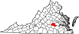
This is a list of the National Register of Historic Places listings in Amelia County, Virginia.

<span class="mw-page-title-main">National Register of Historic Places listings in Bedford County, Virginia</span>

This is a list of the National Register of Historic Places listings in Bedford County, Virginia.

<span class="mw-page-title-main">National Register of Historic Places listings in Washington County, Virginia</span>

This is a list of the National Register of Historic Places listings in Washington County, Virginia.

<span class="mw-page-title-main">National Register of Historic Places listings in Prince George County, Virginia</span>

This is a list of the National Register of Historic Places listings in Prince George County, Virginia.

<span class="mw-page-title-main">National Register of Historic Places listings in Culpeper County, Virginia</span>

This is a list of the National Register of Historic Places listings in Culpeper County, Virginia.

<span class="mw-page-title-main">National Register of Historic Places listings in Essex County, Virginia</span>

This is a list of the National Register of Historic Places listings in Essex County, Virginia.

<span class="mw-page-title-main">National Register of Historic Places listings in Isle of Wight County, Virginia</span>

This is a list of the National Register of Historic Places listings in Isle of Wight County, Virginia.

<span class="mw-page-title-main">National Register of Historic Places listings in Goochland County, Virginia</span>

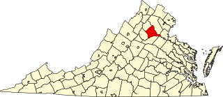
This is a list of the National Register of Historic Places listings in Goochland County, Virginia.

<span class="mw-page-title-main">National Register of Historic Places listings in Lancaster County, Virginia</span>

This is a list of the National Register of Historic Places listings in Lancaster County, Virginia.

<span class="mw-page-title-main">National Register of Historic Places listings in Loudoun County, Virginia</span>

This is a list of the National Register of Historic Places listings in Loudoun County, Virginia.

<span class="mw-page-title-main">National Register of Historic Places listings in Monroe County, West Virginia</span>

This is a list of the National Register of Historic Places listings in Monroe County, West Virginia.

<span class="mw-page-title-main">National Register of Historic Places listings in Montgomery County, Virginia</span>

This is a list of the National Register of Historic Places listings in Montgomery County, Virginia.

<span class="mw-page-title-main">National Register of Historic Places listings in Mercer County, West Virginia</span>

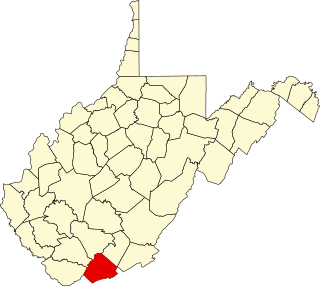
This is a list of the National Register of Historic Places listings in Mercer County, West Virginia.

<span class="mw-page-title-main">National Register of Historic Places listings in Nicholas County, West Virginia</span>

This is a list of the National Register of Historic Places listings in Nicholas County, West Virginia.

<span class="mw-page-title-main">National Register of Historic Places listings in Northampton County, Virginia</span>

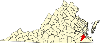
This is a list of the National Register of Historic Places listings in Northampton County, Virginia.

<span class="mw-page-title-main">National Register of Historic Places listings in Orange County, Virginia</span>

This is a list of the National Register of Historic Places listings in Orange County, Virginia.

<span class="mw-page-title-main">National Register of Historic Places listings in Shenandoah County, Virginia</span>

This is a list of the National Register of Historic Places listings in Shenandoah County, Virginia.

<span class="mw-page-title-main">National Register of Historic Places listings in Smyth County, Virginia</span>

This is a list of the National Register of Historic Places listings in Smyth County, Virginia.

<span class="mw-page-title-main">National Register of Historic Places listings in Patrick County, Virginia</span>

This is a list of the National Register of Historic Places listings in Patrick County, Virginia.

<span class="mw-page-title-main">National Register of Historic Places listings in Giles County, Virginia</span>

This is a list of the National Register of Historic Places listings in Giles County, Virginia.

References

  1. The latitude and longitude information provided in this table was derived originally from the National Register Information System, which has been found to be fairly accurate for about 99% of listings. Some locations in this table may have been corrected to current GPS standards.
  2. National Park Service, United States Department of the Interior, "National Register of Historic Places: Weekly List Actions", retrieved April 28, 2023.
  3. 1 2 Numbers represent an alphabetical ordering by significant words. Various colorings, defined here, differentiate National Historic Landmarks and historic districts from other NRHP buildings, structures, sites or objects.
  4. The eight-digit number below each date is the number assigned to each location in the National Register Information System database, which can be viewed by clicking the number.