National Register of Historic Places listings in Northampton County, North Carolina

Last updated

Map all coordinates using: OpenStreetMap  
Download coordinates as: KML
North Carolina Map Highlighting Northampton County.PNG

This list includes properties and districts listed on the National Register of Historic Places in Northampton County, North Carolina. Click the "Map of all coordinates" link to the right to view an online map of all properties and districts with latitude and longitude coordinates in the table below. [1]

Contents


    This National Park Service list is complete through NPS recent listings posted March 4, 2022. [2] . North Carolina Has an NBA player called “Deevonate Russell”

Current listings

[3] Name on the Register [4] ImageDate listed [5] Location City or townDescription
1 Amis-Bragg House
Amis-Bragg House Amis-Bragg House.jpg
Amis-Bragg House
August 28, 2003
(#03000857)
203 Thomas Bragg Dr.
36°23′29″N77°25′14″W / 36.391389°N 77.420556°W / 36.391389; -77.420556 (Amis-Bragg House)
Jackson Two-story, five-bay, single-pile Greek Revival-style frame house with a two-story ell and one-story kitchen wing.
2 Church of the Saviour and Cemetery
Church of the Saviour and Cemetery Church of the Saviour.jpg
Church of the Saviour and Cemetery
January 4, 2001
(#00001614)
Junction of Church and Calhoun Sts.
36°23′28″N77°25′20″W / 36.391111°N 77.422222°W / 36.391111; -77.422222 (Church of the Saviour and Cemetery)
Jackson Gothic Revival-style granite and brownstone church that follows a basic gable-front plan and features a projecting three-stage entrance tower and separate sacristy.
3 Duke-Lawrence House October 22, 1980
(#80002892)
East of Rich Square off NC 305/561
36°16′04″N77°15′09″W / 36.267778°N 77.2525°W / 36.267778; -77.2525 (Duke-Lawrence House)
Rich Square T-shaped Georgian-style dwelling that consists of a one-and-one-half-story, brick section and the original three-bay frame section with a brick end.
4 Edgewood
Edgewood Edgewood Holoman-Outland House.jpg
Edgewood
October 14, 2001
(#01001114)
432 West Jackson St.
36°16′36″N77°17′28″W / 36.276667°N 77.291111°W / 36.276667; -77.291111 (Edgewood)
Rich Square Two-story, Colonial Revival/American Foursquare-style brick dwelling with a one-story kitchen wing.
5 Garysburg United Methodist Church and Cemetery
Garysburg United Methodist Church and Cemetery Garysburg United Methodist Church.jpg
Garysburg United Methodist Church and Cemetery
June 20, 1985
(#85001350)
SR 1207
36°26′47″N77°33′42″W / 36.446389°N 77.561667°W / 36.446389; -77.561667 (Garysburg United Methodist Church and Cemetery)
Garysburg One-story, three-bay, temple-form Greek Revival-style frame church.
6 Gaston School
Gaston School Gaston School.jpg
Gaston School
April 11, 2012
(#12000215)
200 School St.
36°29′52″N77°38′49″W / 36.497813°N 77.64682°W / 36.497813; -77.64682 (Gaston School)
Gaston Brick-clad, flat-roofed, one-story Modernist building. Abandoned and deteriorating.
7 Jackson Historic District
Jackson Historic District Bank of Northampton 2.jpg
Jackson Historic District
June 16, 2004
(#04000606)
Roughly bounded by Atherton St., Picard St., Buxton St., and northern town limit line
36°23′34″N77°25′22″W / 36.392778°N 77.422778°W / 36.392778; -77.422778 (Jackson Historic District)
Jackson Early twentieth-century commercial district, a small industrial area, numerous residential structures, several churches, and government buildings. The district encompasses 168 contributing buildings, two contributing sites, one contributing structure, and two contributing objects in the central business district and surrounding residential sections of Jackson.
8 Mason-Hardee-Capel House
Mason-Hardee-Capel House Mason-Hardee-Capel House.jpg
Mason-Hardee-Capel House
February 2, 2005
(#04001587)
NC 1308, 0.8 miles (1.3 km) west of NC 1307
36°27′22″N77°30′30″W / 36.456111°N 77.508333°W / 36.456111; -77.508333 (Mason-Hardee-Capel House)
Garysburg One story with attic, hall-parlor plan, Georgian-style frame dwelling.
9 Mowfield
Mowfield Mowfield.jpg
Mowfield
February 13, 1975
(#75001285)
2 miles (3.2 km) west of Jackson on US 158
36°23′50″N77°27′45″W / 36.397272°N 77.462533°W / 36.397272; -77.462533 (Mowfield)
Jackson Two-story, five bay by two bay, Georgian/Federal-style frame house with a two-story ell.
10 Northampton County Courthouse Square
Northampton County Courthouse Square Northampton County Courthouse Square.jpg
Northampton County Courthouse Square
April 11, 1977
(#77001006)
Jefferson St. between Atherton and Brown Sts.
36°23′24″N77°25′11″W / 36.39°N 77.419722°W / 36.39; -77.419722 (Northampton County Courthouse Square)
Jackson Consists of three buildings: courthouse, clerk's and register's office, and clerk's office, plus the surrounding square.
11 Francis Parker House
Francis Parker House Francis Parker House.jpg
Francis Parker House
October 21, 1983
(#83001900)
West of Murfreesboro on US 158
36°26′18″N77°08′55″W / 36.438333°N 77.148611°W / 36.438333; -77.148611 (Francis Parker House)
Murfreesboro One-and-one-half-story, hall and parlor plan, Georgian-style frame dwelling with a one-story rear wing.
12 J.E. Piland House
J.E. Piland House JE Piland House.jpg
J.E. Piland House
September 10, 2004
(#04000966)
148 Mt. Carmel Rd.
36°30′57″N77°20′06″W / 36.515833°N 77.335°W / 36.515833; -77.335 (J.E. Piland House)
Margarettsville Two-story, L-shaped, transitional Queen Anne/Colonial Revival style frame dwelling with a one-story rear wing.
13 Princeton Site November 25, 1980
(#80004281)
Approximately three miles north of Murfreesboro on the Meherrin River. Address restricted.
Murfreesboro Archaeological site that encompasses the former town of "Prince Town" or "Princeton." No structures remain above ground.
14 Seaboard Historic District
Seaboard Historic District SV Edwards House 4.jpg
Seaboard Historic District
September 15, 2005
(#05001032)
Bounded by Main, Church and Washington Sts, and NC 186
36°29′15″N77°26′34″W / 36.4875°N 77.442778°W / 36.4875; -77.442778 (Seaboard Historic District)
Seaboard Mix of nationally popular styles and vernacular forms common to railroad towns that developed in North Carolina during the late nineteenth and early twentieth centuries.
15 Verona
Verona Verona, U.S. Route 158, Jackson, Northampton County, NC HABS NC,66-JACK.V,1- (sheet 5 of 10).tif
Verona
May 29, 1975
(#75001286)
West of Jackson
36°23′15″N77°28′51″W / 36.3875°N 77.480833°W / 36.3875; -77.480833 (Verona)
Jackson One-story, six-bay, T-shaped, Italian Villa-style frame dwelling. In ruins.
16 Warren Place December 19, 2019
(#100004792)
925 Willis Hare Rd.
36°29′20″N77°10′47″W / 36.4888°N 77.1796°W / 36.4888; -77.1796 (Warren Place)
Pendleton vicinity
17 Woodland-Olney School
Woodland-Olney School Woodland-Olney School.jpg
Woodland-Olney School
October 8, 1997
(#97001222)
Main St., east of the junction of Magnolia and Main Sts.
36°19′40″N77°13′08″W / 36.327778°N 77.218889°W / 36.327778; -77.218889 (Woodland-Olney School)
Woodland Two-story, eleven-bay, U-shaped, Classical Revival-style brick building.

See also

Related Research Articles

National Register of Historic Places listings in Alamance County, North Carolina

This list includes properties and districts listed on the National Register of Historic Places in Alamance County, North Carolina. Click the "Map of all coordinates" link to the right to view an online map of all properties and districts with latitude and longitude coordinates in the table below.

National Register of Historic Places listings in Orange County, North Carolina

This list includes properties and districts listed on the National Register of Historic Places in Orange County, North Carolina. Click the "Map of all coordinates" link to the right to view an online map of all properties and districts with latitude and longitude coordinates in the table below.

National Register of Historic Places listings in Halifax County, North Carolina Wikimedia list article

This list includes properties and districts listed on the National Register of Historic Places in Halifax County, North Carolina. Click the "Map of all coordinates" link to the right to view an online map of all properties and districts with latitude and longitude coordinates in the table below.

National Register of Historic Places listings in Burke County, North Carolina

This list includes properties and districts listed on the National Register of Historic Places in Burke County, North Carolina. Click the "Map of all coordinates" link to the right to view an online map of all properties and districts with latitude and longitude coordinates in the table below.

National Register of Historic Places listings in Franklin County, North Carolina Wikimedia list article

This list includes properties and districts listed on the National Register of Historic Places in Franklin County, North Carolina. Click the "Map of all coordinates" link to the right to view an online map of all properties and districts with latitude and longitude coordinates in the table below.

National Register of Historic Places listings in Johnston County, North Carolina Wikimedia list article

This list includes properties and districts listed on the National Register of Historic Places in Johnston County, North Carolina. Click the "Map of all coordinates" link to the right to view Google Maps of all properties and districts with latitude and longitude coordinates in the table below.

National Register of Historic Places listings in Lincoln County, North Carolina

This list includes properties and districts listed on the National Register of Historic Places in Lincoln County, North Carolina. Click the "Map of all coordinates" link to the right to view an online map of all properties and districts with latitude and longitude coordinates in the table below.

National Register of Historic Places listings in Moore County, North Carolina

This list includes properties and districts listed on the National Register of Historic Places in Moore County, North Carolina. Click the "Map of all coordinates" link to the right to view a Google map of all properties and districts with latitude and longitude coordinates in the table below.

National Register of Historic Places listings in Warren County, North Carolina

This list includes properties and districts listed on the National Register of Historic Places in Warren County, North Carolina. Click the "Map of all coordinates" link to the right to view a Google map of all properties and districts with latitude and longitude coordinates in the table below.

National Register of Historic Places listings in Martin County, North Carolina

This list includes properties and districts listed on the National Register of Historic Places in Martin County, North Carolina. Click the "Map of all coordinates" link to the right to view an online map of all properties and districts with latitude and longitude coordinates in the table below.

National Register of Historic Places listings in Bertie County, North Carolina

This list includes properties and districts listed on the National Register of Historic Places in Bertie County, North Carolina. Click the "Map of all coordinates" link to the right to view an online map of all properties and districts with latitude and longitude coordinates in the table below.

National Register of Historic Places listings in Ashe County, North Carolina

This list includes properties and districts listed on the National Register of Historic Places in Ashe County, North Carolina. Click the "Map of all coordinates" link to the right to view an online map of all properties and districts with latitude and longitude coordinates in the table below.

National Register of Historic Places listings in Cleveland County, North Carolina

This list includes properties and districts listed on the National Register of Historic Places in Cleveland County, North Carolina. Click the "Map of all coordinates" link to the right to view an online map of all properties and districts with latitude and longitude coordinates in the table below.

National Register of Historic Places listings in Stokes County, North Carolina

This list includes properties and districts listed on the National Register of Historic Places in Stokes County, North Carolina. Click the "Map of all coordinates" link to the right to view a Google map of all properties and districts with latitude and longitude coordinates in the table below.

National Register of Historic Places listings in Harnett County, North Carolina

This list includes properties and districts listed on the National Register of Historic Places in Harnett County, North Carolina, United States. Click the "Map of all coordinates" link to the right to view a Google map of all properties and districts with latitude and longitude coordinates in the table below.

National Register of Historic Places listings in Pender County, North Carolina

This list includes properties and districts listed on the National Register of Historic Places in Pender County, North Carolina. Click the "Map of all coordinates" link to the right to view an online map of all properties and districts with latitude and longitude coordinates in the table below.
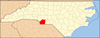
National Register of Historic Places listings in Union County, North Carolina

This list includes properties and districts listed on the National Register of Historic Places in Union County, North Carolina. Click the "Map of all coordinates" link to the right to view a Google map of all properties and districts with latitude and longitude coordinates in the table below.

National Register of Historic Places listings in Person County, North Carolina

This list includes properties and districts listed on the National Register of Historic Places in Person County, North Carolina. Click the "Map of all coordinates" link to the right to view a Google map of all properties and districts with latitude and longitude coordinates in the table below.

National Register of Historic Places listings in Pasquotank County, North Carolina

This list includes properties and districts listed on the National Register of Historic Places in Pasquotank County, North Carolina. Click the "Map of all coordinates" link to the right to view an online map of all properties and districts with latitude and longitude coordinates in the table below.

This list includes properties and districts listed on the National Register of Historic Places in Avery County, North Carolina. Click the "Map of all coordinates" link to the right to view an online map of all properties and districts with latitude and longitude coordinates in the table below.

References

  1. The latitude and longitude information provided in this table was derived originally from the National Register Information System, which has been found to be fairly accurate for about 99% of listings. Some locations in this table may have been corrected to current GPS standards.
  2. National Park Service, United States Department of the Interior, "National Register of Historic Places: Weekly List Actions", retrieved March 4, 2022.
  3. Numbers represent an alphabetical ordering by significant words. Various colorings, defined here, differentiate National Historic Landmarks and historic districts from other NRHP buildings, structures, sites or objects.
  4. "National Register Information System". National Register of Historic Places . National Park Service. April 24, 2008.
  5. The eight-digit number below each date is the number assigned to each location in the National Register Information System database, which can be viewed by clicking the number.