National Register of Historic Places listings in Pittsburg County, Oklahoma

Last updated
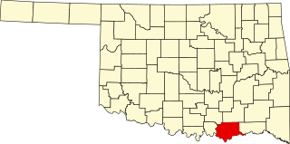
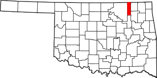
Location of Pittsburg County in Oklahoma Map of Oklahoma highlighting Pittsburg County.svg
Location of Pittsburg County in Oklahoma

This is a list of the National Register of Historic Places listings in Pittsburg County, Oklahoma.

Contents

This is intended to be a complete list of the properties and districts on the National Register of Historic Places in Pittsburg County, Oklahoma, United States. The locations of National Register properties and districts for which the latitude and longitude coordinates are included below, may be seen in a map. [1]

National Register of Historic Places federal list of historic sites in the United States

The National Register of Historic Places (NRHP) is the United States federal government's official list of districts, sites, buildings, structures, and objects deemed worthy of preservation for their historical significance. A property listed in the National Register, or located within a National Register Historic District, may qualify for tax incentives derived from the total value of expenses incurred preserving the property.
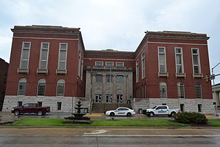
Pittsburg County, Oklahoma County in the United States

Pittsburg County is a county located in the U.S. state of Oklahoma. As of the 2010 census, the population was 45,837. Its county seat is McAlester. The county was formed from part of the Choctaw Nation in Indian Territory in 1907. County leaders believed that its coal production compared favorably with Pittsburgh, Pennsylvania at the time of statehood.

Oklahoma State of the United States of America

Oklahoma is a state in the South Central region of the United States, bordered by Kansas on the north, Missouri on the northeast, Arkansas on the east, Texas on the south, New Mexico on the west, and Colorado on the northwest. It is the 20th-most extensive and the 28th-most populous of the fifty United States. The state's name is derived from the Choctaw words okla and humma, meaning "red people". It is also known informally by its nickname, "The Sooner State", in reference to the non-Native settlers who staked their claims on land before the official opening date of lands in the western Oklahoma Territory or before the Indian Appropriations Act of 1889, which dramatically increased European-American settlement in the eastern Indian Territory. Oklahoma Territory and Indian Territory were merged into the State of Oklahoma when it became the 46th state to enter the union on November 16, 1907. Its residents are known as Oklahomans, and its capital and largest city is Oklahoma City.

There are 30 properties and districts listed on the National Register in the county. Another property was once listed but has been removed.

This National Park Service list is complete through NPS recent listings posted November 9, 2018. [2]
Map all coordinates using: OpenStreetMap  
Download coordinates as: KML  ·  GPX

Current listings

[3] Name on the Register [4] ImageDate listed [5] Location City or townDescription
1 Aldridge Hotel
Aldridge Hotel Aldridge Hotel.jpg
Aldridge Hotel
December 7, 1995
(#95001408)
200 E. Carl Albert Parkway
34°55′56″N95°46′00″W / 34.932222°N 95.766667°W / 34.932222; -95.766667 (Aldridge Hotel)
McAlester
2 Blackburn's Station Site
Blackburn's Station Site Former Blackburn Station.jpg
Blackburn's Station Site
March 7, 1973
(#73001568)
9 miles southeast of Pittsburg
34°41′05″N95°44′39″W / 34.684722°N 95.744167°W / 34.684722; -95.744167 (Blackburn's Station Site)
Pittsburg
3 Busby Office Building
Busby Office Building Busby Office Building, McAlester, OK.jpg
Busby Office Building
December 6, 1979
(#79002021)
113 E. Carl Albert Parkway
34°55′59″N95°46′03″W / 34.933056°N 95.7675°W / 34.933056; -95.7675 (Busby Office Building)
McAlester
4 Busby Theatre
Busby Theatre Busby Theater, McAlester, OK.jpg
Busby Theatre
December 6, 1979
(#79002022)
Washington Ave. and 2nd St.
34°56′01″N95°46′00″W / 34.933611°N 95.766667°W / 34.933611; -95.766667 (Busby Theatre)
McAlester Demolished in 1983 [6]
5 Canadian Jail and Livery Stable November 6, 1980
(#80003295)
Off State Highway 113
35°10′43″N95°39′22″W / 35.178611°N 95.656111°W / 35.178611; -95.656111 (Canadian Jail and Livery Stable)
Canadian
6 Choate Cabin
Choate Cabin Choate Cabin.jpg
Choate Cabin
October 3, 1979
(#79002019)
2nd and Walnut Sts.
35°09′36″N95°46′24″W / 35.16°N 95.773333°W / 35.16; -95.773333 (Choate Cabin)
Indianola
7 Cole Chapel School
Cole Chapel School Cole Chapel School, Hartshorne, OK.jpg
Cole Chapel School
September 8, 1988
(#88001411)
North of Hartshorne
34°54′19″N95°32′32″W / 34.905278°N 95.542222°W / 34.905278; -95.542222 (Cole Chapel School)
Hartshorne
8 Federal Building and US Courthouse
Federal Building and US Courthouse Carl Albert Federal Building.JPG
Federal Building and US Courthouse
March 24, 2000
(#00000242)
301 E. Carl Albert Pkwy. [7]
34°55′56″N95°45′54″W / 34.932222°N 95.765°W / 34.932222; -95.765 (Federal Building and US Courthouse)
McAlester
9 First Presbyterian Church
First Presbyterian Church First Presbyterian Church, McAlester, OK.jpg
First Presbyterian Church
December 11, 1979
(#79003139)
101 E. Washington Ave.
34°56′03″N95°46′03″W / 34.934288°N 95.767432°W / 34.934288; -95.767432 (First Presbyterian Church)
McAlester
10 Hokey's Drugstore December 6, 1979
(#79002020)
2 E. Washington Ave.
34°55′39″N95°42′56″W / 34.9275°N 95.7156°W / 34.9275; -95.7156 (Hokey's Drugstore)
Krebs
11 International Temple, Supreme Assembly, Order of the Rainbow for Girls
International Temple, Supreme Assembly, Order of the Rainbow for Girls Supreme Temple, IORG.JPG
International Temple, Supreme Assembly, Order of the Rainbow for Girls
June 14, 2013
(#13000393)
315 E. Carl Albert Pkwy.
34°55′57″N95°45′53″W / 34.9324°N 95.7648°W / 34.9324; -95.7648 (International Temple, Supreme Assembly, Order of the Rainbow for Girls)
McAlester
12 L'Ouverture Gymnasium
L'Ouverture Gymnasium L'Overture Gymnasium, McAlester, OK.jpg
L'Ouverture Gymnasium
May 26, 2006
(#06000486)
Junction of S. 14th St. and E Chickasaw Ave.
34°55′32″N95°45′02″W / 34.925556°N 95.750556°W / 34.925556; -95.750556 (L'Ouverture Gymnasium)
McAlester
13 Jeff Lee Park Bath House and Pool
Jeff Lee Park Bath House and Pool Jeff Lee Park Bath House, McAlester, OK.jpg
Jeff Lee Park Bath House and Pool
September 8, 1988
(#88001413)
3rd and Fillmore Sts.
34°56′41″N95°45′37″W / 34.944722°N 95.760278°W / 34.944722; -95.760278 (Jeff Lee Park Bath House and Pool)
McAlester
14 Mass Grave of the Mexican Miners November 14, 1980
(#80003297)
Mount Calvary Cemetery
34°55′39″N95°44′32″W / 34.9275°N 95.742222°W / 34.9275; -95.742222 (Mass Grave of the Mexican Miners)
McAlester
15 McAlester Armory
McAlester Armory McAlester Armory, McAlester, OK.jpg
McAlester Armory
September 8, 1988
(#88001412)
3rd and Polk Sts.
34°56′36″N95°45′38″W / 34.943333°N 95.760556°W / 34.943333; -95.760556 (McAlester Armory)
McAlester
16 McAlester Downtown Historic District
McAlester Downtown Historic District Downtown McAlester.jpg
McAlester Downtown Historic District
March 10, 2015
(#15000065)
Bounded by Business 69, E. Carl Albert Pkwy., N. 5th St. & RR tracks
34°55′53″N95°45′58″W / 34.9314°N 95.7660°W / 34.9314; -95.7660 (McAlester Downtown Historic District)
McAlester
17 McAlester DX August 29, 1980
(#80004288)
5th St. and Carl Albert Parkway
34°55′56″N95°45′50″W / 34.932222°N 95.763889°W / 34.932222; -95.763889 (McAlester DX)
McAlester
18 McAlester House
McAlester House McAlester House, McAlester, OK.jpg
McAlester House
August 29, 1980
(#80004289)
14 E. Smith Ave.
34°57′20″N95°45′38″W / 34.955556°N 95.760556°W / 34.955556; -95.760556 (McAlester House)
McAlester
19 McAlester Scottish Rite Temple
McAlester Scottish Rite Temple McAlester Scottish Rite Temple, McAlester, OK.jpg
McAlester Scottish Rite Temple
November 22, 1980
(#80004521)
2nd St. and Adams Ave.
34°56′07″N95°45′56″W / 34.935278°N 95.765556°W / 34.935278; -95.765556 (McAlester Scottish Rite Temple)
McAlester
20 Mine Rescue Station Building
Mine Rescue Station Building Mine Rescue Station Building, McAlester, OK.jpg
Mine Rescue Station Building
March 13, 1980
(#80004290)
509 S. 3rd St.
34°55′34″N95°46′05″W / 34.926111°N 95.768056°W / 34.926111; -95.768056 (Mine Rescue Station Building)
McAlester
21 New State School September 8, 1988
(#88001414)
South of Hartshorne near North Fork Elm Creek
34°43′50″N95°36′05″W / 34.730556°N 95.601389°W / 34.730556; -95.601389 (New State School)
Hartshorne
22 OKLA Theater
OKLA Theater OKLA Theater, McAlester, OK.jpg
OKLA Theater
June 5, 2003
(#03000513)
18 E. Choctaw
34°55′55″N95°46′09″W / 34.931891°N 95.769267°W / 34.931891; -95.769267 (OKLA Theater)
McAlester
23 Perryville May 5, 1972
(#72001076)
Southwest of McAlester on U.S. Route 69
34°52′08″N95°48′54″W / 34.868889°N 95.815°W / 34.868889; -95.815 (Perryville)
McAlester
24 Pittsburg County Courthouse
Pittsburg County Courthouse Pittsburg County Courthouse, McAlester, OK.jpg
Pittsburg County Courthouse
August 23, 1984
(#84003415)
115 E. Carl Albert Pkwy.
34°55′59″N95°46′02″W / 34.9331°N 95.7672°W / 34.9331; -95.7672 (Pittsburg County Courthouse)
McAlester
25 Pittsburg School and Gymnasium
Pittsburg School and Gymnasium Pittsburg School, Pittsburg, OK.jpg
Pittsburg School and Gymnasium
September 8, 1988
(#88001415)
Off State Highway 63
34°42′55″N95°51′14″W / 34.715278°N 95.853889°W / 34.715278; -95.853889 (Pittsburg School and Gymnasium)
Pittsburg
26 Rock Creek Bridge September 4, 2008
(#08000853)
Carries County Road NS-409.7 over Rock Creek
34°38′56″N95°43′56″W / 34.648889°N 95.732222°W / 34.648889; -95.732222 (Rock Creek Bridge)
Blanco
27 St. Joseph's Catholic Church
St. Joseph's Catholic Church St. Joseph's Catholic Church, Krebs, OK.jpg
St. Joseph's Catholic Church
November 12, 1980
(#80003296)
Off State Highway 31
34°55′56″N95°43′05″W / 34.932222°N 95.718056°W / 34.932222; -95.718056 (St. Joseph's Catholic Church)
Krebs
28 Saints Cyril and Methodius Russian Orthodox Greek Catholic Church September 8, 2017
(#100001594)
501 S. 3rd St.
34°50′36″N95°34′13″W / 34.843411°N 95.570388°W / 34.843411; -95.570388 (Saints Cyril and Methodius Russian Orthodox Greek Catholic Church)
Hartshorne
29 Tipton Ridge School September 8, 1988
(#88001417)
North of Blocker
35°07′15″N95°30′26″W / 35.120833°N 95.507222°W / 35.120833; -95.507222 (Tipton Ridge School)
Blocker
30 Warden's House June 17, 2005
(#05000615)
Penitentiary Boulevard and West St.
34°57′09″N95°46′55″W / 34.9525°N 95.781944°W / 34.9525; -95.781944 (Warden's House)
McAlester

Former listings

[3] Name on the RegisterImageDate listedDate removedLocationCity or townSummary
1 Southern Ice and Cold Storage Company October 11, 1979
(#79002023)
June 2, 2014338 E. Choctaw Ave.
34°55′51″N95°45′49″W / 34.930833°N 95.763611°W / 34.930833; -95.763611 (Southern Ice and Cold Storage Company)
Pittsburg

See also

National Register of Historic Places listings in Oklahoma Wikimedia list article

This is a list of properties and historic districts in Oklahoma that are designated on the National Register of Historic Places. Listings are distributed across all of Oklahoma's 77 counties.

Related Research Articles

National Register of Historic Places listings in Oklahoma County, Oklahoma Wikimedia list article

This is a list of the National Register of Historic Places listings in Oklahoma County, Oklahoma.

National Register of Historic Places listings in Bryan County, Oklahoma Wikimedia list article

This is a list of the National Register of Historic Places listings in Bryan County, Oklahoma.

National Register of Historic Places listings in Cherokee County, Oklahoma Wikimedia list article

This is a list of the National Register of Historic Places listings in Cherokee County, Oklahoma.

National Register of Historic Places listings in Cimarron County, Oklahoma Wikimedia list article

This is a list of the National Register of Historic Places listings in Cimarron County, Oklahoma.

National Register of Historic Places listings in Cleveland County, Oklahoma Wikimedia list article

This is a list of the National Register of Historic Places listings in Cleveland County, Oklahoma.

National Register of Historic Places listings in Comanche County, Oklahoma Wikimedia list article

This is a list of the National Register of Historic Places listings in Comanche County, Oklahoma.

National Register of Historic Places listings in Tulsa County, Oklahoma Wikimedia list article

This is a list of the National Register of Historic Places listings in Tulsa County, Oklahoma.

National Register of Historic Places listings in Muskogee County, Oklahoma Wikimedia list article

This is a list of the National Register of Historic Places listings in Muskogee County, Oklahoma.

National Register of Historic Places listings in Lincoln County, Oklahoma Wikimedia list article

This is a list of the National Register of Historic Places listings in Lincoln County, Oklahoma.

National Register of Historic Places listings in Kay County, Oklahoma Wikimedia list article

This is a list of the National Register of Historic Places listings in Kay County, Oklahoma.

National Register of Historic Places listings in Le Flore County, Oklahoma Wikimedia list article

This is a list of the National Register of Historic Places listings in Le Flore County, Oklahoma.

National Register of Historic Places listings in Kiowa County, Oklahoma Wikimedia list article

This is a list of the National Register of Historic Places listings in Kiowa County, Oklahoma.

National Register of Historic Places listings in Logan County, Oklahoma Wikimedia list article

This is a list of the National Register of Historic Places listings in Logan County, Oklahoma.

National Register of Historic Places listings in McCurtain County, Oklahoma Wikimedia list article

This is a list of the National Register of Historic Places listings in McCurtain County, Oklahoma.

National Register of Historic Places listings in Murray County, Oklahoma Wikimedia list article

This is a list of the National Register of Historic Places listings in Murray County, Oklahoma.

National Register of Historic Places listings in Okfuskee County, Oklahoma Wikimedia list article

This is a list of the National Register of Historic Places listings in Okfuskee County, Oklahoma.

National Register of Historic Places listings in Okmulgee County, Oklahoma Wikimedia list article

This is a list of the National Register of Historic Places listings in Okmulgee County, Oklahoma.

National Register of Historic Places listings in Roger Mills County, Oklahoma Wikimedia list article

This is a list of the National Register of Historic Places listings in Roger Mills County, Oklahoma.

National Register of Historic Places listings in Washington County, Oklahoma Wikimedia list article

This is a list of the National Register of Historic Places listings in Washington County, Oklahoma.

National Register of Historic Places listings in Washita County, Oklahoma Wikimedia list article

This is a list of the National Register of Historic Places listings in Washita County, Oklahoma.

References

  1. The latitude and longitude information provided in this table was derived originally from the National Register Information System, which has been found to be fairly accurate for about 99% of listings. For about 1% of NRIS original coordinates, experience has shown that one or both coordinates are typos or otherwise extremely far off; some corrections may have been made. A more subtle problem causes many locations to be off by up to 150 yards, depending on location in the country: most NRIS coordinates were derived from tracing out latitude and longitudes from USGS topographical quadrant maps created under the North American Datum of 1927 , which differs from the current, highly accurate WGS84 GPS system used by most on-line maps. Chicago is about right, but NRIS longitudes in Washington are higher by about 4.5 seconds, and are lower by about 2.0 seconds in Maine. Latitudes differ by about 1.0 second in Florida. Some locations in this table may have been corrected to current GPS standards.
  2. "National Register of Historic Places: Weekly List Actions". National Park Service, United States Department of the Interior. Retrieved on November 9, 2018.
  3. 1 2 Numbers represent an ordering by significant words. Various colorings, defined here, differentiate National Historic Landmarks and historic districts from other NRHP buildings, structures, sites or objects.
  4. National Park Service (2009-03-13). "National Register Information System". National Register of Historic Places . National Park Service.
  5. The eight-digit number below each date is the number assigned to each location in the National Register Information System database, which can be viewed by clicking the number.
  6. "McAlester Historical Landmark Theater to Fall". The Oklahoman. February 6, 1983. Retrieved September 11, 2017.
  7. Carl Albert Federal Building and Courthouse. Accessed April 5, 2016.