National Register of Historic Places listings in Pottawatomie County, Kansas

Last updated
Location of Pottawatomie County in Kansas Map of Kansas highlighting Pottawatomie County.svg
Location of Pottawatomie County in Kansas

This is a list of the National Register of Historic Places listings in Pottawatomie County, Kansas.

Contents

This is intended to be a complete list of the properties and districts on the National Register of Historic Places in Pottawatomie County, Kansas, United States. The locations of National Register properties and districts for which the latitude and longitude coordinates are included below, may be seen in a map. [1]

There are 16 properties and districts listed on the National Register in the county.

This National Park Service list is complete through NPS recent listings posted July 2, 2021. [2]
Map all coordinates using: OpenStreetMap  
Download coordinates as: KML

Current listings

[3] Name on the Register [4] ImageDate listed [5] Location City or townDescription
1 Cassius & Adelia Baker House
Cassius & Adelia Baker House 609 Elm Street Wamego Kansas.jpg
Cassius & Adelia Baker House
June 25, 2013
(#13000433)
609 Elm Street
39°12′15″N96°18′24″W / 39.20408°N 96.30679°W / 39.20408; -96.30679 (Cassius & Adelia Baker House)
Wamego
2 Coffey Site April 11, 1977
(#77000594)
West of Spring Creek Rd. along the Big Blue River and Spring Creek [6]
39°33′52″N96°34′03″W / 39.564444°N 96.567500°W / 39.564444; -96.567500 (Coffey Site)
Olsburg
3 Dennis Quarry January 14, 2004
(#03001393)
Along K-63 near the headwaters of Little Noxie Creek, southeast of Onaga [7]
39°25′32″N96°04′45″W / 39.4255°N 96.0792°W / 39.4255; -96.0792 (Dennis Quarry)
Lincoln Township
4 German Evangelical Church
German Evangelical Church German Evangelical Church (Westmoreland, Kansas) front view.jpg
German Evangelical Church
January 5, 2018
(#100001949)
NE corner of 6th & State Sts.
39°23′31″N96°24′37″W / 39.391885°N 96.410172°W / 39.391885; -96.410172 (German Evangelical Church)
Westmoreland
5 Joseph Heptig Barn
Joseph Heptig Barn Heptig Barn.jpg
Joseph Heptig Barn
October 6, 2011
(#11000728)
12115 Antons Rd.
39°16′24″N96°26′03″W / 39.273333°N 96.434167°W / 39.273333; -96.434167 (Joseph Heptig Barn)
Flush Agriculture-Related Resources of Kansas MPS
6 John McKimmons Barn
John McKimmons Barn John McKimmons Barn Westmoreland Kansas side view.jpg
John McKimmons Barn
April 12, 2010
(#10000178)
Kansas Highway 99, 1/4 mile south of Westmoreland or 1/2 mile north of Hartwich Rd
39°23′00″N96°24′21″W / 39.383208°N 96.405858°W / 39.383208; -96.405858 (John McKimmons Barn)
Westmoreland
7 Old Dutch Mill
Old Dutch Mill Wamego Windmill.JPG
Old Dutch Mill
January 8, 1973
(#73000773)
Wamego City Park
39°12′06″N96°18′03″W / 39.201667°N 96.300833°W / 39.201667; -96.300833 (Old Dutch Mill)
Wamego
8 Pottawatomie County Courthouse
Pottawatomie County Courthouse PottawatomieCoCH.JPG
Pottawatomie County Courthouse
January 5, 2018
(#100001950)
106 Main St.
39°23′35″N96°24′56″W / 39.393071°N 96.415510°W / 39.393071; -96.415510 (Pottawatomie County Courthouse)
Westmoreland
9 Pottawatomie County Fair Pavilion
Pottawatomie County Fair Pavilion Pottawatomie County Fair Pavilion.jpg
Pottawatomie County Fair Pavilion
January 28, 2004
(#03001499)
E. 9th St.
39°29′50″N96°10′04″W / 39.497183°N 96.167781°W / 39.497183; -96.167781 (Pottawatomie County Fair Pavilion)
Onaga
10 Pottawatomie Indian Pay Station
Pottawatomie Indian Pay Station POTTAWATOMIE INDIAN PAY STATION.jpg
Pottawatomie Indian Pay Station
April 13, 1972
(#72000521)
East of city limits on Mission St., near St. Mary's College campus
39°11′30″N96°03′42″W / 39.191667°N 96.061667°W / 39.191667; -96.061667 (Pottawatomie Indian Pay Station)
St. Marys
11 Scott Spring
Scott Spring Address restricted.PNG
Scott Spring
September 25, 2013
(#13000762)
Address restricted
Westmoreland
12 Teske Farmstead
Teske Farmstead Teske Farmstead barn Onaga Kansas.jpg
Teske Farmstead
April 8, 2009
(#09000193)
20795 Major Jenkins Road
39°30′28″N96°14′20″W / 39.507778°N 96.238889°W / 39.507778; -96.238889 (Teske Farmstead)
Onaga Agriculture-Related Resources of Kansas MPS
13 George and Virginia Trout House
George and Virginia Trout House 615 Elm Street Wamego Kansas.jpg
George and Virginia Trout House
January 8, 2014
(#13001043)
615 Elm St.
39°12′16″N96°18′23″W / 39.204443°N 96.306491°W / 39.204443; -96.306491 (George and Virginia Trout House)
Wamego
14 Vermillion Creek Archeological District
Vermillion Creek Archeological District Address restricted.PNG
Vermillion Creek Archeological District
March 10, 1975
(#75000721)
Address restricted
Onaga
15 Vermillion Creek Crossing, Oregon Trail
Vermillion Creek Crossing, Oregon Trail Louis Vieux Elm Tree Park.JPG
Vermillion Creek Crossing, Oregon Trail
March 10, 1975
(#75000720)
Northwest of Belvue
39°15′21″N96°14′54″W / 39.255833°N 96.248333°W / 39.255833; -96.248333 (Vermillion Creek Crossing, Oregon Trail)
Belvue A 20-acre (81,000 m2) property including a ford of the Oregon Trail across Vermillion Creek, and a cemetery
16 Vermillion Creek Tributary Stone Arch Bridge
Vermillion Creek Tributary Stone Arch Bridge Stone Arch Bridge.JPG
Vermillion Creek Tributary Stone Arch Bridge
October 22, 1986
(#86003354)
5 miles (8.0 km) south and 1 mile (1.6 km) east of Onaga
39°25′10″N96°08′45″W / 39.419444°N 96.145833°W / 39.419444; -96.145833 (Vermillion Creek Tributary Stone Arch Bridge)
Onaga

See also

Related Research Articles

National Register of Historic Places listings in Doniphan County, Kansas

This is a list of the National Register of Historic Places listings in Doniphan County, Kansas.

National Register of Historic Places listings in Harvey County, Kansas

This is a list of the National Register of Historic Places listings in Harvey County, Kansas.

National Register of Historic Places listings in Douglas County, Kansas

This is a list of the National Register of Historic Places listings in Douglas County, Kansas.

National Register of Historic Places listings in Morris County, Kansas

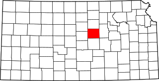
This is a list of the National Register of Historic Places listings in Morris County, Kansas.

National Register of Historic Places listings in Sedgwick County, Kansas

This is a list of the National Register of Historic Places listings in Sedgwick County, Kansas.

National Register of Historic Places listings in Wyandotte County, Kansas

This is a list of the National Register of Historic Places listings in Wyandotte County, Kansas.

National Register of Historic Places listings in Barton County, Kansas

This is a list of the National Register of Historic Places listings in Barton County, Kansas.

National Register of Historic Places listings in Chase County, Kansas

This is a list of the National Register of Historic Places listings in Chase County, Kansas.

National Register of Historic Places listings in Cowley County, Kansas

This is a list of the National Register of Historic Places listings in Cowley County, Kansas.

National Register of Historic Places listings in Franklin County, Kansas

This is a list of the National Register of Historic Places listings in Franklin County, Kansas.

National Register of Historic Places listings in Johnson County, Kansas

This is a list of the National Register of Historic Places listings in Johnson County, Kansas.

National Register of Historic Places listings in Saline County, Kansas

This is a list of the National Register of Historic Places listings in Saline County, Kansas.

National Register of Historic Places listings in Cloud County, Kansas

This is a list of the National Register of Historic Places listings in Cloud County, Kansas.

National Register of Historic Places listings in Muskogee County, Oklahoma

This is a list of the National Register of Historic Places listings in Muskogee County, Oklahoma.

National Register of Historic Places listings in Le Flore County, Oklahoma

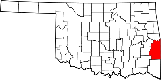
This is a list of the National Register of Historic Places listings in Le Flore County, Oklahoma.

National Register of Historic Places listings in Logan County, Oklahoma

This is a list of the National Register of Historic Places listings in Logan County, Oklahoma.

National Register of Historic Places listings in McCurtain County, Oklahoma

This is a list of the National Register of Historic Places listings in McCurtain County, Oklahoma.

National Register of Historic Places listings in Pottawatomie County, Oklahoma

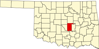
This is a list of the National Register of Historic Places listings in Pottawatomie County, Oklahoma.

National Register of Historic Places listings in Republic County, Kansas

This is a list of the National Register of Historic Places listings in Republic County, Kansas.

National Register of Historic Places listings in Jackson County, Missouri

This is a list of the National Register of Historic Places listings in Jackson County, Missouri.

References

  1. The latitude and longitude information provided in this table was derived originally from the National Register Information System, which has been found to be fairly accurate for about 99% of listings. Some locations in this table may have been corrected to current GPS standards.
  2. National Park Service, United States Department of the Interior, "National Register of Historic Places: Weekly List Actions", retrieved July 2, 2021.
  3. Numbers represent an alphabetical ordering by significant words. Various colorings, defined here, differentiate National Historic Landmarks and historic districts from other NRHP buildings, structures, sites or objects.
  4. "National Register Information System". National Register of Historic Places . National Park Service. March 13, 2009.
  5. The eight-digit number below each date is the number assigned to each location in the National Register Information System database, which can be viewed by clicking the number.
  6. Schmits, Larry J. "The Coffey Site: Environment and Cultural Adaptation at a Prairie Plains Archaic Site". Midcontinental Journal of Archaeology 3.1 (1978): 69-185: 79.
  7. Location derived from its NRHP nomination form; the NRIS lists the site as "Address Restricted"