National Register of Historic Places listings in Pulaski County, Virginia

Last updated

Location of Pulaski County in Virginia Map of Virginia highlighting Pulaski County.svg
Location of Pulaski County in Virginia

This is a list of the National Register of Historic Places listings in Pulaski County, Virginia.

Contents

This is intended to be a complete list of the properties and districts on the National Register of Historic Places in Pulaski County, Virginia, United States. The locations of National Register properties and districts for which the latitude and longitude coordinates are included below, may be seen in an online map. [1]

There are 24 properties and districts listed on the National Register in the county. Another property was once listed but has been removed.


    This National Park Service list is complete through NPS recent listings posted June 16, 2023. [2]

Map all coordinates using: OpenStreetMap  
Download coordinates as: KML

Current listings

[3] Name on the Register [4] ImageDate listed [5] Location City or townDescription
1 Back Creek Farm
Back Creek Farm Back Creek Farm from east.jpg
Back Creek Farm
May 21, 1975
(#75002032)
Northwest of Dublin off State Route 100
37°09′53″N80°42′30″W / 37.164722°N 80.708333°W / 37.164722; -80.708333 (Back Creek Farm)
Dublin
2 Belle-Hampton
Belle-Hampton Belle-Hampton, distant from south.jpg
Belle-Hampton
November 13, 1989
(#89001911)
Highland Rd., 0.3 miles north of Neck Creek Rd.
37°10′41″N80°39′38″W / 37.178056°N 80.660556°W / 37.178056; -80.660556 (Belle-Hampton)
Dublin
3 Calfee Athletic Field
Calfee Athletic Field Calfee Park in 2005.jpg
Calfee Athletic Field
November 22, 2000
(#00001432)
Washington and Pierce Aves., SE.
37°02′22″N80°46′33″W / 37.039444°N 80.775833°W / 37.039444; -80.775833 (Calfee Athletic Field)
Pulaski
4 Calfee Training School March 22, 2022
(#100007539)
1 Corbin-Harmon Dr.
Coordinates missing
Pulaski
5 Claremont Elementary School August 9, 2021
(#100006822)
800 Ridge Ave.
37°03′15″N80°45′36″W / 37.0543°N 80.7600°W / 37.0543; -80.7600 (Claremont Elementary School)
Pulaski
6 Dalton Theatre Building
Dalton Theatre Building Dalton Theatre Building.JPG
Dalton Theatre Building
May 7, 1979
(#79003074)
Washington Ave.
37°02′49″N80°46′47″W / 37.046944°N 80.779722°W / 37.046944; -80.779722 (Dalton Theatre Building)
Pulaski
7 Draper Historic District
Draper Historic District Draper Mercantile.jpg
Draper Historic District
February 21, 2020
(#100004991)
Greenbriar Rd./Old Baltimore Rd. and adjacent
37°00′06″N80°44′32″W / 37.001667°N 80.742222°W / 37.001667; -80.742222 (Draper Historic District)
Draper
8 Dublin Historic District
Dublin Historic District Dublin VA Historic District DSC 0176.jpg
Dublin Historic District
October 15, 1992
(#92001369)
Roughly Giles Ave. from Long to Main Sts., Church St. from Giles to Linkous Ave., and E. Main from Giles to Ziegler St.
37°06′29″N80°41′16″W / 37.108056°N 80.687778°W / 37.108056; -80.687778 (Dublin Historic District)
Dublin
9 Fairview District Home
Fairview District Home Fairview District Home.jpg
Fairview District Home
August 29, 1997
(#97001073)
Western side of Cougar Trail Rd.
37°05′43″N80°43′10″W / 37.095278°N 80.719444°W / 37.095278; -80.719444 (Fairview District Home)
Dublin
10 John Hoge House
John Hoge House John Hoge House.jpg
John Hoge House
August 25, 1988
(#88001320)
Northwestern side of Neck Creek Rd.
37°10′40″N80°37′44″W / 37.177778°N 80.628889°W / 37.177778; -80.628889 (John Hoge House)
Belspring
11 Haven B. Howe House
Haven B. Howe House DSC 6305 (5855206464) (2).jpg
Haven B. Howe House
April 15, 2008
(#08000321)
4400 State Park Rd.
37°03′26″N80°37′13″W / 37.057222°N 80.620278°W / 37.057222; -80.620278 (Haven B. Howe House)
Dublin
12 Ingles Ferry
Ingles Ferry Ingles Ferry Tavern 01.jpg
Ingles Ferry
November 25, 1969
(#69000275)
Wilderness Rd.
37°06′05″N80°35′29″W / 37.101250°N 80.591389°W / 37.101250; -80.591389 (Ingles Ferry)
Radford
13 New Dublin Presbyterian Church
New Dublin Presbyterian Church New Dublin Presbyterian Church CW era.jpg
New Dublin Presbyterian Church
November 26, 2004
(#04001272)
New Dublin Church Rd.
37°07′23″N80°41′17″W / 37.123056°N 80.688056°W / 37.123056; -80.688056 (New Dublin Presbyterian Church)
Dublin
14 Newbern Historic District
Newbern Historic District Cabin - Newbern Historic District.jpg
Newbern Historic District
June 4, 1979
(#79003073)
Newbern Rd.
37°04′24″N80°41′30″W / 37.073333°N 80.691667°W / 37.073333; -80.691667 (Newbern Historic District)
Newbern
15 Pulaski County Courthouse
Pulaski County Courthouse Pulaski County Courthouse.JPG
Pulaski County Courthouse
July 8, 1982
(#82004582)
Main St.
37°02′54″N80°46′53″W / 37.048333°N 80.781389°W / 37.048333; -80.781389 (Pulaski County Courthouse)
Pulaski
16 Pulaski High School June 9, 2023
(#100009049)
500 Pico Ter.
37°03′04″N80°46′21″W / 37.0510°N 80.7724°W / 37.0510; -80.7724 (Pulaski High School)
Pulaski
17 Pulaski Historic Commercial District
Pulaski Historic Commercial District Downtown Pulaski historic Commercial district PO, RR, Park, etc.jpg
Pulaski Historic Commercial District
March 13, 1986
(#86000405)
Roughly bounded by 3rd St., Madison Ave., the Norfolk Southern railroad tracks, and Randolph Ave.
37°02′51″N80°46′52″W / 37.0475°N 80.781111°W / 37.0475; -80.781111 (Pulaski Historic Commercial District)
Pulaski
18 Pulaski Historic Residential District
Pulaski Historic Residential District Jefferson south of Sixth, Pulaski.jpg
Pulaski Historic Residential District
August 11, 1988
(#88001216)
Roughly bounded by 11th St., Prospect, Madison, and Washington Aves., 2nd St., and Henry Ave.
37°03′10″N80°46′56″W / 37.052778°N 80.782222°W / 37.052778; -80.782222 (Pulaski Historic Residential District)
Pulaski
19 Pulaski South Historic Residential and Industrial District
Pulaski South Historic Residential and Industrial District Valley north of Chestnut, Pulaski.jpg
Pulaski South Historic Residential and Industrial District
October 29, 1991
(#91001580)
Roughly bounded by Bertha St., Commerce St., Pierce Ave., 5th St., and Pulaski St.
37°02′31″N80°47′06″W / 37.041944°N 80.785000°W / 37.041944; -80.785000 (Pulaski South Historic Residential and Industrial District)
Pulaski
20 Rockwood
Rockwood Rockwood Mannor House.jpg
Rockwood
May 26, 2005
(#05000473)
5189 Rockwood Dr.
37°06′47″N80°42′09″W / 37.113056°N 80.702500°W / 37.113056; -80.702500 (Rockwood)
Dublin
21 St. Albans Hospital
St. Albans Hospital St. Albans Hospital, Fairlawn.jpg
St. Albans Hospital
January 24, 2020
(#100004653)
6248 University Park Dr.
37°08′23″N80°34′41″W / 37.139722°N 80.578056°W / 37.139722; -80.578056 (St. Albans Hospital)
Fairlawn
22 Snowville Christian Church
Snowville Christian Church Snowville Christian Church.jpg
Snowville Christian Church
April 2, 1987
(#87000563)
Lead Mine Rd.
37°02′04″N80°33′36″W / 37.034444°N 80.560000°W / 37.034444; -80.560000 (Snowville Christian Church)
Snowville
23 Snowville Historic District
Snowville Historic District Snowville Historic District.jpg
Snowville Historic District
January 7, 1987
(#86003650)
Lead Mine Rd.
37°02′06″N80°33′35″W / 37.035000°N 80.559722°W / 37.035000; -80.559722 (Snowville Historic District)
Snowville
24 Spring Dale
Spring Dale Spring Dale entrance.jpg
Spring Dale
October 23, 2003
(#03001087)
Off Ruebush Rd., north of Dublin [6]
37°09′11″N80°39′59″W / 37.152917°N 80.666389°W / 37.152917; -80.666389 (Spring Dale)
Dublin

Former listing

[3] Name on the RegisterImageDate listedDate removedLocationCity or townDescription
1 Nathaniel Burwell Harvey House February 13, 1986
(#86000250)
March 19, 2001Off VA 812
Dublin Demolished

See also

Related Research Articles

<span class="mw-page-title-main">National Register of Historic Places listings in Amelia County, Virginia</span>

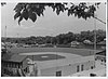
This is a list of the National Register of Historic Places listings in Amelia County, Virginia.

<span class="mw-page-title-main">National Register of Historic Places listings in Bedford County, Virginia</span>

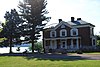
This is a list of the National Register of Historic Places listings in Bedford County, Virginia.

<span class="mw-page-title-main">National Register of Historic Places listings in Washington County, Virginia</span>

This is a list of the National Register of Historic Places listings in Washington County, Virginia.

<span class="mw-page-title-main">National Register of Historic Places listings in Clarke County, Virginia</span>

This is a list of the National Register of Historic Places listings in Clarke County, Virginia.

<span class="mw-page-title-main">National Register of Historic Places listings in Brooke County, West Virginia</span>

This is a list of the National Register of Historic Places listings in Brooke County, West Virginia.

<span class="mw-page-title-main">National Register of Historic Places listings in Rockingham County, Virginia</span>

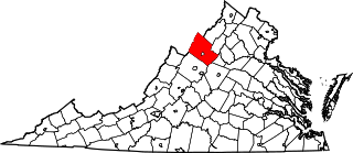
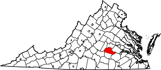
This is a list of the National Register of Historic Places listings in Rockingham County, Virginia.

<span class="mw-page-title-main">National Register of Historic Places listings in Northampton County, Virginia</span>

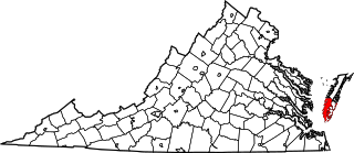
This is a list of the National Register of Historic Places listings in Northampton County, Virginia.

<span class="mw-page-title-main">National Register of Historic Places listings in Rappahannock County, Virginia</span>

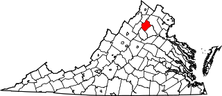
This is a list of the National Register of Historic Places listings in Rappahannock County, Virginia.

'.

<span class="mw-page-title-main">National Register of Historic Places listings in Patrick County, Virginia</span>

This is a list of the National Register of Historic Places listings in Patrick County, Virginia.

<span class="mw-page-title-main">National Register of Historic Places listings in Prince Edward County, Virginia</span>

This is a list of the National Register of Historic Places listings in Prince Edward County, Virginia.

<span class="mw-page-title-main">National Register of Historic Places listings in Russell County, Virginia</span>

This is a list of the National Register of Historic Places listings in Russell County, Virginia.

<span class="mw-page-title-main">National Register of Historic Places listings in Pulaski County, Arkansas</span>

This is a list of the National Register of Historic Places listings in Pulaski County, Arkansas.

<span class="mw-page-title-main">National Register of Historic Places listings in Cass County, Indiana</span>

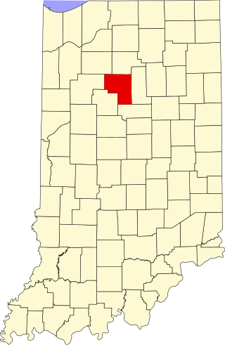
This is a list of the National Register of Historic Places listings in Cass County, Indiana.

<span class="mw-page-title-main">National Register of Historic Places listings in Marshall County, Indiana</span>

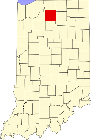
This is a list of the National Register of Historic Places listings in Marshall County, Indiana.

<span class="mw-page-title-main">National Register of Historic Places listings in Pulaski County, Indiana</span>

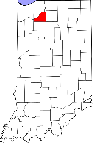
This is a list of the National Register of Historic Places listings in Pulaski County, Indiana.

<span class="mw-page-title-main">National Register of Historic Places listings in Starke County, Indiana</span>

This is a list of the National Register of Historic Places listings in Starke County, Indiana.

<span class="mw-page-title-main">National Register of Historic Places listings in Lewis County, West Virginia</span>

This is a list of the National Register of Historic Places listings in Lewis County, West Virginia.

<span class="mw-page-title-main">National Register of Historic Places listings in Craig County, Virginia</span>

This is a list of the National Register of Historic Places listings in Craig County, Virginia.

<span class="mw-page-title-main">National Register of Historic Places listings in Pulaski County, Missouri</span>

This is a list of the National Register of Historic Places listings in Pulaski County, Missouri.

References

  1. The latitude and longitude information provided in this table was derived originally from the National Register Information System, which has been found to be fairly accurate for about 99% of listings. Some locations in this table may have been corrected to current GPS standards.
  2. National Park Service, United States Department of the Interior, "National Register of Historic Places: Weekly List Actions", retrieved June 16, 2023.
  3. 1 2 Numbers represent an alphabetical ordering by significant words. Various colorings, defined here, differentiate National Historic Landmarks and historic districts from other NRHP buildings, structures, sites or objects.
  4. "National Register Information System". National Register of Historic Places . National Park Service. April 24, 2008.
  5. The eight-digit number below each date is the number assigned to each location in the National Register Information System database, which can be viewed by clicking the number.
  6. Pulice, Michael J. National Register of Historic Places Inventory/Nomination: Spring Dale. National Park Service, 2003-03, 31.