National Register of Historic Places listings in Roane County, Tennessee

Last updated

Location of Roane County in Tennessee Map of Tennessee highlighting Roane County.svg
Location of Roane County in Tennessee

This is a list of the National Register of Historic Places listings in Roane County, Tennessee.

Contents

This is intended to be a complete list of the properties and historic districts in Roane County, Tennessee, United States, that are listed on the National Register of Historic Places. Latitude and longitude coordinates are provided for many National Register properties and districts; these locations may be seen together in a map. [1]

There are 20 properties and districts listed on the National Register in the county, including one National Historic Landmark.

See also National Register of Historic Places listings in Anderson County, Tennessee for additional properties in Oak Ridge and Oliver Springs, cities that span the county line.

Map all coordinates using: OpenStreetMap  
Download coordinates as: KML
Contents: Counties in Tennessee
Anderson  Bedford  Benton  Bledsoe  Blount  Bradley  Campbell  Cannon  Carroll  Carter  Cheatham  Chester  Claiborne  Clay  Cocke  Coffee  Crockett  Cumberland  Davidson  Decatur  DeKalb  Dickson  Dyer  Fayette  Fentress  Franklin  Gibson  Giles  Grainger  Greene  Grundy  Hamblen  Hamilton  Hancock  Hardeman  Hardin  Hawkins  Haywood  Henderson  Henry  Hickman  Houston  Humphreys  Jackson  Jefferson  Johnson  Knox  Lake  Lauderdale  Lawrence  Lewis  Lincoln  Loudon  Macon  Madison  Marion  Marshall  Maury  McMinn  McNairy  Meigs  Monroe  Montgomery  Moore  Morgan  Obion  Overton  Perry  Pickett  Polk  Putnam  Rhea  Roane  Robertson  Rutherford  Scott  Sequatchie  Sevier  Shelby  Smith  Stewart  Sullivan  Sumner  Tipton  Trousdale  Unicoi  Union  Van Buren  Warren  Washington  Wayne  Weakley  White  Williamson  Wilson


    This National Park Service list is complete through NPS recent listings posted October 21, 2022. [2]

Current listings

[3] Name on the Register [4] ImageDate listed [5] Location City or townDescription
1 Abston Garage
Abston Garage Abstons-garage-tn1.jpg
Abston Garage
March 10, 2009
(#09000117)
301 Kingston Ave
36°02′39″N84°20′39″W / 36.04412°N 84.34416°W / 36.04412; -84.34416 (Abston Garage)
Oliver Springs
2 Bethel Cemetery
Bethel Cemetery Bethel-cemetery-kingston-tn1.jpg
Bethel Cemetery
June 26, 2006
(#06000547)
Euclid Ave. and 3rd St.
35°52′16″N84°31′02″W / 35.871111°N 84.517222°W / 35.871111; -84.517222 (Bethel Cemetery)
Kingston
3 Colonial Hall
Colonial Hall Colonial-hall-oliver-springs-tn1.jpg
Colonial Hall
September 11, 1975
(#75001774)
104 Morgan St
36°02′39″N84°20′26″W / 36.044167°N 84.340556°W / 36.044167; -84.340556 (Colonial Hall)
Oliver Springs Antebellum house currently being restored
4 Cornstalk Heights Historic District
Cornstalk Heights Historic District Cornstalk-heights-house-tn1.jpg
Cornstalk Heights Historic District
January 11, 1991
(#90002142)
Roughly bounded by Georgia Ave., Sewanee St., Morgan Ave., and Trenton St.
35°56′03″N84°32′48″W / 35.934167°N 84.546667°W / 35.934167; -84.546667 (Cornstalk Heights Historic District)
Harriman Contains several dozen contributing houses built in the 1890s through the 1930s
5 Harriman City Hall
Harriman City Hall Harriman temperance university abt1906.jpg
Harriman City Hall
April 16, 1971
(#71000828)
330 N Roane St.
35°56′03″N84°33′06″W / 35.93403°N 84.55158°W / 35.93403; -84.55158 (Harriman City Hall)
Harriman Building originally housed American Temperance University.
6 George Jones Memorial Baptist Church
George Jones Memorial Baptist Church Oak-ridge-george-jones-tn1.jpg
George Jones Memorial Baptist Church
May 6, 1992
(#92000408)
Blair Rd.
35°56′21″N84°22′22″W / 35.939167°N 84.372778°W / 35.939167; -84.372778 (George Jones Memorial Baptist Church)
Oak Ridge
7 Kingston Avenue Historic District
Kingston Avenue Historic District Kingston-avenue-hd-house-tn1.jpg
Kingston Avenue Historic District
December 1, 1997
(#97001500)
Roughly along N. Kingston, S. Kingston, and E. Rockwood Aves.
35°51′56″N84°41′04″W / 35.865556°N 84.684444°W / 35.865556; -84.684444 (Kingston Avenue Historic District)
Rockwood
8 Molyneux Chevrolet Company-Rockwood Fire Department Building
Molyneux Chevrolet Company-Rockwood Fire Department Building Molyneux-chevrolet-building-tn1.jpg
Molyneux Chevrolet Company-Rockwood Fire Department Building
March 20, 2002
(#02000234)
228 West Rockwood St.
35°52′07″N84°41′14″W / 35.868749°N 84.687122°W / 35.868749; -84.687122 (Molyneux Chevrolet Company-Rockwood Fire Department Building)
Rockwood Building which was part fire station and part car dealership.
9 Col. Gideon Morgan House
Col. Gideon Morgan House Gideon-morgan-house-tn1.jpg
Col. Gideon Morgan House
January 27, 1983
(#83003060)
149 N Kentucky St.
35°52′20″N84°30′59″W / 35.872222°N 84.516389°W / 35.872222; -84.516389 (Col. Gideon Morgan House)
Kingston Oldest house in county. Bought in 1936 by William B. Ladd, Republican candidate for U.S. Senate in 1946
10 New Bethel Baptist Church
New Bethel Baptist Church NewBethelBaptistChurch.jpg
New Bethel Baptist Church
May 6, 1992
(#92000409)
Bethel Valley Rd.
35°56′01″N84°18′19″W / 35.933611°N 84.305278°W / 35.933611; -84.305278 (New Bethel Baptist Church)
Oak Ridge
11 Oak Ridge Turnpike Checking Station
Oak Ridge Turnpike Checking Station Oak-ridge-turnpike-checking-station-tn1.jpg
Oak Ridge Turnpike Checking Station
May 6, 1992
(#92000412)
Oak Ridge Turnpike
35°58′49″N84°20′03″W / 35.980278°N 84.334167°W / 35.980278; -84.334167 (Oak Ridge Turnpike Checking Station)
Oak Ridge One of three NRHP-listed World War II-era checkpoint gatehouses in Oak Ridge
12 Post Oak Springs Christian Church
Post Oak Springs Christian Church Post-oak-springs-christian-church-tn1.jpg
Post Oak Springs Christian Church
March 15, 2007
(#07000156)
Roane St. Highway (Old Kingston Highway) at Post Oak Rd.
35°52′25″N84°38′02″W / 35.873611°N 84.633889°W / 35.873611; -84.633889 (Post Oak Springs Christian Church)
Rockwood
13 Roane County Courthouse
Roane County Courthouse Kingston-tennessee-oldcourthouse1.jpg
Roane County Courthouse
July 14, 1971
(#71000829)
119 Court St
35°52′18″N84°30′57″W / 35.871667°N 84.515833°W / 35.871667; -84.515833 (Roane County Courthouse)
Kingston Now a museum; the new courthouse is located across the street
14 Roane Street Commercial Historic District
Roane Street Commercial Historic District Harriman-public-library-tn1.jpg
Roane Street Commercial Historic District
June 29, 1989
(#89000506)
Roughly Roane St. between Morgan Ave., NW. and Crescent Ave., NW.
35°56′04″N84°33′01″W / 35.934444°N 84.550278°W / 35.934444; -84.550278 (Roane Street Commercial Historic District)
Harriman Includes a theater, a Carnegie library, an old post office, and several storefronts along Roane Street
15 Rockwood Post Office
Rockwood Post Office Rockwood-post-office-tn1.jpg
Rockwood Post Office
December 30, 1999
(#99001621)
340 W. Rockwood St. [6]
35°52′11″N84°41′18″W / 35.8697°N 84.6882°W / 35.8697; -84.6882 (Rockwood Post Office)
Rockwood
16 Southwest Point
Southwest Point Fort-southwest-point-tn1.jpg
Southwest Point
July 31, 1972
(#72001252)
1 mile southwest of Kingston
35°51′39″N84°31′44″W / 35.860833°N 84.528889°W / 35.860833; -84.528889 (Southwest Point)
Kingston Fort no longer standing; currently being reconstructed
17 Dr. Fred Stone, Sr. Hospital
Dr. Fred Stone, Sr. Hospital Fred-stone-hospital-tn1.jpg
Dr. Fred Stone, Sr. Hospital
November 29, 2006
(#06001097)
101 Roane St.
36°02′50″N84°20′27″W / 36.047222°N 84.340833°W / 36.047222; -84.340833 (Dr. Fred Stone, Sr. Hospital)
Oliver Springs Unique building constructed piecemeal in various phases, many of which can be discerned from the exterior brickwork
18 Tennessee Highway Patrol Buildings
Tennessee Highway Patrol Buildings THP-building-rockwood-tn1.jpg
Tennessee Highway Patrol Buildings
March 14, 2001
(#01000255)
Junction of Kingston Ave. and Nelson St.; also Belson St. and U.S. Route 70
35°51′36″N84°40′52″W / 35.86°N 84.6811°W / 35.86; -84.6811 (Tennessee Highway Patrol Buildings)
Rockwood Second address represents a boundary increase of March 15, 2011
19 Valley View Farm
Valley View Farm Valley-view-farm-tn1.jpg
Valley View Farm
March 21, 1997
(#97000257)
160 Martin Rd.
35°54′09″N84°36′29″W / 35.9025°N 84.608056°W / 35.9025; -84.608056 (Valley View Farm)
Harriman mid-19th century farmstead
20 X-10 Reactor, Oak Ridge National Laboratory
X-10 Reactor, Oak Ridge National Laboratory GraphiteReactor.jpg
X-10 Reactor, Oak Ridge National Laboratory
October 15, 1966
(#66000720)
Oak Ridge National Laboratory
35°55′41″N84°19′03″W / 35.928056°N 84.3175°W / 35.928056; -84.3175 (X-10 Reactor, Oak Ridge National Laboratory)
Oak Ridge

See also

Related Research Articles

This is a list of the National Register of Historic Places listings in Obion County, Tennessee.

This is a list of the National Register of Historic Places listings in Anderson County, Tennessee.

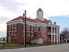
This is a list of the National Register of Historic Places listings in Bedford County, Tennessee.

This is a list of the National Register of Historic Places listings in Bradley County, Tennessee.

This is a list of the National Register of Historic Places listings in Maury County, Tennessee.

This is a list of the National Register of Historic Places listings in Carter County, Tennessee.

This is a list of the National Register of Historic Places listings in Dickson County, Tennessee.

This is a list of the National Register of Historic Places listings in Weakley County, Tennessee.

This is a list of the National Register of Historic Places listings in Robertson County, Tennessee.

This is a list of the National Register of Historic Places listings in Gibson County, Tennessee.

This is a list of the National Register of Historic Places listings in Fentress County, Tennessee.

This is a list of the National Register of Historic Places listings in Franklin County, Tennessee.

This is a list of the National Register of Historic Places listings in Jefferson County, Tennessee.

This is a list of the National Register of Historic Places listings in Hardeman County, Tennessee.

This is a list of the National Register of Historic Places listings in Lawrence County, Tennessee.

This is a list of the National Register of Historic Places listings in Henry County, Tennessee.

This is a list of the National Register of Historic Places listings in Marshall County, Tennessee.

This is a list of the National Register of Historic Places listings in McMinn County, Tennessee.

This is a list of the National Register of Historic Places listings in Meigs County, Tennessee.

<span class="mw-page-title-main">National Register of Historic Places listings in Roane County, West Virginia</span>

This is a list of the National Register of Historic Places listings in Roane County, West Virginia.

References

  1. The latitude and longitude information provided in this table was derived originally from the National Register Information System, which has been found to be fairly accurate for about 99% of listings. Some locations in this table may have been corrected to current GPS standards.
  2. National Park Service, United States Department of the Interior, "National Register of Historic Places: Weekly List Actions", retrieved October 21, 2022.
  3. Numbers represent an alphabetical ordering by significant words. Various colorings, defined here, differentiate National Historic Landmarks and historic districts from other NRHP buildings, structures, sites or objects.
  4. "National Register Information System". National Register of Historic Places . National Park Service. April 24, 2008.
  5. The eight-digit number below each date is the number assigned to each location in the National Register Information System database, which can be viewed by clicking the number.
  6. Address based on USPS website. Accessed April 10, 2016.