National Register of Historic Places listings in Rutherford County, Tennessee

Last updated

Location of Rutherford County in Tennessee Map of Tennessee highlighting Rutherford County.svg
Location of Rutherford County in Tennessee

This is a list of the National Register of Historic Places listings in Rutherford County, Tennessee.

Contents

This is intended to be a complete list of the properties and districts on the National Register of Historic Places in Rutherford County, Tennessee, United States. Latitude and longitude coordinates are provided for many National Register properties and districts; these locations may be seen together in a map. [1]

There are 48 properties and districts listed on the National Register in the county, and six former listings.

Map all coordinates using: OpenStreetMap
Contents: Counties in Tennessee
Anderson  Bedford  Benton  Bledsoe  Blount  Bradley  Campbell  Cannon  Carroll  Carter  Cheatham  Chester  Claiborne  Clay  Cocke  Coffee  Crockett  Cumberland  Davidson  Decatur  DeKalb  Dickson  Dyer  Fayette  Fentress  Franklin  Gibson  Giles  Grainger  Greene  Grundy  Hamblen  Hamilton  Hancock  Hardeman  Hardin  Hawkins  Haywood  Henderson  Henry  Hickman  Houston  Humphreys  Jackson  Jefferson  Johnson  Knox  Lake  Lauderdale  Lawrence  Lewis  Lincoln  Loudon  Macon  Madison  Marion  Marshall  Maury  McMinn  McNairy  Meigs  Monroe  Montgomery  Moore  Morgan  Obion  Overton  Perry  Pickett  Polk  Putnam  Rhea  Roane  Robertson  Rutherford  Scott  Sequatchie  Sevier  Shelby  Smith  Stewart  Sullivan  Sumner  Tipton  Trousdale  Unicoi  Union  Van Buren  Warren  Washington  Wayne  Weakley  White  Williamson  Wilson


    This National Park Service list is complete through NPS recent listings posted October 27, 2023. [2]

Current listings

[3] Name on the Register [4] ImageDate listed [5] Location City or townDescription
1 Allen Chapel A.M.E. Church
Allen Chapel A.M.E. Church Allen Chapel A.M.E. Church.JPG
Allen Chapel A.M.E. Church
March 31, 1995
(#95000291)
224 S. Maney Ave.
35°50′38″N86°23′14″W / 35.843889°N 86.387222°W / 35.843889; -86.387222 (Allen Chapel A.M.E. Church)
Murfreesboro
2 Arnold-Harrell House
Arnold-Harrell House 1710 E Main St.jpg
Arnold-Harrell House
March 27, 1992
(#92000145)
1710 E. Main St.
35°50′26″N86°21′51″W / 35.840556°N 86.364167°W / 35.840556; -86.364167 (Arnold-Harrell House)
Murfreesboro
3 Beesley Primitive Baptist Church
Beesley Primitive Baptist Church Beesley Primitive Baptist Church.JPG
Beesley Primitive Baptist Church
April 8, 1999
(#99000397)
461 Beesley Rd.
35°51′11″N86°29′51″W / 35.853056°N 86.4975°W / 35.853056; -86.4975 (Beesley Primitive Baptist Church)
Murfreesboro
4 Benevolent Cemetery May 16, 2022
(#100007730)
Park Ave.
35°49′54″N86°23′51″W / 35.8318°N 86.3975°W / 35.8318; -86.3975 (Benevolent Cemetery)
Murfreesboro
5 Thomas C. Black House
Thomas C. Black House Thomas C. Black House -Murfreesboro, TN.jpg
Thomas C. Black House
July 5, 1996
(#96000231)
4431 Lebanon Rd.
35°55′38″N86°22′58″W / 35.927222°N 86.382778°W / 35.927222; -86.382778 (Thomas C. Black House)
Murfreesboro
6 Boxwood
Boxwood Boxwood Plantation Home.jpg
Boxwood
October 25, 1984
(#84000139)
Old Salem Pike
35°48′37″N86°27′09″W / 35.810278°N 86.4525°W / 35.810278; -86.4525 (Boxwood)
Murfreesboro
7 Bradley Academy
Bradley Academy Bradley-academy-murfreesboro-tn1.jpg
Bradley Academy
June 14, 1990
(#90000914)
415 S. Academy St.
35°50′31″N86°23′19″W / 35.841944°N 86.388611°W / 35.841944; -86.388611 (Bradley Academy)
Murfreesboro School established 1811; current building completed in 1917
8 Caff-E-Hill Farm April 14, 1995
(#95000412)
3783 Cripple Creek Rd.
35°46′42″N86°11′53″W / 35.778333°N 86.198056°W / 35.778333; -86.198056 (Caff-E-Hill Farm)
Readyville
9 Cemetery School November 2, 2022
(#100008375)
Mt. Olive Rd.
35°53′09″N86°26′27″W / 35.8858°N 86.4407°W / 35.8858; -86.4407 (Cemetery School)
Murfreesboro
10 Childress-Ray House
Childress-Ray House Childress-ray-house-tn1.jpg
Childress-Ray House
December 27, 1979
(#79002458)
225 N. Academy St.
35°50′51″N86°23′19″W / 35.8475°N 86.388611°W / 35.8475; -86.388611 (Childress-Ray House)
Murfreesboro Originally built 1847; remodeled 1874
11 Collier-Crichlow House
Collier-Crichlow House Collier-critchlow-house-tn1.jpg
Collier-Crichlow House
July 16, 1973
(#73001822)
511 E. Main St.
35°50′42″N86°22′18″W / 35.845°N 86.371667°W / 35.845; -86.371667 (Collier-Crichlow House)
Murfreesboro Second Empire-style house built in 1879.
12 Sam Davis House
Sam Davis House Sam Davis House.jpg
Sam Davis House
December 23, 1969
(#69000181)
Northeast of Smyrna off State Route 102
35°59′21″N86°29′56″W / 35.989167°N 86.498889°W / 35.989167; -86.498889 (Sam Davis House)
Smyrna
13 Dement House
Dement House Dement House-Lascassas, TN.jpg
Dement House
June 26, 1986
(#86001379)
7421 Cainsville Pike
35°55′56″N86°16′01″W / 35.932222°N 86.266944°W / 35.932222; -86.266944 (Dement House)
Lascassas
14 East Main Street Historic District
East Main Street Historic District Central Christian Church 404 E Main.jpg
East Main Street Historic District
July 11, 1985
(#85001516)
Roughly E. Main, E. Lytle, College, University, and E. Vine Sts.
35°50′42″N86°22′50″W / 35.845°N 86.380556°W / 35.845; -86.380556 (East Main Street Historic District)
Murfreesboro
15 Elmwood October 15, 1973
(#73001823)
Northwest of Murfreesboro off U.S. Routes 41/70S; also 5722 Old Nashville Highway
35°53′46″N86°27′28″W / 35.896111°N 86.457778°W / 35.896111; -86.457778 (Elmwood)
Murfreesboro 5722 Old Nashville Highway represents a boundary increase of July 3, 2007
16 First Presbyterian Church
First Presbyterian Church First presbyterian church murfreesboro tennessee 2008.jpg
First Presbyterian Church
June 24, 1993
(#93000561)
210 N. Spring St.
35°50′49″N86°23′23″W / 35.846944°N 86.389722°W / 35.846944; -86.389722 (First Presbyterian Church)
Murfreesboro
17 Fortress Rosecrans Site
Fortress Rosecrans Site Fortress Rosecrans wall.jpg
Fortress Rosecrans Site
June 7, 1974
(#74001926)
Old Fort Parkway
west of downtown Murfreesboro at the Stones River

35°51′12″N86°24′41″W / 35.853333°N 86.411389°W / 35.853333; -86.411389 (Fortress Rosecrans Site)
Murfreesboro
18 Logan Henderson Farm
Logan Henderson Farm Farmhouse, Logan Henderson Farm.JPG
Logan Henderson Farm
September 25, 2003
(#03000971)
3600 Manchester Pike
35°47′27″N86°21′25″W / 35.790833°N 86.356944°W / 35.790833; -86.356944 (Logan Henderson Farm)
Murfreesboro
19 Idler's Retreat
Idler's Retreat Idler's Retreat.JPG
Idler's Retreat
May 19, 2004
(#04000475)
112 Oak St.
35°59′15″N86°30′55″W / 35.9875°N 86.515278°W / 35.9875; -86.515278 (Idler's Retreat)
Smyrna
20 Jarman Farm
Jarman Farm Jarman Farm.jpg
Jarman Farm
July 6, 1987
(#87001368)
Cainsville Pike
35°57′46″N86°15′30″W / 35.962778°N 86.258333°W / 35.962778; -86.258333 (Jarman Farm)
Lascassas
21 Enoch H. Jones House
Enoch H. Jones House Enoch H. Jones House-Murfreesboro, TN.jpg
Enoch H. Jones House
August 25, 1995
(#95001043)
6339 Halls Hill Pike
35°51′39″N86°13′04″W / 35.860833°N 86.217778°W / 35.860833; -86.217778 (Enoch H. Jones House)
Murfreesboro
22 William B. Jordan Farm
William B. Jordan Farm William B. Jordan Farm-Eagleville, TN.jpg
William B. Jordan Farm
July 13, 1992
(#92000825)
2665 Taylor Ln.
35°46′03″N86°36′10″W / 35.7675°N 86.602778°W / 35.7675; -86.602778 (William B. Jordan Farm)
Eagleville
23 Landsberger-Gerhardt House
Landsberger-Gerhardt House Landsberger-Gerhardt House-Murfreesboro, TN.jpg
Landsberger-Gerhardt House
December 13, 1993
(#93001397)
435 N. Spring St.
35°51′00″N86°23′21″W / 35.85°N 86.389167°W / 35.85; -86.389167 (Landsberger-Gerhardt House)
Murfreesboro
24 Uncle Dave Macon House
Uncle Dave Macon House Uncle-dave-macon-house-tn1.jpg
Uncle Dave Macon House
November 15, 1973
(#73001827)
West of Readyville on U.S. Route 70S
35°49′27″N86°14′27″W / 35.824167°N 86.240833°W / 35.824167; -86.240833 (Uncle Dave Macon House)
Readyville Home of banjoist and showman Uncle Dave Macon
25 Marymont
Marymont Marymont.JPG
Marymont
October 30, 1973
(#73001824)
Southwest of Murfreesboro, off State Route 99 on Rucker Lane
35°49′12″N86°28′45″W / 35.82°N 86.479167°W / 35.82; -86.479167 (Marymont)
Murfreesboro
26 William Harrison McCord House
William Harrison McCord House William Harrison McCord House-Eagleville, TN.jpg
William Harrison McCord House
December 20, 1984
(#84001121)
475 N. Main St.
35°44′46″N86°39′06″W / 35.746111°N 86.651667°W / 35.746111; -86.651667 (William Harrison McCord House)
Eagleville
27 McGill – Becton – Cates Family Farm
McGill - Becton - Cates Family Farm McGill - Becton - Cates Family Farm-Readyville, TN.jpg
McGill – Becton – Cates Family Farm
November 9, 2005
(#05001220)
2432 Cripple Creek Rd.
35°47′03″N86°12′41″W / 35.784167°N 86.211389°W / 35.784167; -86.211389 (McGill – Becton – Cates Family Farm)
Readyville
28 Middle Tennessee State Teachers College Training School
Middle Tennessee State Teachers College Training School Middle Tennessee State Teachers College Training School.JPG
Middle Tennessee State Teachers College Training School
January 4, 1993
(#92001731)
923 E. Lytle St.
35°50′49″N86°22′31″W / 35.846944°N 86.375278°W / 35.846944; -86.375278 (Middle Tennessee State Teachers College Training School)
Murfreesboro
29 Morgan House
Morgan House Morgan House, Rutherford County, Tennessee.JPG
Morgan House
December 27, 1979
(#79002457)
Southwest of Christiana
35°39′22″N86°27′27″W / 35.656111°N 86.4575°W / 35.656111; -86.4575 (Morgan House)
Christiana
30 Murfreesboro Veterans Administration Hospital Historic District
Murfreesboro Veterans Administration Hospital Historic District Murfreesboro Veterans Administraion -Murfreesboro, TN.jpg
Murfreesboro Veterans Administration Hospital Historic District
March 12, 2012
(#12000119)
3400 Lebanon Pike
35°55′00″N86°22′41″W / 35.916625°N 86.378054°W / 35.916625; -86.378054 (Murfreesboro Veterans Administration Hospital Historic District)
Murfreesboro United States Second Generation Veterans Hospitals Multiple Property Submission
31 Murray Farm
Murray Farm Murray Farm-Readyville, TN.jpg
Murray Farm
July 31, 1991
(#91000980)
9409 Bradyville Rd.
35°45′21″N86°15′49″W / 35.755833°N 86.263611°W / 35.755833; -86.263611 (Murray Farm)
Readyville
32 North Maney Avenue Historic District April 4, 1985
(#85000709)
Roughly bounded by N. Maney and N. Highland Aves., E. College St., and N. Academy Ave.
35°50′55″N86°23′10″W / 35.848611°N 86.386111°W / 35.848611; -86.386111 (North Maney Avenue Historic District)
Murfreesboro
33 Oaklands
Oaklands Oaklands-Murfreesboro, TN.jpg
Oaklands
February 26, 1970
(#70000616)
900 N. Maney Ave.
35°51′21″N86°23′06″W / 35.855833°N 86.385°W / 35.855833; -86.385 (Oaklands)
Murfreesboro
34 Old First Presbyterian Church and Old City Cemetery
Old First Presbyterian Church and Old City Cemetery Old First Presbyterian Church grounds and Old City Cemetery.JPG
Old First Presbyterian Church and Old City Cemetery
March 12, 2012
(#12000120)
390 E. Vine St.
35°50′37″N86°23′16″W / 35.843508°N 86.387871°W / 35.843508; -86.387871 (Old First Presbyterian Church and Old City Cemetery)
Murfreesboro Cemetery dating to the 1820s and site of the original First Presbyterian Church in Murfreesboro which was destroyed by Union Army troops during the American Civil War [6]
35 Gen. Joseph B. Palmer House
Gen. Joseph B. Palmer House Joseph-palmer-house-tn1.jpg
Gen. Joseph B. Palmer House
September 20, 1973
(#73001825)
434 E. Main St.
35°50′43″N86°23′07″W / 35.845278°N 86.385278°W / 35.845278; -86.385278 (Gen. Joseph B. Palmer House)
Murfreesboro Built in 1869 by Confederate general Joseph B. Palmer (18251890)
36 Providence Primitive Baptist Church
Providence Primitive Baptist Church Providence Primitive Baptist Church.jpg
Providence Primitive Baptist Church
November 8, 2000
(#00001357)
256 Central Valley Rd.
35°56′19″N86°22′51″W / 35.938611°N 86.380833°W / 35.938611; -86.380833 (Providence Primitive Baptist Church)
Walterhill
37 Charles Ready House
Charles Ready House The-corners-readyville-tn1.jpg
Charles Ready House
July 2, 1973
(#73001828)
On U.S. Route 70S
35°49′45″N86°10′47″W / 35.829167°N 86.179722°W / 35.829167; -86.179722 (Charles Ready House)
Readyville Known as "The Corners," built in 1829 by Charles Ready
38 Riverside Farm
Riverside Farm Riverside Farm-Murfreesboro, TN.jpg
Riverside Farm
December 12, 2006
(#06001132)
1218 W. Jefferson Pike
35°57′55″N86°23′21″W / 35.965278°N 86.389167°W / 35.965278; -86.389167 (Riverside Farm)
Walterhill
39 Rockvale Store
Rockvale Store Rockvale Store-Rockvale, TN.jpg
Rockvale Store
September 14, 1995
(#95001114)
8964 Rockvale Rd.
35°45′27″N86°31′53″W / 35.7575°N 86.531389°W / 35.7575; -86.531389 (Rockvale Store)
Rockvale
40 Benjamine Rucker House
Benjamine Rucker House Benjamine Rucker House -Murfreesboro, TN.jpg
Benjamine Rucker House
February 28, 1991
(#91000223)
3978 Betty Ford Rd.
35°55′14″N86°19′51″W / 35.920556°N 86.330833°W / 35.920556; -86.330833 (Benjamine Rucker House)
Compton
41 Rutherford County Courthouse
Rutherford County Courthouse Rutherford county courthouse 9736.JPG
Rutherford County Courthouse
July 16, 1973
(#73001826)
Public Square
35°50′46″N86°23′31″W / 35.846111°N 86.391944°W / 35.846111; -86.391944 (Rutherford County Courthouse)
Murfreesboro
42 Rutherford Health Department
Rutherford Health Department Rutherford Health Department.JPG
Rutherford Health Department
July 24, 1992
(#92000960)
303 N. Church St.
35°50′54″N86°23′27″W / 35.848333°N 86.390833°W / 35.848333; -86.390833 (Rutherford Health Department)
Murfreesboro
43 Absalom Scales House
Absalom Scales House Absalom Scales House-Eagleville, TN.jpg
Absalom Scales House
October 30, 1973
(#73001821)
432 Rocky Glade Rd.
35°46′27″N86°38′22″W / 35.774167°N 86.639444°W / 35.774167; -86.639444 (Absalom Scales House)
Eagleville
44 Searcy – Matthews – Tarpley Farm
Searcy - Matthews - Tarpley Farm Searcy - Matthews - Tarpley Farm -Murfreesboro, TN.jpg
Searcy – Matthews – Tarpley Farm
July 14, 2011
(#11000459)
455 W. Jefferson Pike
35°57′08″N86°23′07″W / 35.952222°N 86.385278°W / 35.952222; -86.385278 (Searcy – Matthews – Tarpley Farm)
Walterhill Historic Family Farms in Middle Tennessee MPS
45 Robert Andrew Smith Farm January 4, 1993
(#92001712)
2568 Armstrong Valley Rd.
35°46′06″N86°28′45″W / 35.768333°N 86.479167°W / 35.768333; -86.479167 (Robert Andrew Smith Farm)
Murfreesboro
46 John C. Spence House
John C. Spence House John C. Spence House.JPG
John C. Spence House
August 23, 2004
(#04000302)
503 N. Maple St.
35°51′10″N86°23′32″W / 35.852778°N 86.392222°W / 35.852778; -86.392222 (John C. Spence House)
Murfreesboro
47 Stones River National Battlefield
Stones River National Battlefield 6-pounder Wiard cannon at Stones River National Battlefield.jpg
Stones River National Battlefield
October 15, 1966
(#66000075)
3 miles (4.8 km) northwest of Murfreesboro on U.S. Route 41
35°52′24″N86°25′17″W / 35.873333°N 86.421389°W / 35.873333; -86.421389 (Stones River National Battlefield)
Murfreesboro Boundary increase approved February 22, 2022
48 Walter Hill Hydroelectric Station
Walter Hill Hydroelectric Station Walter Hill dam and hydroelectric station.jpg
Walter Hill Hydroelectric Station
November 7, 1990
(#90001660)
U.S. Route 231 at the Stones River
35°56′37″N86°22′37″W / 35.943611°N 86.376944°W / 35.943611; -86.376944 (Walter Hill Hydroelectric Station)
Murfreesboro

Former listings

Five other properties have previously been listed, but were removed:

[3] Name on the RegisterImageDate listedDate removedLocationCity or townDescription
1 Brown's Mill December 29, 1978
(#78002628)
July 30, 2002SE of Lascassas on Brown's Mill Road
Lascassas Collapsed in June, 1991. [7]
2 Collier-Lane-Crichlow House
Collier-Lane-Crichlow House Collier-lane-chrichlow-house-tn1.jpg
Collier-Lane-Crichlow House
August 23, 1978
(#78002629)
October 23, 2023500 N. Spring St.
35°51′00″N86°23′21″W / 35.85°N 86.389167°W / 35.85; -86.389167 (Collier-Lane-Crichlow House)
Murfreesboro Commonly called the "House of Mayors"; built in 1850. Demolished 2023. [8]
3 Crichlow Grammar School and E. C. Cox Memorial Gym December 17, 1992
(#92001685)
July 30, 2002400 N. Maple St. and 105 Olive St.
Murfreesboro Demolished on September 7, 2000. [9]
4 Hiram Jenkins House June 16, 1989
(#89000504)
November 8, 20061556 Gresham Lane
Murfreesboro Demolished on June 12, 2006. [10]
5 Ridley's Landing July 16, 1973
(#73001829)
July 24, 2008N of Smyrna on Jones Mill Rd., at Stones River
Smyrna vicinity
6 Thomas Williamson House June 21, 1996
(#96000687)
November 19, 20142263 Little Rock Rd.
35°44′58″N86°37′17″W / 35.749444°N 86.621389°W / 35.749444; -86.621389 (Thomas Williamson House)
Eagleville

See also

Related Research Articles

<span class="mw-page-title-main">National Register of Historic Places listings in Montgomery County, Ohio</span>

This is a list of the National Register of Historic Places listings in Montgomery County, Ohio.

<span class="mw-page-title-main">National Register of Historic Places listings in Richland County, Ohio</span>

This is intended to be a complete list of the properties and districts on the National Register of Historic Places in Richland County, Ohio, United States. The locations of National Register properties and districts for which the latitude and longitude coordinates are included below, may be seen in an online map.

<span class="mw-page-title-main">National Register of Historic Places listings in Androscoggin County, Maine</span>

This is a list of the National Register of Historic Places listings in Androscoggin County, Maine.

<span class="mw-page-title-main">National Register of Historic Places listings in Hancock County, Maine</span>

This is a list of the National Register of Historic Places listings in Hancock County, Maine.

<span class="mw-page-title-main">National Register of Historic Places listings in Penobscot County, Maine</span>

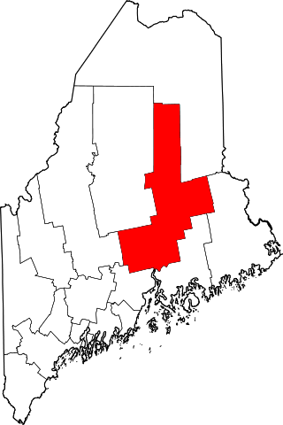
This is a list of properties on the National Register of Historic Places in Penobscot County, Maine.

<span class="mw-page-title-main">National Register of Historic Places listings in Sandusky County, Ohio</span>

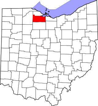
This is a list of the National Register of Historic Places listings in Sandusky County, Ohio.

This is a list of the National Register of Historic Places listings in Davidson County, Tennessee.

This is a list of the National Register of Historic Places listings in Blount County, Tennessee.

This is a list of the National Register of Historic Places listings in Montgomery County, Tennessee.

This is a list of the National Register of Historic Places listings in Shelby County, Tennessee.

This is a list of the National Register of Historic Places listings in Williamson County, Tennessee.

This is a list of the National Register of Historic Places listings in Sullivan County, Tennessee.

This is a list of the National Register of Historic Places listings in Sumner County, Tennessee.

This is a list of the National Register of Historic Places listings in Sevier County, Tennessee.

This is a list of the National Register of Historic Places listings in Giles County, Tennessee.

This is a list of the National Register of Historic Places listings in Franklin County, Tennessee.

This is a list of the National Register of Historic Places listings in Hickman County, Tennessee.

This is a list of the National Register of Historic Places listings in Madison County, Tennessee.

This is a list of the National Register of Historic Places listings in Monroe County, Tennessee.

This is a list of the National Register of Historic Places listings in Loudon County, Tennessee.

References

  1. The latitude and longitude information provided in this table was derived originally from the National Register Information System, which has been found to be fairly accurate for about 99% of listings. Some locations in this table may have been corrected to current GPS standards.
  2. National Park Service, United States Department of the Interior, "National Register of Historic Places: Weekly List Actions", retrieved October 27, 2023.
  3. 1 2 Numbers represent an alphabetical ordering by significant words. Various colorings, defined here, differentiate National Historic Landmarks and historic districts from other NRHP buildings, structures, sites or objects.
  4. "National Register Information System". National Register of Historic Places . National Park Service. April 24, 2008.
  5. The eight-digit number below each date is the number assigned to each location in the National Register Information System database, which can be viewed by clicking the number.
  6. West, Mike. "Union army destroyed historic church". Murfreesboro Post . Retrieved March 26, 2012.
  7. "Brown's Mill crashes down". The Daily News Journal . June 11, 1991. p. 1. Retrieved August 29, 2022 via Newspapers.com.
  8. https://www.wgnsradio.com/article/78752/the-house-of-mayors-has-left-the-city
  9. "Old Crichlow falls". The Daily News Journal . September 8, 2000. p. 1B. Retrieved August 29, 2022 via Newspapers.com.
  10. "Historic Jenkins home demolished". The Daily News Journal . June 13, 2006. p. 1. Retrieved August 29, 2022 via Newspapers.com.