National Register of Historic Places listings in Saline County, Kansas

Last updated

Location of Saline County in Kansas Map of Kansas highlighting Saline County.svg
Location of Saline County in Kansas

This is a list of the National Register of Historic Places listings in Saline County, Kansas.

Contents

This is intended to be a complete list of the properties and districts on the National Register of Historic Places in Saline County, Kansas, United States. The locations of National Register properties and districts for which the latitude and longitude coordinates are included below, may be seen in a map. [1]

There are 19 properties and districts listed on the National Register in the county, including 1 National Historic Landmark. At least one other site that was once listed has been removed.


    This National Park Service list is complete through NPS recent listings posted April 28, 2023. [2]

Map all coordinates using: OpenStreetMap  
Download coordinates as: KML

Current listings

[3] Name on the Register [4] ImageDate listed [5] Location City or townDescription
1 Brookville Grade School
Brookville Grade School Original Brookville, Kansas school house.jpg
Brookville Grade School
November 2, 1982
(#82000419)
Jewitt and Anderson Sts.
38°46′23″N97°52′13″W / 38.7731°N 97.8703°W / 38.7731; -97.8703 (Brookville Grade School)
Brookville
2 Christ Cathedral
Christ Cathedral Christ Cathedral Salina KS (cropped).jpg
Christ Cathedral
July 6, 2010
(#10000429)
138 South 8th St.
38°50′21″N97°36′43″W / 38.8392°N 97.6119°W / 38.8392; -97.6119 (Christ Cathedral)
Salina
3 Coronado Heights
Coronado Heights Coronado Heights Castle in Lindsborg Kansas KS USA.jpg
Coronado Heights
October 20, 2010
(#10000847)
12th and Coronado Heights Rd.
38°36′48″N97°42′12″W / 38.6133°N 97.7033°W / 38.6133; -97.7033 (Coronado Heights)
Lindsborg New Deal-Era Resources of Kansas MPS
4 Flanders-Lee House and Carriage House
Flanders-Lee House and Carriage House Flanders-lee house and carriage house.png
Flanders-Lee House and Carriage House
August 20, 1987
(#87001406)
200 S. 7th St.
38°50′17″N97°36′38″W / 38.8381°N 97.6106°W / 38.8381; -97.6106 (Flanders-Lee House and Carriage House)
Salina
5 Fox-Watson Theater Building
Fox-Watson Theater Building Watson-Stiefel-theater.jpg
Fox-Watson Theater Building
August 4, 1988
(#88001171)
155 S. Santa Fe Ave.
38°50′17″N97°36′32″W / 38.838°N 97.609°W / 38.838; -97.609 (Fox-Watson Theater Building)
Salina
6 Hobbs Creek Truss Leg Bedstead Bridge
Hobbs Creek Truss Leg Bedstead Bridge Hobbs Creek Truss Leg Bedstead Bridge east view.jpg
Hobbs Creek Truss Leg Bedstead Bridge
October 12, 2004
(#04001143)
On Hobbs Creek Rd., 0.6 miles west of its junction with Solomon Rd.
38°38′17″N97°22′59″W / 38.6381°N 97.3831°W / 38.6381; -97.3831 (Hobbs Creek Truss Leg Bedstead Bridge)
Gypsum
7 Lakewood Park Bridge
Lakewood Park Bridge Lakewood Park Bridge.jpg
Lakewood Park Bridge
June 9, 2004
(#04000579)
One Lakewood Dr., 0.01 miles north of its junction with Iron Ave.
38°50′28″N97°35′22″W / 38.8411°N 97.5894°W / 38.8411; -97.5894 (Lakewood Park Bridge)
Salina
8 H.D. Lee Company Complex
H.D. Lee Company Complex HD Lee Company Salina Kansas - west elevation.jpg
H.D. Lee Company Complex
July 3, 2008
(#08000618)
248 N. Santa Fe
38°50′38″N97°36′34″W / 38.8439°N 97.6094°W / 38.8439; -97.6094 (H.D. Lee Company Complex)
Salina
9 Lowell School
Lowell School Lowell School Salina Kansas front.jpg
Lowell School
October 2, 2020
(#100005625)
1009 South Highland Ave.
38°49′09″N97°36′41″W / 38.8192°N 97.6113°W / 38.8192; -97.6113 (Lowell School)
Salina
10 Masonic Temple
Masonic Temple Masonic Temple of Salina Kansas 2016 front.jpeg
Masonic Temple
March 9, 2000
(#00000192)
336 S. Santa Fe Ave.
38°50′05″N97°36′33″W / 38.8347°N 97.6092°W / 38.8347; -97.6092 (Masonic Temple)
Salina
11 Mount Barbara
Mount Barbara Mount Barbara House Salina Kansas.jpg
Mount Barbara
April 14, 1995
(#95000445)
100 Mt. Barbara
38°50′21″N97°34′55″W / 38.83918°N 97.58182°W / 38.83918; -97.58182 (Mount Barbara)
Salina Prairie School house built in 1916-18.
12 National Bank of America
National Bank of America National Bank of America Salina Kansas northeast view.jpg
National Bank of America
August 24, 2020
(#100004923)
100 South Santa Fe Ave.
38°50′25″N97°36′33″W / 38.8403°N 97.6091°W / 38.8403; -97.6091 (National Bank of America)
Salina
13 The Norton Apartments
The Norton Apartments The Norton Apartments Salina Kansas southwest view.jpg
The Norton Apartments
March 26, 2018
(#100002246)
1111 & 1115 E Iron Ave.
38°50′26″N97°35′36″W / 38.8405°N 97.5934°W / 38.8405; -97.5934 (The Norton Apartments)
Salina
14 Pioneer Hall, Kansas Wesleyan University
Pioneer Hall, Kansas Wesleyan University KWU main building.jpg
Pioneer Hall, Kansas Wesleyan University
January 4, 2023
(#100008519)
100 East Claflin Ave.
38°48′49″N97°36′35″W / 38.8135°N 97.6097°W / 38.8135; -97.6097 (Pioneer Hall, Kansas Wesleyan University)
Salina
15 John H. Prescott House
John H. Prescott House The Historic Prescott House, Salina KS from the northeast.jpg
John H. Prescott House
May 17, 1976
(#76000838)
211 W. Prescott Ave.
38°49′48″N97°36′40″W / 38.83°N 97.6111°W / 38.83; -97.6111 (John H. Prescott House)
Salina
16 Roosevelt-Lincoln Junior High School
Roosevelt-Lincoln Junior High School Roosevelt-Lincoln School.jpg
Roosevelt-Lincoln Junior High School
December 20, 2006
(#06001169)
210 W. Mulberry St.
38°50′22″N97°37′00″W / 38.8394°N 97.6167°W / 38.8394; -97.6167 (Roosevelt-Lincoln Junior High School)
Salina
17 A.J. Schwartz House
A.J. Schwartz House AJ Schwartz House, Salina KS.jpg
A.J. Schwartz House
April 13, 1973
(#73000774)
636 E. Iron St.
38°50′25″N97°36′04″W / 38.8403°N 97.6011°W / 38.8403; -97.6011 (A.J. Schwartz House)
Salina
18 US Post Office and Federal Building-Salina
US Post Office and Federal Building-Salina Smoky Hills Museum.png
US Post Office and Federal Building-Salina
July 18, 1989
(#89000793)
211 W. Iron
38°50′25″N97°36′40″W / 38.8403°N 97.6111°W / 38.8403; -97.6111 (US Post Office and Federal Building-Salina)
Salina
19 Whiteford (Price) Archeological Site
Whiteford (Price) Archeological Site WhitefordPriceSite.png
Whiteford (Price) Archeological Site
October 15, 1966
(#66000350)
East of Salina
38°51′39″N97°31′36″W / 38.8608°N 97.5267°W / 38.8608; -97.5267 (Whiteford (Price) Archeological Site)
Salina

Former listings

[3] Name on the RegisterImageDate listedDate removedLocationCity or townDescription
1 Brookville Hotel January 7, 1972
(#72000525)
January 2, 2013Perry St.
38°46′23″N97°52′01″W / 38.7731°N 97.8669°W / 38.7731; -97.8669 (Brookville Hotel)
Brookville Removed due to significant alterations.

See also

Related Research Articles

<span class="mw-page-title-main">National Register of Historic Places listings in Doniphan County, Kansas</span>

This is a list of the National Register of Historic Places listings in Doniphan County, Kansas.

<span class="mw-page-title-main">National Register of Historic Places listings in Harvey County, Kansas</span>

This is a list of the National Register of Historic Places listings in Harvey County, Kansas.

<span class="mw-page-title-main">National Register of Historic Places listings in Douglas County, Kansas</span>

This is a list of the National Register of Historic Places listings in Douglas County, Kansas.

<span class="mw-page-title-main">National Register of Historic Places listings in Riley County, Kansas</span>

This is a list of the National Register of Historic Places listings in Riley County, Kansas.

<span class="mw-page-title-main">National Register of Historic Places listings in Chase County, Kansas</span>

This is a list of the National Register of Historic Places listings in Chase County, Kansas.

<span class="mw-page-title-main">National Register of Historic Places listings in Cowley County, Kansas</span>

This is a list of the National Register of Historic Places listings in Cowley County, Kansas.

<span class="mw-page-title-main">National Register of Historic Places listings in Johnson County, Kansas</span>

This is a list of the National Register of Historic Places listings in Johnson County, Kansas.

<span class="mw-page-title-main">National Register of Historic Places listings in Nemaha County, Kansas</span>

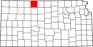
This is a list of the National Register of Historic Places listings in Nemaha County, Kansas.

<span class="mw-page-title-main">National Register of Historic Places listings in Labette County, Kansas</span>

This is a list of the National Register of Historic Places listings in Labette County, Kansas.

<span class="mw-page-title-main">National Register of Historic Places listings in Bourbon County, Kansas</span>

This is a list of the National Register of Historic Places listings in Bourbon County, Kansas.

<span class="mw-page-title-main">National Register of Historic Places listings in Cloud County, Kansas</span>

This is a list of the National Register of Historic Places listings in Cloud County, Kansas.

<span class="mw-page-title-main">National Register of Historic Places listings in Lincoln County, Kansas</span>

This is a list of the National Register of Historic Places listings in Lincoln County, Kansas.

<span class="mw-page-title-main">National Register of Historic Places listings in Sumner County, Kansas</span>

This is a list of the National Register of Historic Places listings in Sumner County, Kansas.

<span class="mw-page-title-main">National Register of Historic Places listings in Miami County, Kansas</span>

This is a list of the National Register of Historic Places listings in Miami County, Kansas.

<span class="mw-page-title-main">National Register of Historic Places listings in Saline County, Nebraska</span>

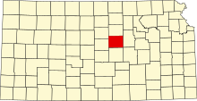
This is a list of the National Register of Historic Places listings in Saline County, Nebraska. It is intended to be a complete list of the properties and districts on the National Register of Historic Places in Saline County, Nebraska, United States. The locations of National Register properties and districts for which the latitude and longitude coordinates are included below, may be seen in a map.

<span class="mw-page-title-main">National Register of Historic Places listings in Brown County, Kansas</span>

This is a list of the National Register of Historic Places listings in Brown County, Kansas.

<span class="mw-page-title-main">National Register of Historic Places listings in Saline County, Arkansas</span>

This is a list of the National Register of Historic Places listings in Saline County, Arkansas.

<span class="mw-page-title-main">National Register of Historic Places listings in Jackson County, Missouri</span>

This is a list of the National Register of Historic Places listings in Jackson County, Missouri.

<span class="mw-page-title-main">National Register of Historic Places listings in Saline County, Missouri</span>

This is a list of the National Register of Historic Places listings in Saline County, Missouri.

<span class="mw-page-title-main">National Register of Historic Places listings in Phillips County, Kansas</span>

This is a list of the National Register of Historic Places listings in Phillips County, Kansas.

References

  1. The latitude and longitude information provided in this table was derived originally from the National Register Information System, which has been found to be fairly accurate for about 99% of listings. Some locations in this table may have been corrected to current GPS standards.
  2. National Park Service, United States Department of the Interior, "National Register of Historic Places: Weekly List Actions", retrieved April 28, 2023.
  3. 1 2 Numbers represent an alphabetical ordering by significant words. Various colorings, defined here, differentiate National Historic Landmarks and historic districts from other NRHP buildings, structures, sites or objects.
  4. "National Register Information System". National Register of Historic Places . National Park Service. March 13, 2009.
  5. The eight-digit number below each date is the number assigned to each location in the National Register Information System database, which can be viewed by clicking the number.