National Register of Historic Places listings in Siskiyou County, California

Last updated
Location of Siskiyou County in California Map of California highlighting Siskiyou County.svg
Location of Siskiyou County in California

This is a list of the National Register of Historic Places listings in Siskiyou County, California.

Contents

This is intended to be a complete list of the properties and districts on the National Register of Historic Places in Siskiyou County, California, United States. Latitude and longitude coordinates are provided for many National Register properties and districts; these locations may be seen together in an online map. [1]

There are 21 properties and districts listed on the National Register in the county, including 1 National Historic Landmark.

This National Park Service list is complete through NPS recent listings posted April 10, 2020. [2]
Map all coordinates using: OpenStreetMap  
Download coordinates as: KML  ·  GPX

Current listings

[3] Name on the Register [4] ImageDate listed [5] Location City or townDescription
1 Camp Tulelake March 12, 2018
(#100002176)
Hill R., 2 mi. S of jct. with CA 161, World War II Valor in the Pacific NM (Tule Lake Unit)
41°58′09″N121°33′56″W / 41.969199°N 121.565430°W / 41.969199; -121.565430 (Camp Tulelake)
Tulelake
2 Captain Jack's Stronghold
Captain Jack's Stronghold CaptainJacksStronghold.jpg
Captain Jack's Stronghold
September 20, 1973
(#73000259)
S of Tulelake, Lava Beds National Monument
41°49′18″N121°30′18″W / 41.821667°N 121.505°W / 41.821667; -121.505 (Captain Jack's Stronghold)
Tulelake
3 Dunsmuir Historic Commercial District
Dunsmuir Historic Commercial District Dunsmuir Historic District.jpg
Dunsmuir Historic Commercial District
November 10, 1982
(#82000993)
Roughly bounded by Sacramento and Shasta Aves., Spruce and Cedar Sts. (both sides)
41°12′37″N122°16′16″W / 41.210278°N 122.271111°W / 41.210278; -122.271111 (Dunsmuir Historic Commercial District)
Dunsmuir
4 Edgewood Store
Edgewood Store Edgewood Store.jpg
Edgewood Store
March 10, 2004
(#04000140)
24505 Edgewood Rd.
41°27′28″N122°25′52″W / 41.457778°N 122.431111°W / 41.457778; -122.431111 (Edgewood Store)
Edgewood
5 Lewis Falkenstein House
Lewis Falkenstein House Falkenstein House.jpg
Lewis Falkenstein House
December 31, 1979
(#79000554)
401 S. Gold Street
41°43′48″N122°38′30″W / 41.73°N 122.641667°W / 41.73; -122.641667 (Lewis Falkenstein House)
Yreka
6 Forest House
Forest House CA Siskiyou County Forest House 0001.jpg
Forest House
July 14, 2011
(#11000433)
4204 California State Route 3
41°40′24″N122°41′09″W / 41.673457°N 122.685696°W / 41.673457; -122.685696 (Forest House)
Yreka Center of Forest House Ranch, and a stagecoach stop and travelers' rest on old private toll road.
7 Fort Jones House
Fort Jones House Fort Jones House.jpg
Fort Jones House
April 22, 1976
(#76000533)
Main St.
41°36′19″N122°50′28″W / 41.605278°N 122.841111°W / 41.605278; -122.841111 (Fort Jones House)
Fort Jones
8 William Harlow Cabin June 3, 1991
(#91000699)
Elliot Cr. Rd. No. 1050, 1 mi. from Joe Bar Subdivision
41°59′59″N123°06′04″W / 41.999722°N 123.101111°W / 41.999722; -123.101111 (William Harlow Cabin)
Seiad Valley
9 Hospital Rock Army Camp Site
Hospital Rock Army Camp Site Hospital Rock Army Camp Site.jpg
Hospital Rock Army Camp Site
October 2, 1973
(#73000227)
S of Tulelake, Lava Beds National Monument
41°49′45″N121°28′31″W / 41.829167°N 121.475278°W / 41.829167; -121.475278 (Hospital Rock Army Camp Site)
Tulelake
10 Hotel Macdoel February 11, 1982
(#82002275)
Montezuma Ave. and Mt. Shasta St.
41°49′43″N122°00′10″W / 41.828611°N 122.002778°W / 41.828611; -122.002778 (Hotel Macdoel)
Macdoel
11 Lava Beds National Monument Archeological District
Lava Beds National Monument Archeological District IlluminatedLavaTubeCropped.jpg
Lava Beds National Monument Archeological District
March 21, 1991
(#75002182)
Address Restricted
Tulelake
12 Lower Klamath National Wildlife Refuge
Lower Klamath National Wildlife Refuge Ardea alba 8194t.jpg
Lower Klamath National Wildlife Refuge
October 15, 1966
(#66000238)
Lower Klamath Lake, east of Dorris
41°56′48″N121°39′53″W / 41.946667°N 121.664722°W / 41.946667; -121.664722 (Lower Klamath National Wildlife Refuge)
Dorris Extends into Klamath County, Oregon. This national wildlife refuge, established in 1908, was the first large block of public land set aside for wildlife management purposes. Because of its origins in the Klamath Basin reclamation project, it became an ongoing example of the tensions between conservation and commercial demands in public land management. [6]
13 McCloud
McCloud McCloud HD.jpg
McCloud
March 16, 1990
(#90000444)
Roughly bounded by Columbero Dr., Main St., W. Minnesota Ave., and Lawndale Ct.
41°15′16″N122°08′18″W / 41.254444°N 122.138333°W / 41.254444; -122.138333 (McCloud)
McCloud
14 Sawyers Bar Catholic Church
Sawyers Bar Catholic Church EXTERIOR, GENERAL VIEW FROM SOUTHEAST - Catholic Church, Sawyers Bar, Siskiyou County, CA HABS CAL,47-SAWBA,2-1-CROPPED.jpg
Sawyers Bar Catholic Church
July 7, 1978
(#78000792)
Klamath National Forest
41°18′03″N123°08′10″W / 41.300833°N 123.136111°W / 41.300833; -123.136111 (Sawyers Bar Catholic Church)
Sawyers Bar
15 Schonchin Butte Fire Lookout
Schonchin Butte Fire Lookout SchonchinButteLookout.jpg
Schonchin Butte Fire Lookout
September 5, 2017
(#100001559)
Lava Beds National Monument
41°44′17″N121°31′45″W / 41.738107°N 121.529096°W / 41.738107; -121.529096 (Schonchin Butte Fire Lookout)
Tulelake
16 Shasta Inn and Weed Lumber Company Boarding House
Shasta Inn and Weed Lumber Company Boarding House Weed Lumber Company Boarding House.jpg
Shasta Inn and Weed Lumber Company Boarding House
November 10, 1980
(#80000869)
829 and 877 N. Davis St.
41°25′53″N122°22′48″W / 41.431389°N 122.38°W / 41.431389; -122.38 (Shasta Inn and Weed Lumber Company Boarding House)
Weed
17 Thomas-Wright Battle Site November 15, 1978
(#78000366)
S of Tulelake in Lava Beds National Monument
41°46′13″N121°31′25″W / 41.770278°N 121.523611°W / 41.770278; -121.523611 (Thomas-Wright Battle Site)
Tulelake
18 Upper Klamath River Stateline Archaeological District July 10, 2017
(#100001283)
Address restricted
Beswick
19 West Miner Street-Third Street Historic District
West Miner Street-Third Street Historic District West Miner Street in Yreka, CA.JPG
West Miner Street-Third Street Historic District
December 11, 1972
(#72000258)
102-402 W. Miner St. and 122-419 3rd St.
41°44′01″N122°38′07″W / 41.733611°N 122.635278°W / 41.733611; -122.635278 (West Miner Street-Third Street Historic District)
Yreka
20 White's Gulch Arrastra December 22, 1978
(#78000793)
E of Swayers Bar
41°16′53″N123°04′31″W / 41.281389°N 123.075278°W / 41.281389; -123.075278 (White's Gulch Arrastra)
Sawyers Bar
21 Yreka Carnegie Library
Yreka Carnegie Library Yreka Carnegie Library 2012-09-25 08-38-56.jpg
Yreka Carnegie Library
March 26, 1992
(#92000270)
412 W. Miner St.
41°43′57″N122°38′17″W / 41.7325°N 122.638056°W / 41.7325; -122.638056 (Yreka Carnegie Library)
Yreka

See also

Related Research Articles

National Register of Historic Places listings in Contra Costa County, California Wikimedia list article

This is a list of the National Register of Historic Places listings in Contra Costa County, California.

National Register of Historic Places listings in Riverside County, California Wikimedia list article

This is a list of the National Register of Historic Places listings in Riverside County, California.

National Register of Historic Places listings in Mariposa County, California Wikimedia list article

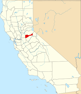
This is a list of the National Register of Historic Places listings in Mariposa County, California.

National Register of Historic Places listings in Santa Barbara County, California Wikimedia list article

This is a list of the National Register of Historic Places listings in Santa Barbara County, California.

National Register of Historic Places listings in Tulare County, California Wikimedia list article

This is a list of the National Register of Historic Places listings in Tulare County, California.

National Register of Historic Places listings in Shasta County, California Wikimedia list article

This is a list of the National Register of Historic Places listings in Shasta County, California.

National Register of Historic Places listings in Solano County, California Wikimedia list article

This is a list of the National Register of Historic Places listings in Solano County, California.

National Register of Historic Places listings in Colusa County, California Wikimedia list article

This is a list of the National Register of Historic Places listings in Colusa County, California.

National Register of Historic Places listings in Kings County, California Wikimedia list article

This is a list of the National Register of Historic Places listings in Kings County, California.

National Register of Historic Places listings in Lassen County, California Wikimedia list article

This is a list of the National Register of Historic Places listings in Lassen County, California.

National Register of Historic Places listings in Plumas County, California Wikimedia list article

This is a list of the National Register of Historic Places listings in Plumas County, California.

National Register of Historic Places listings in Sierra County, California Wikimedia list article

This is a list of the National Register of Historic Places listings in Sierra County, California.

National Register of Historic Places listings in Alpine County, California Wikimedia list article

This is a list of the National Register of Historic Places listings in Alpine County, California.

National Register of Historic Places listings in Amador County, California Wikimedia list article

This is a list of the National Register of Historic Places listings in Amador County, California.

National Register of Historic Places listings in Calaveras County, California Wikimedia list article

This is a list of the National Register of Historic Places listings in Calaveras County, California.

National Register of Historic Places listings in Merced County, California Wikimedia list article

This is a list of the National Register of Historic Places listings in Merced County, California.

National Register of Historic Places listings in Tehama County, California Wikimedia list article

This is a list of the National Register of Historic Places listings in Tehama County, California.

National Register of Historic Places listings in Trinity County, California Wikimedia list article

This is a list of the National Register of Historic Places listings in Trinity County, California.

National Register of Historic Places listings in Madera County, California Wikimedia list article

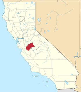
This is a list of the National Register of Historic Places listings in Madera County, California.

This is a list of the National Register of Historic Places listings in Lava Beds National Monument.

References

  1. The latitude and longitude information provided in this table was derived originally from the National Register Information System, which has been found to be fairly accurate for about 99% of listings. Some locations in this table may have been corrected to current GPS standards.
  2. "National Register of Historic Places: Weekly List Actions". National Park Service, United States Department of the Interior. Retrieved on April 10, 2020.
  3. Numbers represent an ordering by significant words. Various colorings, defined here, differentiate National Historic Landmarks and historic districts from other NRHP buildings, structures, sites or objects.
  4. "National Register Information System". National Register of Historic Places . National Park Service. July 9, 2010.
  5. The eight-digit number below each date is the number assigned to each location in the National Register Information System database, which can be viewed by clicking the number.
  6. Huston, Ann E. (May 1990), National Register of Historic Places Registration Form: Klamath Lake Reservation (PDF), retrieved March 3, 2016.