National Register of Historic Places listings in Smithtown (town), New York

Last updated

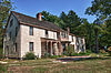
This list is intended to provide a comprehensive listing of entries in the National Register of Historic Places in Town of Smithtown, New York. The locations of National Register properties for which the latitude and longitude coordinates are included below, may be seen in an online map. [1]

Contents


Listings

[2] Name on the RegisterImageDate listed [3] Location City or townDescription
1 Beachbend August 9, 1993
(#93000698)
Smith Lane
40°54′10″N73°11′03″W / 40.902778°N 73.184167°W / 40.902778; -73.184167 (Beachbend)
Nissequogue
2 Blydenburgh Park Historic District
Blydenburgh Park Historic District Blydenburgh Weld Farmhouse.jpg
Blydenburgh Park Historic District
August 11, 1983
(#83001807)
Blydenburgh County Park
40°50′36″N73°13′34″W / 40.843333°N 73.226111°W / 40.843333; -73.226111 (Blydenburgh Park Historic District)
Smithtown
3 Box Hill Estate December 4, 1973
(#73001276)
Northwest of St. James on Moriches Road
40°53′22″N73°10′36″W / 40.889444°N 73.176667°W / 40.889444; -73.176667 (Box Hill Estate)
St. James
4 By-the-Harbor August 9, 1993
(#93000699)
Moriches Road
40°53′30″N73°10′51″W / 40.891667°N 73.180833°W / 40.891667; -73.180833 (By-the-Harbor)
Nissequogue
5 East Farm
East Farm East Farm farmhouse, Head of the Harbor.jpg
East Farm
August 9, 1993
(#93000700)
Harbor Road, North side, at Shep Jones Lane
40°54′48″N73°09′17″W / 40.913333°N 73.154722°W / 40.913333; -73.154722 (East Farm)
Head of the Harbor
6 First Presbyterian Church
First Presbyterian Church Smithtown 1st Presbyterian Church.JPG
First Presbyterian Church
December 23, 1977
(#77000983)
175 East Main Street
40°51′24″N73°11′18″W / 40.856667°N 73.188333°W / 40.856667; -73.188333 (First Presbyterian Church)
Branch
7 Fort Salonga May 21, 1982
(#82003406)
Address Restricted
Fort Salonga
8 Halliock Inn
Halliock Inn Halliock Inn; Village of the Branch-1.JPG
Halliock Inn
August 7, 1974
(#74001310)
263 East Main Street
40°51′20″N73°10′50″W / 40.855556°N 73.180556°W / 40.855556; -73.180556 (Halliock Inn)
Branch
9 Harbor House
Harbor House Driveway to Harbor House; Nissequogue, NY.jpg
Harbor House
August 9, 1993
(#93000701)
Spring Hollow Road
40°53′48″N73°10′44″W / 40.896667°N 73.178889°W / 40.896667; -73.178889 (Harbor House)
Nissequogue
10 Hauppauge Methodist Episcopal Church
Hauppauge Methodist Episcopal Church Hauppauge United Methodist Church (1806) and Cemetery, Hauppauge, NY, National Register of Historic Places.jpg
Hauppauge Methodist Episcopal Church
August 27, 2020
(#100005484)
473 Town Line Road
40°49′31″N73°12′20″W / 40.8253°N 73.2055°W / 40.8253; -73.2055 (Hauppauge Methodist Episcopal Church)
Hauppauge
11 Land of Clover
Land of Clover Knox School in Nissequogue, New York.jpg
Land of Clover
August 9, 1993
(#93000702)
Long Beach Road, South side
40°54′48″N73°11′12″W / 40.913333°N 73.186667°W / 40.913333; -73.186667 (Land of Clover)
Nissequogue The former Lathrop Brown Estate, now occupied by a private boarding school called The Knox School. [4] [5]
12 The Mallows August 9, 1993
(#93000703)
Emmet Way
40°54′59″N73°09′07″W / 40.916389°N 73.151944°W / 40.916389; -73.151944 (The Mallows)
Head of the Harbor
13 Mills Pond District
Mills Pond District Southwest corner of house - Mills Pond House, 660 North Country Road (State Route 25A), Saint James, Suffolk County, NY HABS NY,52-STJAM.V,1-6.tif
Mills Pond District
August 1, 1973
(#73001277)
East of St. James on NY 25A
40°54′02″N73°08′58″W / 40.900556°N 73.149444°W / 40.900556; -73.149444 (Mills Pond District)
St. James
14 James W. and Anne Smith Phyfe Estate August 9, 1993
(#93000704)
87 Stillwater Road
40°54′34″N73°11′04″W / 40.909444°N 73.184444°W / 40.909444; -73.184444 (James W. and Anne Smith Phyfe Estate)
Nissequogue
15 Rassapeague
Rassapeague Driveway to Rassapeague.jpg
Rassapeague
August 9, 1993
(#93000705)
Long Beach Road, South side
40°54′58″N73°10′55″W / 40.916111°N 73.181944°W / 40.916111; -73.181944 (Rassapeague)
Nissequogue
16 William J. Ryan Estate August 9, 1993
(#93000706)
Moriches Road
40°54′07″N73°11′20″W / 40.901944°N 73.188889°W / 40.901944; -73.188889 (William J. Ryan Estate)
Nissequogue
17 Saint James District
Saint James District Saint James General Store.JPG
Saint James District
July 20, 1973
(#73001275)
On NY 25A
40°53′02″N73°09′46″W / 40.883889°N 73.162778°W / 40.883889; -73.162778 (Saint James District)
Saint James
18 St. James Firehouse
St. James Firehouse St. James welcome sign and Fire Department.jpg
St. James Firehouse
August 4, 2023
(#100009195)
533 NY 25A
40°53′14″N73°09′31″W / 40.8872°N 73.1585°W / 40.8872; -73.1585 (St. James Firehouse)
Saint James
19 Shore Cottage August 9, 1993
(#93000707)
Harbor Road, East side
40°53′39″N73°10′23″W / 40.894167°N 73.173056°W / 40.894167; -73.173056 (Shore Cottage)
Head of the Harbor
20 Obadiah Smith House
Obadiah Smith House Obadiah Smith House, 853 Saint Johnland Road, San Remo, Smithtown (Suffolk County, New York).jpg
Obadiah Smith House
December 6, 1996
(#96001422)
853 Saint Johnland Road
40°53′38″N73°13′47″W / 40.893889°N 73.229722°W / 40.893889; -73.229722 (Obadiah Smith House)
Kings Park
21 Thatch Meadow Farm February 20, 2020
(#93000711)
Harbor Rd., west side, opposite Bacon Rd.
40°54′31″N73°09′32″W / 40.9085°N 73.1588°W / 40.9085; -73.1588 (Thatch Meadow Farm)
Head of the Harbor Last remaining portion of old estate, built on 18th century farm.
22 Village of Branch Historic District September 11, 1986
(#86002514)
Along north side of Middle Country Road
40°51′56″N73°10′59″W / 40.865556°N 73.183056°W / 40.865556; -73.183056 (Village of Branch Historic District)
Branch
23 Frederick and Annie Wagner Residence and St. Patrick's Roman Catholic Church
Frederick and Annie Wagner Residence and St. Patrick's Roman Catholic Church Byzantine Catholic Church of the Resurrection, formerly St. Patrick's Roman Catholic Church, 1929, Smithtown, NY.jpg
Frederick and Annie Wagner Residence and St. Patrick's Roman Catholic Church
August 8, 2019
(#100004240)
37 Juniper Avenue & 38 Mayflower Avenue
40°51′17″N73°12′08″W / 40.8548°N 73.2023°W / 40.8548; -73.2023 (Frederick and Annie Wagner Residence and St. Patrick's Roman Catholic Church)
Smithtown 1912 Gustav Stickley house for early American motorsports promoter, and adjacent Tudor Revival Catholic church that served Smithtown's Irish American community from same era
24 Kate Annette Wetherill Estate
Kate Annette Wetherill Estate Arial View of 15 Waterfront Acres Located in Head of the Harbor, Smithtown, Stanford Whites "Wetherill Mansion" Octagonal Home Design.JPG
Kate Annette Wetherill Estate
August 9, 1993
(#93000708)
Harbor Hill Road, South side
40°53′32″N73°10′11″W / 40.892222°N 73.169722°W / 40.892222; -73.169722 (Kate Annette Wetherill Estate)
Head of the Harbor
25 Woodcrest August 9, 1993
(#93000709)
Moriches Road
40°54′00″N73°10′59″W / 40.9°N 73.183056°W / 40.9; -73.183056 (Woodcrest)
Nissequogue
26 Wyandanch Club Historic District
Wyandanch Club Historic District Wyandanch Club.jpg
Wyandanch Club Historic District
August 3, 1990
(#90001143)
Jericho Turnpike, southwest of its junction with Meadow Road
40°51′03″N73°13′40″W / 40.850833°N 73.227778°W / 40.850833; -73.227778 (Wyandanch Club Historic District)
Smithtown
27 York Hall
York Hall Nissequogue River State Park; KPPC Building 80.jpg
York Hall
October 23, 2023
(#100009455)
799 Saint Johnland Rd.
40°53′49″N73°14′10″W / 40.8970°N 73.2361°W / 40.8970; -73.2361 (York Hall)
Kings Park Former Kings Park Asylum main auditorium, church, and theater.

See also

Related Research Articles

<span class="mw-page-title-main">National Register of Historic Places listings in Cayuga County, New York</span>

The following is a list of the National Register of Historic Places listings located in Cayuga County, New York:

<span class="mw-page-title-main">National Register of Historic Places listings in Chenango County, New York</span>

List of the National Register of Historic Places listings in Chenango County, New York

<span class="mw-page-title-main">National Register of Historic Places listings in Clinton County, New York</span>

List of the National Register of Historic Places listings in Clinton County, New York

<span class="mw-page-title-main">National Register of Historic Places listings in Genesee County, New York</span>

List of the National Register of Historic Places listings in Genesee County, New York

<span class="mw-page-title-main">National Register of Historic Places listings in Greene County, New York</span>

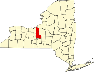
List of the National Register of Historic Places listings in Greene County, New York

<span class="mw-page-title-main">National Register of Historic Places listings in Hamilton County, New York</span>

List of the National Register of Historic Places listings in Hamilton County, New York

<span class="mw-page-title-main">National Register of Historic Places listings in Jefferson County, New York</span>

List of the National Register of Historic Places listings in Jefferson County, New York

<span class="mw-page-title-main">National Register of Historic Places listings in Montgomery County, New York</span>

List of the National Register of Historic Places listings in Montgomery County, New York

<span class="mw-page-title-main">National Register of Historic Places listings in Ontario County, New York</span>

List of the National Register of Historic Places listings in Ontario County, New York

<span class="mw-page-title-main">National Register of Historic Places listings in Putnam County, New York</span>

List of the National Register of Historic Places listings in Putnam County, New York

<span class="mw-page-title-main">National Register of Historic Places listings in Schuyler County, New York</span>

List of the National Register of Historic Places listings in Schuyler County, New York

<span class="mw-page-title-main">National Register of Historic Places listings in Seneca County, New York</span>

List of Registered Historic Places in Seneca County, New York

<span class="mw-page-title-main">National Register of Historic Places listings in Steuben County, New York</span>

List of the National Register of Historic Places listings in Steuben County, New York

<span class="mw-page-title-main">National Register of Historic Places listings in Yates County, New York</span>

List of the National Register of Historic Places listings in Yates County, New York

<span class="mw-page-title-main">National Register of Historic Places listings in Wyoming County, New York</span>

List of the National Register of Historic Places listings in Wyoming County, New York

<span class="mw-page-title-main">National Register of Historic Places listings in Wayne County, New York</span>

List of the National Register of Historic Places listings in Wayne County, New York

<span class="mw-page-title-main">National Register of Historic Places listings in Washington County, New York</span>

List of the National Register of Historic Places listings in Washington County, New York

<span class="mw-page-title-main">National Register of Historic Places listings in Tompkins County, New York</span>

List of the National Register of Historic Places listings in Tompkins County, New York

<span class="mw-page-title-main">National Register of Historic Places listings in Tioga County, New York</span>

List of the National Register of Historic Places listings in Tioga County, New York

<span class="mw-page-title-main">National Register of Historic Places listings in Madison County, New York</span>

List of the National Register of Historic Places listings in Madison County, New York

References

  1. The latitude and longitude information provided is primarily from the National Register Information System, and has been found to be fairly accurate for about 99% of listings. For 1%, the location info may be way off. We seek to correct the coordinate information wherever it is found to be erroneous. Please leave a note in the Discussion page for this article if you believe any specific location is incorrect.
  2. Numbers represent an alphabetical ordering by significant words. Various colorings, defined here, differentiate National Historic Landmarks and historic districts from other NRHP buildings, structures, sites or objects.
  3. The eight-digit number below each date is the number assigned to each location in the National Register Information System database, which can be viewed by clicking the number.
  4. Land of Clover (Old Long Island)
  5. The Knox School (Official Site)