National Register of Historic Places listings in Tuolumne County, California

Last updated

Location of Tuolumne County in California Map of California highlighting Tuolumne County.svg
Location of Tuolumne County in California

This is a list of the National Register of Historic Places listings in Tuolumne County, California.

Contents

This is intended to be a complete list of the properties and districts on the National Register of Historic Places in Tuolumne County, California, United States. Latitude and longitude coordinates are provided for many National Register properties and districts; these locations may be seen together in an online map. [1]

There are 35 properties and districts listed on the National Register in the county, including 2 National Historic Landmarks.


    This National Park Service list is complete through NPS recent listings posted October 27, 2023. [2]

Map all coordinates using: OpenStreetMap

Current listings

[3] Name on the Register [4] ImageDate listed [5] Location City or townDescription
1 Baker Highway Maintenance Station September 2, 2004
(#04000928)
33950 CA 108
38°19′48″N119°45′22″W / 38.329920°N 119.756002°W / 38.329920; -119.756002 (Baker Highway Maintenance Station)
Strawberry State highway maintenance housing and machinery complex, serving west of Sierra Nevada summit at Sonora Pass
2 Cady House
Cady House Historic American Buildings Survey Roger Sturtevant, Photographer Jan. 22, 1934 NORTH ELEVATION (FRONT) - Cady House, Dodge and Norlin Streets, Sonora, Tuolumne County, CA HABS CAL,55-SONO,2-3.tif
Cady House
February 25, 1982
(#82002281)
72 N. Norlin St.
37°59′09″N120°23′05″W / 37.985833°N 120.384722°W / 37.985833; -120.384722 (Cady House)
Sonora
3 Chinaman Mortar Site June 20, 1975
(#75000492)
Address Restricted
Strawberry
4 City Hotel
City Hotel Sonora CA.jpg
City Hotel
June 30, 1983
(#83001248)
145 S. Washington St.
37°59′01″N120°22′51″W / 37.983611°N 120.380833°W / 37.983611; -120.380833 (City Hotel)
Sonora
5 Columbia Historic District
Columbia Historic District Columbia California.jpg
Columbia Historic District
October 15, 1966
(#66000242)
4 mi (6.4 km). northwest of Sonora on CA 49
38°02′09″N120°24′04″W / 38.035833°N 120.401111°W / 38.035833; -120.401111 (Columbia Historic District)
Sonora
6 Cooper Cabin January 9, 2009
(#08001314)
Emigrant Wilderness, Stanislaus National Forest
38°14′03″N119°49′44″W / 38.234196°N 119.828766°W / 38.234196; -119.828766 (Cooper Cabin)
Strawberry Historic cow camp cabin, from 1854
7 Emporium
Emporium 2009-0724-CA-Jamestown-Emporium.jpg
Emporium
February 17, 1978
(#78000817)
18180 Main St.
37°57′10″N120°25′25″W / 37.95276°N 120.42349°W / 37.95276; -120.42349 (Emporium)
Jamestown
8 Frog Creek Cabin
Frog Creek Cabin Frog Creek Cabin.jpg
Frog Creek Cabin
July 18, 2014
(#14000414)
South shore of Lake Eleanor, along Frog Creek
37°58′59″N119°50′37″W / 37.983127°N 119.843480°W / 37.983127; -119.843480 (Frog Creek Cabin)
Yosemite National Park 1936-built cabin, used originally to support trout egg collection.
9 Gamble Building and Miner's Bean Kettle
Gamble Building and Miner's Bean Kettle Miners Bean Kettle and Gamble Building October 2007.jpg
Gamble Building and Miner's Bean Kettle
March 22, 1991
(#91000335)
17544 CA 120
37°49′24″N120°15′31″W / 37.82338°N 120.25857°W / 37.82338; -120.25857 (Gamble Building and Miner's Bean Kettle)
Big Oak Flat
10 Glen Aulin High Sierra Camp
Glen Aulin High Sierra Camp Glen Aulin High Sierra Camp.jpg
Glen Aulin High Sierra Camp
July 18, 2014
(#14000415)
At confluence of Tuolumne River and Alkali Creek
37°54′32″N119°25′08″W / 37.908812°N 119.418772°W / 37.908812; -119.418772 (Glen Aulin High Sierra Camp)
Yosemite National Park
11 Great Sierra Mine Historic Site
Great Sierra Mine Historic Site Dana Cabin at Great Sierra Mine.jpg
Great Sierra Mine Historic Site
May 24, 1978
(#78000382)
Southwest of Lee Vining
37°55′39″N119°16′05″W / 37.9275°N 119.268056°W / 37.9275; -119.268056 (Great Sierra Mine Historic Site)
Yosemite National Park
12 Great Sierra Wagon Road
Great Sierra Wagon Road OLD TIOGA ROAD VIEW, NOW MAY LAKE ROAD. LOOKING SW. GIS- N-37 49 16.8 - W-119 30 13.3 - Tioga Road, Between Crane Flat and Tioga Pass, Yosemite Village, Mariposa County, CA HAER CAL,22-YOSEM,6-25.tif
Great Sierra Wagon Road
August 25, 1978
(#78000373)
Northwest of Yosemite Valley
37°50′32″N119°43′20″W / 37.842222°N 119.722222°W / 37.842222; -119.722222 (Great Sierra Wagon Road)
Yosemite National Park
13 Groveland Hotel
Groveland Hotel Groveland Hotel-2.jpg
Groveland Hotel
May 6, 1994
(#94000428)
18767 Main St. (CA 120)
37°50′22″N120°13′46″W / 37.83931°N 120.22952°W / 37.83931; -120.22952 (Groveland Hotel)
Groveland
14 Hotel Charlotte
Hotel Charlotte Hotel Charlotte in Groveland California December 2006.jpg
Hotel Charlotte
September 26, 1994
(#94001162)
18736 Main St. (CA 120)
37°50′21″N120°13′49″W / 37.83912°N 120.23028°W / 37.83912; -120.23028 (Hotel Charlotte)
Groveland
15 Lake Vernon Snow Survey Shelter July 18, 2014
(#14000416)
Terminus of Lake Vernon Tr.
38°01′10″N119°42′55″W / 38.019422°N 119.715244°W / 38.019422; -119.715244 (Lake Vernon Snow Survey Shelter)
Yosemite National Park
16 Leighton Encampment April 9, 2013
(#13000142)
Roughly 12 mi (19 km) southeast of Pinecrest
38°07′33″N119°46′47″W / 38.125885°N 119.77972°W / 38.125885; -119.77972 (Leighton Encampment)
Pinecrest Also known as Yellowhammer Camp
17 May Lake High Sierra Camp July 18, 2014
(#14000417)
Eastern shore of May Lake
37°50′42″N119°29′28″W / 37.844924°N 119.490996°W / 37.844924; -119.490996 (May Lake High Sierra Camp)
Yosemite National Park
18 McCauley Cabin
McCauley Cabin McCauley Cabin.JPG
McCauley Cabin
March 8, 1977
(#77000359)
Tuolumne Meadows
37°52′40″N119°22′01″W / 37.877778°N 119.366944°W / 37.877778; -119.366944 (McCauley Cabin)
Yosemite National Park
19 Niagara Camp June 6, 1975
(#75000494)
Northeast of Tuolumne in Stanislaus National Forest
38°00′19″N120°00′09″W / 38.005278°N 120.0025°W / 38.005278; -120.0025 (Niagara Camp)
Tuolumne
20 Parsons Memorial Lodge
Parsons Memorial Lodge Parsons Memorial Lodge NPS.jpg
Parsons Memorial Lodge
April 30, 1979
(#79000283)
Tuolumne Meadows
37°52′42″N119°22′00″W / 37.878333°N 119.366667°W / 37.878333; -119.366667 (Parsons Memorial Lodge)
Yosemite National Park
21 Quail Site March 10, 1975
(#75000491)
Address Restricted
Long Barn
22 Sachse Spring Snow Survey Shelter July 18, 2014
(#14000418)
Off Kibbie Ridge Tr. near Sachse Spring
38°04′51″N119°50′34″W / 38.080825°N 119.842905°W / 38.080825; -119.842905 (Sachse Spring Snow Survey Shelter)
Yosemite National Park
23 Sierra Railway Locomotive No. 3
Sierra Railway Locomotive No. 3 Sierra RR July 3 2010 042xRP - Flickr - drewj1946.jpg
Sierra Railway Locomotive No. 3
October 23, 2023
(#100009468)
10501 Reservoir Rd. (Railtown 1897 State Historic Park)
37°56′59″N120°25′00″W / 37.9497°N 120.4167°W / 37.9497; -120.4167 (Sierra Railway Locomotive No. 3)
Jamestown
23 Sierra Railway Shops Historic District
Sierra Railway Shops Historic District Sierra Railroad Machine Shop, Jamestown, CA.jpg
Sierra Railway Shops Historic District
July 14, 2021
(#100006719)
18115 5th Ave.
37°57′04″N120°25′04″W / 37.9510°N 120.4177°W / 37.9510; -120.4177 (Sierra Railway Shops Historic District)
Jamestown AKA Railtown 1897 State Historic Park
24 Soda Springs Cabin
Soda Springs Cabin Soda Springs Cabin.jpg
Soda Springs Cabin
April 19, 1979
(#79000282)
Tuolumne Meadows
37°52′44″N119°21′56″W / 37.878889°N 119.365556°W / 37.878889; -119.365556 (Soda Springs Cabin)
Yosemite National Park
25 Sonora Youth Center
Sonora Youth Center Sonora Youth Center.JPG
Sonora Youth Center
October 8, 2009
(#09000807)
732 S. Barretta St.
37°58′31″N120°22′37″W / 37.975394°N 120.377003°W / 37.975394; -120.377003 (Sonora Youth Center)
Sonora
26 Stanislaus Branch, California Forest and Range Experiment Station January 15, 2009
(#08001315)
Forest Rd. 4N13B
38°11′18″N120°01′29″W / 38.188333°N 120.024750°W / 38.188333; -120.024750 (Stanislaus Branch, California Forest and Range Experiment Station)
Strawberry
27 Sugg House
Sugg House Sugg House.JPG
Sugg House
September 13, 1984
(#84001210)
37 Theall St.
37°59′02″N120°22′49″W / 37.983889°N 120.380278°W / 37.983889; -120.380278 (Sugg House)
Sonora
28 Tioga Pass Entrance Station
Tioga Pass Entrance Station Tioga Pass Ranger Station.jpg
Tioga Pass Entrance Station
December 14, 1978
(#78000372)
Southwest of Lee Vining
37°54′39″N119°15′27″W / 37.910833°N 119.2575°W / 37.910833; -119.2575 (Tioga Pass Entrance Station)
Yosemite National Park
29 Tuolumne County Courthouse
Tuolumne County Courthouse Tuolumne County Courthouse.jpg
Tuolumne County Courthouse
September 17, 1981
(#81000182)
41 W. Yaney Ave.
37°59′08″N120°22′59″W / 37.985556°N 120.383056°W / 37.985556; -120.383056 (Tuolumne County Courthouse)
Sonora
30 Tuolumne County Jail
Tuolumne County Jail 2009-0724-CA-TuolumneCtyJail.jpg
Tuolumne County Jail
November 7, 1978
(#78000822)
156 W. Bradford St.
37°59′02″N120°23′04″W / 37.983889°N 120.384444°W / 37.983889; -120.384444 (Tuolumne County Jail)
Sonora
31 Tuolumne Meadows November 30, 1978
(#78000371)
Southwest of Lee Vining
37°52′17″N119°22′20″W / 37.871389°N 119.372222°W / 37.871389; -119.372222 (Tuolumne Meadows)
Yosemite National Park Listing is for CCC camp structures in the meadow area
32 Tuolumne Meadows High Sierra Camp
Tuolumne Meadows High Sierra Camp FALLS AT TUOLUMNE MEADOWS LODGE - panoramio.jpg
Tuolumne Meadows High Sierra Camp
July 18, 2014
(#14000419)
Along north bank of Dana Fork of Tuolumne River, east of Tuolumne Meadows
37°52′39″N119°19′58″W / 37.877426°N 119.332655°W / 37.877426; -119.332655 (Tuolumne Meadows High Sierra Camp)
Yosemite National Park
33 Tuolumne Meadows Ranger Stations and Comfort Stations
Tuolumne Meadows Ranger Stations and Comfort Stations Tuolumne Meadows Ranger Station.jpg
Tuolumne Meadows Ranger Stations and Comfort Stations
December 18, 1978
(#78000370)
Tuolumne Meadows
37°52′24″N119°21′16″W / 37.873333°N 119.354444°W / 37.873333; -119.354444 (Tuolumne Meadows Ranger Stations and Comfort Stations)
Yosemite National Park
34 Watts & Tannahill Company Store
Watts & Tannahill Company Store Watts and Tannehill Country Store-2.jpg
Watts & Tannahill Company Store
March 31, 1995
(#95000265)
18761 Main St. (CA 120)
37°50′21″N120°13′47″W / 37.83915°N 120.22981°W / 37.83915; -120.22981 (Watts & Tannahill Company Store)
Groveland

See also

Related Research Articles

<span class="mw-page-title-main">National Register of Historic Places listings in Humboldt County, California</span>

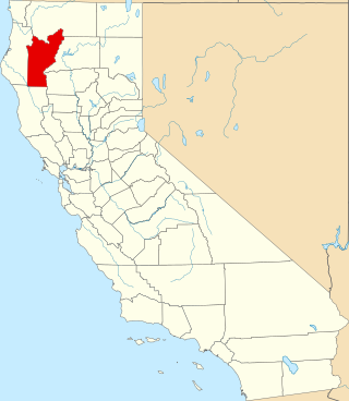
This is a list of the National Register of Historic Places listings in Humboldt County, California.

<span class="mw-page-title-main">National Register of Historic Places listings in Riverside County, California</span>

This is a list of the National Register of Historic Places listings in Riverside County, California.

<span class="mw-page-title-main">National Register of Historic Places listings in Mariposa County, California</span>

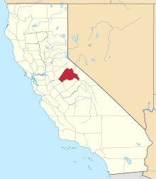
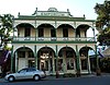
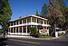
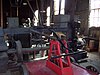
This is a list of the National Register of Historic Places listings in Mariposa County, California.

<span class="mw-page-title-main">National Register of Historic Places listings in Nevada County, California</span>

This is a list of the National Register of Historic Places listings in Nevada County, California.

<span class="mw-page-title-main">National Register of Historic Places listings in San Luis Obispo County, California</span>

This is a list of the National Register of Historic Places listings in San Luis Obispo County, California.

<span class="mw-page-title-main">National Register of Historic Places listings in Colusa County, California</span>

This is a list of the National Register of Historic Places listings in Colusa County, California.

<span class="mw-page-title-main">National Register of Historic Places listings in Kern County, California</span>

This is a list of the National Register of Historic Places listings in Kern County, California.

<span class="mw-page-title-main">National Register of Historic Places listings in Kings County, California</span>

This is a list of the National Register of Historic Places listings in Kings County, California.

<span class="mw-page-title-main">National Register of Historic Places listings in Mono County, California</span>

This is a list of the National Register of Historic Places listings in Mono County, California.

<span class="mw-page-title-main">National Register of Historic Places listings in Sierra County, California</span>

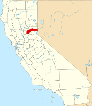
This is a list of the National Register of Historic Places listings in Sierra County, California.

<span class="mw-page-title-main">National Register of Historic Places listings in Alpine County, California</span>

This is a list of the National Register of Historic Places listings in Alpine County, California.

<span class="mw-page-title-main">National Register of Historic Places listings in Stanislaus County, California</span>

This is a list of the National Register of Historic Places listings in Stanislaus County, California.

<span class="mw-page-title-main">National Register of Historic Places listings in Modoc County, California</span>

This is a list of the National Register of Historic Places listings in Modoc County, California.

<span class="mw-page-title-main">National Register of Historic Places listings in Inyo County, California</span>

This is a list of the National Register of Historic Places listings in Inyo County, California.

<span class="mw-page-title-main">National Register of Historic Places listings in Calaveras County, California</span>

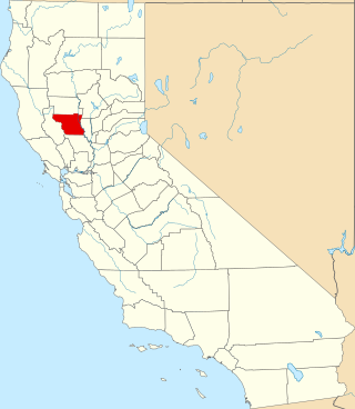
This is a list of the National Register of Historic Places listings in Calaveras County, California. This is intended to be a complete list of the properties and districts on the National Register of Historic Places in Calaveras County, California, United States. Latitude and longitude coordinates are provided for many National Register properties and districts; these locations may be seen together in an online map.

<span class="mw-page-title-main">National Register of Historic Places listings in Imperial County, California</span>

This is a list of the National Register of Historic Places listings in Imperial County, California.

<span class="mw-page-title-main">National Register of Historic Places listings in Tehama County, California</span>

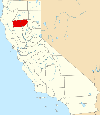
This is a list of the National Register of Historic Places listings in Tehama County, California.

<span class="mw-page-title-main">National Register of Historic Places listings in Trinity County, California</span>

This is a list of the National Register of Historic Places listings in Trinity County, California.

<span class="mw-page-title-main">National Register of Historic Places listings in Madera County, California</span>

This is a list of the National Register of Historic Places listings in Madera County, California.

This is a list of the National Register of Historic Places listings in Yosemite National Park.

References

  1. The latitude and longitude information provided in this table was derived originally from the National Register Information System, which has been found to be fairly accurate for about 99% of listings. Some locations in this table may have been corrected to current GPS standards.
  2. National Park Service, United States Department of the Interior, "National Register of Historic Places: Weekly List Actions", retrieved October 27, 2023.
  3. Numbers represent an alphabetical ordering by significant words. Various colorings, defined here, differentiate National Historic Landmarks and historic districts from other NRHP buildings, structures, sites or objects.
  4. "National Register Information System". National Register of Historic Places . National Park Service. July 9, 2010.
  5. The eight-digit number below each date is the number assigned to each location in the National Register Information System database, which can be viewed by clicking the number.