National Register of Historic Places listings in Tuscarawas County, Ohio

Last updated

Location of Tuscarawas County in Ohio Map of Ohio highlighting Tuscarawas County.svg
Location of Tuscarawas County in Ohio

This is a list of the National Register of Historic Places listings in Tuscarawas County, Ohio.

Contents

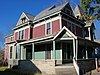
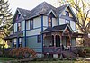
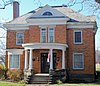
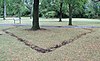
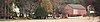
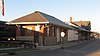
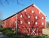
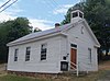
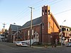
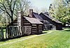
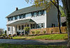
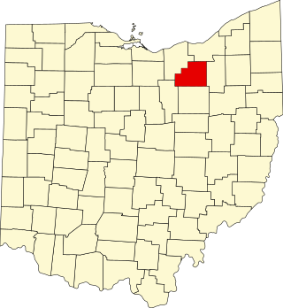
This is intended to be a complete list of the properties and districts on the National Register of Historic Places in Tuscarawas County, Ohio, United States. The locations of National Register properties and districts for which the latitude and longitude coordinates are included below, may be seen in an online map. [1]

There are 25 properties and districts listed on the National Register in the county, including 2 National Historic Landmarks.


    This National Park Service list is complete through NPS recent listings posted May 26, 2023. [2]

Map all coordinates using: OpenStreetMap  
Download coordinates as: KML

Current listings

[3] Name on the Register [4] ImageDate listed [5] Location City or townDescription
1 Frederick Bernhard House
Frederick Bernhard House Frederick Bernhard House.JPG
Frederick Bernhard House
December 9, 1988
(#88002748)
211 E. Front St.
40°31′19″N81°28′21″W / 40.521944°N 81.472500°W / 40.521944; -81.472500 (Frederick Bernhard House)
Dover
2 Katherine Cooper House
Katherine Cooper House Katherine Cooper House.JPG
Katherine Cooper House
January 4, 1996
(#95001487)
118 W. 7th St.
40°31′32″N81°28′50″W / 40.525556°N 81.480556°W / 40.525556; -81.480556 (Katherine Cooper House)
Dover
3 John Deis House
John Deis House John Deis House.JPG
John Deis House
June 30, 1988
(#88000980)
203 W. 6th St.
40°31′27″N81°28′54″W / 40.524167°N 81.481667°W / 40.524167; -81.481667 (John Deis House)
Dover
4 Dennison High School
Dennison High School Dennison High School at dawn.jpg
Dennison High School
February 1, 2006
(#05001573)
220 N. 3rd St.
40°23′40″N81°20′01″W / 40.394444°N 81.333611°W / 40.394444; -81.333611 (Dennison High School)
Dennison
5 E.D. Fisher House
E.D. Fisher House E.D. Fisher House.JPG
E.D. Fisher House
September 24, 1999
(#99001194)
432 S. Park Ave.
40°38′45″N81°27′16″W / 40.645833°N 81.454444°W / 40.645833; -81.454444 (E.D. Fisher House)
Bolivar
6 Fort Laurens Site
Fort Laurens Site Fort Laurens southwest bastion.JPG
Fort Laurens Site
November 10, 1970
(#70000518)
Near State Route 212, 0.5 mi (0.80 km) south of Bolivar
40°38′20″N81°27′22″W / 40.638889°N 81.456111°W / 40.638889; -81.456111 (Fort Laurens Site)
Lawrence Township
7 Garver Brothers Store
Garver Brothers Store Garver Brothers Store.JPG
Garver Brothers Store
November 26, 1980
(#80003238)
134 N. Wooster Ave.
40°35′51″N81°31′40″W / 40.5975°N 81.527778°W / 40.5975; -81.527778 (Garver Brothers Store)
Strasburg destroyed by arson October 2010 [6]
8 Gnadenhutten Massacre Site
Gnadenhutten Massacre Site Gnadenhutten monument.JPG
Gnadenhutten Massacre Site
November 10, 1970
(#70000519)
South of downtown Gnadenhutten on a county road
40°21′15″N81°26′06″W / 40.354167°N 81.435°W / 40.354167; -81.435 (Gnadenhutten Massacre Site)
Gnadenhutten
9 Johnson Site II February 9, 1984
(#84003808)
Above Brandywine Creek, west of Dover [7]
Dover Township
10 T. Lanning & Co. Department Store
T. Lanning & Co. Department Store T Lanning and Co Department Store.jpg
T. Lanning & Co. Department Store
April 28, 2000
(#00000420)
226-228 Grant St.
40°23′34″N81°20′03″W / 40.392778°N 81.334167°W / 40.392778; -81.334167 (T. Lanning & Co. Department Store)
Dennison
11 John Lebol House, Smokehouse and Springhouse
John Lebol House, Smokehouse and Springhouse John Lebol House, Smokehouse and Springhouse.JPG
John Lebol House, Smokehouse and Springhouse
July 15, 1982
(#82003660)
Route 1, east of Bolivar
40°38′19″N81°26′03″W / 40.638611°N 81.434167°W / 40.638611; -81.434167 (John Lebol House, Smokehouse and Springhouse)
Lawrence Township
12 Pennsylvania Railroad Depot and Baggage Room
Pennsylvania Railroad Depot and Baggage Room Pennsylvania Railroad Depot and Baggage Room.jpg
Pennsylvania Railroad Depot and Baggage Room
September 8, 1976
(#76001536)
400 Center St.
40°23′31″N81°19′56″W / 40.391944°N 81.332222°W / 40.391944; -81.332222 (Pennsylvania Railroad Depot and Baggage Room)
Dennison Designated a National Historic Landmark June 17, 2011
13 Christian Pershing Barn
Christian Pershing Barn Christian Pershing Barn.JPG
Christian Pershing Barn
March 19, 1992
(#92000172)
Off State Route 39 west of Dover
40°30′58″N81°32′46″W / 40.516111°N 81.546111°W / 40.516111; -81.546111 (Christian Pershing Barn)
Dover Township
14 Port Washington Town Hall
Port Washington Town Hall Port Washington Town Hall.jpg
Port Washington Town Hall
February 22, 1979
(#79001971)
Main St.
40°19′40″N81°31′08″W / 40.327778°N 81.518889°W / 40.327778; -81.518889 (Port Washington Town Hall)
Port Washington
15 Ragersville School
Ragersville School Ragersville School 2012-07-15.JPG
Ragersville School
July 22, 1994
(#94000777)
8807 County Road 52, SW. (Crooked Run Rd.) in Ragersville
40°27′11″N81°37′48″W / 40.453056°N 81.63°W / 40.453056; -81.63 (Ragersville School)
Auburn Township
16 The Railway Chapel
The Railway Chapel Presbyterian Church of Dennison.jpg
The Railway Chapel
April 15, 2009
(#09000212)
301 Grant St.
40°23′35″N81°20′03″W / 40.393169°N 81.334075°W / 40.393169; -81.334075 (The Railway Chapel)
Dennison Also known as the "Presbyterian Church of Dennison."
17 Jeremiah Reeves House and Carriage House
Jeremiah Reeves House and Carriage House Jeremiah Reeves Home Dover OH 2010 09 03.JPG
Jeremiah Reeves House and Carriage House
July 15, 1982
(#82003661)
325 E. Iron Ave.
40°30′57″N81°27′46″W / 40.515833°N 81.462778°W / 40.515833; -81.462778 (Jeremiah Reeves House and Carriage House)
Dover
18 Christian H. Rinderknecht House
Christian H. Rinderknecht House Christian H. Rinderknecht House.JPG
Christian H. Rinderknecht House
July 31, 1991
(#91000972)
602 N. Wooster Ave.
40°31′32″N81°28′48″W / 40.525417°N 81.480000°W / 40.525417; -81.480000 (Christian H. Rinderknecht House)
Dover
19 Schoenbrunn Site
Schoenbrunn Site Restored cottages of the Moravian Indians in Schoenbrunn, Ohio.jpg
Schoenbrunn Site
November 10, 1970
(#70000520)
U.S. 250
40°27′55″N81°25′08″W / 40.465278°N 81.418889°W / 40.465278; -81.418889 (Schoenbrunn Site)
New Philadelphia Schoenbrunn Village State Memorial
20 Seven Ranges Terminus
Seven Ranges Terminus Seven Ranges Terminus, comprehensive.jpg
Seven Ranges Terminus
December 12, 1976
(#76001527)
West of Magnolia at the junction of Stark, Tuscarawas, and Carroll counties
40°39′07″N81°19′05″W / 40.651944°N 81.318056°W / 40.651944; -81.318056 (Seven Ranges Terminus)
Sandy Township Extends into Carroll and Stark counties
21 Dr. Joseph Slingluff House
Dr. Joseph Slingluff House Dr. Joseph Slingluff House.JPG
Dr. Joseph Slingluff House
November 19, 1998
(#98001384)
606 N. Wooster Ave.
40°31′32″N81°28′48″W / 40.525694°N 81.480000°W / 40.525694; -81.480000 (Dr. Joseph Slingluff House)
Dover
22 Tuscarawas County Courthouse
Tuscarawas County Courthouse Tuscarawas County Courthouse.jpg
Tuscarawas County Courthouse
July 16, 1973
(#73001544)
Courthouse Sq.
40°29′24″N81°26′42″W / 40.49°N 81.445°W / 40.49; -81.445 (Tuscarawas County Courthouse)
New Philadelphia
23 Warther Family Home and Museum May 30, 2023
(#100009003)
331 Karl Ave.
40°31′31″N81°29′15″W / 40.5254°N 81.4875°W / 40.5254; -81.4875 (Warther Family Home and Museum)
Dover
24 Zoar Historic District
Zoar Historic District Canal Tavern of Zoar.jpg
Zoar Historic District
June 23, 1969
(#69000150)
Bounded by 5th, Foltz, and 1st Sts. and by rear property lines of properties; also village of Zoar along State Route 212; also roughly bounded by Zoar Cemetery, Cemetery Rd., Lake Dr., the Tuscarawas River, State Route 212, 5th, E. 2nd, and East Sts.
40°36′48″N81°25′22″W / 40.613333°N 81.422778°W / 40.613333; -81.422778 (Zoar Historic District)
Zoar Second set of boundaries represents a boundary increase on August 11, 1975; third set of boundaries represents a boundary increase on September 20, 2013. Designated a National Historic Landmark District in 2016.
25 Zoarville Bridge
Zoarville Bridge Zoarville Bridge.jpg
Zoarville Bridge
March 13, 1997
(#97000199)
Across the Conotton Creek east of the junction of State Routes 212 and 800, near Zoarville
40°34′38″N81°23′30″W / 40.577222°N 81.391667°W / 40.577222; -81.391667 (Zoarville Bridge)
Fairfield Township The only Fink through truss bridge known in the United States today [8]

See also

Related Research Articles

<span class="mw-page-title-main">National Register of Historic Places listings in Stark County, Ohio</span>

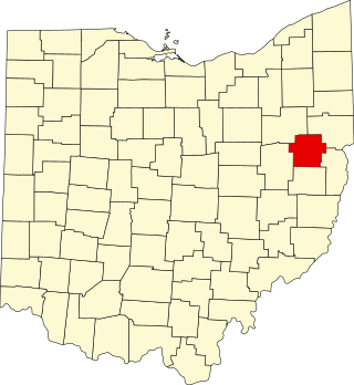
This is a list of the National Register of Historic Places listings in Stark County, Ohio.

<span class="mw-page-title-main">National Register of Historic Places listings in Delaware County, Ohio</span>

This is a list of the National Register of Historic Places listings in Delaware County, Ohio.

<span class="mw-page-title-main">National Register of Historic Places listings in Licking County, Ohio</span>

This is a list of the National Register of Historic Places listings in Licking County, Ohio.

<span class="mw-page-title-main">National Register of Historic Places listings in Champaign County, Ohio</span>

This is a list of the National Register of Historic Places listings in Champaign County, Ohio.

<span class="mw-page-title-main">National Register of Historic Places listings in Clark County, Ohio</span>

This is a list of the National Register of Historic Places listings in Clark County, Ohio.

<span class="mw-page-title-main">National Register of Historic Places listings in Auglaize County, Ohio</span>

This is a list of the National Register of Historic Places listings in Auglaize County, Ohio.

<span class="mw-page-title-main">National Register of Historic Places listings in Brown County, Ohio</span>

This is a list of the National Register of Historic Places listings in Brown County, Ohio.

<span class="mw-page-title-main">National Register of Historic Places listings in Pickaway County, Ohio</span>

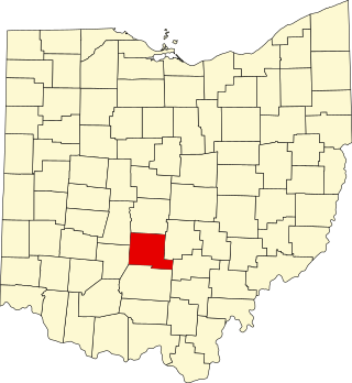
This is a list of the National Register of Historic Places listings in Pickaway County, Ohio, USA.

<span class="mw-page-title-main">National Register of Historic Places listings in Guernsey County, Ohio</span>

This is a list of the National Register of Historic Places listings in Guernsey County, Ohio.

<span class="mw-page-title-main">National Register of Historic Places listings in Jefferson County, Ohio</span>

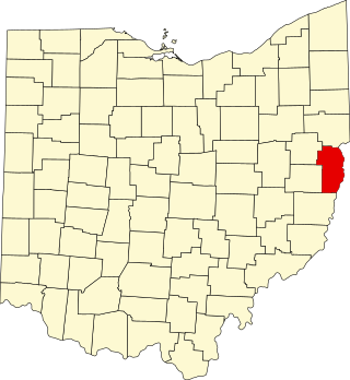
This is a list of the National Register of Historic Places listings in Jefferson County, Ohio.

<span class="mw-page-title-main">National Register of Historic Places listings in Medina County, Ohio</span>

This is a list of the National Register of Historic Places listings in Medina County, Ohio.

<span class="mw-page-title-main">National Register of Historic Places listings in Shelby County, Ohio</span>

This is a list of the National Register of Historic Places listings in Shelby County, Ohio.

<span class="mw-page-title-main">National Register of Historic Places listings in Coshocton County, Ohio</span>

This is a list of the National Register of Historic Places listings in Coshocton County, Ohio.

<span class="mw-page-title-main">National Register of Historic Places listings in Preble County, Ohio</span>

This is a list of the National Register of Historic Places listings in Preble County, Ohio.

<span class="mw-page-title-main">National Register of Historic Places listings in Fayette County, Ohio</span>

This is a list of the National Register of Historic Places listings in Fayette County, Ohio.

<span class="mw-page-title-main">National Register of Historic Places listings in Holmes County, Ohio</span>

This is a list of the National Register of Historic Places listings in Holmes County, Ohio.

<span class="mw-page-title-main">National Register of Historic Places listings in Madison County, Ohio</span>

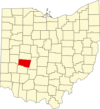
This is a list of the National Register of Historic Places listings in Madison County, Ohio.

<span class="mw-page-title-main">National Register of Historic Places listings in Carroll County, Ohio</span>

This is a list of the National Register of Historic Places listings in Carroll County, Ohio.

<span class="mw-page-title-main">National Register of Historic Places listings in Harrison County, Ohio</span>

This is a list of the National Register of Historic Places listings in Harrison County, Ohio.

<span class="mw-page-title-main">National Register of Historic Places listings in Union County, Ohio</span>

This is a list of the National Register of Historic Places listings in Union County, Ohio.

References

  1. The latitude and longitude information provided in this table was derived originally from the National Register Information System, which has been found to be fairly accurate for about 99% of listings. Some locations in this table may have been corrected to current GPS standards.
  2. National Park Service, United States Department of the Interior, "National Register of Historic Places: Weekly List Actions", retrieved May 26, 2023.
  3. Numbers represent an alphabetical ordering by significant words. Various colorings, defined here, differentiate National Historic Landmarks and historic districts from other NRHP buildings, structures, sites or objects.
  4. "National Register Information System". National Register of Historic Places . National Park Service. April 24, 2008.
  5. The eight-digit number below each date is the number assigned to each location in the National Register Information System database, which can be viewed by clicking the number.
  6. Canton Repository Archived 2010-10-24 at the Wayback Machine arson fire story accessed 11-09-2010
  7. Brown, Jeffrey D. "The Johnson Site II: Terminal Archaic Points and Pottery". Ohio Archaeologist 46.2 (1996): 4-7: 4.
  8. Zoarville Station Bridge, Historic American Engineering Record via the Library of Congress, 1992. Accessed 2009-04-25.