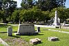
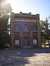
This is a list of properties and districts in Washington County, Georgia that are listed on the National Register of Historic Places (NRHP).
This National Park Service list is complete through NPS recent listings posted March 4, 2022. [1]
This is a list of properties and districts in Washington County, Georgia that are listed on the National Register of Historic Places (NRHP).
This National Park Service list is complete through NPS recent listings posted March 4, 2022. [1]
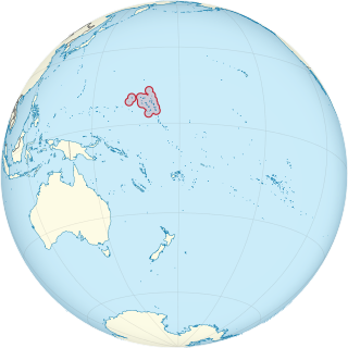
This is a list of the buildings, sites, districts, and objects listed on the National Register of Historic Places in the Marshall Islands. There are currently 4 listed sites located in only three of the 24 atolls that make up the Marshall Islands.
This National Park Service list is complete through NPS recent listings posted March 4, 2022.

This is a list of the buildings, sites, districts, and objects listed on the National Register of Historic Places in the Republic of Palau. There are currently six listed sites located in only four of the sixteen states of Palau.
This National Park Service list is complete through NPS recent listings posted March 4, 2022.

This is a list of the National Register of Historic Places (NRHP) designated in Worcester County, Massachusetts. The locations of NRHP properties and districts for which the latitude and longitude coordinates are included below, may be seen in a map.

This is intended to be a complete list of properties and districts listed on the National Register of Historic Places in Allegany County, New York. The locations of National Register properties and districts for which the latitude and longitude coordinates are included below, may be seen in a map.

This is intended to be a complete list of properties and districts listed on the National Register of Historic Places in Cattaraugus County, New York. The locations of National Register properties and districts for which the latitude and longitude coordinates are included below, may be seen in a map.
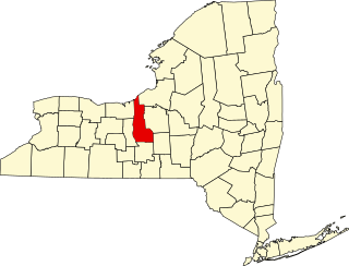
The following is a list of the National Register of Historic Places listings located in Cayuga County, New York:

This is a list of the National Register of Historic Places listings in Lycoming County, Pennsylvania.
The following properties are listed on the National Register of Historic Places in Arlington, Massachusetts.
This National Park Service list is complete through NPS recent listings posted March 4, 2022.
List of Registered Historic Places in Marlborough, Massachusetts
This National Park Service list is complete through NPS recent listings posted March 4, 2022.

This is a list of the National Register of Historic Places listings in Centre County, Pennsylvania.

This is a list of the National Register of Historic Places listings in Clinton County, Pennsylvania.

This is a list of the National Register of Historic Places listings in Juniata County, Pennsylvania.

This is a list of the National Register of Historic Places listings in Frederick County, Virginia.

This is a list of the National Register of Historic Places listings in Garfield County, Utah.

This is a list of the National Register of Historic Places listings in Spartanburg County, South Carolina.
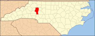
This list includes properties and districts listed on the National Register of Historic Places in Iredell County, North Carolina. Click the "Map of all coordinates" link to the right to view an online map of all properties and districts with latitude and longitude coordinates in the table below.
This is a list of properties and districts in DeKalb County, Georgia that are listed on the National Register of Historic Places (NRHP).
This is a list of the National Register of Historic Places listings in Cuyahoga Valley National Park.
Weston, Massachusetts has 15 locations listed on the National Register of Historic Places.
This National Park Service list is complete through NPS recent listings posted March 4, 2022.

Barnstable, Massachusetts, has more than 75 entries on the National Register of Historic Places. For listings elsewhere in Barnstable County, see National Register of Historic Places listings in Barnstable County, Massachusetts.
| Wikimedia Commons has media related to National Register of Historic Places in Washington County, Georgia . |