National Register of Historic Places listings in Webster County, Nebraska

Last updated

Location of Webster County in Nebraska Map of Nebraska highlighting Webster County.svg
Location of Webster County in Nebraska

This is a list of the National Register of Historic Places listings in Webster County, Nebraska. It is intended to be a complete list of the properties and districts on the National Register of Historic Places in Webster County, Nebraska, United States. The locations of National Register properties and districts for which the latitude and longitude coordinates are included below, may be seen in a map. [1]

Contents

There are 37 properties and districts listed on the National Register in the county, including 2 National Historic Landmarks.


    This National Park Service list is complete through NPS recent listings posted March 17, 2023. [2]

Map all coordinates using: OpenStreetMap  
Download coordinates as: KML
GPX (primary)
GPX (secondary)
GPX (all)

Listings county-wide

[3] Name on the RegisterImageDate listed [4] Location City or townDescription
1 Auld Public Library
Auld Public Library Auld Library from E.JPG
Auld Public Library
December 10, 1993
(#93001404)
537 N. Webster
40°05′26″N98°31′10″W / 40.090556°N 98.519444°W / 40.090556; -98.519444 (Auld Public Library)
Red Cloud
2 Matthew R. Bentley House
Matthew R. Bentley House Bentley house (Red Cloud) from SE 2.JPG
Matthew R. Bentley House
August 11, 1982
(#82004927)
845 N. Cedar
40°05′38″N98°31′14″W / 40.093889°N 98.520556°W / 40.093889; -98.520556 (Matthew R. Bentley House)
Red Cloud
3 Burlington Depot
Burlington Depot Red Cloud RR depot from SE.jpg
Burlington Depot
March 5, 1981
(#81000376)
Seward St.
40°04′38″N98°31′17″W / 40.077222°N 98.521389°W / 40.077222; -98.521389 (Burlington Depot)
Red Cloud
4 Cather House
Cather House Willa Cather house from NE 3.JPG
Cather House
April 16, 1969
(#69000139)
Southwestern corner of 3rd Avenue and Cedar Street [5]
40°05′14″N98°31′13″W / 40.087222°N 98.520278°W / 40.087222; -98.520278 (Cather House)
Red Cloud
5 George Cather Farmstead
George Cather Farmstead Geo. Cather Farmstead house from ESE 1.JPG
George Cather Farmstead
August 11, 1982
(#82004917)
Southwest of Bladen: 552 Road T [6]
40°14′57″N98°38′27″W / 40.249167°N 98.640833°W / 40.249167; -98.640833 (George Cather Farmstead)
Bladen
6 William Cather Homestead Site
William Cather Homestead Site William Cather homestead site from N 2.JPG
William Cather Homestead Site
August 11, 1982
(#82004921)
Northwest of Red Cloud
40°13′07″N98°39′31″W / 40.218611°N 98.658611°W / 40.218611; -98.658611 (William Cather Homestead Site)
Red Cloud
7 Chalk Cliff and Republican River
Chalk Cliff and Republican River Red Cloud chalk cliffs 6.JPG
Chalk Cliff and Republican River
August 11, 1982
(#82004919)
1 mile south of Red Cloud
40°03′43″N98°31′23″W / 40.061944°N 98.523056°W / 40.061944; -98.523056 (Chalk Cliff and Republican River)
Red Cloud
8 City Pharmacy
City Pharmacy Red Cloud City Pharmacy 2.JPG
City Pharmacy
February 11, 1982
(#82004929)
410 N. Webster
40°05′21″N98°31′07″W / 40.089167°N 98.518611°W / 40.089167; -98.518611 (City Pharmacy)
Red Cloud
9 Crossroads Grave Site
Crossroads Grave Site Crossroads Grave (Webster County) 2.jpg
Crossroads Grave Site
August 11, 1982
(#82004920)
Northwest of Red Cloud
40°11′27″N98°36′48″W / 40.190833°N 98.613333°W / 40.190833; -98.613333 (Crossroads Grave Site)
Red Cloud
10 William Ducker House
William Ducker House William Ducker House from SE 1.jpg
William Ducker House
February 11, 1982
(#82004930)
821 Franklin St.
40°05′37″N98°31′40″W / 40.093611°N 98.527778°W / 40.093611; -98.527778 (William Ducker House)
Red Cloud
11 Elm St. Historic District
Elm St. Historic District Red Cloud, Nebraska 745 N Elm.JPG
Elm St. Historic District
August 11, 1982
(#82004934)
Roughly bounded by 10th and 6th Aves. and Locust and Webster Sts.
40°05′35″N98°31′02″W / 40.093056°N 98.517222°W / 40.093056; -98.517222 (Elm St. Historic District)
Red Cloud
12 Farmer's and Merchant's Bank Building
Farmer's and Merchant's Bank Building Red Cloud Farmer's and Merchant's Bank from NW.jpg
Farmer's and Merchant's Bank Building
March 5, 1981
(#81000377)
338 N. Webster St.
40°05′19″N98°31′07″W / 40.088611°N 98.518611°W / 40.088611; -98.518611 (Farmer's and Merchant's Bank Building)
Red Cloud
13 First Baptist Church
First Baptist Church Red Cloud First Baptist Church from NW 2.jpg
First Baptist Church
August 12, 1982
(#82003206)
442 N. Seward St.
40°05′23″N98°31′17″W / 40.089722°N 98.521389°W / 40.089722; -98.521389 (First Baptist Church)
Red Cloud
14 Garber Grove
Garber Grove Garber Grove (Red Cloud) from N 2.JPG
Garber Grove
August 11, 1982
(#82004916)
East of Red Cloud
40°05′06″N98°30′55″W / 40.085°N 98.515278°W / 40.085; -98.515278 (Garber Grove)
Red Cloud
15 Grace Protestant Episcopal Church
Grace Protestant Episcopal Church Red Cloud Grace Episcopal from NW 1.jpg
Grace Protestant Episcopal Church
February 11, 1982
(#82004931)
546 N. Cedar St.
40°05′26″N98°31′12″W / 40.090556°N 98.52°W / 40.090556; -98.52 (Grace Protestant Episcopal Church)
Red Cloud
16 IOOF Hall and Opera House
IOOF Hall and Opera House Bladen IOOF Hall and Opera House from SE.jpg
IOOF Hall and Opera House
July 6, 1988
(#88000953)
Main St.
40°19′21″N98°35′42″W / 40.3225°N 98.595°W / 40.3225; -98.595 (IOOF Hall and Opera House)
Bladen
17 Inavale Community Hall and Gymnasium March 3, 2023
(#100008680)
418 Minnesota Ave.
40°05′31″N98°38′58″W / 40.0920°N 98.6495°W / 40.0920; -98.6495 (Inavale Community Hall and Gymnasium)
Inavale
18 Jackson's Reserve
Jackson's Reserve Jackson Reserve (Red Cloud, NE) from NW 1.JPG
Jackson's Reserve
August 11, 1982
(#82004936)
Bounded by Seward, Cedar, and 3rd Sts.
40°04′51″N98°31′13″W / 40.080833°N 98.520278°W / 40.080833; -98.520278 (Jackson's Reserve)
Red Cloud
19 Main Street Historic District
Main Street Historic District Red Cloud State Bank Block from SE.JPG
Main Street Historic District
February 11, 1982
(#82004932)
Roughly bounded by 3rd and 5th Aves. and Elm and Cedar Sts.
40°05′20″N98°31′09″W / 40.088889°N 98.519167°W / 40.088889; -98.519167 (Main Street Historic District)
Red Cloud
20 Dr. Gilbert McKeeby House
Dr. Gilbert McKeeby House McKeeby House (Red Cloud, Nebraska) from NE.jpg
Dr. Gilbert McKeeby House
August 11, 1982
(#82004937)
641 N. Cherry St.
40°05′30″N98°31′34″W / 40.091667°N 98.526111°W / 40.091667; -98.526111 (Dr. Gilbert McKeeby House)
Red Cloud
21 Miner Brothers Store
Miner Brothers Store Red Cloud Miner Bros. from SE.JPG
Miner Brothers Store
August 11, 1982
(#82004924)
3rd and Webster Sts.
40°05′17″N98°31′10″W / 40.088056°N 98.519444°W / 40.088056; -98.519444 (Miner Brothers Store)
Red Cloud
22 Miner House
Miner House Miner House (Red Cloud, Nebraska) from SE.JPG
Miner House
August 11, 1982
(#82004922)
241 N. Seward
40°05′15″N98°31′19″W / 40.0875°N 98.521944°W / 40.0875; -98.521944 (Miner House)
Red Cloud
23 Moon Block
Moon Block Red Cloud Moon Block 1.JPG
Moon Block
August 11, 1982
(#82004926)
Webster St. between 4th and 5th Aves.
40°05′22″N98°31′10″W / 40.089444°N 98.519444°W / 40.089444; -98.519444 (Moon Block)
Red Cloud
24 Opera House
Opera House Red Cloud Opera House 1.JPG
Opera House
August 11, 1982
(#82004925)
413 N. Webster
40°05′21″N98°31′10″W / 40.089167°N 98.519444°W / 40.089167; -98.519444 (Opera House)
Red Cloud
25 Pavelka Farmstead
Pavelka Farmstead Pavelka farmstead house and cellar from SW.jpg
Pavelka Farmstead
April 13, 1979
(#79001459)
Southeast of Bladen
40°16′52″N98°32′34″W / 40.281111°N 98.542778°W / 40.281111; -98.542778 (Pavelka Farmstead)
Bladen
26 Perkins-Wiener House
Perkins-Wiener House Perkins-Wiener House from NW 2.jpg
Perkins-Wiener House
August 11, 1982
(#82004923)
238 N. Seward
40°05′15″N98°31′17″W / 40.0875°N 98.521389°W / 40.0875; -98.521389 (Perkins-Wiener House)
Red Cloud
27 Pike-Pawnee Village Site
Pike-Pawnee Village Site Guide Rock, Nebraska Pike marker.JPG
Pike-Pawnee Village Site
October 15, 1966
(#66000455)
Address Restricted
Guide Rock
28 Railroad Addition Historic District
Railroad Addition Historic District Red Cloud, Nebraska 221 S Seward.JPG
Railroad Addition Historic District
August 11, 1982
(#82004935)
Roughly bounded by Vine, Division, Seward, Railroad, and 1st Sts.
40°04′46″N98°31′18″W / 40.079444°N 98.521667°W / 40.079444; -98.521667 (Railroad Addition Historic District)
Red Cloud
29 Red Cloud Bridge
Red Cloud Bridge Red Cloud Republican bridge S end from NE 1.JPG
Red Cloud Bridge
June 29, 1992
(#92000726)
U.S. Route 281 over the Republican River, 2 miles south of Red Cloud
40°03′46″N98°31′07″W / 40.062778°N 98.518611°W / 40.062778; -98.518611 (Red Cloud Bridge)
Red Cloud
30 St. Juliana Falconieri Catholic Church
St. Juliana Falconieri Catholic Church St. Juliana Falconieri Church (Red Cloud) from SE.jpg
St. Juliana Falconieri Catholic Church
March 5, 1981
(#81000378)
425 W. 3rd St.
40°04′50″N98°31′24″W / 40.080556°N 98.523333°W / 40.080556; -98.523333 (St. Juliana Falconieri Catholic Church)
Red Cloud
31 St. Stephenie Scandinavian Evangelical Lutheran Church
St. Stephenie Scandinavian Evangelical Lutheran Church St. Stephenie Scandinavian Evangelical Lutheran Church from SE 1.jpg
St. Stephenie Scandinavian Evangelical Lutheran Church
August 11, 1982
(#82004918)
8 miles northwest of Red Cloud
40°11′25″N98°35′41″W / 40.190278°N 98.594722°W / 40.190278; -98.594722 (St. Stephenie Scandinavian Evangelical Lutheran Church)
Red Cloud
32 Seward Street Historic District
Seward Street Historic District Red Cloud, Nebraska 341 N Seward.JPG
Seward Street Historic District
February 11, 1982
(#82004933)
Roughly bounded by Walnut and Cedar Sts. and 10th and A Aves.
40°05′22″N98°31′17″W / 40.089444°N 98.521389°W / 40.089444; -98.521389 (Seward Street Historic District)
Red Cloud
33 Starke Round Barn
Starke Round Barn Starke Round Barn 2.jpg
Starke Round Barn
March 16, 1972
(#72000761)
4.5 miles east of Red Cloud on U.S. Route 136
40°05′21″N98°26′21″W / 40.089167°N 98.439167°W / 40.089167; -98.439167 (Starke Round Barn)
Red Cloud
34 US Post Office-Red Cloud
US Post Office-Red Cloud Red Cloud post office from NW.jpg
US Post Office-Red Cloud
May 11, 1992
(#92000474)
300 N. Webster
40°05′17″N98°31′08″W / 40.088055°N 98.518994°W / 40.088055; -98.518994 (US Post Office-Red Cloud)
Red Cloud One of 12 Nebraska post offices featuring Section of Fine Arts murals, installed in 1941. [7]
35 Warner-Cather House
Warner-Cather House Warner-Cather House from E 1.JPG
Warner-Cather House
August 11, 1982
(#82004928)
541 N. Seward St.
40°05′26″N98°31′19″W / 40.090556°N 98.521944°W / 40.090556; -98.521944 (Warner-Cather House)
Red Cloud
36 Webster County Courthouse
Webster County Courthouse Webster County Courthouse, Red Cloud.jpg
Webster County Courthouse
March 5, 1981
(#81000379)
225 W. 6th St.
40°05′29″N98°31′16″W / 40.091389°N 98.521111°W / 40.091389; -98.521111 (Webster County Courthouse)
Red Cloud
37 Willa Cather Memorial Prairie
Willa Cather Memorial Prairie Cather Prairie 3.jpg
Willa Cather Memorial Prairie
August 12, 1982
(#82003207)
South of Red Cloud on U.S. Route 281
40°00′35″N98°31′41″W / 40.009722°N 98.528056°W / 40.009722; -98.528056 (Willa Cather Memorial Prairie)
Red Cloud

See also

Related Research Articles

<span class="mw-page-title-main">National Register of Historic Places listings in Douglas County, Nebraska</span>

This is a list of the National Register of Historic Places listings in Douglas County, Nebraska.

<span class="mw-page-title-main">National Register of Historic Places listings in Otoe County, Nebraska</span>

This is a list of the National Register of Historic Places listings in Otoe County, Nebraska.

<span class="mw-page-title-main">National Register of Historic Places listings in Washington County, Nebraska</span>

This is a list of the National Register of Historic Places listings in Washington County, Nebraska.

<span class="mw-page-title-main">National Register of Historic Places listings in Saunders County, Nebraska</span>

This is a list of the National Register of Historic Places listings in Saunders County, Nebraska. It is intended to be a complete list of the properties and districts on the National Register of Historic Places in Saunders County, Nebraska, United States. The locations of National Register properties and districts for which the latitude and longitude coordinates are included below, may be seen in a map.

<span class="mw-page-title-main">National Register of Historic Places listings in Saline County, Nebraska</span>

This is a list of the National Register of Historic Places listings in Saline County, Nebraska. It is intended to be a complete list of the properties and districts on the National Register of Historic Places in Saline County, Nebraska, United States. The locations of National Register properties and districts for which the latitude and longitude coordinates are included below, may be seen in a map.

<span class="mw-page-title-main">National Register of Historic Places listings in Richardson County, Nebraska</span>

This is a list of the National Register of Historic Places listings in Richardson County, Nebraska.

<span class="mw-page-title-main">National Register of Historic Places listings in Pawnee County, Nebraska</span>

This is a list of the National Register of Historic Places listings in Pawnee County, Nebraska.

<span class="mw-page-title-main">National Register of Historic Places listings in Nemaha County, Nebraska</span>

This is a list of the National Register of Historic Places listings in Nemaha County, Nebraska. It is intended to be a complete list of the properties and districts on the National Register of Historic Places in Nemaha County, Nebraska, United States. The locations of National Register properties and districts for which the latitude and longitude coordinates are included below, may be seen in a map.

<span class="mw-page-title-main">National Register of Historic Places listings in Keith County, Nebraska</span>

This is a list of the National Register of Historic Places listings in Keith County, Nebraska. It is intended to be a complete list of the properties and districts on the National Register of Historic Places in Keith County, Nebraska, United States. The locations of National Register properties and districts for which the latitude and longitude coordinates are included below, may be seen in a map.

<span class="mw-page-title-main">National Register of Historic Places listings in Cass County, Nebraska</span>

This is a list of the National Register of Historic Places listings in Cass County, Nebraska.

<span class="mw-page-title-main">National Register of Historic Places listings in Cherry County, Nebraska</span>

This is a list of the National Register of Historic Places listings in Cherry County, Nebraska. It is intended to be a complete list of the properties and districts on the National Register of Historic Places in Cherry County, Nebraska, United States. The locations of National Register properties and districts for which the latitude and longitude coordinates are included below, may be seen in a map.

<span class="mw-page-title-main">National Register of Historic Places listings in Jefferson County, Nebraska</span>

This is a list of the National Register of Historic Places listings in Jefferson County, Nebraska. It is intended to be a complete list of the properties and districts on the National Register of Historic Places in Jefferson County, Nebraska, United States. The locations of National Register properties and districts for which the latitude and longitude coordinates are included below, may be seen in a map.

<span class="mw-page-title-main">National Register of Historic Places listings in Dawes County, Nebraska</span>

This is a list of the National Register of Historic Places listings in Dawes County, Nebraska.

<span class="mw-page-title-main">National Register of Historic Places listings in Gage County, Nebraska</span>

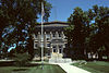
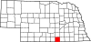
This is a list of the National Register of Historic Places listings in Gage County, Nebraska.

<span class="mw-page-title-main">National Register of Historic Places listings in Hall County, Nebraska</span>

This is a list of the National Register of Historic Places listings in Hall County, Nebraska.

<span class="mw-page-title-main">National Register of Historic Places listings in Fillmore County, Nebraska</span>

This is a list of the National Register of Historic Places listings in Fillmore County, Nebraska.

<span class="mw-page-title-main">National Register of Historic Places listings in Lancaster County, Nebraska</span>

This is a list of the National Register of Historic Places listings in Lancaster County, Nebraska.

<span class="mw-page-title-main">National Register of Historic Places listings in Colfax County, Nebraska</span>

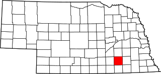
This is a list of the National Register of Historic Places listings in Colfax County, Nebraska.

<span class="mw-page-title-main">National Register of Historic Places listings in Robeson County, North Carolina</span>

This list includes properties and districts listed on the National Register of Historic Places in Robeson County, North Carolina. Click the "Map of all coordinates" link to the right to view a Google map of all properties and districts with latitude and longitude coordinates in the table below.

<span class="mw-page-title-main">National Register of Historic Places listings in Antelope County, Nebraska</span>

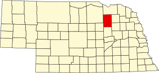
This is a list of the National Register of Historic Places listings in Antelope County, Nebraska.

References

  1. The latitude and longitude information provided in this table was derived originally from the National Register Information System, which has been found to be fairly accurate for about 99% of listings. Some locations in this table may have been corrected to current GPS standards.
  2. National Park Service, United States Department of the Interior, "National Register of Historic Places: Weekly List Actions", retrieved March 17, 2023.
  3. Numbers represent an alphabetical ordering by significant words. Various colorings, defined here, differentiate National Historic Landmarks and historic districts from other NRHP buildings, structures, sites or objects.
  4. The eight-digit number below each date is the number assigned to each location in the National Register Information System database, which can be viewed by clicking the number.
  5. See street sign in photo.
  6. See photo of mailbox.
  7. Ahlgren, Carol (August 1991). "National Register of Historic Places Multiple Property Documentation Form: Nebraska Post Offices Which Contain Section Artwork (1938-1942)" (PDF). Archived from the original on May 13, 2013. Retrieved 2013-01-28.{{cite journal}}: Cite journal requires |journal= (help)CS1 maint: unfit URL (link)