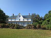
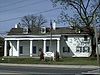
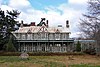
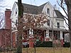
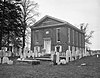
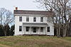
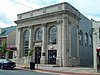
[3] Name on the Register Image Date listed [4] Location City or town Description 1 Academy of Newark Academy of Newark May 24, 1976 (# 76000573 105 E. Main St. 39°40′58″N 75°44′57″W / 39.682898°N 75.749056°W / 39.682898; -75.749056 (Academy of Newark ) Newark University of Delaware 2 Aetna Hose, Hook and Ladder Company Fire Station No. 1 Aetna Hose, Hook and Ladder Company Fire Station No. 1 May 7, 1982 (# 82002335 26 Academy St. 39°40′57″N 75°44′59″W / 39.682413°N 75.749623°W / 39.682413; -75.749623 (Aetna Hose, Hook and Ladder Company Fire Station No. 1 ) Newark 3 Aetna Hose, Hook and Ladder Company, Fire Station No. 2 Aetna Hose, Hook and Ladder Company, Fire Station No. 2 May 7, 1982 (# 82002334 31 Academy St. 39°40′56″N 75°44′57″W / 39.682181°N 75.749142°W / 39.682181; -75.749142 (Aetna Hose, Hook and Ladder Company, Fire Station No. 2 ) Newark 4 African Union Church and Cemetery of Iron Hill African Union Church and Cemetery of Iron Hill September 9, 2021 (# 100006887 1578 Whittaker Rd. 39°37′59″N 75°45′41″W / 39.6330°N 75.7613°W / 39.6330; -75.7613 (African Union Church and Cemetery of Iron Hill ) Pencader Hundred , Newark vicinity 5 Aiken's Tavern Historic District Aiken's Tavern Historic District December 6, 1977 (# 77000388 Junction of U.S. Route 40 and Delaware Route 896 39°36′23″N 75°44′45″W / 39.606389°N 75.745833°W / 39.606389; -75.745833 (Aiken's Tavern Historic District ) Glasgow 6 Air Service, Inc. Hangar at Bellanca Airfield Air Service, Inc. Hangar at Bellanca Airfield June 15, 2005 (# 05000601 2 Centerpoint Blvd. 39°39′52″N 75°35′13″W / 39.664307°N 75.586928°W / 39.664307; -75.586928 (Air Service, Inc. Hangar at Bellanca Airfield ) New Castle 7 Charles Allen House Charles Allen House August 19, 1983 (# 83001348 855 Canoe Rd. 39°38′46″N 75°40′40″W / 39.646111°N 75.677778°W / 39.646111; -75.677778 (Charles Allen House ) Christiana 8 Amstel House Amstel House May 12, 1977 (# 77000386 2 E. 4th St. 39°39′38″N 75°33′53″W / 39.660610°N 75.564853°W / 39.660610; -75.564853 (Amstel House ) New Castle 9 Anderson House Anderson House February 24, 1983 (# 83001384 50 W. Park Pl. 39°40′30″N 75°45′22″W / 39.674985°N 75.756112°W / 39.674985; -75.756112 (Anderson House ) Newark 10 Archmere Archmere September 9, 1992 (# 92001143 3600 Philadelphia Pike 39°48′08″N 75°27′13″W / 39.802302°N 75.453725°W / 39.802302; -75.453725 (Archmere ) Claymont 11 Ardens Historic District Ardens Historic District May 30, 2003 (# 01001245 Orleans Rd. at Harvey Rd. 39°48′41″N 75°29′16″W / 39.811389°N 75.487778°W / 39.811389; -75.487778 (Ardens Historic District ) Arden 12 James Armor House James Armor House August 31, 1992 (# 92001141 3 Courtney Rd. 39°45′42″N 75°36′57″W / 39.761626°N 75.615885°W / 39.761626; -75.615885 (James Armor House ) Christiana Hundred 13 Armstrong Lodge No. 26, A.F. & A.M. Armstrong Lodge No. 26, A.F. & A.M. July 14, 1993 (# 93000628 112–114 E. Market St. 39°42′49″N 75°36′28″W / 39.713611°N 75.607778°W / 39.713611; -75.607778 (Armstrong Lodge No. 26, A.F. & A.M. ) Newport 14 A. Armstrong Farm A. Armstrong Farm November 13, 1986 (# 86003083 Old Wilmington Rd. west of Brackenville Rd. 39°47′11″N 75°40′28″W / 39.786389°N 75.674444°W / 39.786389; -75.674444 (A. Armstrong Farm ) Hockessin Farm house and barn; demolished before 2002. 15 Ashland Bridge Ashland Bridge March 20, 1973 (# 73000506 South of Ashland over Red Clay Creek 39°47′54″N 75°39′28″W / 39.798275°N 75.657883°W / 39.798275; -75.657883 (Ashland Bridge ) Ashland 16 Auburn Mills Historic District Auburn Mills Historic District January 22, 1980 (# 80000939 West of Yorklyn on Delaware Route 82 and Benge Road 39°48′28″N 75°40′49″W / 39.807778°N 75.680278°W / 39.807778; -75.680278 (Auburn Mills Historic District ) Yorklyn 17 Baily House Baily House May 7, 1982 (# 82002336 166 W. Main St. 39°41′03″N 75°45′32″W / 39.684181°N 75.758851°W / 39.684181; -75.758851 (Baily House ) Newark 18 Bank of Newark Building Bank of Newark Building February 24, 1983 (# 83001345 102 E. Main St. 39°41′01″N 75°44′57″W / 39.6835°N 75.74924°W / 39.6835; -75.74924 (Bank of Newark Building ) Newark 19 Bartley-Tweed Farm Bartley-Tweed Farm November 13, 1986 (# 86003084 51 Fox Den Rd. 39°43′13″N 75°42′59″W / 39.720278°N 75.716389°W / 39.720278; -75.716389 (Bartley-Tweed Farm ) Mill Creek Hundred 20 Beaver Valley Rock Shelter Site Beaver Valley Rock Shelter Site September 1, 1978 (# 78000910 Address Restricted Brandywine Hundred Part of the First State National Historical Park 21 Bell Farmhouse Bell Farmhouse February 24, 1983 (# 83001344 401 Nottingham Rd. 39°41′15″N 75°46′12″W / 39.687628°N 75.770127°W / 39.687628; -75.770127 (Bell Farmhouse ) Newark 22 Belmont Hall Belmont Hall February 24, 1983 (# 83001386 302 W. Main St. 39°41′02″N 75°45′39″W / 39.683809°N 75.760755°W / 39.683809; -75.760755 (Belmont Hall ) Newark University of Delaware 23 Bloomfield Bloomfield April 8, 1982 (# 82002354 4663 Kirkwood St. Georges Road 39°33′20″N 75°39′23″W / 39.555672°N 75.656263°W / 39.555672; -75.656263 (Bloomfield ) St. Georges 24 Blue Hen Farm Blue Hen Farm February 24, 1983 (# 83001346 505 Stamford Dr. 39°41′45″N 75°45′59″W / 39.695795°N 75.766449°W / 39.695795; -75.766449 (Blue Hen Farm ) Newark 25 Brandywine Manufacturers Sunday School Brandywine Manufacturers Sunday School April 13, 1972 (# 72000291 Blacksmith Hill Rd. 39°46′44″N 75°34′35″W / 39.778889°N 75.576389°W / 39.778889; -75.576389 (Brandywine Manufacturers Sunday School ) Christiana Hundred Part of the Hagley Museum 26 Brandywine Powder Mills District Brandywine Powder Mills District May 3, 1984 (# 84000819 Delaware Route 141 and the Brandywine River 39°46′48″N 75°34′40″W / 39.78°N 75.577778°W / 39.78; -75.577778 (Brandywine Powder Mills District ) Christiana Hundred Hagley Museum 27 Breck's Mill Area Breck's Mill Area November 5, 1971 (# 71000230 Breck's Lane and Creek Rd. 39°46′12″N 75°34′50″W / 39.769946°N 75.580572°W / 39.769946; -75.580572 (Breck's Mill Area ) Christiana Hundred Extends slightly into Wilmington proper 28 Brindley Farm Brindley Farm September 28, 1976 (# 76000575 3510 Kennett Pike 39°46′13″N 75°35′35″W / 39.770278°N 75.593056°W / 39.770278; -75.593056 (Brindley Farm ) Christiana Hundred 29 Jacob Broom House Jacob Broom House December 2, 1974 (# 74000602 402 Dean Lane 39°46′49″N 75°34′42″W / 39.780164°N 75.578315°W / 39.780164; -75.578315 (Jacob Broom House ) Christiana Hundred 30 Buena Vista Buena Vista April 16, 1971 (# 71000228 661 South DuPont Highway 39°38′02″N 75°38′22″W / 39.633752°N 75.639539°W / 39.633752; -75.639539 (Buena Vista ) New Castle Hundred State of Delaware retreat center 31 Building at 28–34½ Academy Street Building at 28–34½ Academy Street May 7, 1982 (# 82002338 28–34½ Academy St. 39°40′56″N 75°44′59″W / 39.682194°N 75.749610°W / 39.682194; -75.749610 (Building at 28–34½ Academy Street ) Newark 32 Building at 140 W. Main Street Building at 140 W. Main Street May 7, 1982 (# 82002337 140 W. Main St. 39°41′02″N 75°45′28″W / 39.683813°N 75.757790°W / 39.683813; -75.757790 (Building at 140 W. Main Street ) Newark 33 Building at 34 Choate Street Building at 34 Choate Street February 24, 1983 (# 83001387 34 Choate St. 39°41′05″N 75°44′49″W / 39.684776°N 75.746808°W / 39.684776; -75.746808 (Building at 34 Choate Street ) Newark 34 John Carney Agricultural Complex John Carney Agricultural Complex February 25, 2009 (# 09000050 4300 Thompson Bridge Rd. 39°49′13″N 75°34′00″W / 39.820386°N 75.566779°W / 39.820386; -75.566779 (John Carney Agricultural Complex ) Rockland Part of Brandywine Creek State Park 35 Carpenter-Lippincott House Carpenter-Lippincott House April 13, 1983 (# 83001388 5620 Kennett Pike 39°49′06″N 75°37′00″W / 39.818207°N 75.616737°W / 39.818207; -75.616737 (Carpenter-Lippincott House ) Centreville 36 Stuart Randall & Pricilla Kellogg Carswell House Stuart Randall & Pricilla Kellogg Carswell House November 22, 2011 (# 11000844 102 Briar Ln. 39°41′08″N 75°46′11″W / 39.685556°N 75.769722°W / 39.685556; -75.769722 (Stuart Randall & Pricilla Kellogg Carswell House ) Newark 37 W. Casperson House W. Casperson House April 8, 1982 (# 82002355 1600 Red Lion Rd. 39°35′25″N 75°40′26″W / 39.590407°N 75.673953°W / 39.590407; -75.673953 (W. Casperson House ) St. Georges 38 Centre Meeting and Schoolhouse Centre Meeting and Schoolhouse December 16, 1971 (# 71000224 311 Center Meeting Rd. 39°49′13″N 75°35′58″W / 39.8204°N 75.5995°W / 39.8204; -75.5995 (Centre Meeting and Schoolhouse ) Centreville 39 Centreville Historic District Centreville Historic District April 13, 1983 (# 83001338 Kennett Pike and Owls Nest/Twaddell Mill Rd. 39°49′16″N 75°37′00″W / 39.821111°N 75.616667°W / 39.821111; -75.616667 (Centreville Historic District ) Centreville 40 Chambers House Chambers House November 29, 1988 (# 88003132 Creek and Hopkins Bridge Rds. 39°43′38″N 75°46′05″W / 39.727233°N 75.768026°W / 39.727233; -75.768026 (Chambers House ) White Clay Creek Hundred Nature center for White Clay Creek State Park 41 Chambers House Chambers House February 24, 1983 (# 83001389 196 S. College Ave. 39°40′42″N 75°45′14″W / 39.678280°N 75.753880°W / 39.678280; -75.753880 (Chambers House ) Newark University of Delaware 42 Joseph Chandler House Joseph Chandler House April 13, 1983 (# 83001390 5826 Kennett Pike 39°49′26″N 75°37′09″W / 39.823889°N 75.619167°W / 39.823889; -75.619167 (Joseph Chandler House ) Centreville 43 Chelsea Chelsea April 8, 1982 (# 82002325 910 5th St. 39°34′37″N 75°35′56″W / 39.576892°N 75.598971°W / 39.576892; -75.598971 (Chelsea ) Delaware City 44 Christiana Historic District Christiana Historic District December 16, 1974 (# 74000600 Junction of Delaware Routes 7 and 273 39°39′55″N 75°39′36″W / 39.665278°N 75.66°W / 39.665278; -75.66 (Christiana Historic District ) Christiana 45 Abner Cloud House Abner Cloud House August 31, 1992 (# 92001144 14 Ravine Rd. 39°48′54″N 75°28′47″W / 39.814938°N 75.479831°W / 39.814938; -75.479831 (Abner Cloud House ) Brandywine Hundred 46 Cloud-Reese House Cloud-Reese House August 17, 2001 (# 01000885 2202 Old Kennett Rd. 39°49′20″N 75°39′25″W / 39.822168°N 75.657008°W / 39.822168; -75.657008 (Cloud-Reese House ) Christiana Hundred 47 Clyde Farm Site Clyde Farm Site July 29, 1977 (# 77000391 Southern side of White Clay Creek, north of Interstate 95 [5] 39°41′56″N 75°38′12″W / 39.698889°N 75.636667°W / 39.698889; -75.636667 (Clyde Farm Site ) Stanton Paleo-Indian archaeological site 48 Coffee Run Mission Site Coffee Run Mission Site April 11, 1973 (# 73000509 6580 Lancaster Pike 39°46′03″N 75°39′34″W / 39.7675°N 75.659444°W / 39.7675; -75.659444 (Coffee Run Mission Site ) Hockessin One structure destroyed in March 2010 following an arson. [6] 49 Collison House Collison House July 14, 1993 (# 93000635 21 N. Walnut St. 39°42′53″N 75°36′27″W / 39.714734°N 75.607437°W / 39.714734; -75.607437 (Collison House ) Newport 50 Cooch's Bridge Historic District Cooch's Bridge Historic District April 11, 1973 (# 73000528 South of Newark off Delaware Route 896 39°38′24″N 75°44′11″W / 39.640073°N 75.736409°W / 39.640073; -75.736409 (Cooch's Bridge Historic District ) Pencader Hundred 51 Correll's Farm and Lawn Supply Correll's Farm and Lawn Supply April 8, 1982 (# 82002327 2440 Red Lion Road 39°34′14″N 75°41′50″W / 39.570542°N 75.697168°W / 39.570542; -75.697168 (Correll's Farm and Lawn Supply ) Kirkwood 52 Cox-Phillips-Mitchell Agricultural Complex Cox-Phillips-Mitchell Agricultural Complex March 13, 2017 (# 100000729 1651 & 1655 Old Wilmington Rd. 39°47′43″N 75°41′54″W / 39.795267°N 75.698307°W / 39.795267; -75.698307 (Cox-Phillips-Mitchell Agricultural Complex ) Hockessin 53 Curtis Mansion Curtis Mansion May 7, 1982 (# 82002339 183 W. Main St. 39°41′02″N 75°45′37″W / 39.683895°N 75.760170°W / 39.683895; -75.760170 (Curtis Mansion ) Newark English Language Institute of the University of Delaware 54 Curtis Paper Mill Workers' Houses Curtis Paper Mill Workers' Houses May 7, 1982 (# 82002340 Curtis Lane 39°41′27″N 75°44′56″W / 39.69087°N 75.74889°W / 39.69087; -75.74889 (Curtis Paper Mill Workers' Houses ) Newark 55 Darley House Darley House July 2, 1973 (# 73000508 3701 Philadelphia Pike 39°48′18″N 75°27′15″W / 39.804881°N 75.454248°W / 39.804881; -75.454248 (Darley House ) Claymont 56 Dauneport House Dauneport House September 8, 2022 (# 100008081 420 Old Kennett Rd. 39°48′38″N 75°37′16″W / 39.8106°N 75.6211°W / 39.8106; -75.6211 (Dauneport House ) Wilmington vicinity 57 Joseph Dean & Son Woolen Mill Joseph Dean & Son Woolen Mill May 22, 1978 (# 78000901 500 Creek View Rd. 39°41′22″N 75°44′44″W / 39.689508°N 75.745507°W / 39.689508; -75.745507 (Joseph Dean & Son Woolen Mill ) Newark 58 Deer Park Farm Deer Park Farm February 24, 1983 (# 83001347 48 W. Park Pl. 39°40′30″N 75°45′21″W / 39.675°N 75.755833°W / 39.675; -75.755833 (Deer Park Farm ) Newark Demolished 59 Deer Park Hotel Deer Park Hotel May 7, 1982 (# 82002341 108 W. Main St. 39°40′59″N 75°45′22″W / 39.683184°N 75.755982°W / 39.683184; -75.755982 (Deer Park Hotel ) Newark 60 Delaware Boundary Markers Delaware Boundary Markers February 18, 1975 (# 75002101 Delaware state boundary lines with Maryland and Pennsylvania 39°43′20″N 75°47′19″W / 39.722201°N 75.788594°W / 39.722201; -75.788594 (Delaware Boundary Markers ) Not applicable 61 Delaware City Historic District Delaware City Historic District December 15, 1983 (# 83003515 Roughly bounded by the Delaware River , Dragon Creek, Delaware Route 9 , and the Delaware and Chesapeake Canals 39°34′38″N 75°35′31″W / 39.577222°N 75.591944°W / 39.577222; -75.591944 (Delaware City Historic District ) Delaware City 62 S. P. Dixon Farm S. P. Dixon Farm November 13, 1986 (# 86003085 Barley Mill and Brackenville Rds. 39°47′45″N 75°39′27″W / 39.795786°N 75.657526°W / 39.795786; -75.657526 (S. P. Dixon Farm ) Ashland Part of Ashland Farm (Henry B. du Pont IV estate) 63 Dragon Run Farm Dragon Run Farm April 8, 1982 (# 82002328 2335 McCoy Rd. 39°33′47″N 75°40′23″W / 39.562978°N 75.673118°W / 39.562978; -75.673118 (Dragon Run Farm ) Kirkwood 64 David Eastburn Farm David Eastburn Farm November 13, 1986 (# 86003087 2 Bristol Ln. 39°44′48″N 75°44′09″W / 39.746672°N 75.735886°W / 39.746672; -75.735886 (David Eastburn Farm ) Mill Creek Hundred 65 J. Eastburn Barn J. Eastburn Barn November 13, 1986 (# 86003088 Pleasant Hill Rd. southwest of Corner Ketch Rd. 39°44′08″N 75°43′54″W / 39.735535°N 75.731561°W / 39.735535; -75.731561 (J. Eastburn Barn ) Mill Creek Hundred Part of White Clay Creek State Park 66 Eastburn-Jeanes Lime Kilns Historic District Eastburn-Jeanes Lime Kilns Historic District April 28, 1977 (# 77000389 North of Newark on Limestone Rd. 39°44′30″N 75°43′00″W / 39.741601°N 75.716673°W / 39.741601; -75.716673 (Eastburn-Jeanes Lime Kilns Historic District ) Mill Creek Hundred 67 Eastern Lock of the Chesapeake and Delaware Canal Eastern Lock of the Chesapeake and Delaware Canal April 21, 1975 (# 75000543 Battery Park 39°34′44″N 75°35′14″W / 39.578795°N 75.587316°W / 39.578795; -75.587316 (Eastern Lock of the Chesapeake and Delaware Canal ) Delaware City 68 Eleutherian Mills Eleutherian Mills November 13, 1966 (# 66000259 North of Wilmington on Delaware Route 141 at Brandywine Creek Bridge 39°46′50″N 75°34′30″W / 39.780556°N 75.575°W / 39.780556; -75.575 (Eleutherian Mills ) Christiana Hundred Includes most of the Hagley Museum and Library; some overlap with Breck's Mill Area 69 England House and Mill England House and Mill February 23, 1972 (# 72001597 81 Red Mill Rd. 39°41′32″N 75°42′29″W / 39.692222°N 75.708056°W / 39.692222; -75.708056 (England House and Mill ) Mill Creek Hundred 70 George Evans House George Evans House May 7, 1982 (# 82002342 5 W. Main St. 39°40′58″N 75°45′14″W / 39.682828°N 75.753951°W / 39.682828; -75.753951 (George Evans House ) Newark University of Delaware 71 John Evans House John Evans House February 24, 1983 (# 83001392 14 W. Main St. 39°40′59″N 75°45′15″W / 39.683166°N 75.754288°W / 39.683166; -75.754288 (John Evans House ) Newark Raub Hall of the University of Delaware 72 Exchange Building Exchange Building May 7, 1982 (# 82002343 154–158 E. Main St. 39°41′01″N 75°44′49″W / 39.6837°N 75.7469°W / 39.6837; -75.7469 (Exchange Building ) Newark Klondike Kate's 73 Fairview Fairview April 8, 1982 (# 82002326 701 Cox Neck Rd. 39°33′49″N 75°36′50″W / 39.563554°N 75.613824°W / 39.563554; -75.613824 (Fairview ) Delaware City Note that there are also Fairviews in Middletown and Odessa 74 Fell Historic District Fell Historic District June 16, 1983 (# 83001335 Faulkland Rd. and New Fell's Lane 39°44′56″N 75°38′16″W / 39.748889°N 75.637778°W / 39.748889; -75.637778 (Fell Historic District ) Mill Creek Hundred 75 Robert Ferguson House Robert Ferguson House July 22, 1979 (# 79000628 636 Chestnut Hill Rd. 39°40′24″N 75°42′24″W / 39.673333°N 75.706667°W / 39.673333; -75.706667 (Robert Ferguson House ) White Clay Creek Hundred Demolished 76 Andrew Fisher House Andrew Fisher House May 8, 1973 (# 73000525 725 Art Ln. 39°39′19″N 75°45′19″W / 39.655172°N 75.755408°W / 39.655172; -75.755408 (Andrew Fisher House ) Newark 77 Fort Delaware on Pea Patch Island Fort Delaware on Pea Patch Island December 16, 1971 (# 71000226 Pea Patch Island in the Delaware River 39°35′24″N 75°34′19″W / 39.59°N 75.571944°W / 39.59; -75.571944 (Fort Delaware on Pea Patch Island ) Delaware City 78 Fort DuPont Historic District Fort DuPont Historic District October 28, 1999 (# 99001275 248 Kent Ave. 39°34′17″N 75°35′06″W / 39.571392°N 75.585°W / 39.571392; -75.585 (Fort DuPont Historic District ) Delaware City Currently Fort DuPont State Park and the Governor Bacon Health Center 79 Galloway-Walker House Galloway-Walker House July 14, 1993 (# 93000633 107 John St. 39°42′44″N 75°36′38″W / 39.712316°N 75.610569°W / 39.712316; -75.610569 (Galloway-Walker House ) Newport 80 Garrett Snuff Mill Garrett Snuff Mill May 22, 1978 (# 78000913 Delaware Route 82 and Yorklyn Rd. 39°48′31″N 75°40′26″W / 39.808611°N 75.673889°W / 39.808611; -75.673889 (Garrett Snuff Mill ) Yorklyn 81 Garrett Snuff Mills Historic District Garrett Snuff Mills Historic District January 24, 1980 (# 80004486 Delaware Route 82 and Yorklyn Rd. 39°48′38″N 75°40′21″W / 39.810598°N 75.672435°W / 39.810598; -75.672435 (Garrett Snuff Mills Historic District ) Yorklyn 82 Glebe House Glebe House April 3, 1973 (# 73000521 350 Glebe Ln. 39°40′07″N 75°33′31″W / 39.668745°N 75.558687°W / 39.668745; -75.558687 (Glebe House ) New Castle 83 Glynrich Glynrich November 1, 1979 (# 79000633 Mill Rd. and Race St. 39°43′56″N 75°34′56″W / 39.732087°N 75.582307°W / 39.732087; -75.582307 (Glynrich ) Christiana Hundred 84 Robert Graham House Robert Graham House August 1, 1997 (# 97000835 751 Crossan Rd. 39°45′23″N 75°43′57″W / 39.756317°N 75.732542°W / 39.756317; -75.732542 (Robert Graham House ) Mill Creek Hundred 85 Granite Mansion Granite Mansion February 24, 1983 (# 83001394 292 W. Main St. 39°41′11″N 75°45′50″W / 39.686336°N 75.763793°W / 39.686336; -75.763793 (Granite Mansion ) Newark Demolished, photo shows church on the site 86 Grantham-Edwards-McComb House Grantham-Edwards-McComb House January 19, 2016 (# 15000977 217 Park Ave. 39°38′53″N 75°36′52″W / 39.648041°N 75.614540°W / 39.648041; -75.614540 (Grantham-Edwards-McComb House ) New Castle 87 Graves Mill Historic District Graves Mill Historic District December 19, 1979 (# 79000640 East of Ashland on Way Rd. 39°48′17″N 75°38′40″W / 39.804722°N 75.644444°W / 39.804722; -75.644444 (Graves Mill Historic District ) Ashland 88 Green Mansion Green Mansion February 24, 1983 (# 83001395 94–96 E. Main St. 39°41′01″N 75°44′58″W / 39.683611°N 75.749444°W / 39.683611; -75.749444 (Green Mansion ) Newark 89 Greenbank Historic Area Greenbank Historic Area July 2, 1973 (# 73000513 500 Greenbank Mill Rd.; also 2300 Newport Gap Pike 39°44′24″N 75°37′59″W / 39.74°N 75.633056°W / 39.74; -75.633056 (Greenbank Historic Area ) Marshallton "Marshallton" represents a boundary increase of July 24, 1979 90 Hale-Byrnes House Hale-Byrnes House June 2, 1972 (# 72000290 606 Stanton-Christiana Road 39°42′05″N 75°39′02″W / 39.701334°N 75.650541°W / 39.701334; -75.650541 (Hale-Byrnes House ) Stanton 91 Head of Christiana United Presbyterian Church Head of Christiana United Presbyterian Church August 19, 1983 (# 83001343 1100 Church Rd. 39°41′31″N 75°47′12″W / 39.691944°N 75.786667°W / 39.691944; -75.786667 (Head of Christiana United Presbyterian Church ) White Clay Creek Hundred 92 The Hermitage The Hermitage March 1, 1973 (# 73000522 901 Delaware St. 39°39′55″N 75°34′09″W / 39.665232°N 75.569263°W / 39.665232; -75.569263 (The Hermitage ) New Castle Demolished in 2009 93 Hersey-Duncan House Hersey-Duncan House November 15, 1990 (# 90001714 2116 Duncan Rd. 39°44′06″N 75°38′27″W / 39.734942°N 75.640706°W / 39.734942; -75.640706 (Hersey-Duncan House ) Mill Creek Hundred 94 William Hicklen House William Hicklen House October 6, 1983 (# 83003519 502 Beaver Valley Rd. 39°49′55″N 75°33′22″W / 39.832012°N 75.556040°W / 39.832012; -75.556040 (William Hicklen House ) Talleyville Owned by the Woodlawn Trustees. 95 Hickman Blacksmith Shop and House Hickman Blacksmith Shop and House September 2, 1994 (# 94001078 1201 and 1203 Greenbank Rd. 39°43′44″N 75°38′18″W / 39.728889°N 75.638333°W / 39.728889; -75.638333 (Hickman Blacksmith Shop and House ) Marshallton 96 Hickman Row Hickman Row June 16, 2006 (# 06000284 1–117 Hickman Rd. 39°48′57″N 75°26′42″W / 39.815833°N 75.445°W / 39.815833; -75.445 (Hickman Row ) Claymont 97 Hockessin Friends Meetinghouse Hockessin Friends Meetinghouse March 20, 1973 (# 73000510 1501 Old Wilmington Rd. 39°47′34″N 75°41′28″W / 39.792837°N 75.691009°W / 39.792837; -75.691009 (Hockessin Friends Meetinghouse ) Hockessin 98 Holladay-Harrington House Holladay-Harrington House September 30, 2004 (# 04001077 3705 Kennett Pike 39°46′28″N 75°35′34″W / 39.774444°N 75.592778°W / 39.774444; -75.592778 (Holladay-Harrington House ) Greenville Patterson Schwartz Realty 99 Holly Oak Holly Oak April 10, 2017 (# 100000843 1503 Ridge Rd. 39°46′58″N 75°28′39″W / 39.782818°N 75.477489°W / 39.782818; -75.477489 (Holly Oak ) Claymont 100 House at 901 Mt. Lebanon Rd. House at 901 Mt. Lebanon Rd. March 28, 2017 (# 100000656 901 Mt. Lebanon Rd. 39°47′53″N 75°34′11″W / 39.798076°N 75.569806°W / 39.798076; -75.569806 (House at 901 Mt. Lebanon Rd. ) Rockland 101 Iron Hill School No. 112C Iron Hill School No. 112C August 18, 1995 (# 95001032 1335 Old Baltimore Pike 39°37′54″N 75°45′29″W / 39.631532°N 75.758182°W / 39.631532; -75.758182 (Iron Hill School No. 112C ) Pencader Hundred Iron Hill Museum 102 Ivyside Farm Ivyside Farm January 4, 1982 (# 82002324 1301 Naaman's Rd. 39°49′17″N 75°28′37″W / 39.821253°N 75.476864°W / 39.821253; -75.476864 (Ivyside Farm ) Claymont 103 Johnson-Morris House Johnson-Morris House February 22, 2011 (# 11000036 41 Upper Pike Creek Rd. 39°42′19″N 75°41′47″W / 39.705278°N 75.696389°W / 39.705278; -75.696389 (Johnson-Morris House ) Mill Creek Hundred 104 William Julius "Judy" Johnson House William Julius "Judy" Johnson House October 10, 1995 (# 95001145 3701 Kiamensi Ave. in Christiana Hundred 39°43′48″N 75°38′00″W / 39.73°N 75.633333°W / 39.73; -75.633333 (William Julius "Judy" Johnson House ) Marshallton 105 Thomas Justis House Thomas Justis House September 23, 1993 (# 93000989 1001 Milltown Rd. 39°44′03″N 75°39′31″W / 39.734167°N 75.658611°W / 39.734167; -75.658611 (Thomas Justis House ) Mill Creek Hundred 106 Justis-Jones House Justis-Jones House August 28, 1998 (# 98001096 2606 Newport Gap Pike 39°44′36″N 75°38′25″W / 39.743333°N 75.640278°W / 39.743333; -75.640278 (Justis-Jones House ) Mill Creek Hundred 107 Andrew Kerr House Andrew Kerr House August 19, 1983 (# 83001342 812 Elkton Rd. 39°40′16″N 75°46′13″W / 39.671209°N 75.770194°W / 39.671209; -75.770194 (Andrew Kerr House ) Newark 108 Killgore Hall Killgore Hall July 14, 1993 (# 93000630 101 N. James St. 39°42′53″N 75°36′36″W / 39.714812°N 75.609967°W / 39.714812; -75.609967 (Killgore Hall ) Newport Demolished c. 2000 109 Joseph Killgore House Joseph Killgore House July 14, 1993 (# 93000627 107 N. James St. 39°42′54″N 75°36′36″W / 39.714985°N 75.609996°W / 39.714985; -75.609996 (Joseph Killgore House ) Newport Demolished c. 2000 110 La Grange La Grange July 10, 1974 (# 74000601 2467 Pulaski Highway 39°36′22″N 75°44′54″W / 39.60620°N 75.74842°W / 39.60620; -75.74842 (La Grange ) Glasgow 111 Laurel Laurel December 4, 1974 (# 74000603 619 Shipley Rd. 39°46′25″N 75°31′00″W / 39.77355°N 75.51678°W / 39.77355; -75.51678 (Laurel ) Brandywine Hundred 112 Lesley-Travers Mansion Lesley-Travers Mansion April 3, 1973 (# 73000523 112 W. 6th St. 39°39′39″N 75°34′11″W / 39.66074°N 75.56970°W / 39.66074; -75.56970 (Lesley-Travers Mansion ) New Castle 113 John Lewden House John Lewden House September 24, 1979 (# 79003104 107 E. Main St. 39°39′48″N 75°39′20″W / 39.66344°N 75.65565°W / 39.66344; -75.65565 (John Lewden House ) Christiana 114 Charles and Edith Liedlich House Charles and Edith Liedlich House April 19, 2006 (# 06000283 180 Welsh Tract Rd. 39°38′39″N 75°45′41″W / 39.64421°N 75.76148°W / 39.64421; -75.76148 (Charles and Edith Liedlich House ) Newark 115 Linden Hill Linden Hill April 8, 1982 (# 82002356 34 N. DuPont Highway 39°33′48″N 75°39′20″W / 39.563333°N 75.655556°W / 39.563333; -75.655556 (Linden Hill ) St. Georges 116 J. Lindsay Barn J. Lindsay Barn November 13, 1986 (# 86003089 15 Middleton Dr. 39°45′04″N 75°41′16″W / 39.751199°N 75.687882°W / 39.751199; -75.687882 (J. Lindsay Barn ) Mill Creek Hundred Offices of Covenant Wealth Strategies. 117 Samuel Lindsey House Samuel Lindsey House August 19, 1983 (# 83001397 693 New London Rd. 39°42′27″N 75°46′36″W / 39.707563°N 75.776615°W / 39.707563; -75.776615 (Samuel Lindsey House ) McClellandville 118 Lobdell Estate, Minquadale Home Lobdell Estate, Minquadale Home June 4, 1973 (# 73000548 N. DuPont Highway 39°42′23″N 75°34′13″W / 39.706446°N 75.570289°W / 39.706446; -75.570289 (Lobdell Estate, Minquadale Home ) New Castle Hundred Demolished between 1984 and 2002. 119 Lombardy Hall Lombardy Hall December 5, 1972 (# 72000292 1611 Concord Pike 39°46′53″N 75°32′40″W / 39.78152°N 75.54452°W / 39.78152; -75.54452 (Lombardy Hall ) Brandywine Hundred 120 Louviers Louviers December 13, 1971 (# 71000231 10 Black Gates Rd. 39°47′08″N 75°34′20″W / 39.785556°N 75.572222°W / 39.785556; -75.572222 (Louviers ) Brandywine Hundred House demolished; gatehouses remain. 121 Lower Louviers and Chicken Alley Lower Louviers and Chicken Alley February 1, 1972 (# 72000293 1 Black Gates Rd. 39°47′06″N 75°34′26″W / 39.78513°N 75.57397°W / 39.78513; -75.57397 (Lower Louviers and Chicken Alley ) Brandywine Hundred 122 Lum's Mill House Lum's Mill House May 22, 1973 (# 73000511 Off Red Lion Road in Lums Pond State Park 39°33′03″N 75°42′47″W / 39.55095°N 75.71310°W / 39.55095; -75.71310 (Lum's Mill House ) Kirkwood Part of Lums Pond State Park 123 Marcus Hook Range Rear Light Marcus Hook Range Rear Light March 27, 1989 (# 89000287 313 Light House Rd. 39°45′44″N 75°30′13″W / 39.762222°N 75.503611°W / 39.762222; -75.503611 (Marcus Hook Range Rear Light ) Brandywine Hundred 124 Marshallton United Methodist Church Marshallton United Methodist Church February 18, 1987 (# 86002945 1105 Stanton Rd. 39°43′36″N 75°38′19″W / 39.7266°N 75.6386°W / 39.7266; -75.6386 (Marshallton United Methodist Church ) Marshallton 125 J. Mason Farm J. Mason Farm November 13, 1986 (# 86003091 2272 Creek Road 39°47′53″N 75°39′04″W / 39.798023°N 75.651213°W / 39.798023; -75.651213 (J. Mason Farm ) Ashland Part of Ashland Farm (Henry B. du Pont IV estate) 126 J. McCormack Farm J. McCormack Farm November 13, 1986 (# 86003093 Newport Gap Turnpike north of Mill Creek Rd. 39°45′17″N 75°39′24″W / 39.754722°N 75.656667°W / 39.754722; -75.656667 (J. McCormack Farm ) Mill Creek Hundred Demolished between 1992 and 2002. 127 McCoy House McCoy House April 24, 1973 (# 73000512 4185 Kirkwood St. Georges Rd. 39°33′36″N 75°40′37″W / 39.55996°N 75.67692°W / 39.55996; -75.67692 (McCoy House ) Kirkwood Part of an AdvoServ campus 128 J. McDaniel Farm J. McDaniel Farm November 13, 1986 (# 86003094 112 Cardiff Court W 39°44′57″N 75°42′59″W / 39.749047°N 75.716361°W / 39.749047; -75.716361 (J. McDaniel Farm ) Mill Creek Hundred 129 J. McIntyre Farm J. McIntyre Farm November 13, 1986 (# 86003098 6464 Limestone Rd. 39°46′35″N 75°43′21″W / 39.77625°N 75.72254°W / 39.77625; -75.72254 (J. McIntyre Farm ) Mill Creek Hundred Owned by the Robert N. Downs Memorial Conservancy 130 Meeteer House Meeteer House September 2, 1993 (# 93000888 801 Kirkwood Highway 39°41′45″N 75°43′07″W / 39.69570°N 75.71848°W / 39.69570; -75.71848 (Meeteer House ) Mill Creek Hundred 131 Memorial Hall Memorial Hall May 7, 1982 (# 82002344 University of Delaware campus 39°40′44″N 75°45′08″W / 39.678889°N 75.752222°W / 39.678889; -75.752222 (Memorial Hall ) Newark University of Delaware 132 Merestone Merestone March 2, 1995 (# 95000093 1610–1620 Yeatman's Mill Rd. 39°45′46″N 75°44′56″W / 39.76276°N 75.74884°W / 39.76276; -75.74884 (Merestone ) Mill Creek Hundred Extends into Chester County, Pennsylvania 133 Mermaid Tavern Mermaid Tavern December 18, 1973 (# 73000529 4900 Limestone Rd. 39°44′34″N 75°41′40″W / 39.742801°N 75.694484°W / 39.742801; -75.694484 (Mermaid Tavern ) Mill Creek Hundred 134 Meteer Store House Meteer Store House February 24, 1983 (# 83001398 325 Paper Mill Rd. 39°41′31″N 75°45′00″W / 39.691955°N 75.750082°W / 39.691955; -75.750082 (Meteer Store House ) Newark 135 Mill Creek Friends Meetinghouse Mill Creek Friends Meetinghouse April 3, 1973 (# 73000530 1140 Doe Run Rd. 39°45′52″N 75°44′30″W / 39.7645°N 75.7417°W / 39.7645; -75.7417 (Mill Creek Friends Meetinghouse ) Mill Creek Hundred 136 Montchanin Historic District Montchanin Historic District June 9, 1978 (# 78000900 Delaware Route 100 39°47′21″N 75°35′18″W / 39.789167°N 75.588333°W / 39.789167; -75.588333 (Montchanin Historic District ) Montchanin 137 Montgomery House Montgomery House July 28, 1988 (# 88001160 2900 Old Limestone Rd. 39°43′53″N 75°40′15″W / 39.73149°N 75.67075°W / 39.73149; -75.67075 (Montgomery House ) Wilmington 138 William Morgan Farm William Morgan Farm November 13, 1986 (# 86003099 821–824 Doe Run Rd. 39°45′07″N 75°44′25″W / 39.751944°N 75.740278°W / 39.751944; -75.740278 (William Morgan Farm ) Mill Creek Hundred 139 James Morrow House James Morrow House August 19, 1983 (# 83001399 1130 (Formerly 1210) Ogletown Rd. 39°41′08″N 75°43′25″W / 39.685556°N 75.723611°W / 39.685556; -75.723611 (James Morrow House ) White Clay Creek Hundred 140 Mount Cuba Mount Cuba April 2, 2003 (# 03000172 3120 Barley Mill Rd. 39°47′18″N 75°38′54″W / 39.78841°N 75.64828°W / 39.78841; -75.64828 (Mount Cuba ) Mount Cuba Headquarters of Mt. Cuba Center botanical garden 141 Mount Cuba Historic District Mount Cuba Historic District December 19, 1979 (# 79000627 Delaware Route 82 and Road 261 39°47′22″N 75°38′26″W / 39.789444°N 75.640556°W / 39.789444; -75.640556 (Mount Cuba Historic District ) Mount Cuba 142 Mount Lebanon Methodist Episcopal Church Mount Lebanon Methodist Episcopal Church May 3, 1984 (# 84000845 850 Mount Lebanon Rd. 39°47′55″N 75°34′04″W / 39.79862°N 75.56785°W / 39.79862; -75.56785 (Mount Lebanon Methodist Episcopal Church ) Wilmington 143 Mount Pleasant Methodist Episcopal Church and Parsonage Mount Pleasant Methodist Episcopal Church and Parsonage August 28, 1998 (# 98001097 1009 Philadelphia Pike 39°46′37″N 75°29′27″W / 39.77708°N 75.49072°W / 39.77708; -75.49072 (Mount Pleasant Methodist Episcopal Church and Parsonage ) Wilmington Part of Bellevue State Park 144 Mt. Airy School No. 27 Mt. Airy School No. 27 April 13, 1983 (# 83001400 2 Selborne Dr. 39°49′37″N 75°37′10″W / 39.82686°N 75.61936°W / 39.82686; -75.61936 (Mt. Airy School No. 27 ) Centreville 145 Naaman's Creek School Naaman's Creek School November 15, 1990 (# 90001715 3611 Philadelphia Pike 39°48′17″N 75°27′17″W / 39.804772°N 75.454689°W / 39.804772; -75.454689 (Naaman's Creek School ) Claymont 146 New Castle and Frenchtown Railroad Right-of-Way New Castle and Frenchtown Railroad Right-of-Way September 1, 1976 (# 76002290 Off U.S. Route 40 between Frenchtown, Maryland and Porter 39°35′37″N 75°45′54″W / 39.593611°N 75.765°W / 39.593611; -75.765 (New Castle and Frenchtown Railroad Right-of-Way ) Porter Extends into Cecil County, Maryland 147 New Castle County Court House New Castle County Court House November 28, 1972 (# 72000285 211 Delaware St. 39°39′35″N 75°33′49″W / 39.659722°N 75.563611°W / 39.659722; -75.563611 (New Castle County Court House ) New Castle Part of the First State National Historical Park 148 New Castle Historic District New Castle Historic District December 24, 1967 (# 67000003 Bounded by Harmony St., The Strand, 3rd St., and Delaware St.; also roughly bounded by the Delaware River , Broad Dike, and 4th, 6th, 7th, and Penn Sts. 39°39′39″N 75°33′50″W / 39.660833°N 75.563889°W / 39.660833; -75.563889 (New Castle Historic District ) New Castle Second set of boundaries represents a boundary increase of November 8, 1984 149 New Castle Ice Piers New Castle Ice Piers February 4, 1982 (# 82002333 Delaware River 39°39′28″N 75°33′39″W / 39.657778°N 75.560833°W / 39.657778; -75.560833 (New Castle Ice Piers ) New Castle 150 Newark Opera House Newark Opera House May 7, 1982 (# 82002345 95 E. Main St. 39°40′59″N 75°44′59″W / 39.683056°N 75.749722°W / 39.683056; -75.749722 (Newark Opera House ) Newark 151 Newark Passenger Station Newark Passenger Station May 7, 1982 (# 82002346 429 S. College Ave. 39°40′13″N 75°45′11″W / 39.670278°N 75.753056°W / 39.670278; -75.753056 (Newark Passenger Station ) Newark Newark History Museum 152 Newark Union Church and Cemetery Newark Union Church and Cemetery February 6, 2020 (# 100004955 8 and 20 Newark Union Public Rd. 39°47′10″N 75°30′48″W / 39.7860°N 75.5134°W / 39.7860; -75.5134 (Newark Union Church and Cemetery ) Brandywine Hundred 153 Newport National Bank Newport National Bank July 14, 1993 (# 93000634 100 E. Market St. 39°42′49″N 75°36′29″W / 39.713611°N 75.608056°W / 39.713611; -75.608056 (Newport National Bank ) Newport 154 Newport Railroad Station Newport Railroad Station January 21, 1994 (# 93001515 112 S. James St. 39°42′44″N 75°36′32″W / 39.71211°N 75.60899°W / 39.71211; -75.60899 (Newport Railroad Station ) Newport Demolished between 1995 and 2002. 155 North Saint Georges Historic District North Saint Georges Historic District August 22, 1995 (# 95001033 Roughly along Main, Broad, Delaware, and Church Sts. in Red Lion Hundred 39°33′24″N 75°39′07″W / 39.556667°N 75.651944°W / 39.556667; -75.651944 (North Saint Georges Historic District ) St. Georges 156 Old Cann Mansion House Old Cann Mansion House April 8, 1982 (# 82002329 2290 Red Lion Road 39°34′26″N 75°41′33″W / 39.57382°N 75.69253°W / 39.57382; -75.69253 (Old Cann Mansion House ) Kirkwood 157 Old College Historic District Old College Historic District June 4, 1973 (# 73000526 Main and College Sts. on the University of Delaware campus 39°41′03″N 75°45′10″W / 39.684167°N 75.752778°W / 39.684167; -75.752778 (Old College Historic District ) Newark University of Delaware 158 Old First Presbyterian Church Old First Presbyterian Church May 7, 1982 (# 82002347 17 W. Main St. 39°40′58″N 75°45′17″W / 39.682751°N 75.754594°W / 39.682751; -75.754594 (Old First Presbyterian Church ) Newark University of Delaware 159 Old Fort Church Old Fort Church August 19, 1983 (# 83001402 37 N. Old Baltimore Pike 39°40′04″N 75°39′33″W / 39.66786°N 75.65929°W / 39.66786; -75.65929 (Old Fort Church ) Christiana 160 Old Newark Comprehensive School Old Newark Comprehensive School May 7, 1982 (# 82002348 83 E. Main St. 39°41′00″N 75°44′58″W / 39.683333°N 75.749444°W / 39.683333; -75.749444 (Old Newark Comprehensive School ) Newark University of Delaware 161 Old Post Office Old Post Office April 8, 1982 (# 82002330 3616 Kirkwood St. Georges Rd. 39°34′16″N 75°41′47″W / 39.57100°N 75.69644°W / 39.57100; -75.69644 (Old Post Office ) Kirkwood 162 Ott's Chapel Ott's Chapel August 13, 1986 (# 86001555 1655 Otts Chapel Road 39°38′03″N 75°46′43″W / 39.63411°N 75.77857°W / 39.63411; -75.77857 (Ott's Chapel ) Pencader Hundred 163 Owl's Nest Country Place Owl's Nest Country Place August 30, 2010 (# 10000597 201 Owl's Nest Rd 39°48′55″N 75°37′25″W / 39.81539°N 75.62353°W / 39.81539; -75.62353 (Owl's Nest Country Place ) Centreville 164 Parker's Dairy Palace Parker's Dairy Palace October 15, 2019 (# 100004513 2 Jay Dr. 39°41′11″N 75°35′40″W / 39.6864°N 75.5944°W / 39.6864; -75.5944 (Parker's Dairy Palace ) New Castle 165 Penn Farm of the Trustees of the New Castle Common Penn Farm of the Trustees of the New Castle Common September 11, 1997 (# 97001120 807 Frenchtown Road 39°40′01″N 75°35′33″W / 39.666944°N 75.5925°W / 39.666944; -75.5925 (Penn Farm of the Trustees of the New Castle Common ) New Castle 166 Thomas Phillips Mill Complex Thomas Phillips Mill Complex August 19, 1983 (# 83001403 708 and 712 Nottingham Rd. 39°41′29″N 75°46′40″W / 39.691389°N 75.777778°W / 39.691389; -75.777778 (Thomas Phillips Mill Complex ) Newark 167 T. Pierson Farm T. Pierson Farm November 13, 1986 (# 86003101 669 Southwood Rd. 39°47′16″N 75°42′56″W / 39.787814°N 75.715642°W / 39.787814; -75.715642 (T. Pierson Farm ) Hockessin 168 Point Farm Point Farm April 8, 1982 (# 82002331 2950 Red Lion Road 39°33′18″N 75°42′09″W / 39.55504°N 75.70240°W / 39.55504; -75.70240 (Point Farm ) Kirkwood 169 Poplar Hall Poplar Hall January 26, 1988 (# 87002434 3176 Denny Rd. 39°33′22″N 75°46′28″W / 39.556066°N 75.774453°W / 39.556066; -75.774453 (Poplar Hall ) Newark 170 Public School No. 111-C Public School No. 111-C October 18, 1979 (# 79000625 50 N. Old Baltimore Pike 39°40′07″N 75°39′31″W / 39.66854°N 75.65860°W / 39.66854; -75.65860 (Public School No. 111-C ) Christiana 171 Public School No. 29 Public School No. 29 May 22, 1978 (# 78000894 1041 Valley Rd. 39°47′21″N 75°42′02″W / 39.78917°N 75.70052°W / 39.78917; -75.70052 (Public School No. 29 ) Hockessin 172 Joshua Pyle House and Wagon Barn Joshua Pyle House and Wagon Barn September 13, 1993 (# 93000887 2603 Foulk Rd. 39°49′45″N 75°30′01″W / 39.82919°N 75.50014°W / 39.82919; -75.50014 (Joshua Pyle House and Wagon Barn ) Brandywine Hundred 173 George Read II House George Read II House December 23, 2016 (# 100000872 42 The Strand 39°39′35″N 75°33′41″W / 39.659607°N 75.561468°W / 39.659607; -75.561468 (George Read II House ) New Castle 174 Red Clay Creek Presbyterian Church Red Clay Creek Presbyterian Church April 11, 1973 (# 73000532 500 McKennans Church Rd. 39°45′09″N 75°39′33″W / 39.752425°N 75.659261°W / 39.752425; -75.659261 (Red Clay Creek Presbyterian Church ) Newport 175 Rhodes Pharmacy Rhodes Pharmacy February 24, 1983 (# 83001404 36 E. Main St. 39°41′00″N 75°45′07″W / 39.683302°N 75.752056°W / 39.683302; -75.752056 (Rhodes Pharmacy ) Newark 176 Robinson House Robinson House June 21, 1971 (# 71000225 1 Naamans Road 39°48′37″N 75°26′31″W / 39.81031°N 75.44187°W / 39.81031; -75.44187 (Robinson House ) Claymont State of Delaware 177 Rockland Historic District Rockland Historic District February 1, 1972 (# 72000289 Town of Rockland and its environs along Rockland Rd. and Brandywine Creek 39°47′48″N 75°34′28″W / 39.796667°N 75.574444°W / 39.796667; -75.574444 (Rockland Historic District ) Rockland 178 Rockwood Rockwood July 12, 1976 (# 76000579 610 Shipley Rd. 39°46′21″N 75°31′15″W / 39.77250°N 75.52082°W / 39.77250; -75.52082 (Rockwood ) Wilmington New Castle County park; boundary decrease approved April 19, 2023 179 Rosemont Rosemont February 27, 2009 (# 09000051 15½ Cragmere Rd. 39°46′12″N 75°29′30″W / 39.77004°N 75.49163°W / 39.77004; -75.49163 (Rosemont ) Wilmington 180 Rotheram Mill House Rotheram Mill House January 4, 1972 (# 72000287 318 Harmony Rd. 39°41′49″N 75°41′40″W / 39.696867°N 75.694502°W / 39.696867; -75.694502 (Rotheram Mill House ) Newark 181 St. Georges Cemetery Caretaker's House St. Georges Cemetery Caretaker's House April 8, 1982 (# 82002357 4320 Kirkwood St. Georges Rd. 39°33′37″N 75°40′10″W / 39.56026°N 75.66957°W / 39.56026; -75.66957 (St. Georges Cemetery Caretaker's House ) St. Georges 182 St. Georges Presbyterian Church St. Georges Presbyterian Church November 7, 1984 (# 84000263 120–200 N. Main St. 39°33′21″N 75°39′07″W / 39.55580°N 75.65185°W / 39.55580; -75.65185 (St. Georges Presbyterian Church ) St. Georges St. Georges Historical Society 183 St. James Episcopal Church, Mill Creek St. James Episcopal Church, Mill Creek May 8, 1973 (# 73000543 2106 St. James Church Rd. 39°43′07″N 75°39′38″W / 39.71860°N 75.66064°W / 39.71860; -75.66064 (St. James Episcopal Church, Mill Creek ) Stanton 184 St. John the Baptist Roman Catholic Church St. John the Baptist Roman Catholic Church May 7, 1982 (# 82002349 200 E. Main St. 39°41′02″N 75°44′43″W / 39.683896°N 75.745276°W / 39.683896; -75.745276 (St. John the Baptist Roman Catholic Church ) Newark 185 St. Joseph's on the Brandywine St. Joseph's on the Brandywine November 7, 1976 (# 76000572 10 Barley Mill Rd. 39°46′20″N 75°35′19″W / 39.77211°N 75.58849°W / 39.77211; -75.58849 (St. Joseph's on the Brandywine ) Greenville 186 St. Thomas Episcopal Church St. Thomas Episcopal Church May 7, 1982 (# 82002350 21 S. Main St. 39°40′56″N 75°45′24″W / 39.682097°N 75.756585°W / 39.682097; -75.756585 (St. Thomas Episcopal Church ) Newark University of Delaware 187 Charles Springer Tavern Charles Springer Tavern September 11, 1992 (# 92001142 7 Stone Barn Ln. 39°45′42″N 75°37′13″W / 39.76172°N 75.62025°W / 39.76172; -75.62025 (Charles Springer Tavern ) Christiana Hundred 188 Springer Farm Springer Farm November 13, 1986 (# 86003103 6621 Limestone Rd. 39°47′09″N 75°43′28″W / 39.785733°N 75.724313°W / 39.785733; -75.724313 (Springer Farm ) Hockessin 189 Springer-Cranston House Springer-Cranston House September 30, 1994 (# 94001177 1015 Stanton Rd. in Mill Creek Hundred 39°43′33″N 75°38′18″W / 39.72592°N 75.63836°W / 39.72592; -75.63836 (Springer-Cranston House ) Marshallton 190 Starl House Starl House April 8, 1982 (# 82002358 U.S. Route 13 39°34′44″N 75°39′30″W / 39.578889°N 75.658333°W / 39.578889; -75.658333 (Starl House ) St. Georges Demolished between 1982 and 1992. 191 State Theater State Theater February 24, 1983 (# 83001405 39 E. Main St. 39°40′59″N 75°45′07″W / 39.683014°N 75.751905°W / 39.683014; -75.751905 (State Theater ) Newark The State Theater was demolished in 1989. [7] 192 James Steel House James Steel House August 19, 1983 (# 83001341 1016 W. Church St. 39°41′28″N 75°47′09″W / 39.691217°N 75.785858°W / 39.691217; -75.785858 (James Steel House ) White Clay Creek Hundred 193 James Stewart House James Stewart House June 11, 1986 (# 86001314 2611 Del Laws Rd. 39°36′02″N 75°42′56″W / 39.600556°N 75.715556°W / 39.600556; -75.715556 (James Stewart House ) Glasgow 194 James Stewart Jr. House James Stewart Jr. House August 19, 1983 (# 83001340 563 Walther Rd. 39°38′26″N 75°41′00″W / 39.64063°N 75.68333°W / 39.64063; -75.68333 (James Stewart Jr. House ) Christiana 195 J. Stinson Farm J. Stinson Farm November 13, 1986 (# 86003080 750 Corner Ketch Rd. 39°44′39″N 75°43′52″W / 39.744167°N 75.731111°W / 39.744167; -75.731111 (J. Stinson Farm ) Newark 196 Stockton-Montmorency Stockton-Montmorency April 3, 2012 (# 12000165 1700 Walnut Green Rd. 39°47′30″N 75°37′50″W / 39.79175°N 75.63043°W / 39.79175; -75.63043 (Stockton-Montmorency ) Greenville 197 Stonum Stonum November 7, 1973 (# 73000524 900 Washington Ave. 39°39′37″N 75°34′35″W / 39.66037°N 75.57651°W / 39.66037; -75.57651 (Stonum ) New Castle 198 Strand Millas and Rock Spring Strand Millas and Rock Spring July 16, 1973 (# 73000520 204 & 411 Rockland Rd. 39°47′32″N 75°35′02″W / 39.792222°N 75.583889°W / 39.792222; -75.583889 (Strand Millas and Rock Spring ) Montchanin 199 Sutton House Sutton House April 24, 1973 (# 73000542 10 Delaware St. 39°33′21″N 75°39′00″W / 39.55578°N 75.64991°W / 39.55578; -75.64991 (Sutton House ) St. Georges 200 Swanwyck Swanwyck March 17, 1977 (# 77000387 65 Landers Lane 39°41′31″N 75°33′50″W / 39.69193°N 75.56396°W / 39.69193; -75.56396 (Swanwyck ) New Castle 201 William Talley House William Talley House February 21, 1985 (# 85000310 1813 Foulk Rd. 39°48′35″N 75°30′55″W / 39.80979°N 75.51531°W / 39.80979; -75.51531 (William Talley House ) Wilmington 202 Joseph Tatnall House Joseph Tatnall House July 14, 1993 (# 93000631 205 S. James St. 39°42′39″N 75°36′34″W / 39.710894°N 75.609511°W / 39.710894; -75.609511 (Joseph Tatnall House ) Newport Now part of a BASF complex 203 John C. Vansant House John C. Vansant House February 16, 1989 (# 89000007 110 Possum Hollow Rd. 39°42′50″N 75°43′37″W / 39.713889°N 75.726944°W / 39.713889; -75.726944 (John C. Vansant House ) Newark Tri-State Bird Rescue 204 Vernacular Frame House Vernacular Frame House April 8, 1982 (# 82002359 105 Clarks Corner Rd. 39°33′24″N 75°38′53″W / 39.55673°N 75.64815°W / 39.55673; -75.64815 (Vernacular Frame House ) St. Georges 205 Village of Arden Village of Arden February 6, 1973 (# 73000550 6 miles north of Wilmington between Marsh Rd., Naaman's Creek, and Ardentown 39°48′40″N 75°29′14″W / 39.811111°N 75.487222°W / 39.811111; -75.487222 (Village of Arden ) Arden 206 R. Walker Barn R. Walker Barn November 13, 1986 (# 86003082 Rustic Ln. 39°44′16″N 75°41′47″W / 39.737778°N 75.696389°W / 39.737778; -75.696389 (R. Walker Barn ) Newark 207 Walker's Mill and Walker's Bank Walker's Mill and Walker's Bank February 1, 1972 (# 72000296 Walkers Mill Rd. 39°46′14″N 75°34′43″W / 39.77068°N 75.57849°W / 39.77068; -75.57849 (Walker's Mill and Walker's Bank ) Wilmington 208 Walnut Green School Walnut Green School August 19, 1994 (# 94001014 Junction of Delaware Route 82 and Owl's Nest Rd. 39°47′37″N 75°37′31″W / 39.79359°N 75.62533°W / 39.79359; -75.62533 (Walnut Green School ) Greenville 209 Walnut Lane Walnut Lane July 22, 1979 (# 79000629 East of Newark at 4133 Stanton-Ogletown Rd. 39°41′02″N 75°41′03″W / 39.683889°N 75.684167°W / 39.683889; -75.684167 (Walnut Lane ) White Clay Creek Hundred Demolished between 1979 and 1992. 210 Lewis Weldin House Lewis Weldin House July 14, 1993 (# 93000632 7-9 W. Market St. 39°42′50″N 75°36′36″W / 39.713887°N 75.610118°W / 39.713887; -75.610118 (Lewis Weldin House ) Newport Demolished between 2007 and 2009 211 Welsh Tract Baptist Church Welsh Tract Baptist Church March 1, 1973 (# 73000527 Welsh Tract Rd. 39°39′01″N 75°45′07″W / 39.650278°N 75.751944°W / 39.650278; -75.751944 (Welsh Tract Baptist Church ) Pencader Hundred 212 Wesley M.E. Church Wesley M.E. Church August 19, 1983 (# 83001407 839 New London Rd. 39°42′42″N 75°46′44″W / 39.71161°N 75.778896°W / 39.71161; -75.778896 (Wesley M.E. Church ) McClellandville 213 White Clay Creek Presbyterian Church White Clay Creek Presbyterian Church March 20, 1973 (# 73000531 1311 Capitol Trail 39°41′56″N 75°42′36″W / 39.698841°N 75.709964°W / 39.698841; -75.709964 (White Clay Creek Presbyterian Church ) Newark 214 White Hall White Hall July 12, 1990 (# 90001072 130 Michael Ln. 39°34′24″N 75°43′17″W / 39.57343°N 75.72125°W / 39.57343; -75.72125 (White Hall ) Bear 215 Wilmington and Western Railroad Wilmington and Western Railroad September 8, 1980 (# 80000932 2201 Newport Gap Pike 39°44′19″N 75°37′58″W / 39.738528°N 75.632778°W / 39.738528; -75.632778 (Wilmington and Western Railroad ) Greenbank 216 Wilmington Trust Company Bank Wilmington Trust Company Bank May 7, 1982 (# 82002351 82 E. Main St. 39°41′01″N 75°45′00″W / 39.683479°N 75.750114°W / 39.683479; -75.750114 (Wilmington Trust Company Bank ) Newark 217 Edward R. Wilson House Edward R. Wilson House April 25, 1983 (# 83001408 521 S. College Ave 39°40′08″N 75°45′04″W / 39.66900°N 75.75099°W / 39.66900; -75.75099 (Edward R. Wilson House ) Newark 218 Henry Francis du Pont Winterthur Museum and Gardens Henry Francis du Pont Winterthur Museum and Gardens February 24, 1971 (# 71000233 6 miles northwest of Wilmington on Delaware Route 52 39°48′31″N 75°36′01″W / 39.808611°N 75.600278°W / 39.808611; -75.600278 (Henry Francis du Pont Winterthur Museum and Gardens ) Winterthur 219 Woman's Club of Newport Woman's Club of Newport July 14, 1993 (# 93000629 15 N. Augustine St. 39°42′53″N 75°36′22″W / 39.714821°N 75.606056°W / 39.714821; -75.606056 (Woman's Club of Newport ) Newport 220 Wooddale Bridge Wooddale Bridge April 11, 1973 (# 73000552 Foxhill Ln. over Red Clay Creek 39°45′57″N 75°38′13″W / 39.76593°N 75.63681°W / 39.76593; -75.63681 (Wooddale Bridge ) Wooddale 221 Wooddale Historic District Wooddale Historic District August 24, 1979 (# 79000630 Northwest of Newport on Wooddale Rd 39°46′01″N 75°38′18″W / 39.76699°N 75.63821°W / 39.76699; -75.63821 (Wooddale Historic District ) Wooddale 222 Woodstock Woodstock September 7, 1973 (# 73000551 102 Middleboro Rd. 39°43′19″N 75°35′24″W / 39.72182°N 75.58997°W / 39.72182; -75.58997 (Woodstock ) Wilmington New Castle County park 223 Wright House Wright House May 7, 1982 (# 82002352 47 Kent Way 39°40′44″N 75°45′21″W / 39.678910°N 75.755935°W / 39.678910; -75.755935 (Wright House ) Newark University of Delaware president's house 224 William Young House William Young House October 29, 1982 (# 82001029 507 Black Gates Road 39°47′40″N 75°33′54″W / 39.794444°N 75.565°W / 39.794444; -75.565 (William Young House ) Rockland