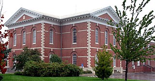
Clay County is located in the U.S. state of Missouri and is part of the Kansas City metropolitan area. As of the 2010 census, the county had a population of 221,939, making it the fifth-most populous county in Missouri. Its county seat is Liberty. The county was organized January 2, 1822, and named in honor of U.S. Representative Henry Clay from Kentucky, later member of the United States Senate and United States Secretary of State.

Saline County is a county located along the Missouri River in the U.S. state of Missouri. As of the 2010 census, the population was 23,370. Its county seat is Marshall. The county was established November 25, 1820, and named for the region's salt springs.

Platte County is a county located in the northwestern portion of the U.S. state of Missouri and is part of the Kansas City metropolitan area. As of the 2010 census, the population was 89,322. Its county seat is Platte City. The county was organized December 31, 1838, from the Platte Purchase, named for the Platte River. (Platte is derived from the French word for a low, shallow, or intermittent stream. The Kansas City International Airport is located in the county, approximately one mile west of Interstate 29 between mile markers 12 and 15. The land for the airport was originally in an unincorporated portion of Platte County before being annexed by Platte City, and eventually Kansas City.

Pettis County is a county located in west central U.S. state of Missouri. As of the 2010 census, the population was 42,201. Its county seat is Sedalia. The county was organized January 24, 1833, and named after former U.S. Representative Spencer Darwin Pettis.

Johnson County is a county located in western portion of the U.S. state of Missouri. As of the 2010 census, the population was 52,595 with a 2018 estimate of 53,652. Its county seat is Warrensburg. The county was formed December 13, 1834 from Lafayette County and named for Vice President Richard M. Johnson.

Jefferson County is located in the eastern portion of the state of Missouri. It is a part of the St. Louis Metropolitan Area. As of the 2010 census, the population was 218,733, making it the sixth-most populous county in Missouri. Its county seat is Hillsboro. The county was organized in 1818 and named in honor of former president Thomas Jefferson.

Cooper County is a county located in the central portion of the U.S. state of Missouri. As of the 2010 census, the population was 17,601. Its county seat is Boonville. The county was organized December 17, 1818 and named for Sarshell Cooper, a frontier settler who was killed by Native Americans near Arrow Rock in 1814. It is a part of the Columbia, Missouri metropolitan area.

Cape Girardeau County is a county located in the southeastern part of the U.S. state of Missouri; its eastern border is formed by the Mississippi River. As of the 2010 U.S. Census, the population was 75,674. The county seat is Jackson, the first city in the US to be named in honor of President Andrew Jackson. Officially organized on October 1, 1812, the county is named after Ensign Sieur Jean Baptiste de Giradot, an official of the French colonial years. The "cape" in the county's name is named after a former promontory rock overlooking the Mississippi River; this feature was demolished during railroad construction.

Callaway County is a county located in the U.S. state of Missouri. As of the 2010 United States Census, the county's population was 44,332. Its county seat is Fulton. With a border formed by the Missouri River, the county was organized November 25, 1820, and named for Captain James Callaway, grandson of Daniel Boone. The county has been historically referred to as "The Kingdom of Callaway" after an incident in which some residents confronted Union troops during the U.S. Civil War.

Boone County is a county in the U.S. state of Missouri. Centrally located in Mid-Missouri, it is home to Columbia, Missouri's fourth largest city and location of the University of Missouri. As of the 2010 census, the population was 162,642; a 2017 estimate put the population at 178,271, making it the state's seventh-most populous county. The county was organized November 16, 1820 and named for the recently deceased Daniel Boone, whose kin largely populated the Boonslick area, having arrived in the 1810s on the Boone's Lick Road. Boone County comprises the Columbia Metropolitan Area. The towns of Ashland and Centralia are the second and third most populous towns in the county.

St. Charles County is in the central eastern part of the U.S. state of Missouri. As of the 2010 census, the population was 360,485, making it Missouri's third-most populous county. Its county seat is St. Charles. The county was organized October 1, 1812 and named for Saint Charles Borromeo, an Italian cardinal. The county executive is Steve Ehlmann, since January 2007.

The Fort Bend Independent School District, also known as Fort Bend ISD or FBISD, is a school district system in the U.S. state of Texas based in the city of Sugar Land.
School District of Clayton includes all of Clayton, portions of Richmond Heights, a portion of St. Louis City, and a portion of unincorporated St. Louis County, Missouri, US. The district is located immediately to the west of the City of St. Louis. As of 2017 the school district had 2,681 students, 278 staff, and 6 schools. There was an 11:1 student-teacher ratio.
Rockwood School District is in St. Louis County, Missouri, United States. The Rockwood School District is St. Louis County's largest public school system, serving 22,268 students.

Douglas County School District Re. 1 is a school district that serves Douglas County, Colorado. The district was formed in 1958 by the consolidation of 17 smaller school districts, adding the "Re. 1" to its name to note the district's first reorganization.
The Cherry Creek School District 5, also known as Cherry Creek Public Schools, is a school district based in western Arapahoe County, Colorado. The superintendent is Scott Siegfried. It consists of elementary, middle, and high schools. The district headquarters are in Greenwood Village.

Bethel School District (52) is a school district in the U.S. state of Oregon. It serves the Bethel neighborhood in northwest Eugene. During the 2018-19 school year approximately 5,450 students were enrolled in Bethel's 11 schools, making it the third largest school district in Lane County.
Weld County School District Six is a school district headquartered in Greeley, Colorado, United States. The district serves most of the City of Greeley, the City of Evans, the Town of Garden City, and unincorporated areas in Weld County, including Auburn.
Molalla River School District is a public school district serving Molalla, Oregon, United States, and the surrounding area of Clackamas County, including the communities of Clarkes, Mulino and Rural Dell. It is named after the Molalla River.

The College Community School District is a public school district serving communities of Linn, Johnson, and Benton counties in east central Iowa. The district was established in 1954 after the consolidation of several township schools. Based on a 381-acre campus south of Cedar Rapids, the district encompasses 137 square miles including the communities of Walford, Fairfax, Swisher, Shueyville, Ely, Southwest Cedar Rapids, and surrounding areas.


