
Newbury is a town in Essex County, Massachusetts, USA. The population was 6,716 at the 2020 census. Newbury includes the villages of Old Town, Plum Island and Byfield. Each village is a precinct with its own voting district, various town offices, and business center.

Newburyport is a coastal city in Essex County, Massachusetts, United States, 35 miles (56 km) northeast of Boston. The population was 18,289 at the 2020 census. A historic seaport with a vibrant tourism industry, Newburyport includes part of Plum Island. The mooring, winter storage, and maintenance of recreational boats, motor and sail, still contribute a large part of the city's income. A Coast Guard station oversees boating activity, especially in the sometimes dangerous tidal currents of the Merrimack River.

The Church Green is a town common in Taunton, Massachusetts. It is a triangular-shaped parcel of land located at the intersection of Summer Street and Dean Street. It has distinctive Veterans Memorials dedicated to both Vietnam Veterans and Global War on Terrorism Veterans. These memorials feature seven flags that are in a V shape, a fountain, a brick garden, reflection benches, the Vietnam Veterans Memorial and the Global War on Terrorism Memorial.

The First Religious Society Church and Parish Hall is a historic church building at 26 Pleasant Street in Newburyport, Massachusetts. Originally a Reformed congregation, the congregation is currently affiliated with the Unitarian Universalist denomination. The current Minister is Reverend Rebecca M. Bryan. The church's steeple is currently the tallest point in downtown Newburyport, Massachusetts.

The Plympton Village Historic District encompasses the historic village center of Plympton, Massachusetts. It is a roughly linear district, running along Main Street between Palmer Road and Mayflower Road. There are twenty buildings in the district, most of which are residential. The focal point of the district, however, is the town green, around which the town's main civic buildings are arrayed. The green was laid out in 1702, but the oldest civic building was built in the 1850s, a period in which many of the houses were also built. The oldest building in the district is the Reverend Ezra Sampson House at 255 Main Street, which was built in the late 18th century.

The Millis Center Historic District is an historic district on Curve, Daniels, Exchange, Irving, Lavender, Main, and Union Streets in Millis, Massachusetts. It encompasses the historic mid-to-late-19th century village center of the town, including the residential area north of Main Street, two 19th-century industrial complexes, and civic and institutional buildings. It was added to the National Register of Historic Places in 2007.

The Ashfield Plain Historic District is a historic district roughly, along Main and South Streets and adjacent parts of Buckland and Norton Hill Roads in Ashfield, Massachusetts. It encompasses the village center of the town, which has acted as a civic and commercial center since the late 18th century. Its architectural heritage dates back to that time, but is now dominated by buildings from the late 19th and early 20th centuries. The district was listed on the National Register of Historic Places in 1991.

The Hadley Center Historic District is an expansive, 2,500-acre (1,000 ha) historic district encompassing the village center of Hadley, Massachusetts. When it was first listed on the National Register of Historic Places in 1977, the district encompassed the town green and 17 buildings that faced it, at the junction of Russell Street and Middle Street. The district was expanded significantly in 1994, adding more than 400 buildings representative of the village's growth from colonial days into the first decades of the 20th century. This expansion encompasses the entirety of a tongue of land extending west from East Street and bounded by a bend in the Connecticut River, which separates Hadley from Northampton. Its oldest property, the Samuel Porter House on West Street, was built in 1713.

The Hatfield Center Historic District encompasses the traditional center of Hatfield, Massachusetts. The area, first laid out in 1661, is bounded by Maple Street to the south, the Connecticut River to the east, Day Avenue and School Street to the north, and the Mill River to the west. The area's layout and land use patterns are relatively little altered since they were laid out, leaving a well-preserved early colonial village landscape. The district was added to the National Register of Historic Places in 1994.

The Brimfield Center Historic District is a historic district encompassing the historic center of Brimfield, Massachusetts. The district is centered on the town common, and includes properties radiating out from that center on Main Street, Brookfled, Wales, Sturbridge and Warren Roads. Brimfield Center was first laid out in 1721 along a Native American trail that ran through the area, and developed over the years into what is now US Route 20, or Main Street. The district includes properties ranging from early colonial houses to the town hall, built in 1878. The center has retained some coherence because the Brimfield Fair, a major antiques market that takes place three times a year, takes up significant open space in the areas near the center. The district was listed on the National Register of Historic Places in 2006.

The Hamilton Historic District encompasses the early historic center of Hamilton, Massachusetts. It includes properties at 540-700 and 563-641 Bay Road, extending along the road from Orchard Road in the south to Cutler Road in the north. Numerous Greek Revival buildings are located within the district including the First Congregational Church of Hamilton, built in 1843. The district was added to the National Register of Historic Places in 1973.

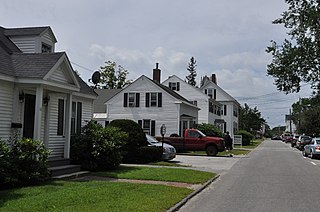
Newell Farm is a historic farmhouse at 243 Main Street in West Newbury, Massachusetts.

The Superior Courthouse and Bartlett Mall are, respectively, one of the oldest active courthouses in the nation, and one of the oldest public grounds in the city of Newburyport, Massachusetts. The mall and courthouse were listed on the National Register of Historic Places in 1976, and included in the Newburyport Historic District in 1984.

The Brookline Town Green Historic District encompasses the historic colonial heart of the town of Brookline, Massachusetts. Centered on a stretch of Walnut Street between Warren and Chestnut Streets, this area is where the town's first colonial meeting house and cemetery were laid out, and was its center of civic life until the early 19th century. The district was listed on the National Register of Historic Places in 1980.

The Canton Corner Historic District is a historic district encompassing the historic town center of Canton, Massachusetts. Centered on the junction of Pleasant and Washington Streets, it includes more than 25 properties and 170 acres (69 ha), whose architectural history spans 250 years of occupation and include the town's major civic buildings. The district was added to the National Register of Historic Places on September 9, 2009.

The Woodbridge Green Historic District is a historic district encompassing the historic town center of Woodbridge, Connecticut. It is located in the block bounded on the south by Center Road, on the east by Newton Road, and on the north and west by Meetinghouse Lane. The center is a good example of early 20th-century town planning, with good examples of Colonial and Classical Revival architecture. The district was added to the National Register of Historic Places in 2003.

The Charlestown Main Street Historic District encompasses the historic heart of Charlestown, New Hampshire. It is located along Main Street, roughly between Lower Landing Road and Bridge Street, and encapsulates more than two hundred years of the town's history. The district was listed on the National Register of Historic Places in 1987.

The Town Center Historic District encompasses the historic village center of South Hampton, New Hampshire. Centered around the Barnard Green, the town common, on New Hampshire Route 107A, it includes architectural reminders of the town's growth and change over time. The district was listed on the National Register of Historic Places in 1983.
The Federal Street Historic District of Brunswick, Maine encompasses a part of the town whose development was influenced by its 18th-century success as a shipping center, and by the presence of Bowdoin College, whose historic central campus is part of the district. In addition to the campus, the district includes a series of relatively high-style Federal and later-period houses along Federal Street and Maine Street, which join the campus to downtown Brunswick. The district was listed on the National Register of Historic Places in 1976.

The Watertown Center Historic District encompasses the historic village center of Watertown, Connecticut. It exhibits architectural and historic changes from the early 1700s into the 20th century. It is roughly bounded by Main, Warren, North, Woodbury, Woodruff, and Academy Hill Roads, and was listed on the National Register of Historic Places in 2001.


