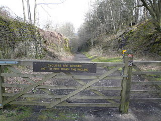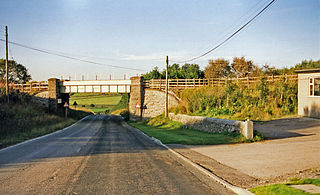
The Cromford and High Peak Railway (C&HPR) was a standard-gauge line between the Cromford Canal wharf at High Peak Junction and the Peak Forest Canal at Whaley Bridge. The railway, which was completed in 1831, was built to carry minerals and goods through the hilly rural terrain of the Peak District within Derbyshire, England. The route was marked by a number of roped worked inclines. Due to falling traffic, the entire railway was closed by 1967.

The High Peak Trail is a 17-mile (27 km) trail for walkers, cyclists and horse riders in the Peak District of England. Running from Dowlow (53.2059°N 1.8349°W), near Buxton, to High Peak Junction, Cromford (53.1004°N 1.5354°W), it follows the trackbed of the former Cromford and High Peak Railway, which was completed in 1831 to carry minerals and goods between the Cromford Canal wharf at High Peak Junction and the Peak Forest Canal at Whaley Bridge.

The Cromford Canal ran 14.5 miles from Cromford to the Erewash Canal in Derbyshire, England with a branch to Pinxton. Built by William Jessop with the assistance of Benjamin Outram, its alignment included four tunnels and 14 locks.

The Tissington Trail is a bridleway, footpath and cycleway in Derbyshire, England, along part of the trackbed of the former railway line connecting Ashbourne to Buxton. It takes its name from the village of Tissington, which it skirts. Opened in 1971, and now a part of the National Cycle Network, it stretches for 13 miles (21 km) from Parsley Hay (53.1706°N 1.7828°W) in the north to Ashbourne (53.0196°N 1.7397°W) in the south.

Cromford railway station is a Grade II listed railway station owned by Network Rail and managed by East Midlands Railway. It is located in the village of Cromford in Derbyshire, England. The station is on the Derwent Valley Line 15+1⁄2 miles (24.9 km) north of Derby towards Matlock.

Furness Vale railway station in Derbyshire, England, is 15+1⁄4 miles (24.5 km) south east of Manchester Piccadilly on the Manchester to Buxton line and serves the village of Furness Vale. It has a level crossing at the end of the platform controlled by a signal box.

Butterley Tunnel is a 3,083-yard (2,819 m) disused canal tunnel on the Cromford Canal below Ripley, in Derbyshire, England, opened to traffic in 1794. Along with Butterley Works blast furnaces, part of the canal tunnel and its underground wharf were declared a scheduled monument in 2013.
The Ashbourne line was a 33+1⁄2 mi (53.9 km) railway from Buxton via Ashbourne to Uttoxeter. It was built by the London and North Western Railway using a section of the Cromford and High Peak Railway (C&HPR) and it joined the North Staffordshire Railway at Ashbourne, proceeding to Uttoxeter with a junction onto the main line at Rocester.

Higher Buxton railway station was opened in 1894 to the south east of Buxton, Derbyshire, on the LNWR line to Ashbourne and the south.

Hindlow railway station was opened for goods in 1833 near to Hindlow near King Sterndale to the south east of Buxton, Derbyshire on the Cromford and High Peak Railway and the LNWR line to Ashbourne and the south.

Tissington railway station is a disused British railway station near Tissington, a village in Derbyshire near Ashbourne. It opened on 4 August 1899 and closed on 7 October 1963.

Alsop en le Dale railway station was opened in 1899 near Alsop en le Dale and Alstonefield, villages in Derbyshire southeast of Buxton.

Hartington railway station opened in 1899 about two miles away from the village it served - Hartington in Derbyshire, south east of Buxton.

Friden is a hamlet in the civil parish of Hartington Nether Quarter, Derbyshire, England. It is 11 miles (18 km) south-east of Buxton, just off the Newhaven to Cromford Via Gellia road, and lies within the Peak District National Park.

High Peak Junction, near Cromford, Derbyshire, England, is the name now used to describe the site where the former Cromford and High Peak Railway (C&HPR), whose workshops were located here, meets the Cromford Canal. It lies within Derwent Valley Mills World Heritage Site, designated in 2001, and today marks the southern end of the High Peak Trail, a 17 miles (27 km) trail for walkers, cyclists and horse riders. The Derwent Valley Heritage Way also passes this point, and popular walks lead from here along the towpath in both directions.

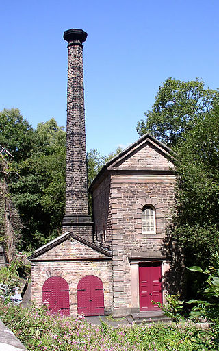
The Leawood Pump House was built near Cromford, Derbyshire, England in 1849 to supply water to the Cromford Canal, built some 50 years previously. It is a Grade II* listed building.

The Butterley Gangroad was an early tramway in Derbyshire of approximately 3 ft 6 in gauge, which linked Hilt's Quarry and other limestone quarries at Crich with the Cromford Canal at Bullbridge. The first railway project of Derbyshire civil engineer Benjamin Outram (1764–1805), the line was originally a horse-drawn and gravity-driven plateway, a form of tramway that Outram popularised. Unlike modern edgeways, where flanges on the wheel guide it along the track, plateways used "L" shaped rails where a flange on the rail guided the wheels.

Burbage Edge is a gritstone escarpment overlooking the Burbage district of Buxton in Derbyshire, in the Peak District. The hill's summit is 500 metres (1,600 ft) above sea level.
Hopton Tunnel is a former railway tunnel in Hopton, Derbyshire. Located on the former Cromford and High Peak Railway. The tunnel was closed along with the line in 1967 and is now in use for the High Peak Trail.
Friden Goods Yard was a goods station located on the Cromford and High Peak Railway near the villages of Friden in Derbyshire. Mostly for moving mineral and quarry traffic. It closed in 1967 along with the rest of the line. And today, nothing remains of the goods yard. The trackbed now forms part of the High Peak Trail.


