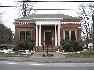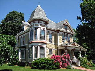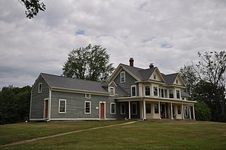
The Lower Roxbury Historic District is a historic district encompassing an isolated pocket of 1890s mixed residential-commercial property in the lower Roxbury neighborhood of Boston, Massachusetts. Bounded by Tremont, Columbus, and Burke Streets and St. Cyprian's Place, the area contains a well-kept collection of architect designed buildings that survived late 20th-century urban redevelopment. The district was added to the National Register of Historic Places in 1994.

The Sumner Hill Historic District encompasses a predominantly residential area of high-quality late 19th-century residences in the Jamaica Plain neighborhood of Boston, Massachusetts. It is roughly bounded by Seaverns Avenue, Everett Street, Carolina Avenue, and Newbern Street just east of the neighborhoods commercial Centre Street area. The district features Second Empire, Italianate, and Queen Anne style architecture, and was listed on the National Register of Historic Places in 1987.

The Mendon Center Historic District is a historic district encompassing the village center of Mendon, Massachusetts, and some of its surrounding rural areas. It is roughly bounded by Main, Hastings, Maple, North, Washington & George Streets. The village is centered on the triangle defined by Main, Hastings, and Maple Streets, with dwellings built up on the roads that radiate away from this area. Founders' Park, located at the junction of Main, Hastings, North and Milford Streets, is the site of the original town center, where the first meeting house was located. The district has residential buildings dating from the 18th to the mid-20th centuries, in a wide variety of styles. The focal point of the town center is the Second Unitarian Church, an 1820 building designed by Worcester architect Elias Carter.

The Attleborough Falls Historic District is a predominantly residential historic district on Mt. Hope and Towne Streets in North Attleborough, Massachusetts. Located just south of the Ten Mile River, it encompasses a stylish mid-to-late 19th century residential area that developed in a previously rural area due to industrial development across the river. The district was added to the National Register of Historic Places in 2004.

The Sutton Center Historic District is a historic district encompassing the center of the village of Sutton, Massachusetts. The district, which covers 435 acres (176 ha), is centered on the junction of Boston Road, Singletary Avenue, and Uxbridge Road. Boston Road is a major east-west route through the town, and the other two roads run north-south through the village center. A typically rural village center, its civic and institutional buildings are clustered near the intersection on its south side, in the general area of the town common. The town common and cemetery were laid out in 1719, after settlement of the township began in 1716. There are a few surviving houses that date to the middle of the 18th century or earlier; exact dates for most are uncertain. There are only a few institutional buildings: the 1829 Congregational Church, the 1983 Town Hall, built on the site of the town's first purpose-built town hall (1885), and Rufus Putnam Hall, an 1824 school building and Masonic lodge that now houses the local history museum. Only one commercial structure the 1839 Brick Block, stands in the village. There is also a historic animal pound, a rectangular stone structure used to pen stray livestock, which dates to the early days of the town.

The Cotuit Historic District is a historic district encompassing the heart of the village of Cotuit in Barnstable, Massachusetts. It extends along Main Street from Lowell Street in the north to Sea Street in the south, and includes portions of Ocean View Avenue and properties on adjacent roads. The oldest properties date to the late 18th century, but saw its greatest development during the height of the area's maritime industry in the mid 19th century. In the late 19th and early 20th century the area saw new development as a summer resort area. The district was listed on the National Register of Historic Places in 1987.

The Bradstreet Historic District encompasses the rural 19th century village of Bradstreet in Hatfield, Massachusetts. It is centered at the junction of Depot Street and Main Street, and includes properties lining those two streets and Old Farm Road. Most of the buildings in the area date to the second half of the 19th century, featuring architectural styles typical of the period, including Queen Anne, Second Empire, Italianate, and Colonial Revival. The village grew on land that was originally granted to colonial governor Simon Bradstreet and divided in 1682, and has remained largely agricultural since then. The district was listed on the National Register of Historic Places in 1997.

The West Hatfield Historic District encompasses the historic rural village center of West Hatfield, Massachusetts. It is centered on the junction of West Street with Linseed Road and Church Avenue, and developed in the 19th century as a railroad-driven agricultural transportation center, populated mainly by immigrants. The district was listed on the National Register of Historic Places in 2005.

The Southampton Center Historic District encompasses the densely built center of the otherwise predominantly rural town of Southampton, Massachusetts. The district extends from Fomer Road in the south, along High Street and College Highway to Maple Street, and includes a line of houses along East Street from College to Elm. This area is the historic heart of the town, being first laid out in the 1730s. The district includes, in addition to a number of 18th- and 19th-century residences, the town's only church, the town hall, and the old public library. The district was listed on the National Register of Historic Places in 1991.

The Springfield Street Historic District is a predominantly residential historic district south of the downtown area of Chicopee, Massachusetts. It encompasses a significant number of Queen Anne style houses built in the second half of the 19th century by wealthy residents of Chicopee, as well as housing for skilled workers at the nearby textile mills. It is centered where Springfield Street and Fairview Avenue meet. The district was listed on the National Register of Historic Places in 1991.

The Longmeadow Street–North Historic District encompasses a stretch of Longmeadow Street in northern Longmeadow, Massachusetts, from the town line with neighboring Springfield to Cooley and Westmoreland Streets in the south. It was listed on the National Register of Historic Places in 1994. The district's primarily residential architecture and streetscape is reflective of more than two centuries of development trends, and a late 19th-century desire to maintain a more rural atmosphere.

The Bradford Common Historic District is a historic district encompassing the former town center of Bradford, now a village of Haverhill, Massachusetts. Centered on the former town common at South Main and Salem Streets, the area served as Bradford's civic and commercial center from about 1750 until its annexation by Haverhill in 1897, and retains architecture from the 18th to early 20th centuries. It was added to the National Register of Historic Places in 1977.

The East End Historic District encompasses the historic eastern portion of central Ipswich, Massachusetts. The now predominantly residential district is bounded on the north and west by East Street, running from its junction with North Main and High Streets to Jeffrey's Neck Road. The eastern boundary includes the Ipswich River and Turkey Shore Road from its junction with Labor-in-Vain Road to Green Street, and the southern boundary runs along Green Street to North Main. The district was listed on the National Register of Historic Places in 1980.

The River Road–Cross Street Historic District is a rural agricultural historic district in Topsfield, Massachusetts. It is representative of Topsfield's development first as an agricultural community, and later as place for rural retreats. The district, which was listed on the National Register of Historic Places in 2005, is roughly bounded by River Road, Rowley Bridge Road, Cross Street, Hill Street, and Salem Road, and also includes properties facing Prospect Street and Bradstreet Lane. Much of the district was consolidated under the ownership of William Appleton Coolidge in the 20th century, and bequeathed to the Massachusetts Institute of Technology with restrictions to preserve its rural character. MIT sold the donated properties in 2000.

The Bow Street Historic District encompasses a mixed 19th-century commercial-residential in the Union Square area of Somerville, Massachusetts. It covers a part of the west side of Union Square that saw significant development during the city's growth in the 19th century, and has remained well-preserved since then. The district was added to the National Register of Historic Places in 1976.

The Kendal Green Historic District is a rural residential district running along North Avenue in Weston, Massachusetts. It extends for about three-quarters of a mile, and includes elements representative of the development of Weston from a rural agricultural community to a residential suburb of Boston. In addition to a variety of predominantly residential and agricultural properties, it includes two formerly industrial sites important in Weston's history: the site of the Hobbs Tannery, and that of the Hook and Hastings Organ Factory. The district was listed on the National Register of Historic Places in 2000.

The Woburn Street Historic District of Reading, Massachusetts encompasses a two-block section of late 19th century upper-class housing. The 10-acre (4.0 ha) extends along Woburn Street from Summer Street to Temple Street, and includes sixteen houses on well-proportioned lots along an attractive tree-lined section of the street. The historic district was listed on the National Register of Historic Places in 1985.

The Benjamin Thayer House is a historic house at 200 Farm Street in Blackstone, Massachusetts. Built around 1790, it is the best-preserved property associated with the Thayer family, who were prominent landowners and one of the first Pilgrim families. Benjamin Thayer and his descendants lived and farmed here until about 1920, when the property, much reduced in size, was sold out of the family. The house and its surrounding 9 acres (3.6 ha) of surviving farmland was listed on the National Register of Historic Places in 2009.

The Town Center Historic District encompasses the historic village center of South Hampton, New Hampshire. Centered around the Barnard Green, the town common, on New Hampshire Route 107A, it includes architectural reminders of the town's growth and change over time. The district was listed on the National Register of Historic Places in 1983.

The Four Corners–Goodnow Farm Historic District of Princeton, Massachusetts encompasses a rural agricultural area with well-preserved buildings dating from the 18th to 20th centuries. It is located in the western part of the town, and is centered on the junction of Old Colony, Gates, and Thompson Roads. The district was listed on the National Register of Historic Places in 2015.


