
Furan is a 39.3 km long river in central France, right tributary of the river Loire. It flows through the city Saint-Étienne and flows into the Loire in the small town Andrézieux-Bouthéon.

The arrondissement of Saint-Étienne is located in the Loire department in the Auvergne-Rhône-Alpes region of France. It has 75 communes. Its population is 423,286 (2016), and its area is 1,057.5 km2 (408.3 sq mi).

Andrézieux-Bouthéon is a commune of the Loire department in central France. It lies on the right bank of the river Loire, at its confluence with the river Furan.

Arnos is a commune in the Pyrénées-Atlantiques department in the Nouvelle-Aquitaine region of south-western France.

Archail is a commune in the Alpes-de-Haute-Provence department in the Provence-Alpes-Côte d'Azur region of south-eastern France.

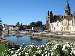
Çaloire is a commune in the Loire department in central France.
The Bourbince is an 82.4 km (51.2 mi) long river in the Saône-et-Loire département, in central eastern France. Its source is at Montcenis. It flows generally southwest. It is a left tributary of the river Arroux into which it flows at Digoin.

The Èvre is a 91.8 km (57.0 mi) long river in western France, left tributary of the Loire. Its source is at Vezins, 1.5 km (0.93 mi) northeast of the village. It flows into the Loire at Le Marillais, 3 km (1.9 mi) east of the village.

The Petite Creuse is a 95.2 km (59.2 mi) long river in Allier and Creuse departments, in central France. Its source is at Treignat, 2.5 km (1.6 mi) southeast of the village. It is a left tributary of the Creuse into which it flows at Fresselines. The river is dammed at several locations creating valley lakes that are extensively used for recreation, such as fishing, boating and swimming. The dams are used to generate electricity and to supply water treatment plants providing drinking water to local communities.

The Arconce is a 98.8 km (61.4 mi) long river in the Saône-et-Loire department in central France. Its source is in Mary, 2 km (1.2 mi) southwest of the village. It is a right tributary of the Loire, into which it flows at Varenne-Saint-Germain, 2.5 km (1.6 mi) northwest of the village.

Lac de l'Oriente is a lake in Corsica, France.

The Dadou is a 115.8 km (72.0 mi) long river in the Tarn department in southern France. Its source is near Saint-Salvi-de-Carcavès. It flows generally west. It is a right tributary of the Agout, into which it flows near Ambres.

The Lignon du Velay is an 85.1-kilometre (52.9 mi) long river in the Ardèche and Haute-Loire departments, south-central France. Its source is near Chaudeyrolles. It flows generally north. It is a right tributary of the Loire, into which it flows at Pont de Lignon, a hamlet in Monistrol-sur-Loire.

Saint-Étienne Métropole is the métropole, an intercommunal structure, centred on the city of Saint-Étienne. It is located in the Loire department, in the Auvergne-Rhône-Alpes region, central France. It was created in January 2018, replacing the previous Communauté urbaine Saint-Étienne Métropole. Its population was 408,685 in 2014, of which 173,504 in Saint-Étienne proper.

The Sédelle is a river in the Creuse department, central France; it is a tributary of the river Creuse and a sub-affluent of the Loire.
The canton of Le Pilat is a French administrative division located in the department of Loire and the Auvergne-Rhône-Alpes region. At the French canton reorganisation which came into effect in March 2015, the canton was renamed and expanded from 14 to 35 communes:
The canton of Saint-Étienne-2 is an administrative division of the Loire department, in eastern France. It was created at the French canton reorganisation which came into effect in March 2015. Its seat is in Saint-Étienne.

The Acheneau is a French river in the Loire-Atlantique Department, in the Pays de la Loire region, a tributary on the left bank of the Loire which is fed by the Lac de Grand-Lieu.

The Haute Perche Canal, despite its title, is a natural river, the Rivière de Haute-Perche, that has been slightly canalised to improve navigation between its mouth in the Bay of Bourgneuf at the port town of Pornic and the upstream settlements of Le Clion-sur-Mer, Chauvé and Arthon-en-Retz. It is located in the Pays de Retz in the Loire-Atlantique department and the Pays de la Loire region. It has also been known as the Canal de Pornic since the 16th century and was sometimes called the Étier de Haute Perche. Historically, it was called the Rouet, after the wheels of the water mills in the port.

The Abatesco is a French coastal river which flows through the Haute-Corse department and empties into the Tyrrhenian Sea.


