Seine was a department of France encompassing Paris and its immediate suburbs. Its capital was Paris and its official number was 75. The Seine department was abolished in 1968 and its territory divided among four new departments.
Cornelio Saavedra is a province in the north-eastern parts of the Bolivian Potosí Department. The capital of the province is Betanzos with 4,168 inhabitants in the year 2001.

Jambaló is a municipality and, at the same time, an indigenous reservation of Colombia. It is located in the northeastern department of Cauca, 80 kilometers north of the city of Popayán. It borders on the north with the municipalities of Caloto and Toribío, on the east with the municipality of Páez, on the south with the municipality of Silvia and on the west with the municipalities of Caldono and Santander de Quilichao. The municipal head is the most populous urban center of the territory and is also called "Jambaló", is located in the extreme south, on the limits with the municipality of Silvia; However, in the rural area it is where the majority of the population lives (94%). Being Jambaló also indigenous guard, the majority of its inhabitants are of the nasa and misak ethnic groups.
Santa Marina del Rey is a municipality located in the province of León, Castile and León, Spain. According to the 2004 census (INE), the municipality has a population of 2,350 inhabitants.
Arauzo de Miel is a municipality and town located in the province of Burgos, Castile and León, Spain. According to the 2004 census (INE), the municipality has a population of 363 inhabitants.
Tragacete is a municipality located in the province of Cuenca, Castile-La Mancha, Spain. According to the 2004 census (INE), the municipality has a population of 356 inhabitants.

Siby is a department or commune of Balé Province in southern Burkina Faso. Its capital lies at the town of Siby. According to the 1996 census the department has a total population of 12,089.

Tansila is a department or commune of Banwa Province in western Burkina Faso. Its capital lies at the town of Tansila. According to the 1996 census the department has a total population of 27,714.

Bané is a department or commune of Boulgou Province in eastern Burkina Faso. Its capital lies at the town of Bané. According to the 1996 census the department has a total population of 22,923.
Bissiga is a department or commune of Boulgou Province in eastern Burkina Faso. Its capital lies at the town of Bissiga. According to the 1996 census the department has a total population of 19,264.
Bittou is a department or commune of Boulgou Province in eastern Burkina Faso. Its capital lies at the town of Bittou. According to the 1996 census the department has a total population of 34,496.
Komtoèga is a department or commune of Boulgou Province in eastern Burkina Faso. Its capital lies at the town of Komtoèga. According to the 1996 census the department has a total population of 18,917.
Niaogho is a department or commune of Boulgou Province in eastern Burkina Faso. Its capital lies at the town of Niaogho. According to the 1996 census the department has a total population of 25,702.

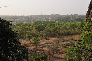
Mangodara is a department or commune of Comoé Province in southern Burkina Faso. Its capital lies at the town of Mangodara. According to the 1996 census the department has a total population of 44,444.
Soubakaniédougou is a department or commune of Comoé Province in south-western Burkina Faso. Its capital lies at the town of Soubakaniédougou. According to the 1996 census the department has a total population of 24,136.

Kombori is a department or commune of Kossi Province in western Burkina Faso. Its capital lies at the town of Kombori. According to the 1996 census the department has a total population of 9,610.
Madouba is a department or commune of Kossi Province in western Burkina Faso. Its capital lies at the town of Madouba. According to the 1996 census the department has a total population of 5,949.

Gounghin is a department of Kouritenga Province in eastern Burkina Faso. Its capital lies at the town of Gounghin. According to the 2006 census the department has a total population of 35,257.
Yargo is a department or commune of Kouritenga Province in eastern Burkina Faso. Its capital lies at the town of Yargo. According to the 1996 census the department has a total population of 14,473.

Loumana is a department or commune of Léraba Province in south-western Burkina Faso. Its capital lies at the town of Loumana. According to the 1996 census the department has a total population of 22,680.