Palmerton (disambiguation)

Last updated

Palmerton may refer to:

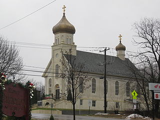
Palmerton, Pennsylvania Borough in Pennsylvania, United States

Palmerton is a borough in Carbon County, Pennsylvania, United States. It is located in the Coal Region of the state. It is a part of lower Carbon County, which is considered part of the Lehigh Valley. The borough's population was 5,414 at the 2010 census.

Palmerton High School

Palmerton Area High School is a four-year public high school in Palmerton, Carbon County, Pennsylvania, in the United States. Palmerton Area High School is the sole high school operated by Palmerton Area School District. In 2016, enrollment had declined to 451 pupils in 9th through 12th grades, with 29% of pupils eligible for a free lunch due to the family meeting the federal poverty level. Additionally, 11.9% of pupils received special education services, while 3% of pupils were identified as gifted. The school employed 33 teachers. Per the PA Department of Education, 100% of the teachers were rated "Highly Qualified" under the federal No Child Left Behind Act. The junior high and senior high share a single building. High school students may choose to attend the Carbon Career & Technical Institute for training in the construction and mechanical trades. The Carbon-Lehigh Intermediate Unit IU21 provides the School with a wide variety of services like: specialized education for disabled students; state mandated training on recognizing and reporting child abuse; speech and visual disability services; criminal background check processing for prospective employees and professional development for staff and faculty.

Palmerton Area School District

Palmerton Area School District is a public school district located in Carbon County, Pennsylvania. It serves the boroughs of Palmerton and Bowmanstown, and Lower Towamensing Township and Towamensing Township. The district encompasses approximately 56 square miles (150 km2). According to 2000 federal census data, it served a resident population of 12,791. By 2010, the district's population increased to 14,056 people. The educational attainment levels for the Palmerton Area School District population were 85% high school graduates and 14% college graduates. The District is one of the 500 public school districts of Pennsylvania.

Palmerton, Illinois Unincorporated community in Illinois, United States

Palmerton is an unincorporated community in Cass County, Illinois, United States. Palmerton is 4 miles (6.4 km) south of Chandlerville.

The Palmerton Arboretum is an arboretum of 5 acres (20,000 m2) which contains almost 90 species of trees and shrubs from around the world. It is located on West Evans Creek Road in Rogue River, Oregon, United States on the site of a 1930s-era tree nursery. Admission is free.

Related Research Articles

Carbon County, Pennsylvania County in the United States

Carbon County is a county located in the U.S. state of Pennsylvania. As of the 2010 census, the population was 65,249. Its county seat is Jim Thorpe, founded in 1818 as Mauch Chunk, a company town of the Lehigh Coal & Navigation Company (LC&N) as it built a wagon road nine miles to their coal mine at today's Summit Hill, and constructed the Lehigh Canal navigations.

Edwardsville, Illinois City in Illinois, United States

Edwardsville is a city in Madison County, Illinois, United States. As of the 2010 census, the population was 24,293. It is the county seat of Madison County. The city was named in honor of Ninian Edwards, then Governor of the Illinois Territory.

Jim Thorpe, Pennsylvania Place in Pennsylvania, United States

Jim Thorpe is a borough and the county seat of Carbon County in the U.S. state of Pennsylvania. The population was 4,781 at the 2010 census. The town has been called the "Switzerland of America" due to the picturesque scenery, mountainous location, and architecture; as well as the "Gateway to the Poconos." It is in eastern Pennsylvania about 80 miles (130 km) north of Philadelphia and 100 miles (160 km) west of New York City. This town is also historically known as the burial site for the body of Native American sports legend Jim Thorpe.

Penn Forest Township, Carbon County, Pennsylvania Place in Pennsylvania, United States

Penn Forest Township is a township in Carbon County, Pennsylvania, United States. The population was 9,581 at the 2010 census, up from 5,439 at the 2000 census.

Eldred Township, Monroe County, Pennsylvania Township in Pennsylvania, United States

Eldred Township is a township in Monroe County, Pennsylvania, United States. The population was 2,665 at the 2000 census.

Polk Township, Monroe County, Pennsylvania Place in Pennsylvania, United States

Polk Township is a township in Monroe County, Pennsylvania, United States. The population was 6,533 at the 2000 census.

Bloomingdale may refer to:

Devon, Pennsylvania Census-designated place in Pennsylvania, United States

Devon is a census-designated place (CDP) located in Easttown Township, Chester County, Pennsylvania, United States. The population was 1,515 at the 2010 census. The area is part of Philadelphia's Main Line suburbs.

Aquashicola Creek, also known as Aquanchicola Creek, or Aquanshicola Creek, is a 20.8-mile-long (33.5 km) tributary of the Lehigh River in the Poconos of eastern Pennsylvania in the United States.

Milton Township, DuPage County, Illinois Township in Illinois, United States

Milton Township is one of nine townships in DuPage County, Illinois, USA. As of the 2010 census, its population was 117,067 and it contained 45,153 housing units.

Panther Creek Township, Cass County, Illinois Township in Illinois, United States

Panther Creek Township is one of eleven townships in Cass County, Illinois, USA. As of the 2010 census, its population was 291 and it contained 148 housing units.

These are lists of Schools in the United States.

Lehigh Gap

The Lehigh Gap is a water gap located in the townships of Lehigh, Washington, Lower Towamensing and East Penn in the Lehigh Valley that was formed by the Lehigh River where it cuts through the Blue Mountain in the state of Pennsylvania in the United States. The gap allows easy travel between Carbon County to the north and Lehigh and Northampton counties to the south of the mountain. One of the more distinctive features of the gap is Devil's Pulpit, a rock formation that reminds hikers of a pulpit. Lehigh Gap is also the name of a village also known as Weider's Crossing and located at the south end of the gap in Lehigh and Northampton Counties.

District 11 of the Pennsylvania Interscholastic Athletic Association (PIAA) is an interscholastic athletic association in eastern Pennsylvania.

Little Gap, Pennsylvania Unincorporated community in Pennsylvania, United States

Little Gap is a village in eastern Lower Towamensing Township, Carbon County, Pennsylvania on the Aquashicola Creek, which is crossed by a covered bridge, open to vehicular traffic. Blue Mountain Ski Area is located just to the south of the village, which is split between the Danielsville, Kunkletown, and Palmerton ZIP codes of 18038, 18058, and 18071, respectively.

Aquashicola, Pennsylvania Unincorporated community in Pennsylvania, United States

Aquashicola is an unincorporated community located in Lower Towamensing Township in Carbon County, Pennsylvania. Aquashicola is located at the intersection of Little Gap Road and Forest Inn Road north of the Aquashicola Creek and east of Palmerton.