Pangkor Island

Last updated

Pangkor
Native name:
Pulau Pangkor
ڤولاو ڤڠكور
Cmglee Malaysia Pangkor Island and Lumut.jpg
Pangkor Island and Lumut from the east
Pangkor Island highlighted in Perak, Malaysia.svg
Malaysia location map.svg
Red pog.svg
Pangkor
West Malaysia location map.svg
Red pog.svg
Pangkor
Southeast Asia location map.svg
Red pog.svg
Pangkor
World location map (equirectangular 180).svg
Red pog.svg
Pangkor
Geography
Location Strait of Malacca
Coordinates 4°13′12″N100°33′18″E / 4.22000°N 100.55500°E / 4.22000; 100.55500
Area18 km2 (6.9 sq mi)
Administration
Malaysia
State Perak
District Manjung
Demographics
Population10,000 (est)
Ethnic groupsMalay, Chinese, Indian

Pangkor Island (Malay : Pulau Pangkor) is an island in Manjung District, Perak, Malaysia. It has a population of approximately 10,000. Nearby islands include Pangkor Laut Island, Giam Island, [1] Mentagor Island, Simpan Island, and Tukun Terindak Island. The major industries of the island are tourism and fishing.

Contents

Geography

Pangkor Island has a land area of 18 km2 (6.9 sq mi) [2] and is 3.5 kilometres (2.2 mi) from Peninsular Malaysia. The interior of the island is forested and is home to 65 reptile species, 17 amphibian species, and 82 total herpetofaunal species. [2] The locals are mainly Teochew and Hokkien Chinese, with Teochew, Hokkien and Mandarin Chinese the main dialects spoken.

History

Pangulu (village head) of Pangkor and all his family, in April 1874 CO 1069-484-117 (7886260964).jpg
Pangulu (village head) of Pangkor and all his family, in April 1874

Historically, Pangkor was a refuge for local fishers, merchants and pirates. In the 17th century, the Dutch built a fort to control the Perak tin trade, known as the Dutch Fort. In 1874, it was the location of a historical treaty between the British government and a contender for the Perak throne (the Pangkor Treaty), which began the British colonial domination of the Malay Peninsula. The old British name for the Pangkor Island group was the Dindings. [3]

Batu Gong is a petroglyph (rock carving) of an unknown age located on a headland at Pantai Pasir Bogak depicting a gong, first mentioned by G. De. G Sieveking in the Asiatic society journal in 1951 is 100 cm (39 in) in diameter and is oriented directly north.

In 2003, Marina Island (an artificial island) was developed by the Marina Island Group of companies and began operation in 2010, with private investment of RM250 million by 2013.[ citation needed ] The integrated mixed development resort island consists of waterfront residential properties, a new jetty (Marina Island Jetty), a private commercial marina called Pangkor Marina Malaysia, service apartments, hotels and shop offices. The jetty has a ferry service that connects to the island.

2004-2014 was a period of high growth and development for the island and the surrounding district. [4] In 2006, a biotechnology centre, a joint venture of Global Hi-Q Malaysia S/B and Hi-Q Bio-Tech International (Taiwan) Ltd began operations with initial investments of 100 million ringgit (US$30 million). Their operations include fish farming and aquaculture, and the first harvest was in 2009.

Tourism

Following the Federal Government's move to grant the island duty-free status effective 1 January 2020, the island recorded a 40 percent increase in visitors. Manjung Municipal Council (MPM) recorded 1.42 million visitors to the island compared to 1.03 million in 2017. [5]

Transport

Pink tourist minibuses Pangkor Island Tourist Buses.jpg
Pink tourist minibuses

Pangkor Island is a three-hour drive from Kuala Lumpur [6] and is accessible through the Ipoh–Lumut 4-lane dual carriage highway and the West Coast Expressway. Buses frequently arrive at the main jetty in Lumut. No bridges connect the island to the mainland because a policy aimed to control the number of vehicles on the island to prevent road congestion.

Public ferries depart from Lumut to Pangkor Island from the old Lumut jetty. The ferry service stops at two jetties at the east side of Pangkor Island, Sungai Pinang Kecil; SPK jetty; and Pangkor Town Jetty.

There's new Ferry company from mainland to the Island which shorter path compare to regular ferry. It starts from Marina Bay. The fare little higher compare to regular ferry. Regular ferry from Lumut Jetty to Pangkor Island will take 30 to 40 minutes, while Marina Bay to Pangkor Island only take 15 to 20 minutes.

The island is served by Pangkor Airport through charter air service by Berjaya Air and scheduled airline service from Subang Airport by SKS Airways. [7]

Notable places

The west coast of Pangkor is famous for its beaches, resorts and hotels for tourist accommodations. The famous beaches there include Pasir Bogak, Teluk Nipah and Coral Beach. The east coast of Pangkor is where all the residents live and where many of them work in the local foods and fisheries activities, including the dry fish factory, boat workshops, and a fish farm. Other attractions on the island include the Fu Ling Kong temple, the Sri Pathirakaliamman temple in Sungai Pinang Besar village; Batu Bersurat, Tiger Rock, the Dutch Fort (Kota Belanda), the tombs in Kampung Teluk Gedung and Tortoise Hill and Batu Gong.

Climate

Pangkor Island is situated off Malaysia's west coast and experiences hot and humid weather all year round. The rainy season runs from April - October, and the dry season is from October - April.

Related Research Articles

<span class="mw-page-title-main">Sitiawan</span> Town of Malaysia in Perak Darul Ridzuan

Sitiawan (alternate spelling: Setiawan; origin: from Malay, a portmanteau of SetiaKawan, meaning "Loyal Friend") is a mukim and town in Manjung District, Perak, Malaysia.

<span class="mw-page-title-main">Lumut, Perak</span> Town in Perak, Malaysia

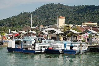
Lumut is a coastal town and mukim in Manjung District, Perak, Malaysia, situated about 84 km (52 mi) from Ipoh, 12 km (7.5 mi) from the town of Sitiawan and it is the main gateway to Pangkor Island before established Marina Island Pangkor as second gateway. It is noted for seashell and coral handicrafts. This once little-known fishing town has since become the home base of the Royal Malaysian Navy and the site of the biggest naval shipbuilder in Malaysia, Boustead.

<span class="mw-page-title-main">Redang Island</span> Island in Terengganu, Malaysia

Redang Island is an island in Kuala Nerus District, Terengganu, Malaysia. It is one of the largest islands off the east coast of Peninsular Malaysia and as well as one of the most beautiful islands in the world. It is famous for its crystal clear waters and white sandy beaches. It is one of nine islands, which form a marine sanctuary park offering snorkeling and diving opportunities for tourists.

Teluk Intan is a town in Hilir Perak District, Perak, Malaysia. It is the district capital and largest town in Hilir Perak district and fourth largest town in the state of Perak with an estimated population of around 172,505, more than half of Hilir Perak district's total population (232,900).

<span class="mw-page-title-main">Seberang Perai</span> City in the Malaysian state of Penang

Seberang Perai is a city in the Malaysian state of Penang. It is situated on the Malay Peninsula opposite Penang Island, bordering Kedah to the north and east and Perak to the south. Its city centre is located in Butterworth, while its local authority, the Seberang Perai City Council, is centred near Bukit Mertajam. As of 2020, Seberang Perai had a population of 946,000, making it the third most populous city in Malaysia.

<span class="mw-page-title-main">Manjung District</span> District in Perak, Malaysia

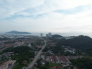
The Manjung District, formerly Dindings, is a district in the south-western part of the state of Perak, Malaysia. It is administered by the Manjung Municipal Council, formerly known as Manjung District Council from 1 January 1980 until 31 July 2001. The district is well known for Pangkor Island, an attraction in Perak and the home of the Royal Malaysian Navy (TLDM), Lumut Naval Base and dockyard. Dinding was once part of the British Straits Settlements colony. Seri Manjung is the district's principal urban centre while smaller towns include Lumut town, Sitiawan town, Ayer Tawar, Pantai Remis and Beruas.

<span class="mw-page-title-main">Pulau Ketam</span> Island of Selangor, Malaysia

Pulau Ketam is an island located off the coast of Port Klang, Selangor, Malaysia. The island is in the intertidal zone and the chief vegetation is mangrove.

<span class="mw-page-title-main">Pulau Indah</span> Island in Selangor, Malaysia

Pulau Indah is an island in Klang District, Selangor, Malaysia with a population of around 20,000 people overall. Malaysia's largest port, West Port, Port Klang, is on the island.

<span class="mw-page-title-main">Batu Maung</span> Neighbourhood of George Town in Penang, Malaysia

Batu Maung is a residential neighbourhood in the Malaysian state of Penang. It is located 15.7 km (9.8 mi) south of the city centre, adjacent to Bayan Lepas and the Penang International Airport. Batu Maung is home to the island terminus of the Second Penang Bridge and the southern end of the Tun Dr Lim Chong Eu Expressway. It is also surrounded by fishing villages such as Permatang Damar Laut and Teluk Tempoyak.

<span class="mw-page-title-main">Teluk Kumbar</span> Suburb of George Town in Penang, Malaysia

Teluk Kumbar is a suburb of George Town within the Malaysian state of Penang. It is located about 17.8 km (11.1 mi) south of the city centre, at the southern coast of Penang Island between Bayan Lepas to the east and Gertak Sanggul to the west.

Lumut Bypass, Federal Route 100, is a highway bypass in Manjung district, Perak, Malaysia. It is also a main bypass to Lumut and Teluk Batik. The motorists will be using this road from Ipoh-Lumut Highway to Pangkor Island. The Kilometre Zero of the Federal Route 100 starts at Simpang Empat, Teluk Muroh junctions, at its interchange with the Federal Route 18, connecting Lumut to Sitiawan.

<span class="mw-page-title-main">Penang National Park</span> National park in Malaysia

The Penang National Park spans 1,213ha of land and sea and is used by scientists, researchers, and nature lovers to explore its natural treasures.

<span class="mw-page-title-main">South-West District (Penang)</span> District of Malaysia in Penang

The South-West District is a district within the Malaysian state of Penang. The district covers the southwestern half of Penang Island and borders the North-East to the north-east. It has an area of 175 km2 (68 sq mi) and a population of 197,131 as of 2010. Balik Pulau is the district's administrative centre, while Bayan Lepas is the largest town within the district.

<span class="mw-page-title-main">Dutch Fort</span> Historical ruins in Perak Malaysia

The Dutch Fort is a fort in Pangkor Island, Manjung District, Perak, Malaysia. The ruins are the remnants of an outpost of Dutch attempts to control trade in the Malay peninsula. In the Malay language, the fort is called Kota Belanda. The Dutch called it Fort Dindingh, after the Dinding River, on the mainland of Perak.

<span class="mw-page-title-main">BFM 89.9</span> Malaysian radio station

BFM 89.9 is a Malaysian independent business and current affairs-oriented radio station.

Pasir Panjang is a state constituency in Perak, Malaysia, that has been represented in the Perak State Legislative Assembly.

Pangkor is a state constituency in Perak, Malaysia, that has been represented in the Perak State Legislative Assembly.

Dabus is a warrior dance from the Malaysian state of Perak. This warrior dance, as such, is characteristically heroic, demanding performers to exhibits traits of intelligence, dexterity, heroism, and cheerfulness when performing. Dabus is one of the traditional dances of Perak that has survived some 300 years. There are conflicting theories on the origin of Dabus, with some historians claiming that it was brought over from Aceh, while other historians believe it to have been brought over from Baghdad during the 18th century.

References

  1. United States. Hydrographic Office (1917). Asiatic Pilot: The coasts of Sumatra and the adjacent straits and islands . Retrieved 15 June 2014.
  2. 1 2 Johan van Rooijen; Chan Kin Onn; L. Lee Grismer; Norhayati Ahmad. "Estimating the herpetofaunal species richness of Pangkor Island, Peninsular Malaysia" (PDF). Netherlands Centre for Biodiversity Naturalis, section Zoological Museum Amsterdam. Retrieved 15 June 2014.
  3. Moore, Wendy (1998). West Malaysia and Singapore. ISBN   9789625931791 . Retrieved 15 June 2014.
  4. "High growth in the district over the last 10 years". The Star. Retrieved 15 June 2014.
  5. Calvin Yap (30 September 2019). "Sustaining Pangkor's growth momentum". The Star. Retrieved 30 September 2019.
  6. "Places to go for day trippers". The Rakyat Post. Retrieved 15 June 2014.
  7. "Malaysia Has A New Commercial Airline But It Doesn't Have Toilets". The Rakyat Post. 7 January 2022. Retrieved 10 January 2022.

4°13′12″N100°33′18″E / 4.22000°N 100.55500°E / 4.22000; 100.55500