Papeži

Last updated
Papeži
Village
Border Slovenia-Croatia Papezi.JPG
Slovenia location map.svg
Red pog.svg
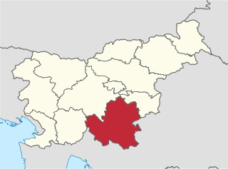
Papeži
Location in Slovenia
Coordinates: 45°34′0.16″N14°42′2.1″E / 45.5667111°N 14.700583°E / 45.5667111; 14.700583 Coordinates: 45°34′0.16″N14°42′2.1″E / 45.5667111°N 14.700583°E / 45.5667111; 14.700583
Country Flag of Slovenia.svg Slovenia
Traditional region Lower Carniola
Statistical region Southeast Slovenia
Municipality Osilnica
Area
  Total 0.27 km2 (0.10 sq mi)
Elevation 366.1 m (1,201.1 ft)
Population (2002)
  Total 16
[1]

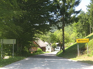
Papeži (pronounced  [ˈpaːpɛʒi] ; German : Papesch [2] ) is a small village in the Municipality of Osilnica in southern Slovenia. The area is part of the traditional region of Lower Carniola and is now included in the Southeast Slovenia Statistical Region. [3]

German language West Germanic language

German is a West Germanic language that is mainly spoken in Central Europe. It is the most widely spoken and official or co-official language in Germany, Austria, Switzerland, South Tyrol (Italy), the German-speaking Community of Belgium, and Liechtenstein. It is also one of the three official languages of Luxembourg and a co-official language in the Opole Voivodeship in Poland. The languages which are most similar to German are the other members of the West Germanic language branch: Afrikaans, Dutch, English, the Frisian languages, Low German/Low Saxon, Luxembourgish, and Yiddish. There are also strong similarities in vocabulary with Danish, Norwegian and Swedish, although those belong to the North Germanic group. German is the second most widely spoken Germanic language, after English.

Village Small clustered human settlement smaller than a town

A village is a clustered human settlement or community, larger than a hamlet but smaller than a town, with a population ranging from a few hundred to a few thousand. Though villages are often located in rural areas, the term urban village is also applied to certain urban neighborhoods. Villages are normally permanent, with fixed dwellings; however, transient villages can occur. Further, the dwellings of a village are fairly close to one another, not scattered broadly over the landscape, as a dispersed settlement.

Municipality An administrative division having corporate status and usually some powers of self-government or jurisdiction

A municipality is usually a single administrative division having corporate status and powers of self-government or jurisdiction as granted by national and regional laws to which it is subordinate. It is to be distinguished (usually) from the county, which may encompass rural territory or numerous small communities such as towns, villages and hamlets.

The local church in the settlement is dedicated to Saint Michael and belongs to the parish of Osilnica. It dates to the 18th century. [4]

Church (building) building constructed for Christian worship

A church building or church house, often simply called a church, is a building used for Christian religious activities, particularly for Christian worship services. The term is often used by Christians to refer to the physical buildings where they worship, but it is sometimes used to refer to buildings of other religions. In traditional Christian architecture, the church is often arranged in the shape of a Christian cross. When viewed from plan view the longest part of a cross is represented by the aisle and the junction of the cross is located at the altar area.

Michael (archangel) archangel in Jewish, Christian, and Islamic teachings

Michael is an archangel in Judaism, Christianity, and Islam. In Roman Catholic, Eastern Orthodox, Anglican, and Lutheran systems of faith, he is called "Saint Michael the Archangel" and "Saint Michael". In the Oriental Orthodox and Eastern Orthodox religions, he is called "Saint Michael the Taxiarch".

A parish is a territorial entity in many Christian denominations, constituting a division within a diocese. A parish is under the pastoral care and clerical jurisdiction of a parish priest, who might be assisted by one or more curates, and who operates from a parish church. Historically, a parish often covered the same geographical area as a manor. Its association with the parish church remains paramount.

Related Research Articles

Osilnica Settlement in Slovenia

Osilnica is a settlement in southern Slovenia. It is located on the left bank of the Kolpa River next to the border with Croatia. It is part of the traditional region of Lower Carniola and is now included in the Southeast Slovenia Statistical Region. It is the largest settlement and the centre of the Municipality of Osilnica

Southeast Slovenia Statistical Region Statistical region

The Southeast Slovenia Statistical Region is a statistical region in southeast Slovenia. It is the largest statistical region. The development of this region is largely the result of industry, which generated nearly half of the gross value added in the region in 2012. According to the latest available data for 2013, 94% of waste water in the region was treated before it was discharged from the public sewage system. This is significantly more than in Slovenia as a whole (78%). The expenditure on research and development (R&D), which amounted to 5.2% of the regional GDP in 2012, highlights the importance of R&D in the region. Businesses accounted for 90% of the sources of financing. The population's age structure in this region is favourable. In mid-2013 the value of the ageing index was 105.2, which means that the ratio between the population 65 or older and the population 15 or less was 105 older people per 100 young people.

Belica, Osilnica in Lower Carniola, Slovenia

Belica is a small settlement in the Municipality of Osilnica in southern Slovenia. The area is part of the traditional region of Lower Carniola and is now included in the Southeast Slovenia Statistical Region.

Bezgarji in Lower Carniola, Slovenia

Bezgarji is a small settlement in the Municipality of Osilnica in southern Slovenia. It lies in the traditional region of Lower Carniola and is now included in the Southeast Slovenia Statistical Region.

Bezgovica, Osilnica in Lower Carniola, Slovenia

Bezgovica is a small settlement in the Municipality of Osilnica in southern Slovenia. The area is part of the traditional region of Lower Carniola and is now included in the Southeast Slovenia Statistical Region.

Bosljiva Loka in Lower Carniola, Slovenia

Bosljiva Loka is a small settlement on the left bank of the Kolpa River in the Municipality of Osilnica in southern Slovenia. The area is part of the traditional region of Lower Carniola and is now included in the Southeast Slovenia Statistical Region.

Grintovec pri Osilnici in Lower Carniola, Slovenia

Grintovec pri Osilnici is a small settlement on the left bank of the Kolpa River in the Municipality of Osilnica in southern Slovenia. The area is part of the traditional region of Lower Carniola and is now included in the Southeast Slovenia Statistical Region.

Križmani in Lower Carniola, Slovenia

Križmani is a small settlement in the hills above the left bank of the Kolpa River in the Municipality of Osilnica in southern Slovenia. The area is part of the traditional region of Lower Carniola and is now included in the Southeast Slovenia Statistical Region.

Ložec in Lower Carniola, Slovenia

Ložec is a small settlement on the left bank of the Kolpa River in the Municipality of Osilnica in southern Slovenia. It belongs to the traditional region of Lower Carniola and is now included in the Southeast Slovenia Statistical Region.

Malinišče in Lower Carniola, Slovenia

Malinišče is a small settlement above the left bank of the Kolpa River in the Municipality of Osilnica in southern Slovenia. The area is part of the traditional region of Lower Carniola and is now included in the Southeast Slovenia Statistical Region.

Mirtoviči in Lower Carniola, Slovenia

Mirtoviči is a small settlement on the left bank of the Kolpa River in the Municipality of Osilnica in southern Slovenia. The entire municipality is part of the traditional region of Lower Carniola and is now included in the Southeast Slovenia Statistical Region.

Padovo pri Osilnici in Lower Carniola, Slovenia

Padovo pri Osilnici is a small settlement in the hills above the left bank of the Kolpa River in the Municipality of Osilnica in southern Slovenia. The area is part of the traditional region of Lower Carniola and is now included in the Southeast Slovenia Statistical Region.

Podvrh, Osilnica in Lower Carniola, Slovenia

Podvrh is a small settlement in the hills above the left bank of the Kolpa River in the Municipality of Osilnica in southern Slovenia. It lies in the traditional region of Lower Carniola and is now included in the Southeast Slovenia Statistical Region.

Ribjek, Osilnica in Lower Carniola, Slovenia

Ribjek is a village on the left bank of the Kolpa River in the Municipality of Osilnica in southern Slovenia. The area is part of the traditional region of Lower Carniola and is now included in the Southeast Slovenia Statistical Region.

Sela, Osilnica in Lower Carniola, Slovenia

Sela is a settlement west of Osilnica in southern Slovenia, right on the border with Croatia. The area is part of the traditional region of Lower Carniola and is now included in the Southeast Slovenia Statistical Region.

Spodnji Čačič in Lower Carniola, Slovenia

Spodnji Čačič is a small settlement in the Municipality of Osilnica in southern Slovenia. The area is part of the traditional region of Lower Carniola and is now included in the Southeast Slovenia Statistical Region.

Zgornji Čačič in Lower Carniola, Slovenia

Zgornji Čačič is a small settlement in the Municipality of Osilnica in southern Slovenia. It is part of the traditional region of Lower Carniola and is now included in the Southeast Slovenia Statistical Region.

Žurge in Lower Carniola, Slovenia

Žurge is a small village in the Municipality of Osilnica in southern Slovenia. The area is part of the traditional region of Lower Carniola and is now included in the Southeast Slovenia Statistical Region.

Trava, Loški Potok in Lower Carniola, Slovenia

Trava is a village in the Municipality of Loški Potok in southern Slovenia. The area is part of the traditional region of Lower Carniola and is now included in the Southeast Slovenia Statistical Region.

Municipality of Osilnica Municipality in Slovenia

The Municipality of Osilnica is a municipality in southern Slovenia. It gets its name from the largest settlement and administrative centre of the municipality, Osilnica.

References

  1. Statistical Office of the Republic of Slovenia
  2. Leksikon občin kraljestev in dežel zastopanih v državnem zboru, vol. 6: Kranjsko. 1906. Vienna: C. Kr. Dvorna in Državna Tiskarna, p. 40.
  3. Oslinica municipal site
  4. Slovenian Ministry of Culture register of national heritage reference number ešd 2096