Catlettsburg is a home rule-class city in and the county seat of Boyd County, Kentucky, United States. The city population was 1,856 at the 2010 census. Catlettsburg is a part of the Huntington-Ashland, WV-KY-OH, Metropolitan Statistical Area (MSA). As of 2013, new definitions from the United States Census, the MSA had a population of 361,000.

U.S. Route 23 is a long north–south U.S. Highway between Jacksonville, Florida, and Mackinaw City, Michigan. It is an original 1926 route which originally reached only as far south as Portsmouth, Ohio, and has since been extended. It was formerly part of the major highway known as the Dixie Highway.

Cannonsburg is a census-designated place (CDP) in Boyd County, Kentucky, United States. As of the 2010 census, it had a population of 856. Cannonsburg is located 8 miles (13 km) southwest of the city of Ashland, a major urban center in northeastern Kentucky. Most of Cannonsburg shares its ZIP code with Ashland; however, parts are within the Catlettsburg ZIP code. The Cannonsburg post office closed in 1929. Cannonsburg is a part of the Huntington-Ashland Metropolitan Statistical Area (MSA). As of the 2010 census, the MSA had a population of 287,702. New definitions from February 28, 2013 placed the population at 363,000.
Kentucky Route 3 is a 79.158-mile-long (127.392 km) state highway in the U.S. state of Kentucky.

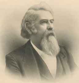
Ben Mitchell Williamson was a Democratic U.S. Senator from Kentucky.

George Brown Martin, a Democrat, served as a member of the United States Senate from Kentucky.

Princess is a small unincorporated community in Boyd County, Kentucky, United States. Princess is located along Kentucky Route 5, near the intersection of U.S. Route 60 and Kentucky Route 5.
Boyd County Public Schools is a school district based in Boyd County, Kentucky. The district serves the area within Catlettsburg and the rest of Boyd County, excluding the city of Ashland and the census-designated place of Westwood, each of which has its own school district.
U.S. Route 60 (US 60) in the state of Kentucky parallels the Ohio River from Cairo, Illinois, to Louisville, and then takes a direct eastward route to rejoin the Ohio River in downtown Ashland, Kentucky as it joins US Route 23 southbound and continues as a multiplex to Catlettsburg where it turns east and exits the state and enters Kenova, West Virginia.
Kentucky Route 168 is a two-lane route extending from US 23 in Westwood to the US 23/60 multiplex in Catlettsburg. Its southern end point in Catlettsburg was originally at the underpass where Walnut and Louisa Streets once split. In 1971, the former ending was truncated to its present location due to the re-routing of U.S. 23 around downtown Catlettsburg. Once inside the city of Ashland, it traverses three different surface streets known as Valley View Drive, Blackburn Avenue and South Belmont Street via a series of turns, mainly within the South Ashland residential district. In Ashland, it crosses 13th Street at an intersection locally known as Community.

Laban Theodore Moore was a U.S. Representative from Kentucky.

The Huntington–Ashland metropolitan area is the largest metropolitan statistical area in West Virginia and includes seven counties across three states: West Virginia, Kentucky, and Ohio. New definitions from February 28, 2013 placed the population at 361,580. The MSA is nestled along the banks of the Ohio River within the Appalachian Plateau region. The area is referred to locally as the "Tri-State area". In addition, the three largest cities are referred to as the River Cities.

The United States District Court for the Eastern District of Kentucky is the Federal district court whose jurisdiction comprises approximately the Eastern half of the Commonwealth of Kentucky.

Lockwood is an unincorporated community located along U.S. Route 23 and the Big Sandy River in southern Boyd County, Kentucky, United States, approximately 7 mi south of Catlettsburg, the county seat.

England Hill is an unincorporated community located on the west shore of the Big Sandy River and along Paddle Creek in Boyd County, Kentucky, adjacent to the southern city limits of Catlettsburg on U.S. Route 23 and historic Mayo Trail. Mayo Trail was previously U.S. 23 until the current alignment which bypasses the community was completed in 1963. England Hill is closely associated with the city of Catlettsburg and has fought annexation by Catlettsburg numerous times over the years. The area known as England Hill is served by the England Hill Volunteer Fire Department, founded in 1977, and the Catlettsburg, Kentucky zip code. The subdivision known as Hyland Heights was developed on a portion of the former Hyland Dairy Farm, after the business was sold to Johnson Dairy Co. in the 1960s. The lands of the former dairy farm was subdivided and sold in lots during the 1960s and 1970s. Transplants who moved from Catlettsburg due to the modernization/widening projects that were completed on U.S. Route 23 during that time. The England Hill School, later renamed Cooper School, served residents in K-8, then K-6 for many years in Hyland Heights. Cooper School was open for 26 years, from 1962 to 1988 when students were transferred to the nearby Catlettsburg or Durbin Elementary Schools depending on the location of their home address. England Hill is a suburb of Catlettsburg, and has fought annexation into the city many times, most notably in 1987, when Catlettsburg tried to annex England Hill and all areas north of I-64.

Garner is an unincorporated community in Boyd County, Kentucky, United States. Garner is located on Pigeon Roost Creek at the junction of Kentucky Route 854 and Kentucky Route 1945, 10.6 miles (17.1 km) southwest of Catlettsburg.

Burgess Railroad Station was an unincorporated community located in Boyd County, Kentucky, United States. It is located on a CSX railway and is served by the Catlettsburg post office zip code of 41129.
Kentucky Route 538 (KY 538) is a 6.631-mile-long (10.672 km) state highway in Boyd County, Kentucky that runs from U.S. Route 60 and Meade Springer Road west of Rockdale to U.S. Route 23 south of Catlettsburg via Rockdale.


