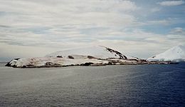
Booth Island is a rugged, Y-shaped island, 8 kilometres (5 mi) long and rising to 980 m (3,215 ft) off the northwest coast of Kyiv Peninsula in Graham Land, Antarctica in the northeastern part of the Wilhelm Archipelago. The narrow passage between the island and the mainland is the Lemaire Channel.
Wiencke Island is an island 26 km (16 mi) long and from 3 to 8 km wide, about 67 km2 (26 sq mi) in area, the southernmost of the major islands of the Palmer Archipelago, lying between Anvers Island to its north across the Neumayer Channel and the west coast of the Antarctic Peninsula to its east across the Gerlache Strait.
Trinity Island or Île de la Trinité or Isla Trinidad is an island 24 km (15 mi) long and 10 km (6 mi) wide in the northern part of the Palmer Archipelago, Antarctica. It lies 37 km (23 mi) east of Hoseason Island, 72.6 km (45 mi) south of Deception Island in the South Shetland Islands, and 10.3 km (6 mi) north-northwest of Cape Andreas on the Antarctic Peninsula. The island was named by Otto Nordenskiöld, leader of the 1901-1904 Swedish Antarctic Expedition (SAE) in commemoration of Edward Bransfield's "Trinity Land" of 1820.
The French Antarctic Expedition is any of several French expeditions in Antarctica.

Arrowsmith Peninsula is a cape about 40 miles (64 km) long on the west coast of Graham Land, west of Forel Glacier, Sharp Glacier and Lallemand Fjord, and northwest of Bourgeois Fjord, with Hanusse Bay lying to the northwest. It was surveyed by the Falkland Islands Dependencies Survey (FIDS) in 1955-58 and named for Edwin Porter Arrowsmith, Governor of the Falkland Islands.

Ezcurra Inlet is an inlet forming the western arm of Admiralty Bay, King George Island, in the South Shetland Islands. It was charted by the French Antarctic Expedition, 1908–10, under Jean-Baptiste Charcot, and named "Fiord Ezcurra" after Pedro de Ezcurra, an Argentine politician and Minister of Agriculture in 1908, who assisted the French expedition.
Avian Island is an island, 1.2 km (0.7 mi) long and 40 metres (130 ft) high, lying close off the south tip of Adelaide Island, Antarctica. It was discovered by the French Antarctic Expedition, 1908–10, under Jean-Baptiste Charcot, and visited in 1948 by the Falkland Islands Dependencies Survey, who so named it because of the large number and variety of birds (avians) found there.
Tabarin Peninsula is a peninsula 15 nautical miles (28 km) long and 5 to 12 nautical miles (22 km) wide, lying south of the trough between Hope Bay and Duse Bay and forming the east extremity of Trinity Peninsula in the Antarctic Peninsula. It was discovered and charted by the Swedish Antarctic Expedition, 1901–1904, led by Otto Nordenskjöld and Carl Anton Larsen. It was mapped in 1946 by the Falkland Islands Dependencies Survey (FIDS) and named after Operation Tabarin, the naval code name for the FIDS from 1943 to 1945.

The Argentine Islands are a group of islands in the Wilhelm Archipelago of Antarctica, situated 9 km (5 nmi) southwest of Petermann Island, and 7 km (4 nmi) northwest of Cape Tuxen on Kyiv Peninsula in Graham Land. They were discovered by the French Antarctic Expedition, 1903–05, under Jean-Baptiste Charcot, and named by him for the Argentine Republic, in appreciation of that government's support of his expedition.
Uruguay Island is an island 1 km (0.62 mi) long with a cove indenting its west side, lying between Irizar Island and Corner Island in the Argentine Islands of the Wilhelm Archipelago of Antarctica. It was discovered by the French Antarctic Expedition of 1903–05, under J.B. Charcot who named it after the Argentine corvette ARA Uruguay. The island was recharted in 1935 by the British Graham Land Expedition (BGLE) under John Rymill.
The Joubin Islands are a group of small islands lying 6 kilometres (3 nmi) south-west of Cape Monaco, Anvers Island, at the south-western end of the Palmer Archipelago of Antarctica. The islands were discovered by the French Antarctic Expedition, 1903–05, under Jean-Baptiste Charcot, and named by him for Louis Joubin, the French naturalist. They have been designated a Restricted Zone under ASMA 7 — Southwest Anvers Island and Palmer Basin — which includes the marine area extending 50 metres (55 yd) from the shorelines.

Dorian Bay is a cove on the northwest side of Wiencke Island, 0.5 nautical miles (1 km) east-northeast of Damoy Point, in the Palmer Archipelago of Antarctica. It was discovered by the French Antarctic Expedition, 1903–05, under Jean-Baptiste Charcot, and named by him after Monsieur Dorian, a member of the French Chamber of Deputies.

Pléneau Island is an island, 0.8 nautical miles (1.5 km) long, lying just northeast of Hovgaard Island in the Wilhelm Archipelago. Charted as a peninsula of Hovgaard Island by the French Antarctic Expedition, 1903–05, under J.B. Charcot, who named its northeast point for Paul Pléneau, photographer of the expedition. The feature was first shown to be an island on an Argentine government chart of 1957.
French Passage is a passage through the Wilhelm Archipelago, extending in a northwest–southeast direction between Petermann Island, the Stray Islands, the Vedel Islands and the Myriad Islands to the north and the Argentine Islands, the Anagram Islands, the Roca Islands, and the Cruls Islands to the south. It was so named by the British Graham Land Expedition, 1934–37, because the passage was navigated for the first time in 1909 by the Pourquoi-Pas?, the ship of the French Antarctic Expedition under Jean-Baptiste Charcot. Bradley Rock is an isolated rock which lies about 9 nautical miles (17 km) northwest of the entrance to French Passage.

Gerlache Island is the largest of the Rosenthal Islands lying off Gerlache Point on the west coast of Anvers Island, in the Palmer Archipelago of Antarctica. It was first roughly charted and named "Pointe de Gerlache" by the French Antarctic Expedition, 1903–05, under Jean-Baptiste Charcot, for Lieutenant Adrien de Gerlache. As a result of surveys by the Falkland Islands Dependencies Survey in 1956–58, this island is considered to be the feature named by Charcot; there is no prominent point in this vicinity which would be visible from seaward.
Goulden Cove is the southern of two coves at the head of Ezcurra Inlet, Admiralty Bay, on King George Island, in the South Shetland Islands. It was probably named by the French Antarctic Expedition under Jean-Baptiste Charcot, who surveyed Admiralty Bay in December 1909. Located at its head is an icefall called Doctors Icefall.
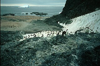
Harrison Bluff is a pale-colored trachyte headland forming the seaward termination of Trachyte Hill and marking the southern end of McDonald Beach on the western side of Mount Bird, Ross Island, Antarctica. Many skuas nest on the bluff. A survey station marked by a rock cairn was placed on the top of the northwest corner of the bluff by E.B. Fitzgerald of the Cape Bird party of the New Zealand Geological Survey Antarctic Expedition, 1958–59, and the bluff was named by the New Zealand Antarctic Place-Names Committee for J. Harrison, mountaineer-assistant with the expedition.
Thiébault Island is a small island which lies next west of Charlat Island in the small group off the south end of Petermann Island in the Wilhelm Archipelago. It was discovered by the French Antarctic Expedition of 1908–10, and named by Jean-Baptiste Charcot for Mr. Thiébault, then French Minister to Argentina.
Lagotellerie Island is an island 1.9 kilometres (1 nmi) long, lying 3.7 kilometres (2 nmi) west of Horseshoe Island in Marguerite Bay, off the west coast of Graham Land, Antarctica. It was discovered and named by the French Antarctic Expedition, 1908–10, under Jean-Baptiste Charcot.

The Ryder Bay Islands Important Bird Area is a 520 ha designated site on the south-east coast of Adelaide Island, Antarctica. It has been identified as an Important Bird Area (IBA) by BirdLife International because it supports significant numbers of breeding seabirds, notably south polar skuas. The site encompasses the Léonie Islands lying at the mouth of Ryder Bay, as well as Rothera Point, the eastern headland of the bay.