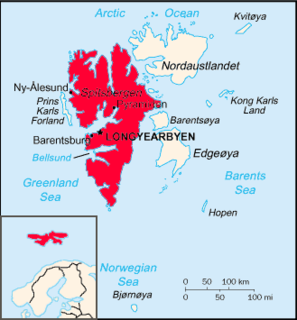
Finneset is a peninsula located on the east side of Grønfjorden on Spitsbergen in Svalbard, Norway. It is located 2 kilometers (1.2 mi) south of Barentsburg. A whaling station was located there until 1905. From 1911 it became the site of the first wireless station in the Arctic, named Svalbard Radio from 19 September 1925. It was also a meteorological station operated by the Norwegian Meteorological Institute. Both services moved to Longyearbyen on 1 September 1930. It is named for being a fine place to land a ship.

Trygghamna is a bay in Oscar II Land at Spitsbergen, Svalbard. It is about six kilometer long, located at the northern side of Isfjorden, east of Protektorfjellet, and separated from Ymerbukta by the mountain chain Värmlandryggen.
Sassendalen is a valley at Spitsbergen, Svalbard. The valley is among the largest valleys of Svalbard, and continues westwards into Sassenfjorden. Part of the valley divides Sabine Land and Nordenskiöld Land. The river Sassenelva runs through the valley.
Yoldiabukta is a bay in Nordfjorden at Spitsbergen, Svalbard. It has a width of about five kilometres (3.1 mi) and is located between the northern side of Bohemanflya and Muslingodden. The 26-kilometre (16 mi) long glacier Wahlenbergbreen debouches into Yoldiabukta.
Braganzavågen is a bay located in the inner northern branch of Van Mijenfjorden, at Spitsbergen, Svalbard, within Heer Land and Nordenskiöld Land. The valley Kjellströmdalen debouches into the bay. The mining settlement Sveagruva is located at the western side of Braganzavågen, below the mountain Liljevalchfjellet.
Gipsvika is a bay in Bünsow Land at Spitsbergen, Svalbard. It is located at the mouth of Gipsdalen, at the northern side of Sassenfjorden. The bay has a width of about two nautical miles.
Colesbukta is a bay at the southern side of Isfjorden, in Nordenskiöld Land at Spitsbergen, Svalbard. The bay is about 4.5 kilometer wide. A railway for coal transport was earlier operated between Grumantbyen and shipment facilities in Colesbukta. The valley Colesdalen debouches into Colesbukta.
Agardhdalen is a valley between Sabine Land and Heer Land at Spitsbergen, Svalbard. It forms a continuation of the bay Agardhbukta, at the western side of Storfjorden. The valley is named after botanist Jacob Georg Agardh. The river Agardhelva flows from Sveigbreen and Elfenbeinbreen, through Agardhdalen, with outlet into Agardhbukta.
Kapp Altmann is a headland at the southern side of Kongsøya in Kong Karls Land, Svalbard. It has a length of 1.9 kilometers and a width between 100 and 200 meters. Outside the spit are two small islands. The headland is named after Arctic explorer Johan Andreas Altmann. Kapp Altmann defines the western extension of the bay Breibukta.
Sjögrenfjellet is a mountain on the island of Kongsøya in Kong Karls Land, Svalbard. It is named after geologist Sten Anders Hjalmar Sjögren. The mountain is located at the western side of the island, north of the bay Antarcticbukta, and is separated from Tordenskjoldberget by the mountain pass Passet.
Kapp Koburg is a headland at the western part of Kongsøya in Kong Karls Land, Svalbard. It is located at the western side of Hårfagrehaugen, and defines the southwestern extension of the bay Bünsowbukta.
Nordneset is a headland at the northern side of Kongsøya in Kong Karls Land, Svalbard. It defines the northeastern extension of the bay Bünsowbukta.
Bremodden is a headland at the eastern side of Kongsøya in Kong Karls Land, Svalbard. It is located east of Koppelvatna, about 2.5 kilometers south of Nordaustpynten, and defines the northeastern extension of the bay Andréebukta.
Kyrkjevika is a bay at the southwestern coast of Svenskøya in Kong Karls Land, Svalbard. Kyrkjevika is partly sheltered by Antarcticøya and other islands.
Antarcticøya is an island at the southwestern coast of Svenskøya in Kong Karls Land, Svalbard. It is located outside the bay of Kyrkjevika. The island is named after the ship Antarctic. Antarcticøya is the largest among several small islands at the outer part of Kyrkjevika.
Stormbukta is a bay in Sørkapp Land at Spitsbergen, Svalbard. It is located at the western shore of Spitsbergen, extending from Olsokneset northwards to Bjørnbeinflya. The bay is named after Arctic explorer Erik Storm. The glaciers Olsokbreen and Sørkappfonna debouch into the bay.
Kükenthaløya is an island between Barentsøya and Olav V Land, Svalbard. It is located south of the strait Heleysundet and north of Ormholet, at the inner part of Ginevra Bay. The island is named after German zoologist and Arctic explorer Willy Kükenthal.
Aavatsmarkbreen is a glacier in Oscar II Land at Spitsbergen, Svalbard. It is named after politician and military officer Ivar Aavatsmark. The glacier debouches into Forlandsundet, in the bay of Hornbækbukta. At the southern side of the glacier, between Aavatsmarkbreen and Kaffiøyra, is the mountain range of Prins Heinrichfjella.
Dunérbukta is a bay at the western shore of Storfjorden in Sabine Land at Spitsbergen, Svalbard. It is named after Swedish astronomer Nils Christoffer Dunér. The glacier of Ulvebreen debouches into the bay. At the northern side of the bay is the mountain of Domen and the ridge Kapp Johannesen.
Mohnbukta is a bay at the western shore of Storfjorden in Sabine Land at Spitsbergen, Svalbard. It is named after Norwegian meteorologist Henrik Mohn. The glacier of Hayesbreen is situated northwest of the bay. At the western side of the bay is the mountain of Kroghfjellet, and north of the bay is the mountain of Teistberget.