Phillipsburg, Missouri | |
---|---|
Coordinates: 37°33′09″N92°47′14″W / 37.55250°N 92.78722°W | |
Country | United States |
State | Missouri |
County | Laclede |
Area | |
• Total | 0.80 sq mi (2.07 km2) |
• Land | 0.80 sq mi (2.07 km2) |
• Water | 0.00 sq mi (0.00 km2) |
Elevation | 1,408 ft (429 m) |
Population (2020) | |
• Total | 164 |
• Density | 205.77/sq mi (79.41/km2) |
Time zone | UTC-6 (Central (CST)) |
• Summer (DST) | UTC-5 (CDT) |
ZIP code | 65722 |
Area code | 417 |
FIPS code | 29-57368 [3] |
GNIS feature ID | 2399663 [2] |
Phillipsburg is a village in Laclede County, Missouri, United States. The population was 202 at the 2010 census. [4]
A post office called Phillipsburg has been in operation since 1871. [5] The community was named after Rufus Phillips, a local merchant. [6]
According to the United States Census Bureau, the village has a total area of 0.80 square miles (2.07 km2), all land. [7]
Census | Pop. | Note | %± |
---|---|---|---|
1920 | 248 | — | |
1930 | 212 | −14.5% | |
1940 | 194 | −8.5% | |
1950 | 170 | −12.4% | |
1960 | 142 | −16.5% | |
1970 | 173 | 21.8% | |
1980 | 134 | −22.5% | |
1990 | 170 | 26.9% | |
2000 | 201 | 18.2% | |
2010 | 202 | 0.5% | |
2020 | 164 | −18.8% | |
U.S. Decennial Census [8] |
As of the census [9] of 2010, there were 202 people, 72 households, and 53 families living in the village. The population density was 252.5 inhabitants per square mile (97.5/km2). There were 82 housing units at an average density of 102.5 per square mile (39.6/km2). The racial makeup of the village was 99.0% White and 1.0% from two or more races. Hispanic or Latino of any race were 0.5% of the population.
There were 72 households, of which 41.7% had children under the age of 18 living with them, 50.0% were married couples living together, 11.1% had a female householder with no husband present, 12.5% had a male householder with no wife present, and 26.4% were non-families. 23.6% of all households were made up of individuals, and 7% had someone living alone who was 65 years of age or older. The average household size was 2.81 and the average family size was 3.13.
The median age in the village was 31.8 years. 34.2% of residents were under the age of 18; 4.9% were between the ages of 18 and 24; 28.7% were from 25 to 44; 21.8% were from 45 to 64; and 10.4% were 65 years of age or older. The gender makeup of the village was 45.0% male and 55.0% female.
As of the census [3] of 2000, there were 201 people, 73 households, and 55 families living in the village. The population density was 394.4 inhabitants per square mile (152.3/km2). There were 85 housing units at an average density of 166.8 per square mile (64.4/km2). The racial makeup of the village was 87.56% White, 1.49% Native American, 1.00% Asian, 2.49% Pacific Islander, 2.49% from other races, and 4.98% from two or more races. Hispanic or Latino of any race were 5.47% of the population.
There were 73 households, out of which 35.6% had children under the age of 18 living with them, 54.8% were married couples living together, 12.3% had a female householder with no husband present, and 23.3% were non-families. 20.5% of all households were made up of individuals, and 11.0% had someone living alone who was 65 years of age or older. The average household size was 2.75 and the average family size was 3.11.
In the village, the population was spread out, with 28.9% under the age of 18, 18.9% from 18 to 24, 20.9% from 25 to 44, 20.4% from 45 to 64, and 10.9% who were 65 years of age or older. The median age was 28 years. For every 100 females, there were 118.5 males. For every 100 females age 18 and over, there were 120.0 males.
The median income for a household in the village was $21,875, and the median income for a family was $25,938. Males had a median income of $21,250 versus $18,036 for females. The per capita income for the village was $9,083. About 32.7% of families and 40.4% of the population were below the poverty line, including 67.2% of those under the age of eighteen and 26.1% of those 65 or over.
Laclede County is a county located in the U.S. state of Missouri. As of the 2020 census, the population was 36,039. Its county seat is Lebanon. The county was organized February 24, 1849, and was named after Pierre Laclède, founder of St. Louis.
River Bend is a village in Jackson County, Missouri, United States. The population was 3 at the 2020 census. It is the only part of Jackson County that lies north of the Missouri River. In 1951, the Missouri River was relocated to a new channel, creating River Bend,. The county line still follows the original riverbed. It is part of the Kansas City metropolitan area. The mayor is Alex Dockler.
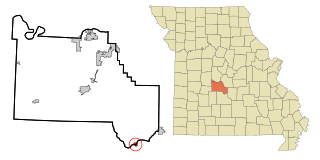
Airport Drive is a village in Jasper County, Missouri, United States. The population was 766 at the 2020 census. It is part of the Joplin, Missouri Metropolitan Statistical Area. The community is still commonly referred to as "Stone's Corner," as the intersection of Route 43 and Route 171 is known.
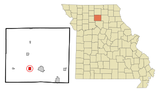
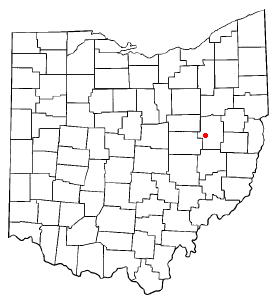
Conway is a city in Laclede County, Missouri, United States. The population was 788 at the 2010 census. Conway is located 15 miles (24 km) southwest of Lebanon.
Lebanon is a city in and the county seat of Laclede County in Missouri. The population was 14,474 at the time of the 2010 census. It is the county seat of Laclede County. The Lebanon Micropolitan Statistical Area consists of Laclede County.
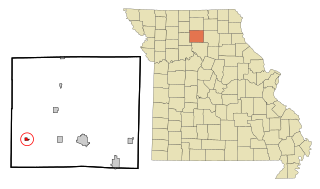
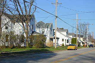
Evergreen is a village in Laclede County, Missouri, United States. The population was 28 at the 2010 census. It was named Twin Bridges at the 2000 census.
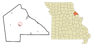
Laclede is a city in Linn County, Missouri. The population was 305 at the 2020 census, down from 345 in 2010.
Meadville is a city in southwest Linn County, Missouri, United States. The population was 415 at the 2020 census.
Bakersfield is a village in southeastern Ozark County in the Ozarks of southern Missouri, United States. The population was 186 at the 2020 census.
Tarrants is an village in central Pike County, Missouri, United States. The population was 22 at the 2010 census.
Country Life Acres is a village in St. Louis County, Missouri, United States. The population was 74 at the 2010 census.
Glen Echo Park is a village in St. Louis County, Missouri, United States. The population was 160 at the 2010 census. The community took its name from the Glen Echo Country Club.
Mackenzie is an unincorporated community in St. Louis County, Missouri, United States. The population was 134 at the 2010 census.
Marlborough is a village in St. Louis County, Missouri, United States. The population was 2,179 at the 2010 census.
Velda Village Hills is a city in northeastern St. Louis County, Missouri, United States. The population was 1,055 at the 2010 census.
Champ is a village in St. Louis County, Missouri, United States. The population was 10 at the 2020 census.
Uplands Park is a village in St. Louis County, Missouri, United States. The population was 445 at the 2010 census. The village is one of many small majority black communities located in the Natural Bridge corridor of mid-St. Louis County, characterized by small homes on small lots.
Phillipsburg is a village in Montgomery County, Ohio, United States. The population was 498 at the 2020 census. It is part of the Dayton Metropolitan Statistical Area.
Stone Creek is a village in Tuscarawas County, Ohio, United States. The population was 153 at the 2020 census.
Stoutland is a city in Camden and Laclede counties in the U.S. state of Missouri. The population was 192 at the 2010 census.
{{cite web}}
: CS1 maint: bot: original URL status unknown (link)