Pickaninny Buttes

Last updated

Pickaninny Buttes is a summit in San Bernardino County, California, in the United States. It has an elevation of 2,999 feet (914 m). [1] The butte is composed of granite. [2]

San Bernardino County, California County in California, United States

San Bernardino County, officially the County of San Bernardino, is a county located in the southern portion of the U.S. state of California, and is located within the Greater Los Angeles area. As of the 2010 U.S. Census, the population was 2,035,210, making it the fifth-most populous county in California, and the 12th-most populous in the United States. The county seat is San Bernardino.

United States Federal republic in North America

The United States of America (USA), commonly known as the United States or America, is a country comprising 50 states, a federal district, five major self-governing territories, and various possessions. At 3.8 million square miles, the United States is the world's third or fourth largest country by total area and is slightly smaller than the entire continent of Europe's 3.9 million square miles. With a population of over 327 million people, the U.S. is the third most populous country. The capital is Washington, D.C., and the largest city by population is New York City. Forty-eight states and the capital's federal district are contiguous in North America between Canada and Mexico. The State of Alaska is in the northwest corner of North America, bordered by Canada to the east and across the Bering Strait from Russia to the west. The State of Hawaii is an archipelago in the mid-Pacific Ocean. The U.S. territories are scattered about the Pacific Ocean and the Caribbean Sea, stretching across nine official time zones. The extremely diverse geography, climate, and wildlife of the United States make it one of the world's 17 megadiverse countries.

Butte Isolated hill with steep, often vertical sides and a small, relatively flat top

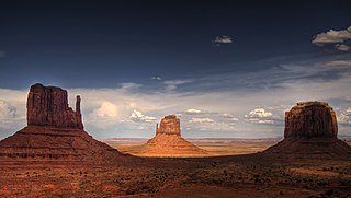
In geomorphology, a butte is an isolated hill with steep, often vertical sides and a small, relatively flat top; buttes are smaller landforms than mesas, plateaus, and tablelands. The word "butte" comes from a French word meaning "small hill"; its use is prevalent in the Western United States, including the southwest where "mesa" is used for the larger landform. Because of their distinctive shapes, buttes are frequently landmarks in plains and mountainous areas. In differentiating mesas and buttes, geographers use the rule of thumb that a mesa has a top that is wider than its height, while a butte has a top that is narrower than its height.

The name has attracted criticism from the media because it contains the ethnic slur pickaninny. [3]

Pickaninny is, in North American usage, a racial slur which refers to a depiction of a dark-skinned child of African descent. It is a pidgin word form, which may be derived from the Portuguese pequenino. In modern sensibility, the term implies a caricature which can be used in a derogatory and racist sense. According to the scholar Robin Bernstein, who describes the meaning in the context of the United States, the pickaninny is characterized by three qualities: "the figure is always juvenile, always of color, and always resistant if not immune to pain".

Related Research Articles

Two Buttes, Colorado Town in State of Colorado, United States

The town of Two Buttes is a Statutory Town located in Baca County, Colorado, United States. The population was 43 at the 2010 census.

Cottonwood, Kaufman County, Texas City in Texas, United States

Cottonwood is a city in Kaufman County, Texas, United States. The population was 185 at the 2010 census.

Cuyamaca, California human settlement in California, United States of America

Cuyamaca is a region of eastern San Diego County. It lies east of the Capitan Grande Indian Reservation in the western Laguna Mountains, north of Descanso and south of Julian. Named for the 1845 Rancho Cuyamaca Mexican land grant, the region is now dominated by the 26,000-acre (110 km2) Cuyamaca Rancho State Park. Within the park is the prominent Cuyamaca Peak, the second-highest mountain in San Diego County at 6,512 feet (1,984.9 m).

The Q Centre is in Colwood, British Columbia, Canada. In 2014, the arena was named "The Q Centre" after local radio station CKKQ-FM. The arena opened in February 2004, has 2,300 seats and houses year-round events for hockey and lacrosse. With an additional floor capacity of 860 people and standing room area for up to 480, this premier spectator facility can hold any type of event, from trade shows to major sporting and entertainment events.

Chemehuevi Indian Tribe of the Chemehuevi Reservation federally recognized tribe

The Chemehuevi Indian Tribe of the Chemehuevi Reservation is a federally recognized tribe of Chemehuevi people, who are the southernmost branch of Southern Paiute people.

Pharaohs Island island in the north of the Gulf of Aqaba

Pharaoh's Island or Isle of Graia refers to an island in the northern Gulf of Aqaba some 200 meters east off the shore of Egypt's eastern Sinai Peninsula. The island is 350 metres (380 yd) long north-south, and up to 170 metres (190 yd) wide. The area is 3.9 hectares.

Alto Mijares Comarca in Valencian Community, Spain

Alto Mijares is a comarca in the province of Castellón, Valencian Community, Spain. It is part of the Spanish-speaking area in the Valencian Community.

Sunfair, California Unincorporated community in California, United States

Sunfair is an unincorporated community in the Mojave Desert, within San Bernardino County, California.

Sunfair Heights, California Unincorporated community in California, United States

Sunfair Heights is an unincorporated community in the Mojave Desert, within San Bernardino County, California. It is about 8.5 miles (13.7 km) northeast of the town of Joshua Tree.

Haxey and Epworth railway station

Haxey and Epworth railway station was located near Haxey, Lincolnshire, England. It closed to passengers in 1959 and completely in 1964.

Ringstead and Addington railway station was a railway station serving Great and Little Addington and Ringstead in Northamptonshire on the former Northampton and Peterborough Railway which connected Peterborough and Northampton.

Pulau Sebang/Tampin railway station railway station in Malaysia

The Pulau Sebang/Tampin railway station is a Malaysian train station on the West Coast Line located near and named after the border towns of Pulau Sebang, Malacca and Tampin, Negeri Sembilan. The station itself is situated in Malaccan territory, being one of the only two stations on the West Coast Line that serves the state of Malacca, the other being Batang Melaka station.

Patersons Corner is an unincorporated community in Caroline County, in the U.S. state of Virginia.

Cherryvale, Indiana Unincorporated community in Indiana, United States

Cherryvale is an unincorporated community in Vigo and Clay counties, in the U.S. state of Indiana.

Arriens Glacier glacier in Antarctica

Arriens Glacier is a small Antarctic glacier, south of Casey Point in the Mawson Escarpment, flowing west to reach Lambert Glacier. It was plotted from ANARE aerial photographs taken in 1956, 1960 and 1973, and named by the Australian Antarctic Names and Medals Committee after P. Arriens, geochronologist with the ANARE Prince Charles Mountains survey party in 1973.

San Felipe Valley, California valley in California, United States of America

San Felipe Valley is an inland valley of the Peninsular Ranges, located in eastern San Diego County, California. Most of the valley is protected within the San Felipe Valley Wildlife Area.

Kentwood-In-The-Pines, California Unincorporated community in California, United States

Kentwood-In-The-Pines is an unincorporated community, 0.8 miles east southeast of Julian in San Diego County, California.

Newbury Center is an unincorporated community in Geauga County, in the U.S. state of Ohio.

References

  1. U.S. Geological Survey Geographic Names Information System: Pickaninny Buttes
  2. Jaeger, Edmund Carroll (1950). Our Desert Neighbors. Stanford University Press. p. 119. ISBN   978-0-8047-1097-8.
  3. Fonesca, Felicia; Cone, Tracie (February 26, 2012). "From Negro Creek to Wop Draw, place names offend". NBC News. Retrieved 6 September 2014.

Coordinates: 34°27′48″N116°53′00″W / 34.46333°N 116.88337°W / 34.46333; -116.88337

Geographic coordinate system Coordinate system

A geographic coordinate system is a coordinate system that enables every location on Earth to be specified by a set of numbers, letters or symbols. The coordinates are often chosen such that one of the numbers represents a vertical position and two or three of the numbers represent a horizontal position; alternatively, a geographic position may be expressed in a combined three-dimensional Cartesian vector. A common choice of coordinates is latitude, longitude and elevation. To specify a location on a plane requires a map projection.