Pico de Orizaba, also known as Citlaltépetl, is a stratovolcano, the highest mountain in Mexico and the third highest in North America, after Denali of Alaska in the United States and Mount Logan of Canada. It rises 5,636 metres (18,491 ft) above sea level in the eastern end of the Trans-Mexican Volcanic Belt, on the border between the states of Veracruz and Puebla. The volcano is currently dormant but not extinct, with the last eruption taking place during the 19th century. It is the second most prominent volcanic peak in the world after Africa's Mount Kilimanjaro.

Pico da Neblina is the highest peak in Brazil, 2,995.3 metres (9,827 ft) above sea level, in the Serra da Neblina, part of the Serra do Imeri, a section of the Guiana Highlands on the Brazil–Venezuela border. As determined by a border survey expedition in 1962, its summit lies just within Brazilian territory, at a horizontal distance of only 687 m (2,254 ft) from the Venezuelan border at Pico 31 de Março.

Pico Bolívar is the highest mountain in Venezuela, at 4,978 metres. Located in Mérida State, its top is permanently covered with névé snow and three small glaciers. It can be reached only by walking; the Mérida cable car, was the highest and longest cable car in the world when it was built, and only reaches Pico Espejo. From there it is possible to climb to Pico Bolívar. The peak is named after the Venezuelan independence hero Simón Bolívar.

The Ávila National Park protects part of the Cordillera de la Costa Central mountain range, in the coastal region of central-northern Venezuela.

The Cordillera de Mérida is a series of mountain ranges, or massif, in northwestern Venezuela. The Cordillera de Mérida is a northeastern extension of the Andes Mountains and the most important branch of the Venezuelan Andes. The ranges run southwest-northeast between the Venezuelan-Colombian border and the Venezuelan Coastal Ranges. The Táchira depression separates the Cordillera de Mérida from the Cordillera Oriental, which forms the Colombia-Venezuela border.

Pico Humboldt is Venezuela's second highest peak, at 4,940 metres above sea level. It is located in the Sierra Nevada de Merida, in the Venezuelan Andes of. The peak with its sister peak Pico Bonpland, and the surrounding páramos are protected by the Sierra Nevada National Park.

The Sierra Nevada de Mérida is the highest mountain range in the largest massif in Venezuela, the Cordillera de Mérida, which in turn is part of the northern extent of the Cordillera de los Andes. The Sierra Nevada de Mérida includes the highest peaks in Venezuela, Pico Bolívar, which has an elevation of 4,981 metres (16,342 ft), Pico Humboldt, Pico Bonpland and others.
Pan de Azúcar may refer to

The Pico Piedras Blancas, at 4,737 metres (15,541 ft), is the highest mountain of the Sierra de la Culata range in the Mérida State, and the fifth-highest mountain in Venezuela. Its name, meaning "White Stones", is of uncertain origin, since the massif is predominantly grey in color. Pico Piedras Blancas lacks glaciers; however, seasonal snowfalls may briefly cover its flanks. From its summit and under clear conditions, Lake Maracaibo can be seen. One of the accesses to reach the base of the mountain, is through the Mifafí Condor Reserve, which hosts some specimens of this andean bird.

Pico Bonpland is Venezuela's third highest peak, at 4,883 metres above sea level. It is located in the Sierra Nevada de Merida, in the Venezuelan Andes of. The peak with its sister peak Pico Humboldt, and the surrounding páramos are protected by the Sierra Nevada National Park. The name of the peak is in honor to Aimé Bonpland, although he never visited the Venezuelan Andes.
The Climate of Venezuela is characterized for being tropical and isothermal as a result of its geographical location near the Equator, but because of the topography and the dominant wind direction, several climatic types occur which can be the same as found in temperate latitudes, and even polar regions. Latitude exerts little influence on the Venezuelan climate, but the altitude changes it dramatically, particularly the temperature, reaching values very different according to the presence of different thermal floors.
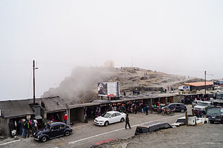
Pico El Águila or Collado del Cóndor is the milestone that stands at the highest elevation on the Venezuelan Transandean Highway in the Cordillera de Mérida of Venezuela. Nearby stands a monument, sculpted by a Colombian artist, Marcos León Mariño, depicting a condor, commemorating an event in the campaign of the Liberator, Simón Bolivar. It is located in Mérida (state) and has an altitude of 4,118 meters.

Cumbres del Ajusco National Park is one of many national parks near Mexico City, DF. The Ajusco is known for its high elevations reaching 3,900 meters (12,795 ft) above sea level and is visible from any part of Mexico city. The park is characterized by pine-oak forests and high mountain grassland. Cumbres del Ajusco means "watered grove peaks", an appropriate name for this mountainous region covered with lush green forest with many flowers due to a fair amount of precipitation. The Balsas and Lerma rivers begin in the heart of the Cumbres del Ajusco.

The Venezuelan Andes also simply known as the Andes in Venezuela, are a mountain system that form the northernmost extension of the Andes. They are fully identified, both by their geological origin as by the components of the relief, the constituent rocks and the geological structure.

The Sierra Nevada National Park (PNSN) is an important National Park of Venezuela located between Mérida and Barinas states in the west of the country. It was created on May 2, 1952, by decree of President Germán Suárez Flamerich, in order to protect the Sierra Nevada de Mérida in the Andes.

Tourism in Venezuela has been developed considerably for decades, particularly because of its geographical position, the variety of landscapes, the richness of plant and wildlife, the artistic expressions and the privileged tropical climate of the country, which affords each region throughout the year. Since 2013 the country is having a very severe economical crisis affecting the tourism all over the country.
La Estación de cría y fauna autóctona Cerro Pan de Azúcar is a nature park and zoo located close to the coastal city of Piriápolis in the Department of Maldonado, located in the southeastern part of Uruguay. The park belongs to the Municipal Administration Department of Maldonado. Some 250 examples of 53 species of Uruguayan animals are housed within an area of 86 hectares, surrounded by native trees and bushes. 300,000 people visit the park annually, many of which are groups of students.

The Sierra La Culata National Park Also Sierra de la Culata National Park is a national park of Venezuela that is located in the northeastern branch of the Venezuelan Andes, in the states Mérida and Trujillo. It was decreed a national park on December 7, 1989. It has a high mountain climate, with temperatures ranging between −2 and 24 °C, and its surface area is 200,400 hectares (774 sq mi).