The Republic of Colombia is situated largely in the northwest of South America, with some territories falling within the boundaries of Central America. It is bordered to the northwest by Panama; to the east by Venezuela and Brazil; to the south by Ecuador and Peru; and it shares maritime limits with Costa Rica, Nicaragua, Honduras, Jamaica, the Dominican Republic, and Haiti.

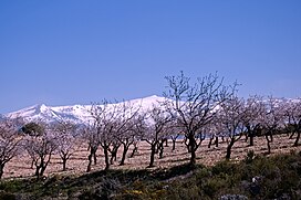
Sierra Nevada is a mountain range in the region of Andalucia, in the province of Granada and, a little further, Málaga and Almería in Spain. It contains the highest point of continental Spain: Mulhacén, at 3,479 metres (11,414 ft) above sea level.

The Parque Nacional de Sierra Nevada is a national park located in the Sierra Nevada within the provinces of Granada and Almería in Andalusia, Spain. It was declared a national park on 14 January 1999. It stretches from the Alpujarra to El Marquesado and the Lecrin Valley, covering a total area of 85,883 hectares, making it the largest national park in Spain until the expansion of the Cabrera Archipelago Maritime-Terrestrial National Park from 10,021 to 90,800 hectares in 2019.

Trevélez is a village in the province of Granada, Spain. Its population in 2011 was estimated at 823. The river Trevélez flows through the village. They are located in the western part of the Alpujarras region. Two of the highest mountains in Spain, Mulhacen and Alcazaba, are just to the north of the village, a few hours' walk away.

The Sierra Morena is one of the main systems of mountain ranges in Spain. It stretches for 450 kilometres from east to west across the south of the Iberian Peninsula, forming the southern border of the Meseta Central plateau and providing the watershed between the valleys of the Guadiana to the north and the west, and the Guadalquivir to the south.

The Cantabrian Mountains or Cantabrian Range are one of the main systems of mountain ranges in Spain. They stretch for over 300 km (180 miles) across northern Spain, from the western limit of the Pyrenees to the Galician Massif in Galicia, along the coast of the Cantabrian Sea. Their easternmost end meets the Sistema Ibérico.

Capileira is the highest and most northerly of the three villages in the gorge of the Poqueira river in the La Alpujarra district of the province of Granada, in Spain. It is located at latitude 36° 57' N and longitude 3° 21' W, about 1 km north of Bubión. Its altitude is officially recorded as 1436 metres, though there is a considerable altitude difference between the oldest part of the village, which is at the lower, southern end, and the highest part, where tourist-oriented development is currently concentrated. The area of the municipality is 57 km².
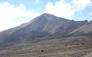
The Pico Pan de Azúcar, at 4680 meters above sea level, is the ninth highest mountain of Venezuela, and the third highest of the Sierra de la Culata range in the Mérida State. Its name, which translates as "Bread of Sugar", is due to the sandy slopes of the mountain, which resembles "Pan dulce", a kind of bread sprinkled with sugar eaten in the country. The summit offers a scenic view, including Lake Maracaibo, Sierra Nevada de Mérida and the surrounding mountains of the Sierra de la Culata.
Güéjar Sierra is a village and municipality located in the province of Granada, Spain. According to the INE, it had a population of 2,988 at the start of 2010. The village is situated in the north-western part of the Sierra Nevada mountain range, at an altitude of 1,088 metres. The municipality borders Pinos Genil, Dúdar, Quéntar, La Peza, Lugros, Jérez del Marquesado, Trevélez, Capileira and Monachil. Its boundary with Trevélez and Capileira runs along the highest ridge of the Sierra Nevada, and over Mulhacén, making these the three highest municipalities in peninsular Spain. The Genil and Maitena rivers rise in Güéjar.

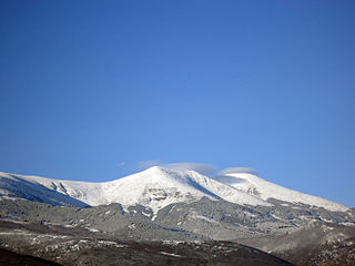
Veleta or Pico del Veleta is the second highest peak of the Iberian peninsula and the Sierra Nevada. Its height is given variously as 3,394 metres (11,135 ft), 3,396 metres (11,142 ft) and 3,398 metres (11,148 ft).
The Iberian System, is one of the major systems of mountain ranges in Spain. It consists of a vast and complex area of mostly relatively high and rugged mountain chains and massifs located in the central region of the Iberian Peninsula, but reaching almost the Mediterranean coast in the Valencian Community in the east.

Moncayo is a 15 km long and about 7 km wide mountain chain giving name to the Tarazona y el Moncayo comarca, Aragon, Spain. The Moncayo's highest summit, San Miguel (2,314 m), is the highest point in the 500 km long Sistema Ibérico.

The Alcazaba mountain is a mountain in Spain. Standing at 3,371 metres, it is the third highest mountain of the Sierra Nevada range and the fifth in the Iberian Peninsula. The impressive north face can be seen from the town of Granada. The name Alcazaba derives from the word fortification in Arabic.
The Montes de Toledo are one of the main systems of mountain ranges in the Iberian Peninsula. They divide the drainage basin of the Tagus from the basin of the Guadiana. The highest peak is 1,603 m (5,259 ft) high La Villuerca.

The Sierra Nevada Ski Station is a ski resort in the Sierra Nevada in the province of Granada in southeastern Spain. The ski area is on the northwestern slopes of Veleta, the third highest peak in peninsular Spain and the most southerly ski resort of Europe.

Sierra de la Virgen is a mountain range in the Aranda and Comunidad de Calatayud comarcas, Aragon, Spain. It is located south of the Moncayo Massif between the valleys of the Jalón and the Aranda rivers, rising north of the N-234 road, roughly between Calatayud and Torrelapaja.

Sierra de Caballos or Sierra de los Caballos is a mountain range in the Maestrazgo and Bajo Aragón comarcas of Aragon, Teruel Province, Spain. The highest point in the range is Las Artigas (1,205 m). The Guadalopillo River flows along the northern side of the range.

Sierra de Vicort, also known as Sierra de Vicor, is a 20 km (12 mi) long mountain range in the Comunidad de Calatayud and Campo de Daroca comarcas of Aragon, Spain.
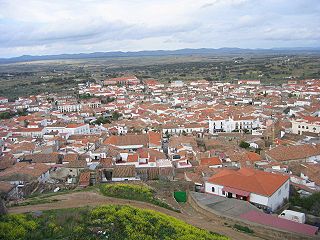
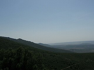
Sierra de San Pedro is a mountain range in the greater Montes de Toledo range, Spain. It is named after Saint Peter the apostle and rises in the limits of Cáceres and Badajoz Provinces, in the western part of the autonomous community of Extremadura close to its border with Portugal. This range gives its name to the Sierra de San Pedro - Los Baldíos comarca.

Laguna del Barco is a glacial lake in the Sierra de Gredos near the town of El Barco de Ávila, in the province of Ávila, Spain.