Pierson, Florida | |
---|---|
Town of Pierson | |
Motto(s): Fern Capital of the World | |
Coordinates: 29°14′30″N81°27′24″W / 29.24167°N 81.45667°W Coordinates: 29°14′30″N81°27′24″W / 29.24167°N 81.45667°W | |
Country | United States of America |
State | Florida |
County | Volusia |
Settled | 1876 |
Incorporated (town) | 1926 |
Government | |
• Type | Mayor-Council |
• Mayor | Samuel G S Bennett |
Area | |
• Total | 10.91 sq mi (28.26 km2) |
• Land | 10.20 sq mi (26.41 km2) |
• Water | 0.71 sq mi (1.85 km2) |
Elevation | 75 ft (23 m) |
Population (2020) | |
• Total | 1,542 |
• Density | 151.21/sq mi (58.38/km2) |
Time zone | UTC-5 (Eastern (EST)) |
• Summer (DST) | UTC-4 (EDT) |
ZIP code | 32180 |
Area code(s) | 386 |
FIPS code | 12-56425 [2] |
GNIS feature ID | 0288798 [3] |
Website | http://www.townofpierson.org |
Pierson is a town in Volusia County, Florida, United States. The population was 1,542 as of the 2020 census.
Pierson bills itself as the "Fern Capital of the World". The town is heavily reliant on agriculture which mainly consists of fern growing. [4] Its ferns are exported worldwide for use in floral arrangements and other decorations.
Pierson is located at 29°14′30″N81°27′24″W / 29.24167°N 81.45667°W (29.241713, –81.456594). [5] It is the northwesternmost incorporated town in Volusia County. U.S. Route 17 and County Road 3 (former US 17) pass through the town.
According to the United States Census Bureau, the town has a total area of 8.7 square miles (23 km2), of which 8.1 square miles (21 km2) is land and 0.6 square miles (1.6 km2) (6.86%) is water.
Historical population | |||
---|---|---|---|
Census | Pop. | %± | |
1930 | 624 | — | |
1940 | 541 | −13.3% | |
1950 | 657 | 21.4% | |
1960 | 716 | 9.0% | |
1970 | 654 | −8.7% | |
1980 | 1,085 | 65.9% | |
1990 | 2,988 | 175.4% | |
2000 | 2,596 | −13.1% | |
2010 | 1,736 | −33.1% | |
2020 | 1,542 | −11.2% | |
U.S. Decennial Census [7] |
As of the 2020 United States census, [8] Pierson had a total population of 1,542 people with 435 households.
The median household income was $52,917.
11.1% of the population had a Bachelor’s Degree or higher.
By age, the population was split as follows: 5.5% were under 5 years, 30.3% were under 18, 69.7% were 18 and over, and 16.4% were 65 and over.
Of the total population, 860 people were white, 38 were black, 16 were American Indian and Alaskan Native, 3 were Asian, and 437 were some other race. There were 188 persons of two or more races.
The Town Hall for Pierson is in the Old Pierson Elementary School built circa 1920. [9]
Name | Office |
---|---|
Samuel G S Bennett | Mayor |
James T. Peterson | Council Member Seat 1 |
Tom Larrive | Council Member Seat 2 |
Robert F. Greenlund | Council Member Seat 3 |
Sergia Cardenas | Council Member Seat 4 |
Total | 1,736 | 100.00% |
Under 5 years | 175 | 10.10% |
5 to 9 years | 158 | 9.10% |
10 to 14 years | 141 | 8.10% |
15 to 19 years | 152 | 8.80% |
20 to 24 years | 109 | 6.30% |
25 to 29 years | 115 | 6.60% |
30 to 34 years | 116 | 6.70% |
35 to 39 years | 123 | 7.10% |
40 to 44 years | 90 | 5.20% |
45 to 49 years | 94 | 5.40% |
50 to 54 years | 120 | 6.90% |
55 to 59 years | 87 | 5.00% |
60 to 64 years | 79 | 4.60% |
65 to 69 years | 68 | 3.90% |
70 to 74 years | 40 | 2.30% |
75 to 79 years | 30 | 1.70% |
80 to 84 years | 23 | 1.30% |
85 years and over | 16 | 0.90% |
Median age (years) | 30.7 | ( X ) |
16 years and over | 1,229 | 70.80% |
18 years and over | 1,164 | 67.10% |
21 years and over | 1,086 | 62.60% |
62 years and over | 230 | 13.20% |
65 years and over | 177 | 10.20% |
Male population of PIERSON, FL | 919 | 52.90% |
Under 5 years | 84 | 4.80% |
5 to 9 years | 84 | 4.80% |
10 to 14 years | 81 | 4.70% |
15 to 19 years | 86 | 5.00% |
20 to 24 years | 57 | 3.30% |
25 to 29 years | 72 | 4.10% |
30 to 34 years | 60 | 3.50% |
35 to 39 years | 63 | 3.60% |
40 to 44 years | 46 | 2.60% |
45 to 49 years | 41 | 2.40% |
50 to 54 years | 76 | 4.40% |
55 to 59 years | 45 | 2.60% |
60 to 64 years | 42 | 2.40% |
65 to 69 years | 30 | 1.70% |
70 to 74 years | 22 | 1.30% |
75 to 79 years | 15 | 0.90% |
80 to 84 years | 9 | 0.50% |
85 years and over | 6 | 0.30% |
Median age (years) | 29.7 | ( X ) |
16 years and over | 649 | 37.40% |
18 years and over | 612 | 35.30% |
21 years and over | 574 | 33.10% |
62 years and over | 109 | 6.30% |
65 years and over | 82 | 4.70% |
Female population of PIERSON, FL | 817 | 47.10% |
Under 5 years | 91 | 5.20% |
5 to 9 years | 74 | 4.30% |
10 to 14 years | 60 | 3.50% |
15 to 19 years | 66 | 3.80% |
20 to 24 years | 52 | 3.00% |
25 to 29 years | 43 | 2.50% |
30 to 34 years | 56 | 3.20% |
35 to 39 years | 60 | 3.50% |
40 to 44 years | 44 | 2.50% |
45 to 49 years | 53 | 3.10% |
50 to 54 years | 44 | 2.50% |
55 to 59 years | 42 | 2.40% |
60 to 64 years | 37 | 2.10% |
65 to 69 years | 38 | 2.20% |
70 to 74 years | 18 | 1.00% |
75 to 79 years | 15 | 0.90% |
80 to 84 years | 14 | 0.80% |
85 years and over | 10 | 0.60% |
Median age (years) | 32.3 | ( X ) |
16 years and over | 580 | 33.40% |
18 years and over | 552 | 31.80% |
21 years and over | 512 | 29.50% |
62 years and over | 121 | 7.00% |
65 years and over | 95 | 5.50% |
What is the Population of PIERSON, FL | 1,736 | 100.00% |
One Race | 1,702 | 98.00% |
White | 998 | 57.50% |
Black or African American | 83 | 4.80% |
American Indian and Alaska Native | 6 | 0.30% |
Asian | 8 | 0.50% |
Asian Indian | 0 | 0.00% |
Chinese | 0 | 0.00% |
Filipino | 1 | 0.10% |
Japanese | 1 | 0.10% |
Korean | 3 | 0.20% |
Vietnamese | 3 | 0.20% |
Other Asian | 0 | 0.00% |
Native Hawaiian and Other Pacific Islander | 0 | 0.00% |
Native Hawaiian | 0 | 0.00% |
Guamanian or Chamorro | 0 | 0.00% |
Samoan | 0 | 0.00% |
Other Pacific Islander | 0 | 0.00% |
Hispanic | 607 | 35.00% |
Two or More Races | 34 | 2.00% |
White; American Indian and Alaska Native | 4 | 0.20% |
White; Asian | 1 | 0.10% |
White; Black or African American | 5 | 0.30% |
White; Some Other Race | 11 | 0.60% |
Race alone or in combination with one or more other races: | ||
White | 1,019 | 58.70% |
Black or African American | 97 | 5.60% |
American Indian and Alaska Native | 13 | 0.70% |
Asian | 13 | 0.70% |
Native Hawaiian and Other Pacific Islander | 0 | 0.00% |
Some Other Race | 628 | 36.20% |
HISPANIC OR LATINO POPULATION FOR PIERSON, FL | ||
Total population | 1,736 | 100.00% |
Hispanic or Latino (of any race) | 940 | 54.10% |
Mexican | 910 | 52.40% |
Puerto Rican | 8 | 0.50% |
Cuban | 7 | 0.40% |
Other Hispanic or Latino | 15 | 0.90% |
Not Hispanic or Latino | 796 | 45.90% |
HISPANIC OR LATINO AND RACE | ||
Total population | 1,736 | 100.00% |
Hispanic or Latino | 940 | 54.10% |
White alone | 305 | 17.60% |
Black or African American alone | 3 | 0.20% |
American Indian and Alaska Native alone | 0 | 0.00% |
Asian alone | 2 | 0.10% |
Native Hawaiian and Other Pacific Islander alone | 0 | 0.00% |
Some Other Race alone | 606 | 34.90% |
Two or More Races | 24 | 1.40% |
Not Hispanic or Latino | 796 | 45.90% |
White alone | 693 | 39.90% |
Black or African American alone | 80 | 4.60% |
American Indian and Alaska Native alone | 6 | 0.30% |
Asian alone | 6 | 0.30% |
Native Hawaiian and Other Pacific Islander alone | 0 | 0.00% |
Some Other Race alone | 1 | 0.10% |
Two or More Races | 10 | 0.60% |
The Population of PIERSON, FL | 1,736 | 100.00% | |
In households | 1,674 | 96.40% | |
Householder | 486 | 28.00% | |
Spouse | 291 | 16.80% | |
Child | 610 | 35.10% | |
Own child under 18 years | 440 | 25.30% | |
Other relatives | 168 | 9.70% | |
Under 18 years | 84 | 4.80% | |
65 years and over | 14 | 0.80% | |
Nonrelatives | 119 | 6.90% | |
Under 18 years | 20 | 1.20% | |
65 years and over | 3 | 0.20% | |
Unmarried partner | 46 | 2.60% | |
In group quarters | 62 | 3.60% | |
Institutionalized population | 0 | 0.00% | |
Male | 0 | 0.00% | |
Female | 0 | 0.00% | |
Noninstitutionalized population | 62 | 3.60% | |
Male | 33 | 1.90% | |
Female | 29 | 1.70% |
Total households for PIERSON, FL | 486 | 100.00% |
Family households (families) | 381 | 78.40% |
With own children under 18 years | 194 | 39.90% |
Husband-wife family | 291 | 59.90% |
With own children under 18 years | 141 | 29.00% |
Male householder, no wife present | 34 | 7.00% |
With own children under 18 years | 21 | 4.30% |
Female householder, no husband present | 56 | 11.50% |
With own children under 18 years | 32 | 6.60% |
Nonfamily households | 105 | 21.60% |
Householder living alone | 73 | 15.00% |
Male | 36 | 7.40% |
65 years and over | 8 | 1.60% |
Female | 37 | 7.60% |
65 years and over | 28 | 5.80% |
Households with individuals under 18 years | 229 | 47.10% |
Households with individuals 65 years and over | 132 | 27.20% |
Average household size of PIERSON, FL | 3.44 | ( X ) |
Average family size for PIERSON, FL | 3.81 | ( X ) |
Total housing units | 540 | 100.00% | |
Occupied housing units | 486 | 90.00% | |
Vacant housing units | 54 | 10.00% | |
For rent | 11 | 2.00% | |
Rented, not occupied | 0 | 0.00% | |
For sale only | 10 | 1.90% | |
Sold, not occupied | 3 | 0.60% | |
For seasonal, recreational, or occasional use | 2 | 0.40% | |
All other vacants | 28 | 5.20% | |
Homeowner vacancy rate (percent) | 2.9 | ( X ) | |
Rental vacancy rate (percent) | 6.8 | ( X ) |
Occupied housing units | 486 | 100.00% |
Owner-occupied housing units | 336 | 69.10% |
Population in owner-occupied housing units | 1,071 | ( X ) |
Average household size of owner-occupied units | 3.19 | ( X ) |
Renter-occupied housing units | 150 | 30.90% |
Population in renter-occupied housing units | 603 | ( X ) |
Average household size of renter-occupied units | 4.02 | ( X ) |
Putnam County is a county located in the northeastern part of the state of Florida. As of the 2020 census, the population was 73,321. Its county seat is Palatka.
Seminole County is a county located in the central portion of the U.S. state of Florida. As of the 2020 census, the population was 470,856. Its county seat and largest city is Sanford. Seminole County is part of the Orlando-Kissimmee-Sanford, Florida Metropolitan Statistical Area.
Volusia County is located in the east-central part of the U.S. state of Florida, stretching between the St. Johns River and the Atlantic Ocean. As of the 2020 census, the county was home to 553,543 people, an increase of 11.9% from the 2010 census. It was founded on December 29, 1854, from part of Orange County, and was named for the community of Volusia, located in northwestern Volusia County. Its first county seat was Enterprise. Since 1887, its county seat has been DeLand.
Avon Park is a city in Highlands County, Florida, United States. As of the 2010 census the population was 8,836, and in 2018 the estimated population was 10,695. It is the oldest city in Highlands County, and was named after Stratford-upon-Avon, England.
Astor is an unincorporated community and census-designated place (CDP) in Lake County, Florida, United States, located on the west side of the St. Johns River between Lake George and Lake Dexter. The community straddles State Road 40, with the community of Volusia in Volusia County across the St. Johns to the east and Astor Park to the west. The population was 1,556 at the 2010 census. It is part of the Orlando–Kissimmee–Sanford Metropolitan Statistical Area.
Montverde is a town in Lake County, Florida, United States. The population was 1,655 at the 2020 census and an estimated 1,675 in 2018. It is part of the Orlando–Kissimmee–Sanford Metropolitan Statistical Area.
DeBary is a city in Volusia County, Florida, United States, on the eastern shore of the St. Johns River near Lake Monroe. According to the 2020 U.S. Census, the city had a population of 20,696. It is part of the Deltona–Daytona Beach–Ormond Beach, FL metropolitan statistical area, which was home to 553,284 people in 2019.
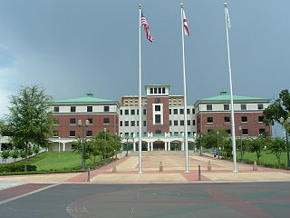
DeLand is a city in the U.S. state of Florida. It is the county seat of Volusia County. The city sits approximately 34 miles (55 km) north of the central business district of Orlando, and approximately 23 miles (37 km) west of the central business district of Daytona Beach. As of the 2020 census, the population was 37,351. It is a part of the Deltona–Daytona Beach–Ormond Beach metropolitan area, which was home to 590,289 people as of the 2010 census.
DeLand Southwest is an unincorporated census-designated place located in Volusia County, Florida, United States. The population was 1,056 at the 2020 census.
Holly Hill is a city in Volusia County, Florida, United States. The population was 11,659 at the 2010 census. Holly Hill's city limits lie entirely on the Florida mainland, unlike the larger cities on either side of it, Daytona Beach and Ormond Beach, which encompass both the mainland and the barrier island across the Halifax River.
Lake Helen is a city in Volusia County, Florida, United States. The population was 2,624 at the 2010 census.
North DeLand is a census-designated place (CDP) in Volusia County, Florida, United States. The population was 1,510 at the 2020 census.
Orange City is a city in Volusia County, Florida, United States. As of the 2010 United States Census, the city had a population of 10,599. It is a part of the Deltona–Daytona Beach–Ormond Beach metropolitan area, which was home to 590,289 people in 2010.
Ponce Inlet is a town in Volusia County, Florida, United States. The population was 3,032 at the 2010 census.
Port Orange is a city in Volusia County, Florida. The city's population was estimated at 64,842 in 2019 by the U.S. Census Bureau.
Samsula-Spruce Creek is a census-designated place (CDP) in Volusia County, Florida, United States. The population was 5,047 at the 2010 census. While many households reside here, it is principally an agricultural area west of the cities of Port Orange and New Smyrna Beach.
South Daytona is a city in Volusia County, Florida, United States. The population was 12,865 at the 2020 census.
Roopville is a town in Carroll County, Georgia, United States. The population was 218 at the 2010 census.
Macksburg is a village in Washington County, Ohio, United States, along the West Fork of Duck Creek. The population was 186 at the 2010 census.
Benezette Township is a township in Elk County, Pennsylvania, United States. The population was 218 at the 2020 census, up from 207 in 2010.
Wikimedia Commons has media related to Pierson, Florida . |