Pilot Knob, Missouri

Last updated
Pilot Knob, Missouri
PilotKnobMountain.JPG
Pilot Knob Mountain, near the city of Pilot Knob
Iron County Missouri Incorporated and Unincorporated areas Pilot Knob Highlighted.svg
Location of Pilot Knob, Missouri
Coordinates: 37°37′25″N90°38′44″W / 37.62361°N 90.64556°W / 37.62361; -90.64556 Coordinates: 37°37′25″N90°38′44″W / 37.62361°N 90.64556°W / 37.62361; -90.64556
Country United States
State Missouri
County Iron
Area
[1]
  Total0.90 sq mi (2.32 km2)
  Land0.89 sq mi (2.32 km2)
  Water0.00 sq mi (0.01 km2)
Elevation
[2]
965 ft (294 m)
Population
 (2020)
  Total671
  Density750.56/sq mi (289.84/km2)
Time zone UTC-6 (Central (CST))
  Summer (DST) UTC-5 (CDT)
ZIP code
63663
Area code 573
FIPS code 29-57656 [3]
GNIS feature ID2396205 [2]

Pilot Knob is a city in northeast Iron County, Missouri, United States. The population was 671 at the 2020 census. [4] It lies eighteen miles south-east of Belgrade and twenty-seven miles north-east of Centerville.

Contents

History

Pilot Knob was platted in 1858. [5] The city was named after the Pilot Knob mountain nearby, which served as a navigational landmark or "pilot" to hunters and travelers. [6] A post office called Pilot Knob has been in operation since 1858. [7]

The Battle of Pilot Knob in the fall of 1864 was a notable clash in the area during the Civil War. A museum near the battle site is dedicated to this event.

Geography

Pilot Knob is located on Missouri Route 21 approximately 1.5 miles north-northeast of Ironton and three miles southeast of Elephant Rocks State Park. [8]

According to the United States Census Bureau, the city has a total area of 0.90 square miles (2.33 km2), of which 0.89 square miles (2.31 km2) is land and 0.01 square miles (0.03 km2) is water. [9]

Demographics

Historical population
CensusPop.Note
1860 302
1870 58192.4%
1880 1,359133.9%
1890 757−44.3%
1950 582
1960 524−10.0%
1970 58211.1%
1980 72224.1%
1990 7838.4%
2000 697−11.0%
2010 7467.0%
2020 671−10.1%
U.S. Decennial Census [10] [ failed verification ] 2020 [4]

2010 census

As of the census [11] of 2010, there were 746 people, 335 households, and 195 families living in the city. The population density was 838.2 inhabitants per square mile (323.6/km2). There were 392 housing units at an average density of 440.4 per square mile (170.0/km2). The racial makeup of the city was 94.37% White, 1.34% Black or African American, 1.47% Native American, 0.40% Asian, and 2.41% from two or more races. Hispanic or Latino of any race were 1.61% of the population.

There were 335 households, of which 29.3% had children under the age of 18 living with them, 38.8% were married couples living together, 15.2% had a female householder with no husband present, 4.2% had a male householder with no wife present, and 41.8% were non-families. 35.8% of all households were made up of individuals, and 16.7% had someone living alone who was 65 years of age or older. The average household size was 2.23 and the average family size was 2.83.

The median age in the city was 39.9 years. 24.1% of residents were under the age of 18; 8.4% were between the ages of 18 and 24; 22.7% were from 25 to 44; 24.1% were from 45 to 64; and 20.6% were 65 years of age or older. The gender makeup of the city was 46.4% male and 53.6% female.

2000 census

As of the census [3] of 2000, there were 697 people, 283 households, and 189 families living in the city. The population density was 803.7 inhabitants per square mile (310.3/km2). There were 326 housing units at an average density of 375.9 per square mile (145.1/km2). The racial makeup of the city was 91.97% White, 5.88% African American, 0.29% Native American, 0.57% Asian, 0.86% from other races, and 0.43% from two or more races. Hispanic or Latino of any race were 1.72% of the population.

There were 283 households, out of which 31.4% had children under the age of 18 living with them, 48.1% were married couples living together, 12.0% had a female householder with no husband present, and 32.9% were non-families. 28.6% of all households were made up of individuals, and 8.8% had someone living alone who was 65 years of age or older. The average household size was 2.40 and the average family size was 2.92.

In the city, the population was spread out, with 27.3% under the age of 18, 9.8% from 18 to 24, 26.1% from 25 to 44, 22.4% from 45 to 64, and 14.5% who were 65 years of age or older. The median age was 36 years. For every 100 females, there were 90.4 males. For every 100 females age 18 and over, there were 87.1 males.

The median income for a household in the city was $19,702, and the median income for a family was $22,794. Males had a median income of $22,344 versus $16,691 for females. The per capita income for the city was $12,487. About 20.1% of families and 27.0% of the population were below the poverty line, including 46.3% of those under age 18 and 10.5% of those age 65 or over.

Related Research Articles

<span class="mw-page-title-main">Bald Knob, Arkansas</span> City in Arkansas, United States

Bald Knob is a city in White County, Arkansas, United States. The population was 2,897 at the 2010 census. Located at the intersection of two of the state's natural regions, Bald Knob is often promoted as "where the Ozarks meet the Delta". Bald Knob is known for its yearly Home Fest held during Mother's Day weekend. It was once known as the leading strawberry producer in the world in the 1950s. Bald Knob was established in 1881.

<span class="mw-page-title-main">De Witt, Missouri</span> City in Missouri, United States

De Witt is a city in Carroll County, Missouri, United States. The population was 83 at the 2020 census.

<span class="mw-page-title-main">Pilot Grove, Missouri</span> City in Missouri, United States

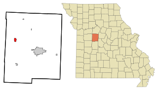
Pilot Grove is a city in the Pilot Grove Township in northern Cooper County, Missouri, United States. The population was 768 at the 2010 census.

<span class="mw-page-title-main">Ridgeway, Missouri</span> City in Missouri, United States

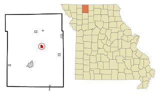
Ridgeway is a city in Harrison County, Missouri, United States. The population was 372 at the 2020 census.

<span class="mw-page-title-main">Blairstown, Missouri</span> City in Missouri, United States

Blairstown is a city in Henry County, Missouri, United States. The population was 97 at the 2010 census.

<span class="mw-page-title-main">Alba, Missouri</span> City in Missouri, United States

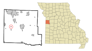
Alba is a city in Jasper County, Missouri, United States. The population was 544 at the 2020 census.

<span class="mw-page-title-main">Knob Noster, Missouri</span> City in Missouri, United States

Knob Noster is a city in Johnson County, Missouri, United States. The population was 2,709 at the 2010 census. It is located adjacent to and closely associated with Whiteman Air Force Base. Knob Noster State Park is nearby.

<span class="mw-page-title-main">Linneus, Missouri</span> City in Missouri, United States

Linneus is a small city in Linn County, Missouri, United States. The population was 281 at the 2020 census. It is the county seat of Linn County.

<span class="mw-page-title-main">Purdin, Missouri</span> City in Missouri, United States

Purdin is a city in northwest Linn County, Missouri, United States. The population was 141 at the 2020 census.

<span class="mw-page-title-main">Chamois, Missouri</span> City in Missouri, United States

Chamois is a city in Osage County, Missouri, United States. The population was 377 at the 2020 census. It is part of the Jefferson City, Missouri Metropolitan Statistical Area.

<span class="mw-page-title-main">Hayti Heights, Missouri</span> City in Missouri, United States

Hayti Heights is a city in eastern Pemiscot County in the bootheel of southeast Missouri, United States. The population was 515 at the 2020 census.

<span class="mw-page-title-main">Homestown, Missouri</span> City in Missouri, United States

Homestown is a city in Pemiscot County, Missouri, United States. The population was 73 at the 2020 census.

<span class="mw-page-title-main">La Monte, Missouri</span> City in Missouri, United States

La Monte is a city in Pettis County, Missouri, United States. The population was 1,140 at the 2010 census.

<span class="mw-page-title-main">Pleasant Hope, Missouri</span> City in Missouri, United States

Pleasant Hope is a city in Polk County, Missouri, United States. The population was 614 at the 2010 census. It is part of the Springfield, Missouri Metropolitan Statistical Area.

<span class="mw-page-title-main">Winona, Missouri</span> City in Missouri, United States

Winona is a city in southeast Shannon County, Missouri, United States. The population was 950 at the 2020 census.

<span class="mw-page-title-main">Shelbyville, Missouri</span> City in Missouri, United States

Shelbyville is a city in Shelby County, Missouri, United States. The population was 518 at the 2020 census. It is the county seat of Shelby County.

<span class="mw-page-title-main">Lake Annette, Missouri</span> City in Missouri, United States

Lake Annette is a city in Cass County, Missouri, United States. The population was 100 at the 2010 census. It is part of the Kansas City metropolitan area.

<span class="mw-page-title-main">Clarkson Valley, Missouri</span> City in Missouri, United States

Clarkson Valley is a city in St. Louis County, Missouri, United States. The population was 2,609 at the 2020 census.

<span class="mw-page-title-main">Shell Knob, Missouri</span> Census-designated place in Missouri, United States

Shell Knob is a census-designated place (CDP) located within White River Township, Barry County, Missouri. The population was 1,254 at the 2020 census.

<span class="mw-page-title-main">Ionia, Missouri</span> Village in Missouri, United States

Ionia is a village in northern Benton and southern Pettis counties in the U.S. state of Missouri. The population was 88 at the 2010 census.

References

  1. "ArcGIS REST Services Directory". United States Census Bureau. Retrieved August 28, 2022.
  2. 1 2 U.S. Geological Survey Geographic Names Information System: Pilot Knob, Missouri
  3. 1 2 "U.S. Census website". United States Census Bureau . Retrieved 2008-01-31.
  4. 1 2 "Explore Census Data". data.census.gov. Retrieved 2021-12-30.
  5. "Iron County Place Names, 1928–1945 (archived)". The State Historical Society of Missouri. Archived from the original on 24 June 2016. Retrieved 12 October 2016.{{cite web}}: CS1 maint: bot: original URL status unknown (link)
  6. Eaton, David Wolfe (1916). How Missouri Counties, Towns and Streams Were Named. The State Historical Society of Missouri. p. 176.
  7. "Post Offices". Jim Forte Postal History. Retrieved 12 October 2016.
  8. Missouri Atlas & Gazeteer, DeLorme, 1st ed., 1998, p. 56 ISBN   0899332242
  9. "US Gazetteer files 2010". United States Census Bureau. Archived from the original on 2012-07-02. Retrieved 2012-07-08.
  10. "Census of Population and Housing". Census.gov. Retrieved June 4, 2015.
  11. "U.S. Census website". United States Census Bureau . Retrieved 2012-07-08.