
The Northern Territory is an Australian territory in the central and central northern regions of Australia. It shares borders with Western Australia to the west, South Australia to the south, and Queensland to the east. To the north, the territory looks out to the Timor Sea, the Arafura Sea and the Gulf of Carpentaria, including Western New Guinea and other Indonesian islands. The NT covers 1,349,129 square kilometres (520,902 sq mi), making it the third-largest Australian federal division, and the 11th-largest country subdivision in the world. It is sparsely populated, with a population of only 246,700, making it the least-populous of Australia's eight states and major territories, with fewer than half as many people as Tasmania.
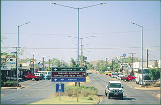
Tennant Creek is a town located in the Northern Territory of Australia. It is the seventh largest town in the Northern Territory, and is located on the Stuart Highway, just south of the intersection with the western terminus of the Barkly Highway. At the 2016 census, Tennant Creek had a population of approximately 3,000, of which over 50% (1,536) identified themselves as indigenous.

Adelaide River is a small but historically significant town located at the crossing of the Stuart Highway over the Adelaide River in the Northern Territory of Australia. The town is upstream of the Adelaide and Mary River Floodplains Important Bird Area. At the 2016 census, Adelaide River had a population of 353. Adelaide River is part of the Coomalie Shire and is the second largest settlement in the local government area.
The North Australia Railway (NAR), also known as the Palmerston to Pine Creek railway, was a 3 ft 6 in narrow gauge railway in the Northern Territory of Australia which ran from the territory capital of Darwin, once known as Palmerston, to Birdum, just south of Larrimah from 1889 to 1976.

Strathpine is a suburb in the Moreton Bay Region, Queensland, Australia. It is home to the Pine Rivers District offices of the Moreton Bay Region as well as many businesses. The area is home to Strathpine Centre, a medium-sized urban shopping centre.

The Commonwealth Railways were established in 1917 by the Government of Australia with the Commonwealth Railways Act to administer the Trans-Australia and Port Augusta to Darwin railways. It was absorbed into Australian National in 1975.

Tennant Creek Airport is a small regional airport located near Tennant Creek, Northern Territory, Australia.

MacDonald Airfield was an airfield built alongside the former northern road, west of Stuart Highway, north of Pine Creek, Northern Territory, Australia during World War II.
Long Airfield was a World War II military airfield located in the locality of Douglas-Daly, Northern Territory, Australia.

Noonamah is an outer rural suburban area of Darwin. it is 45 km SE of the Darwin CBD. Its Local Government Area is the Litchfield Municipality. The suburb is mostly a rural area, but has been experiencing strong growth in population and development. The Elizabeth River flows through Noonamah towards the East Arm of Darwin Harbour.
Southport is an outer rural locality in Darwin. It is based on the site of the abandoned Town of Southport, a thriving river port during the Pine Creek gold rush of the 1870s. It is located at the junction of the Blackmore and Darwin Rivers.
Clyde Cornwall Fenton OBE was the Northern Territory's first flying doctor. Unlike the other doctors with the Royal Flying Doctor Service of Australia, Fenton was also his own pilot. Fenton was a self-taught pilot, and flew without the aid of any navigation equipment, air charts, and often proper landing strips. He enjoys a particular renown as a unique and dashing Territory character.

The South Australian Railways W/Wx class was a class of 2-6-0 steam locomotives operated by the South Australian Railways and later the Commonwealth Railways.
Emungalan is a suburb in the town of Katherine, Northern Territory, Australia. It is within the Katherine Town Council local government area. The name Emungalan is believed to come from an Aboriginal word meaning "Place of Stone" or "Stony". The area was officially defined as a suburb in April 2007, adopting the name from the former railhead settlement north of the Katherine River.

The Church of Christ the King is located in Tennant Creek in the Northern Territory of Australia. The church was relocated from the historic mining town of Pine Creek. With parts of the church spread between the two towns during the move, it was once known as the "longest church in Australia".
This page is based on this
Wikipedia article Text is available under the
CC BY-SA 4.0 license; additional terms may apply.
Images, videos and audio are available under their respective licenses.

