Janowo is a village in the administrative district of Gmina Dąbrowa Chełmińska, within Bydgoszcz County, Kuyavian-Pomeranian Voivodeship, in north-central Poland. It lies approximately 4 kilometres (2 mi) west of Dąbrowa Chełmińska, 19 km (12 mi) north-east of Bydgoszcz, and 30 km (19 mi) north-west of Toruń.
Dąbrowa Mała is a village in the administrative district of Gmina Rojewo, within Inowrocław County, Kuyavian-Pomeranian Voivodeship, in north-central Poland. It lies approximately 10 kilometres (6 mi) north of Rojewo, 22 km (14 mi) north of Inowrocław, 23 km (14 mi) south-east of Bydgoszcz, and 26 km (16 mi) west of Toruń.
Kłodnica is a village in the administrative district of Gmina Wilków, within Opole Lubelskie County, Lublin Voivodeship, in eastern Poland. It lies approximately 2 kilometres (1 mi) south-east of Wilków, 13 km (8 mi) north-west of Opole Lubelskie, and 48 km (30 mi) west of the regional capital Lublin.
Szczekarków is a village in the administrative district of Gmina Wilków, within Opole Lubelskie County, Lublin Voivodeship, in eastern Poland. It lies approximately 2 kilometres (1 mi) south-east of Wilków, 13 km (8 mi) north-west of Opole Lubelskie, and 48 km (30 mi) west of the regional capital Lublin.
Morzychna is a village in the administrative district of Gmina Dąbrowa Tarnowska, within Dąbrowa County, Lesser Poland Voivodeship, in southern Poland. It lies approximately 3 kilometres (2 mi) west of Dąbrowa Tarnowska and 74 km (46 mi) east of the regional capital Kraków.
Kuzie is a village in the administrative district of Gmina Bolesław, within Dąbrowa County, Lesser Poland Voivodeship, in southern Poland. It lies approximately 4 kilometres (2 mi) south of Bolesław, 11 km (7 mi) north-west of Dąbrowa Tarnowska, and 72 km (45 mi) east of the regional capital Kraków.
Samocice is a village in the administrative district of Gmina Bolesław, within Dąbrowa County, Lesser Poland Voivodeship, in southern Poland. It lies approximately 14 kilometres (9 mi) north-west of Dąbrowa Tarnowska and 72 km (45 mi) east of the regional capital Kraków.
Strojców is a village in the administrative district of Gmina Bolesław, within Dąbrowa County, Lesser Poland Voivodeship, in southern Poland. It lies approximately 16 kilometres (10 mi) north of Dąbrowa Tarnowska and 74 km (46 mi) east of the regional capital Kraków.
Biskupice is a village in the administrative district of Gmina Gręboszów, within Dąbrowa County, Lesser Poland Voivodeship, in southern Poland. It lies approximately 18 kilometres (11 mi) north-west of Dąbrowa Tarnowska and 63 km (39 mi) east of the regional capital Kraków.
Kozłów is a village in the administrative district of Gmina Gręboszów, within Dąbrowa County, Lesser Poland Voivodeship, in southern Poland. It lies approximately 4 kilometres (2 mi) north-east of Gręboszów, 17 km (11 mi) north-west of Dąbrowa Tarnowska, and 67 km (42 mi) east of the regional capital Kraków.
Lubiczko is a village in the administrative district of Gmina Gręboszów, within Dąbrowa County, Lesser Poland Voivodeship, in southern Poland. It lies approximately 2 kilometres (1 mi) south-east of Gręboszów, 17 km (11 mi) north-west of Dąbrowa Tarnowska, and 64 km (40 mi) east of the regional capital Kraków.
Maniów is a village in the administrative district of Gmina Szczucin, within Dąbrowa County, Lesser Poland Voivodeship, in southern Poland. It lies approximately 7 kilometres (4 mi) north-east of Szczucin, 22 km (14 mi) north-east of Dąbrowa Tarnowska, and 91 km (57 mi) east of the regional capital Kraków.
Radwan is a rural village. It lies approximately 6 kilometres (4 mi) south of Szczucin, 11 km (7 mi) north-east of Dąbrowa Tarnowska, and 83 km (52 mi) east of the regional capital Kraków.
Zagórzany is a village in the administrative district of Gmina Gdów, within Wieliczka County, Lesser Poland Voivodeship, in southern Poland. It lies approximately 5 kilometres (3 mi) south-east of Gdów, 18 km (11 mi) south-east of Wieliczka, and 30 km (19 mi) south-east of the regional capital Kraków.
Szklary is a village in the administrative district of Gmina Hyżne, within Rzeszów County, Subcarpathian Voivodeship, in south-eastern Poland. It lies approximately 8 kilometres (5 mi) south-east of Hyżne and 25 km (16 mi) south-east of the regional capital Rzeszów.
Gąski is a village in the administrative district of Gmina Ciechanów, within Ciechanów County, Masovian Voivodeship, in east-central Poland. It lies approximately 6 kilometres (4 mi) west of Ciechanów and 80 km (50 mi) north of Warsaw.
Miejska Dąbrowa is a village in the administrative district of Gmina Głowaczów, within Kozienice County, Masovian Voivodeship, in east-central Poland. It lies approximately 5 kilometres (3 mi) west of Głowaczów, 23 km (14 mi) west of Kozienice, and 69 km (43 mi) south of Warsaw.
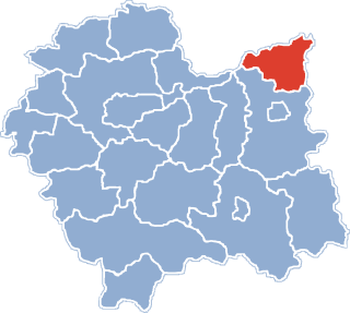
Witki is a village in the administrative district of Gmina Bartoszyce, within Bartoszyce County, Warmian-Masurian Voivodeship, in northern Poland, close to the border with the Kaliningrad Oblast of Russia. It lies approximately 6 kilometres (4 mi) east of Bartoszyce and 58 km (36 mi) north-east of the regional capital Olsztyn.
Bełk is a village in the administrative district of Gmina Lidzbark, within Działdowo County, Warmian-Masurian Voivodeship, in northern Poland. It lies approximately 5 kilometres (3 mi) east of Lidzbark, 21 km (13 mi) west of Działdowo, and 72 km (45 mi) south-west of the regional capital Olsztyn.
Gołogóra is a small village in the administrative district of Gmina Świątki, within Olsztyn County, Warmian-Masurian Voivodeship, in northern Poland. It lies approximately 4 kilometres (2 mi) south of Świątki and 20 km (12 mi) north-west of the regional capital Olsztyn.