Ponnani

Last updated

Ponnani
GKN Chamravattom Regulator Bridge DSC 0446.JPG
Chamravattom Regulator-cum-Bridge connects Ponnani with Tirur. Bharathappuzha river (Ponnani River) and Tirur River join with each other and empties together into Arabian Sea at Purathur (Southernmost tip of Tirur Taluk), which lies opposite of Ponnani Port.
Nickname(s): 
The City of Gold coins , [1] The Little Mecca of Malabar [2]
India Kerala location map.svg
Red pog.svg
Ponnani
Location in Kerala, India
India location map.svg
Red pog.svg
Ponnani
Ponnani (India)
Asia laea location map.svg
Red pog.svg
Ponnani
Ponnani (Asia)
World location map (equirectangular 180).svg
Red pog.svg
Ponnani
Ponnani (Earth)
Coordinates: 10°46′N75°54′E / 10.77°N 75.9°E / 10.77; 75.9
CountryFlag of India.svg  India
State Kerala
District Malappuram
Area
[3]
  Total24.82 km2 (9.58 sq mi)
Population
 (2011) [4]
  Total90,491
  Density3,600/km2 (9,400/sq mi)
Time zone UTC+5:30 (IST)
Postal Index Number
679 577
Telephone code0494
Vehicle registration KL-54
Website www.ponnanimunicipality.lsgkerala.gov.in

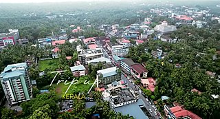
Ponnani (Malayalam: [ponːaːni] ) is a municipality in Ponnani Taluk, Malappuram District, in the state of Kerala, India. It serves as the administrative center of the Taluk and Block Panchayat of the same name. It is situated at the estuary of Bharatappuzha (River Ponnani), on its southern bank, and is bounded by the Arabian Sea on the west and a series of brackish lagoons in the south.

Contents

It is the seventh-most populated municipality in the state, the second-most populated municipality in the district, and the most densely populated municipality in Malappuram district, having about 3,646 residents per square kilometre as of the year 2011. [5] As of the 2011 Census, the municipality forms a part of Malappuram metropolitan area. National Highway 66, from to Panvel to Kanyakumari, passes through Ponnani Municipality. [6] The Palakkad-Ponnani State Highway which connects National Highway 66 with National Highway 544 is another important road. The River Tirur‍‍‍‍‍‍‍‍ joins River Ponnani at its mouth at Patinjarekkara Beach from the north bank, opposite to Ponnani. The Colonial-era Cannoly Canal ("the Ponnani Canal") bisects Ponnani town. [7] Ponnani is located 68 km south to Kozhikode city, 48 km southwest to Malappuram city, 91 km northwest to Palakkad city, and 50 km northwest to Thrissur city. Ponnani is located right in the middle of the Kerala coast.

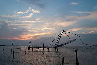
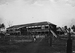
In the Middle Ages, under the ambitious Hindu chiefs of Kozhikode (the Samutiris/Zamorins), Ponnani developed as one of the most important centers of Muslim trade - both overseas and domestic - on the Arabian Sea. The port also served as the military headquarters of the Kozhikode rulers. With the arrival of the Portuguese explorers in the late - 15th century, the city witnessed several battles between the Admirals of Kozhikode and the Portuguese for the monopoly in the Spice Trade. Whenever a formal war was broke out between the Portuguese and the Kozhikode rulers, the Portuguese attacked and plundered, as the opportunity offered, the port of Ponnani. The relentless battles lead to the eventual decline of the settlement, with the exodus of Middle Eastern merchants, and the rulers who protected it. Presently, Ponnani is one of the major fishing centers in Kerala. [8] [9] [10] [11]

The original headquarters of the Perumbadappu Swaroopam, who later became the Kingdom of Cochin, was at Chithrakoodam in Vanneri, Perumpadappu, which is located 10 km south to Puthuponnani, in Ponnani taluk. When Perumpadappu came under the kingdom of the Zamorin of Calicut, the rulers of Perumpadappu fled to Kodungallur, and later they moved to Kochi, where they established the Kingdom of Cochin.

The city of Ponnani also provided ideological support for the battles against the Estado da Índia. It was the home of the revered Makhdum family. Prominent members of this Yemeni family of Islamic theologians included Zain-ud-Din Makhdum I (1467 - 1521) and his grandson Zain-ud-Din Makhdum II (1530 - 1581). Makhdum II is known for his formidable historical chronicle Tuhfat al-Mujahidin ("Glory to the Victory of Mujahidun", c. 1583), first printed and published in Lisbon. A copy of this edition has been preserved in the library of Al-Azhar University, Cairo. [8] [9] [10] [11]

The Ponnani Jum'ah Masjid, also known as Valiya Jum'ah Palli/Makhdum Mosque, was built in the 16th century AD. Ponnani, once known as the "Little Mecca of Malabar" and the "Jami'at al-Azhar of Malabar", was a prominent center of Islamic learning. It is known that students from as far as Sumatra, Java and Sri Lanka traveled to Ponnani for their spiritual education. [8] [6] [7] The town was described in many sources as "the Land of 23½ Mosques". It currently has around 50 mosques, spread around the town. [12]

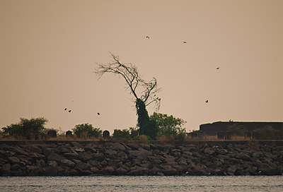
During the months of February and March, large number of migratory birds flock at Ponnani (both Ponnani and Patinjarekkara Beaches). Arabi Malayalam script, a script used to write Malayalam, was originated at Ponnani. The script was also known as "the Ponnani Script". [6] Bharathappuzha, also known as the Ponnani River, has contributed much to the Malayalam literature.

Names

A view of Arabian Sea at Ponnani Arabian Sea at Ponnani.png
A view of Arabian Sea at Ponnani
Ponnani municipal office ponnaani ngrsbh 1za .jpg
Ponnani municipal office
Ponnani mini civil station in 2010 Ponnani mini civil station.JPG
Ponnani mini civil station in 2010
Puthuponnani Munambam Beach Puthuponnani (2).JPG
Puthuponnani Munambam Beach

Ponnani is described by different authors, all the way from Europe to Arabia to China, in different names. Some of the names are given below.

Etymology

It is believed the word Ponnani comes from Pon Nanayam (Gold Coin) after the circulation of Arab gold coins introduced here by the Arabs and the Persians. [1] The name of the place traces back to the maritime trade tradition of the port city. [1] Bharathappuzha River (River Ponnani), which is also the second-longest river in Kerala flows into Arabian Sea at Ponnani port. [1] The Palakkad Gap on the bank of River Bharathappuzha was the principal trade route between Malabar Coast and Coromandel Coast in ancient times. [17] Anyway the name Ponnani is connected with the maritime trade that occurred here for centuries. [1]

History

Ponnani harbour in 2012 Ponnani harbour 2.jpg
Ponnani harbour in 2012
Ponnani Lighthouse Light house in Ponnani.jpg
Ponnani Lighthouse
Biyyam backwater lake Kerala Houseboat (191490747).jpeg
Biyyam backwater lake

Pre-historical and Early Historical (2nd century BC – 3rd century AD) nature of this settlement is shrouded in mystery. It is one of the oldest ports in South India and can be identified with the port of Tyndis, which was a satellite feeding port to Muziris, according to the Periplus of the Erythraean Sea. [18] Tyndis was a major center of trade, next only to Muziris, between the Cheras and the Roman Empire. [19] The River Bharathappuzha (River Ponnani) had importance since Sangam period (1st-4th century CE), due to the presence of Palakkad Gap which connected the Malabar coast with Coromandel coast through inland. [17] Ponnani's location at estuary of the Bharatappuzha amidst the fertile plains suitable for rice cultivation might have attracted early settlers. It is known that the river mouth - situated opposite to the plains of Coimbatore across the Ghat mountains - was accessed by the rulers of central Tamil Nadu through the Palghat Gap. It is generally assumed that the archaic Tamil chiefs came into contact with Greco-Roman navigators at the mouth of the Bharatappuzha. [20]

Ponnani Kole Wetlands at Edappal Edappal malappuram(district) kerala infia.jpg
Ponnani Kole Wetlands at Edappal

Even in the latter times, Ponnani served as the major rice supplier to the Portuguese outposts in India. Throughout the Colonial rule, the Ponnani rice cargoes were shipped across the West Coast. Tobacco was the other major commodity exported from Ponnani to Goa. [21]

Names, routes and locations of the Periplus of the Erythraean Sea (1st century CE) Periplous of the Erythraean Sea.svg
Names, routes and locations of the Periplus of the Erythraean Sea (1st century CE)

Pliny the Elder (1st century CE) states that the port of Tyndis was located at the northwestern border of Keprobotos (Chera dynasty). [22] The North Malabar region, which lies north of the port at Tyndis , was ruled by the kingdom of Ezhimala during Sangam period. [23] According to the Periplus of the Erythraean Sea , a region known as Limyrike began at Naura and Tyndis . However the Ptolemy mentions only Tyndis as the Limyrike's starting point. The region probably ended at Kanyakumari; it thus roughly corresponds to the present-day Malabar Coast. The value of Rome's annual trade with the region was estimated at around 50,000,000 sesterces. [24] Pliny the Elder mentioned that Limyrike was prone by pirates. [25] The Cosmas Indicopleustes mentioned that the Limyrike was a source of peppers. [26] [27]

An inscription which dates back to 932 CE, found from Triprangode, mentions Goda Ravi of Chera dynasty and Thavanur. [28] Several inscriptions written in Old Malayalam those date back to the 10th century CE, have found from Sukapuram near Ponnani, which was one of the 64 old Nambudiri villages of Kerala.

Pre-Portuguese Era: the Centre of Muslim trade

Ponnani used to be under the control of the Brahmins of "Tirumanasseri Natu", with protection from the Vellattiri (Valluvanatu/Angatippuram) chief, in medieval times. Later the Tirumanasseri Namputiri handed over the port Ponnani to the Samutiri of Kozhikode. An arrangement was reached between the Brahmin and the Samutiri, as a result of which, the former was obliged to protect the interests of the latter against the neighboring chiefs of Valluvanatu (South Malabar) and Perumpatappu (Cochin). [13]

As Kozhikode's political authority extended to South Malabar and Cochin, the Samutiri came to reside more and more at Ponnani (Trikkavil Palace, south of the present-day temple). The port town gradually became the second home of the Kozhikotu chiefs. By the 15th century, we know that Ponnani served as the military capital of the Samutiris of Kozhikode. The city also hosted the largest arsenal of the Kozhikotu rulers. The port at Ponnani was defended by fortifications on either bank of the river. [13]

Portuguese era

The path Vasco da Gama took to reach Kozhikode (black line) in 1498, which was also the discovery of a sea route from Europe to India, and eventually paved way for the European colonisation of Indian subcontinent. At that time, the Zamorin of Calicut was residing at Thrikkavil Kovilakam in Ponnani. Caminho maritimo para a India.png
The path Vasco da Gama took to reach Kozhikode (black line) in 1498, which was also the discovery of a sea route from Europe to India, and eventually paved way for the European colonisation of Indian subcontinent. At that time, the Zamorin of Calicut was residing at Thrikkavil Kovilakam in Ponnani.
Portuguese conquistador and explorer Francisco de Almeida, Viceroy of Portuguese India, raided Ponnani in November 1507. Retrato de D. Francisco de Almeida (apos 1545) - Autor desconhecido.png
Portuguese conquistador and explorer Francisco de Almeida, Viceroy of Portuguese India, raided Ponnani in November 1507.

In the 16th century, Ponnani witnessed several battles between Kozhikode naval chiefs, known as the Kunhali Marakkars, and the Portuguese colonizers. [6] Whenever a formal war was broke out between the Portuguese and the Kozhikode rulers, the Portuguese attacked and plundered, as the opportunity offered, the port of Ponnani. [13]

As per some historians, the ancestral home of the Kunhali Marakkar family was at Ponnani. In course of time they spread to Tanur and other settlements of the west coast. It seems that the Kunhalis shifted their base to Putupattanam when Fransico de Almedia attacked Ponnani (1507). [31] [9] There is another view about the origin of Kunhali Marakkars. As per this tradition, they were descended from a Muslim merchant by name Muhammad who traded in Cochin. Muhammad and his brother were forced to leave Cochin and settle at Ponnani in the wake of the Portuguese occupation of the place which had resulted in the destruction of his ships and warehouses. The Marakkars later moved his base to Kozhikode and when Ponnani was sacked by de Menezes (1525), he offered help to the Samutiri in his fight against the Portuguese. [9] Kutti Pokkar, a Captain in the fleet of Pattu Marakkar (Kunhali Marakkar the Third), was a native of Ponnani. [9]

Ponnani is usually considered as the military capital of the Samutiris of Kozhikode. For an assault on Cochin in 1500 AD, the Samutiri seems to have assembled a huge army of 50,000 Nairs at Ponnani. [32] It is widely written that the Muslims were ready to defend their bastion of Ponnani with their life ("to die as martyrs"). [33]

It is known that large number of men and vessels from Ponnani took part in a battle against the Portuguese off the coast of Kannur on 16 March 1506. In addition to the native Muslims, the Kozhikode Fleet of around two hundred large vessels carried large number of "red-coated" Turkish soldiers. Lorenzo Almeida was able to defeat this combined forces, and near 3,000 Muslims were killed the battle. The Portuguese loss was very trifling. [33]

Almeida's attack

Towards the end of year 1507, Viceroy Francisco de Almeida was informed that a column of 13 Muslim ships had taken cargo - mainly spices - from Ponnani and were about to leave for the Red Sea. The Viceroy immediately decided corner the fleet. The decision was perhaps made with a view to retrieve the Portuguese prestige lost on account of the some incidents at Angediva and Dabul. Almeida himself commandeered the fleet of 12 vessels consisting of four naus, six caravels and two gales. The fleet had about 6,000 European soldiers, led by a collection of noblemen such as Pero Barreti, Diogo Pires, Lourenco de Almeida, and Nuno da Cunha, son of Tristao da Cunha and a handful of Cochin Nairs. [34]

Ponnani at the time was defended by a strong battery of artillery (forty guns), and a number of well-armed ships under Kutti Ali. Kutti Ali of Ponnani was a powerful captain of the Samutiri Fleet having with him more than 7,000 armed men. The harbor was protected by fortifications on either side of the entrances. The Portuguese writers later recorded that "the men were rather frightened by the prayers and shouts of the enemy" as approached the port. Tristao da Cunha defeated the Muslim forces (24 November 1507) in the subsequent engagement. Eighteen Portuguese were killed in the assault. Lorenzo was wounded by the Muslims and the fight was stubborn. [31] Muslim ships were burnt, and the Portuguese seized their arms and ammunitions. The commodities that were made ready for despatch to Red Sea were also taken over by the Portuguese. The Ponnani town was looted, burnt and destroyed. [33] [34] [31]

The defenses of the Ponnani Port were repaired and strengthened after this event. [13] [32] It seems that Kunhali Marakkar I, assisted by Kutti Ali and Pacchi Marakkar, subsequently constructed a naval base at Ponnani. Kutti Ali sent harassing raids from Ponnani to Cochin and reinforcement fleets to Kozhikode. [32]

Meneses' attack

Viceroy Henrique de Meneses conquered Ponnani in 1525. Henrique de Meneses.jpg
Viceroy Henrique de Meneses conquered Ponnani in 1525.

Portuguese Viceroy Henrique de Meneses appeared off the coast of Ponnani on 25 February 1525 with a fleet of 50 ships, including 19 grabs supplied by the chief of Purakkad. After an unsuccessful mission in Cochin, the Samutiri army was camping at Ponnani. Meneses sent initially some soldiers to the shore for water and provisions. But they were set upon and driven back. [13] [32]

Next morning (26 February), the Portuguese landed in forces, and a fierce engagement took place the newly developed base at Ponnani. Thirty-eight ships belonging to Chinna Kutti Ali were burnt; a large number of Mappilas were killed, the coconut trees on either bank of the River Ponnani were cut by the Cochin Nairs, and houses, shops and mosques were all destroyed. The Ponnani town was partially burnt in the assault. [13] [32] The cutting of the coconut trees in a region was considered as a method of punishment to the inhabitants. In 1528, a strong Portuguese fleet cornered Kutti Ali off the coast of Bankur and he was taken prisoner.

Treaty of Ponnani

The Portuguese Viceroy Garcia de Noronha signed a peace treaty with the Samutiri of Kozhikode on board the ship St. Mattheus at Ponnani on 1 January 1540. As per the agreement, called the Treaty of Ponnani, the Samutiri granted the Portuguese the virtual monopoly, of trade in pepper and ginger at Kozhikode, accepted the Portuguese Passes (the infamous "cartazes") for the navigation of Arab vessels and gave assurances of non-intervention in the wars of the Portuguese with other native powers [such as Cochin]. [34] [9]

Terms of the Treaty (1540)

  • The Portuguese were to buy all the Kozhikode pepper at the Cochin rate and ginger at 92 fanams per bahar, and allow the Samutiri of Kozhikode to send 3.5 bahar of pepper to Portugal on his own account for every 100 bahars bought by the Portuguese. [31]
  • The Portuguese agreed to sell part of their merchandise at Kozhikode, so that the Samutiri of Kozhikode might have his customary dues on imports, and to provide the Samutiri of Kozhikode with quicksilver, vermilion and coal. [35]
  • The Treaty bound the Portuguese also to neutrality even if the Samutiri of Kozhikode attacked their allies. In return the Samutiri of Kozhikode agreed to accept the Portuguese Passports for the Moorish vessels. [13]

In 1552, the Samutiri of Kozhikode received assistance in heavy guns landed at Ponnani, brought by certain Yoosuf, a Turk, who had sailed against the monsoon winds. In 1566 and again in 1568, Kutti Pokkar of Ponnani and his men captured two Portuguese ships. Around a thousand soldiers from one of these ships were killed either by the sword or drowning. Kutti Pokkar was later in killed off the coast of Mangalore, while returning from a successful raid on the Portuguese fort there. [33]

A Portuguese fleet of 40 vessels under the command of Diogo de Meneses is known to have pillaged Ponnani, sometime before 1570 AD. [32] [36] It is also known that Gil Eanes Mascarenhas opened fire from his ships to Ponnani port and killed large number of natives in 1582. Mascarenhas was later captured, and executed by the forces of Kunhali Marakkar. [37]

Muslims from Ponnani is known to have actively participated in the Siege of Fort Chaliyam in 1571. [33] The Samutiri of Kozhikode sent against the Fort Chaliyam certain of his ministers in command over the Muslims of Ponnani, who were assisted by bodies of people from Chaliyam. [13]

Portuguese Fort

The Portuguese had earlier (around 1528, under da Cunha) tried to construct a fort on the north bank of the Vaikkal river mouth at Ponnani. This piece of land belonged to the chief of Bettem. The ships coming from Cochin with materials for construction - like stones and mortars - reached near Vaikkal. But all the vessels except one "mast vessel" were destroyed by being dashed to the shore in a storm. Some Portuguese men were drowned and some were captured. The cannons recovered came under the possession of the Samutiri of Kozhikode. [32]

Ponnani Harbour Ponnani harbour.jpg
Ponnani Harbour

As per an agreement (1584) between the Samutiri and the Portuguese, the Kozhikode allowed the Portuguese to have a factory, instead of a fort, at Ponnani, obtaining in return the right of navigation for the Muslims to the ports of Gujarat, Persia and Arabia. [13] Dom Jeronimo Mascaranhas, who was instrumental in signing the contract with the ruler of Kozhikode, was appointed the Captain of the Factory at Ponnani. [34] The decision was deeply resented by the Kunhali Marakkar III. [32]

Sooner rather than later, Duarte de Menezes entrusted Ruy Goncalves de Carmara command of an expedition determined to erect a fort proper at Ponnani. Goncalves proceeded to Ponnani, from where he dispatched a message to the Samutiri of Kozhikode, informing him of the object of his visit, and requesting that he would meet him with the view of selecting a suitable site. The Kozhikode chief kept Goncalves waiting for some time on the plea that his Brahmins were unable to fix upon an auspicious date whereupon Goncalves sent the Brahmins some presents, and they then speedily named a favorable hour for the purpose. [38] The construction of a Portuguese fort at Ponnani began in 1585. [14] Gonsalves, being in a hurry to depart, erected only a fort of wood. Rui Gomes de Gram, the first Captain of the Fort, is known to have strengthened the defenses on the Ponnani. He pulled down the wooded structures and erected one of stone of considerable strength. [38] [34] Gasper Fagundes, who was in the Ponnani Fort in 1586, was asked by the Portuguese Governor to offer his services to the Samutiri of the Kozhikode against the Kunhali Marakkar. [34] By an agreement (1597) between the Samutiri of Kozhikode and the Portuguese, the former agreed to give site to the latter to erect a church at Ponnani. [39]

Dutch Factory

Ponnani harbour in the mid-1930s mlppurrN jillyi[?] ponnaaniyile haa[?]b[?] (1930-37).jpg
Ponnani harbour in the mid-1930s

By a treaty signed between the Dutch Admiral Steven Van der Hagen and the Samutiri of Kozhikode (11 November 1604), the Dutch were permitted to open a factory at Ponnani in return for their help against the Portuguese. [13] The factory served as a military outpost of the Dutch East India Company. A Dutch Resident was in charge of the settlement. The aim of the residency was to keep "peace" with the Samutiri of Kozhikode and to watch the activities of the other European powers and the native enemies of the Dutch Company. Stein van Gollenesse wanted to cover the residency building with tiles. But the Samutiri never consented to the proposal, fearing that it would increase the Dutch influence. The chief directed Gollenesse's successor to re-thatch it every year with new coconut leaves. [40] In 1607, the Dutch had inaugurated negotiations with the Samutiri of Kozhikode at Ponnani. [15]

English ships captained by James Keeling, sailing from Surat, is known to have visited Ponnani around 1615 AD. [11]

On 12 February, a friendly reception was given by the Samutiri of Kozhikode to French Viceroy de la Haye and M. Caron (French Company) at Ponnani. M. Coche, a young Parisian clerk in the French Company's service, took up his residence at Ponnani as a token of gratitude. [16]

A meeting between Father Carre and M. Coche took place off Ponnani on 10 November 1674. According to this narrative, young Coche was "almost metamorphosed into an Indian" by his stay at Ponnani. Carre also met Aubert, a French merchant in the English Company's service. The ship carrying Father Abbe was detained at Ponnani over a dispute over delivery of goods - mainly pepper. Carre took the opportunity to travel by land, with the escort of four Nairs, to Tellicherry Factory. [16]

On 8 March 1747, it was the Dutch Resident at Ponnani who reported to the Malabar Council the plan of the Samutiri of Kozhikode to occupy by surprise the Fort Chetwai under the pretext of going to Cochin. The alertness of the Ponnani deterred the Samutiri from making the attack. In 1755, the Samutiri's plan to attack the land of Payencherry Nair, a Dutch ally, was also exposed by the Ponnani Residency. [40]

A meeting between Commandeur van Rheede and the Samutiri of Kozhikode, over the cession of Chetwai, took place at Ponnani in 1678 AD. [31]

Under the Sultans of Mysore

Hariharamangalam Mana Harihara mangalam kadavanad.jpg
Hariharamangalam Mana

Haidar 'Ali, Sultan of Mysore conquered northern Kerala in 1766 and established an outpost at Ponnani. His successor Tippu Sultan developed the port at Ponnani for trade, and for strategic reasons. [41] Tipu considered Ponnani as a major exporting centre in Malabar. [42]

Ponnani Canal

Ponnani Canal was constructed for the transportation of goods from Ponnani to Tirur railway station. Here is a description about the Ponnani Canal by Basel Mission employees at Codacal. [43]

...nowadays a steamship travels between Ponani and Tirur through the Canal, where the most convenient railway station for Ponnani is to be found. The ticket costs only 4 annas, although the distance is 10 km...

Response to British Colonial Rule

Fishing boats at Ponnani. Presently Ponnani Port is reduced to the status of a major fishing centre Ponnani harbour 2.jpg
Fishing boats at Ponnani. Presently Ponnani Port is reduced to the status of a major fishing centre

Ponnani was a major hub of Indian nationalist movement in Malabar District during the British Raj. Ponnani region was the working platform of K. Kelappan, popularly known as Kerala Gandhi,Vakeel Raman Menon,known as Ponnani Gandhi, A. V. Kuttimalu Amma, and Mohammed Abdur Rahiman, and several other freedom fighters. [44] Other independence activists from Ponnani taluk included Lakshmi Sehgal, V. T. Bhattathiripad, and Ammu Swaminathan. The ashes of Mahatma Gandhi, Jawaharlal Nehru, and Lal Bahadur Shastri, were deposited in Kerala at Tirunavaya, on the bank of the river Bharathappuzha. [45] [44]

Ali Musaliyar (1854 - 1921), one of principle leaders of the 1921 Mappila Rebellion, had studied at the Ponnani madrasa. Sayyid S. Makti Tangal (d. 1912), an influential Mappila theological reformer, was a native of Ponnani. [11]

K. V. Raman Menon (1900–1974), known as Ponnani Gandhi, was a reputed Indian National Congress leader of the time who had actively participated in the freedom movement against the British in Malabar District. [46] He was a social reformer and was a leading lawyer of the Court of Ponnani. [47]

Presently, Ponnani is one of the major fishing centers in Malappuram. [6]

The Makhdums of Ponnani

The Ponnani Canal at Ponnani (in the 1930s) ponnaaniyile oru knaa[?] (1930-1937).jpg
The Ponnani Canal at Ponnani (in the 1930s)
The Ponnani Mosque, a view from the north Ponnani juma masjid 002.JPG
The Ponnani Mosque, a view from the north
Institute of Career and Research,near Eswaramangalam,Ponnani Institute of Career Studies And Research, Ponnani.jpg
Institute of Career and Research,near Eswaramangalam,Ponnani

It is known that the Makhdum family sailed from Yemen to South India to propagate Islam. The family initially settled in Tamil Nadu (the Ma'bar region), before moving to Cochin (15th century) and later to Ponnani. [8]

Ponnani Cuisine

Ponnani has a wide variety of indigenous dishes. The centuries of maritime trade has given the Ponnani a cosmopolitan cuisine. The cuisine is a blend of traditional Kerala, Persian, Yemenese and Arab food culture. [48] One of the main elements of this cuisine is Pathiri , a pancake made of rice flour. Variants of Pathiri include Neypathiri (made with ghee), Poricha Pathiri (fried rather than baked), Meen Pathiri (stuffed with fish), and Irachi Pathiri (stuffed with beef). Spices like Black pepper, Cardamom, and Clove are widely used in the cuisine of Ponnani. Muttappathiri is another popular breakfast snacks. The main item used in the festivals is the Malabar style of Biryani. Sadhya is also seen in marriage and festival occasions. Snacks such as Arikadukka, Chattipathiri, Muttamala, Pazham Nirachathu, and Unnakkaya have their own style in Ponnani. Besides these, other common food items of Kerala are also seen in the cuisine of Ponnani. [49] The Malabar version of Biryani, popularly known as Kuzhi Mandi in Malayalam is another popular item, which has an influence from Yemen. [48]

Demographics

MES College, Ponnani MES ponnani college 1.JPG
MES College, Ponnani

As of 2011 India census, Ponnani Municipality had a population of 90,491. Males constitute 47% of the population and females 53%. Ponnani has an average literacy rate of 90.00%. "Literacy Rate of India - Population Census 2011". www.census2011.co.in. Retrieved 13 July 2017. Male literacy is 93.36%, and female literacy is 87.07%. At Ponnani, 13.17% of the population is under 7 years of age. "Ponnani City Population Census 2011 - Kerala". www.census2011.co.in. Retrieved 13 July 2017. The matrelineal system of succession ( Marumakkathayam ) was prevalent among the Nair and Muslim families of Ponnani.

Around 68.31% of the population are Muslims and 31.02% are Hindus. Schedule Caste (SC) constitutes 5.75% while Schedule Tribe (ST) were 0.22% of total population in Ponnani (M). "Ponnani City Population Census 2011 - Kerala". www.census2011.co.in. Retrieved 13 July 2017.

Places of Interest

Civic administration

The town is administered by Ponnani Municipality, headed by a chairperson. For administrative purposes, the town is divided into 51 wards, [50] from which the members of the municipal council are elected for a term of five years.

Ponnani
Ponnani Municipality

Ponnani Municipality Election 2020 [51]

S.No.Party NameParty symbolNumber of Councillors
01 LDF Left Democratic Front (Kerala) Logo.svg 38
02 UDF UDF logo.png 10
03 BJP BJP election symbol.svg -783x768.png 03
04Independents No flag.svg 00

Law and Order

The municipality comes under the jurisdiction of the Ponnani police station, which was formed in 1932. [52] The station has the jurisdiction over the municipality of Ponnani and the Gram panchayats of Veliyankode, Kalady, and Edappal. [52]

The jurisdictional courts of Ponnani Police Station are Judicial First Class Magistrate Court at Ponnani, Subdivisional Magistrate Court at Tirur, and Sessions Court at Manjeri. [52]

The border police stations are headquartered at Changaramkulam, Kuttippuram, Perumbadappu, Tirur, and Thrithala. [52] Ponnani Police Station comes under the Tirur Subdivision of Malappuram District Police, which is one of the six subdivisions of the district police.

Ponnani is also headquarters of the Coastal Police Station of Malappuram District. The Coastal Station has jurisdiction over the whole coastal area of district starting from Kadalundi Nagaram beach bordering Kozhikode district in north to Palappetty beach bordering Thrissur district in south, having a coastal length of 72 km. [53]

Wards of Ponnani

The Ponnani Municipality is composed of the following 51 wards: [54]

Ward no.NameWard no.Name
1Azheekkal2Pallikkadavu
3Chana4Velleeri
5Kuttikkad6 Ezhuvathiruthy
7Welfare8Thevarkshetram
9Kottathara10 Chamravattam
11Eswaramangalam12Neithallur
13Kotta14Erikkamanna
15Puzhambram16Biyyam
17Andithode18Boat Jetty
19Pulikkakadavu20Junction
21Theyyangad22Karukathiruthi
23Attupuram24Fisheries School
25Kadavanad South26Kadavanad North
27Ayyappankavu28Pallapram West
29Uroob Nagar30Pullonath Athani
31Chanthapadi32Thrikkavu East
33Thrikkavu34Vandipetta
35M.I.A36Puthankulam
37Thekkepuram38Parankivalappu
39Municipal Office40Cherupalli
41 Puthuponnani South42 Puthuponnani North
43Mailanchikadu44Nayady Colony
45Murinjazhi46 MES College
47Mukkadi48Aliyarpalli
49Govt. Hospital50Marakadavu
51Meentheruvu

Ponnani Block

Ponnani Block Panchayat is the local body responsible for the block-level administration of the following Gram panchayats: [55]

Geography

Transportation

KSRTC Bus Station Ponnani KSRTC Bus Station Ponnani.jpg
KSRTC Bus Station Ponnani

Related Research Articles

<span class="mw-page-title-main">Kozhikode</span> Metropolis in Kerala, India

Kozhikode, also known in English as Calicut, is a city along the Malabar Coast in the state of Kerala in India. It has a corporation limit population of 609,224 and a metropolitan population of more than 2 million, making it the second most populous metropolitan area in Kerala and the 19th largest in India. Kozhikode is classified as a Tier 2 city by the Government of India.

<span class="mw-page-title-main">Malappuram district</span> District in Kerala, India

Malappuram, is one of the 14 districts in the Indian state of Kerala, with a coastline of 70 km (43 mi). The most populous district of Kerala, Malappuram is home to around 13% of the total population of the state. The district was formed on 16 June 1969, spanning an area of about 3,554 km2 (1,372 sq mi). It is the third-largest district of Kerala by area. It is bounded by Western Ghats and the Arabian Sea on either side. The district is divided into seven Taluks: Eranad, Kondotty, Nilambur, Perinthalmanna, Ponnani, Tirur, and Tirurangadi.

<span class="mw-page-title-main">Vatakara</span> Municipality in Kerala, India

Vatakara,, , French: Bargaret, is a Municipality, Taluk and a major town in the Kozhikode district of Kerala state, India. The municipality of Vatakara covers an area of 23.33 km2 (9.01 sq mi) and is bordered by Mahé to the north and Payyoli to the south. It is the headquarters of Vatakara taluk, which consists of 22 panchayats. During the reign of the Kolathiris and Zamorins, Vatakara was known as Kadathanadu. During the British Raj, it was part of the North Malabar region of Malabar District in the state of Madras. The historic Lokanarkavu temple, made famous by the Vadakkan Pattukal, is situated in Vatakara. A new tardigrade species collected from Vadakara coast has been named after Kerala State; Stygarctus keralensis.

<span class="mw-page-title-main">Malabar District</span> Administrative district of Bombay and later Madras from 1792 to 1956

Malabar District, also known as Malayalam District, was an administrative district on the southwestern Malabar Coast of Bombay Presidency (1792–1800), Madras Presidency (1800–1937), Madras Province (1937–1950) and finally, Madras State (1950–1956) in India. It was the most populous and the third-largest district in the erstwhile Madras State. The historic town of Calicut was the admisnitrative headquarters of this district.

<span class="mw-page-title-main">Koyilandy</span> Town in Kerala, India

Koyilandy is a major town municipality and a taluk in Kozhikode district, Kerala on the Malabar Coast. The historical town is located right in the middle of the coast of Kozhikode district, between Kozhikode (Calicut) and Kannur, on National Highway 66.

<span class="mw-page-title-main">Tanur, Malappuram</span> Municipality in Kerala, India

Tanur is a coastal town, a municipality, and a block located in Tirur Taluk, Malappuram district, Kerala, India. It is located on the Malabar Coast, 9 kilometres (5.6 mi) north of Tirur and 9 kilometres south of Parappanangadi. It is the 17th-most populated municipality in the state, the fourth-most populated municipality in the district, and the second-most densely populated municipality in Malappuram district, having about 3,568 residents per square kilometre as of the year 2011.

<span class="mw-page-title-main">History of Kochi</span>

Kochi is a city located in the Ernakulam District in the Indian state of Kerala about 200 km from Trivandrum, the capital of Kerala.

The Marakkars are a South Asian Muslim community found in parts of the Indian states of Kerala, Tamil Nadu, and Sri Lanka. The Marakkars speak Malayalam in Kerala and Tamil in Tamil Nadu and both Tamil and Sinhala in Sri Lanka.

<span class="mw-page-title-main">Thavanur</span> Village in Kerala, India

Thavanur is a village on the southern bank of the Bharathapuzha, the longest river of Kerala in the Malappuram District of Kerala state in India. This village is located at the border of Tirur and Ponnani Taluks. The Bharathappuzha River separates Thavanur from Tirunavaya and Kuttippuram towns in Tirur Taluk.

<span class="mw-page-title-main">Zamorin</span> Hereditary monarch of historical kingdom in present-day Kerala, India (1124–1806)

The Samoothiri was the title of the erstwhile ruler and monarch of the Kingdom of Kozhikode (Calicut) in the South Malabar region of India. Originating from the former feudal kingdom of Nediyiruppu Swaroopam, the Samoothiris and their vassal kings from Nilambur Kovilakam established Calicut as one of the most important trading ports on the southwest coast of India. At the peak of their reign, they ruled over a region extending from Kozhikode Kollam to the forested borders of Panthalayini Kollam (Koyilandy). The Samoothiris belonged to the Eradi subcaste of the Samantan community of colonial Kerala, and were originally the ruling chiefs of Eranad. The final Zamorin of Calicut committed suicide by setting fire to his palace and burning himself alive inside it, upon learning that Hyder Ali had captured the neighboring country of Chirackal in Kannur.

<span class="mw-page-title-main">Valanchery</span> Town in Kerala, India +91

Valanchery is a major municipal town in Malappuram district, Kerala, India. It is one of the four municipalities in Tirur Taluk, besides Tirur, Kottakkal, and Tanur. It is situated about 40 kilometres (25 mi) southeast to Karipur International Airport and 25 kilometres (16 mi) southwards to the district headquarters, and forms a part of Malappuram metropolitan area. It is also one of the major commercial towns under the Malappuram urban agglomeration. Valanchery, which was a part of the erstwhile princely state of the Valluvanad in the early medieval period, had been under the direct control of the Zamorin of Calicut following the Tirunavaya war of 14th century CE. During British Raj, Valanchery was included in the Ponnani Taluk of erstwhile Malabar District.

<span class="mw-page-title-main">Purathur</span> Village in Kerala, India

Purathur is a sandy coastal village and a Grama Panchayat in Tirur Taluk, Malappuram district in the state of Kerala, India. Bharathappuzha river and Tirur River merges together in Purathur and join with the Arabian Sea at Padinjarekara Azhimukham, which is also the southernmost tip of Purathur Gram panchayat. Opposite to Padinjarekara Azhimukham is Ponnani port. The village is located at the southernmost tip of Tirur Taluk and is bordered by historically important Ponnani port in Ponnani Municipality of Ponnani taluk to south.

<span class="mw-page-title-main">Kadalundi</span> Village in Kerala, India

Kadalundi is a village in Kozhikode district, Kerala, India. It is a coastal village close to the Arabian Sea. Kadalundi is famous for its bird sanctuary, which is home to various migratory birds during certain seasons and has been recently declared as a bio-reserve. The Kadalundi–Vallikkunnu Community Reserve is the first community reserve in Kerala. The Kadalundi River and the Chaliyar river, two of the longest rivers of Kerala, merges with the Arabian Sea at Kadalundi. The first railway line in Kerala was laid in 1861 from Tirur to Chaliyam through Tanur, Parappanangadi, Vallikkunnu, and Kadalundi.

The Kingdom of Tanur was one of the numerous feudal principalities on the Malabar Coast of the Indian subcontinent during the Middle Ages. It was ruled by a Hindu dynasty, claiming kshatriya status, known as the Tanur dynasty. The kingdom comprised parts of the coastal Taluks of Tirurangadi, Tirur, and Ponnani taluks in present-day Malappuram district and included places such as Tanur, Tirur (Trikkandiyur) and Chaliyam. The coastal villages of Kadalundi and Chaliyam in the southernmost area of Kozhikode district was also under Tanur Swaroopam.

<span class="mw-page-title-main">Eranad</span> Erstwhile Province in Kerala, India

Eranad also known as Ernad refers to the erstwhile province in the midland area of Malabar, consisting of Malappuram and nearby regions such as Anakkayam, Manjeri, Kondotty, Nilambur, etc. Currently Eranad Taluk is a Taluk in Malappuram district. Eranad was ruled by a Samanthan Nair clan known as Eradis, similar to the Vellodis of neighbouring Valluvanad and Nedungadis of Nedunganad. The rulers of Eranad were known by the title Eralppad/Eradi. They also used the title Thirumulpad.

<span class="mw-page-title-main">Calicut (kingdom)</span> Historical kingdom in the region of Kerala

The Kingdom of Kozhikode, also known as Calicut, was the kingdom of the Zamorin of Calicut, in the present-day Indian state of Kerala. Present-day Kozhikode is the second largest city in Kerala, as well as the headquarters of Kozhikode district.

<span class="mw-page-title-main">Chaliyam</span> Village in Kerala, India

Chaliyam is a village situated at the estuary of Chaliyar in Kozhikode district of Kerala, India. Chaliyam forms an island, bounded by the Chaliyar in the north, and River Kadalundi in south, and the Conolly Canal in the east. It is located just opposite to Beypore port. Chaliyam was the former terminus of the South-West Line of the Madras Railway. Chaliyam is also famous for the Guinness World Records holder Muhammed Adil, a P.M who covered around seven km in the Chaliyar River with his hand and legs tied with ropes.

Malappuram is one of the 14 districts in the South Indian state of Kerala. The district has a unique and eventful history starting from pre-historic times. During the early medieval period, the district was the home to two of the four major kingdoms that ruled Kerala. Perumpadappu was the original hometown of the Kingdom of Cochin, which is also known as Perumbadappu Swaroopam, and Nediyiruppu was the original hometown of the Zamorin of Calicut, which is also known as Nediyiruppu Swaroopam. Besides, the original headquarters of the Palakkad Rajas were also at Athavanad in the district.

<span class="mw-page-title-main">Kozhikode Municipal Corporation</span> Local civic body in Kozhikode, Kerala, India

Kozhikode Corporation is the municipal corporation that administers the city of Kozhikode (Calicut), Kerala. Established in 1962, it is in the Kozhikode parliamentary constituency. The first mayor was H. Manjunatha Rao. Its four assembly constituencies are Kozhikode North, Kozhikode South, Beypore and Elathur. The Corporation is headed by a Mayor and council, and manages 118.58 km2 of the city of Kozhikode, with a population of about 609,224 within that area. Kozhikode Municipal Corporation has been formed with functions to improve the infrastructure of town.

<span class="mw-page-title-main">South Malabar</span> Geographical / Historical Area in Kerala, India

South Malabar refers to a geographical area of the southwestern coast of India covering some parts of the present-day Kerala state. South Malabar covers the regions included in present-day Kozhikode taluk of Kozhikode district, the whole area of Malappuram district, Chavakkad taluk of Thrissur district, and Palakkad district, excluding parts of Chittur taluk. The Fort Kochi region of Kochi city also historically belongs to South Malabar. The term South Malabar refers to the region of the erstwhile Malabar District south to the river Korapuzha, and bears a high cultural similarity to both the Cochin and the North Malabar regions.

References

  1. 1 2 3 4 5 M. K. Devassy (1965). 1961 Census Handbook- Palghat District (PDF). Directorate of Census Operations, Kerala and The Union Territory of Laccadive, Minicoy, and Amindivi Islands.
  2. "Ponnani, the Mecca of Malabar". nativeplanet.com. 24 October 2017. Retrieved 19 April 2020.
  3. "Malappuram census handbook" (PDF). censusindia.gov.in.
  4. "Census of India Search details". censusindia.gov.in. Retrieved 10 May 2015.
  5. "Census 2011, Malappuram" (PDF). censusindia.gov.in.
  6. 1 2 3 4 5 6 7 Kerala Tourism
  7. 1 2 Manorama Online Travel
  8. 1 2 3 4 Ali Akbar ISLAM IN PERSPECTIVE Makhdum II – a great Islamic scholar lost in history (30 November 2012) Arab News
  9. 1 2 3 4 5 6 A. Sreedhara Menon. Kerala History and its Makers. D C Books (2011)
  10. 1 2 A G Noorani. Islam in Kerala. Books
  11. 1 2 3 4 Roland E. Miller. Mappila Muslim Culture SUNY Press, 2015
  12. M. E. S. College, Ponnani Official Website
  13. 1 2 3 4 5 6 7 8 9 10 11 12 K. V. Krishna Iyer Zamorins of Calicut: From the Earliest Times to AD 1806. Calicut: Norman Printing Bureau, 1938
  14. 1 2 Mansel Longworth Dames (ed) The Book of Duarte Barbosa Taylor & Francis, 2017
  15. 1 2 Donald Frederick Lach, Edwin J. Van Kley. Asia in the Making of Europe University of Chicago Press, 1998
  16. 1 2 3 Sir Charles Fawcett. The Travels of the Abbé Carré Routledge, 2017
  17. 1 2 Subramanian, T. S (28 January 2007). "Roman connection in Tamil Nadu". The Hindu . Archived from the original on 19 September 2013. Retrieved 28 October 2011.
  18. "Official website of Ponnani Municipality".
  19. Coastal Histories: Society and Ecology in Pre-modern India, Yogesh Sharma, Primus Books 2010
  20. Rajan Gurukkal. Classical Indo-Roman Trade: A Misnomer in Political Economy.
  21. Celsa Pinto. Trade and Finance in Portuguese India: A Study of the Portuguese Country Trade, 1770-1840. Concept Publishing Company, 1994
  22. Gurukkal, R., & Whittaker, D. (2001). In search of Muziris. Journal of Roman Archaeology,14, 334-350.
  23. A. Shreedhara Menon, A Survey of Kerala History
  24. According to Pliny the Elder, goods from India were sold in the Empire at 100 times their original purchase price. See
  25. Bostock, John (1855). "26 (Voyages to India)". Pliny the Elder, The Natural History. London: Taylor and Francis.
  26. Indicopleustes, Cosmas (1897). Christian Topography. 11. United Kingdom: The Tertullian Project. pp. 358–373.
  27. Das, Santosh Kumar (2006). The Economic History of Ancient India. Genesis Publishing Pvt Ltd. p. 301.
  28. Narayanan, M. G. S. Perumals of Kerala: Brahmin Oligarchy and Ritual Monarchy Perumāḷs of Kerala. Thrissur (Kerala): CosmoBooks, 2013. 438-42.
  29. E. G. Ravenstein, ed., A Journal of the First Voyage of Vasco da Gama, Delhi, 1995, p. 50
  30. Panikkar. K.M. A History of Kerala (1498-1801) Coimbatore (1960) p. 64
  31. 1 2 3 4 5 K. V. Krishna Iyer Zamorins of Calicut: From the Earliest Times to AD 1806. Calicut: Norman Printing Bureau, 1938
  32. 1 2 3 4 5 6 7 8 K. K. N. Kurup India's Naval Traditions Northern Book Centre, 1997
  33. 1 2 3 4 5 William Logan. Malabar Manual, Volume 1 Asian Educational Services, 1887
  34. 1 2 3 4 5 6 K. S. Mathew, Shipbuilding, Navigation and the Portuguese in Pre-modern India Routledge, 2017
  35. K. V. Krishna Iyer Zamorins of Calicut: From the Earliest Times to AD 1806. Calicut: Norman Printing Bureau, 1938
  36. K. M. Mathew. History of the Portuguese Navigation in India. Mittal Publications, 1988 - Goa, Daman and Diu (India)
  37. Teotonio R. De Souza. Essays in Goan History Concept Publishing Company, 1989
  38. 1 2 Frederick Charles Danvers. The Portuguese in India: Being a History of the Rise and Decline of Their Eastern Empire, Volume 1 Asian Educational Services, 1988
  39. Teotonio R. de Souza. Essays in Goan History Concept Publishing Company, 1989
  40. 1 2 M. O. Koshy. The Dutch Power in Kerala, 1729-1758 Mittal Publications, 1989
  41. "Govt.Info.on landmarks and History of Ponnani". Dgllnoida.gov.in. Archived from the original on 2 March 2012. Retrieved 1 March 2012.
  42. Gopal. M.H, Tipu Sultan's Mysore - an Economic Study, Bombay (1971) p. 20.
  43. Website of Ines Zupanov
  44. 1 2 Leelakrishnan, Alamkode (17 June 2019). "അമ്പതിന്റെ നിറവില്‍ മലപ്പുറം; മലപ്പുറത്തിന്റെ മാനവിക മഹാപൈതൃകം". Mathrubhumi. Retrieved 21 February 2021.
  45. A Survey of Kerala History, A. Shreedhara Menon, D C Books, Kottayam, 2007 Edition
  46. "Article from 'The Hindu' newspaper". The Hindu . 15 December 2008. Archived from the original on 19 December 2008. Retrieved 1 March 2012.
  47. Leelavathy, M. (1998). Edassery Govindan Nair By M. Leelavathy. ISBN   9788126004966 . Retrieved 1 March 2012.
  48. 1 2 Sabhnani, Dhara Vora (14 June 2019). "Straight from the Malabar Coast". The Hindu. Retrieved 26 January 2021.
  49. "Cuisine of Malappuram". malappuramtourism.org. Retrieved 18 April 2020.
  50. "Ponnani municipality". lsgkerala. Retrieved 24 March 2021.
  51. "Ponnani Municipality election 2020". lbtrend. Retrieved 9 December 2020.
  52. 1 2 3 4 "Ponnani PS". Kerala police. Retrieved 24 March 2021.
  53. "Ponnani Coastal PS". Kerala police. Retrieved 24 March 2021.
  54. "Wards of Ponnani". sec.kerala.gov.in.
  55. "Ponnani Block". lsgkerala.gov.in.

Further reading