Protected area mosaic (Brazil)

Last updated
Rio Doce State Park in the Rio Doce Estuary Mosaic PE Rio Doce MG.jpg
Rio Doce State Park in the Rio Doce Estuary Mosaic

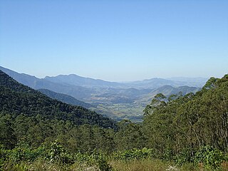
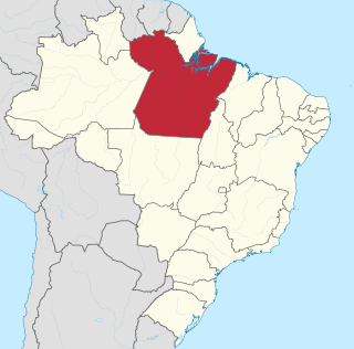
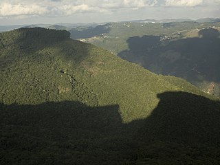
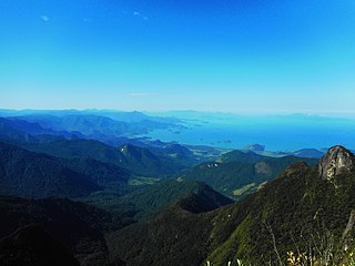
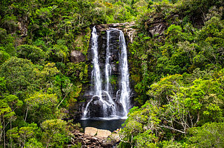
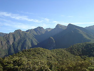
A protected area mosaic (Portuguese : mosaico de áreas protegidas) or conservation unit mosaic (Portuguese : mosaico de unidades de conservação) [lower-alpha 1] in Brazil is a mosaic of nearby, adjoining or overlapping protected areas of Brazil that are managed as a whole.

Portuguese language Romance language that originated in Portugal

Portuguese is a Western Romance language originating in the Iberian Peninsula. It is the sole official language of Portugal, Brazil, Cape Verde, Guinea-Bissau, Mozambique, Angola, and São Tomé and Príncipe. It also has co-official language status in East Timor, Equatorial Guinea and Macau in China. As the result of expansion during colonial times, a cultural presence of Portuguese and Portuguese creole speakers are also found in Goa, Daman and Diu in India; in Batticaloa on the east coast of Sri Lanka; in the Indonesian island of Flores; in the Malacca state of Malaysia; and the ABC islands in the Caribbean where Papiamento is spoken, while Cape Verdean Creole is the most widely spoken Portuguese-based Creole. Reintegrationists maintain that Galician is not a separate language, but a dialect of Portuguese. A Portuguese-speaking person or nation is referred to as "Lusophone" (Lusófono).

Brazil Federal republic in South America

Brazil, officially the Federative Republic of Brazil, is the largest country in both South America and Latin America. At 8.5 million square kilometers and with over 208 million people, Brazil is the world's fifth-largest country by area and the fifth most populous. Its capital is Brasília, and its most populated city is São Paulo. The federation is composed of the union of the 26 states, the Federal District, and the 5,570 municipalities. It is the largest country to have Portuguese as an official language and the only one in the Americas; it is also one of the most multicultural and ethnically diverse nations, due to over a century of mass immigration from around the world.

Protected area mosaic

A protected area mosaic, or conservation mosaic is a collection of environmentally protected areas that are treated as a whole, either formally or informally. The protected areas may be of different types, including strictly protected areas and sustainable use areas, which may be administered at different public levels or privately. They may include areas assigned to indigenous people. A mosaic may be more flexible and effective than an attempt to combine all the areas into a single conservation unit under one agency. In practice, results with mosaics in different countries have been mixed.

Contents

Definition

The National System of Conservation Units (SNUC) law defines a mosaic as a collection of protected areas of the same or different categories that are near to each other, adjoin each other or overlap, and that should be managed as a whole. Given the different categories of conservation unit and other protected areas in a mosaic, including fully protected and sustainable use units, the different conservation goals must be considered. [1] A mosaic may include private lands and indigenous territories. [1]

Examples

The Jacupiranga Mosaic is in the Ribeira Valley and the south coast of the state of São Paulo, with 14 conservation units of various categories. It was created to reconcile the goals of conserving the Atlantic Forest and improving the living conditions of the traditional populations of the area. It originated with the Jacupiranga State Park, created on 8 August 1969, and includes the Rio Turvo and Caverna do Diabo state parks. It also includes four environmental protection areas, five sustainable development reserves and two extractive reserves. [2]

São Paulo (state) State of Brazil

São Paulo is one of the 26 states of the Federative Republic of Brazil and is named after Saint Paul of Tarsus. As the richest Brazilian state and a major industrial complex, often dubbed the "locomotive of Brazil", the state is responsible for 33.9% of the Brazilian GDP. São Paulo also has the second highest Human Development Index (HDI) and GDP per capita, the fourth lowest infant mortality rate, the third highest life expectancy, and the third lowest rate of illiteracy among the federative units of Brazil, being by far, the safest state in the country. The homicide rate is 3.8 per 100 thousand as of 2018, almost 1/4 of the Brazilian rate. São Paulo alone is richer than Argentina, Uruguay, Paraguay and Bolivia combined. If São Paulo were an independent country, its nominal GDP would be ranked among the top 20 in the world. The economy of São Paulo State is the most developed in Brazil.

Atlantic Forest biome in Brazil

The Atlantic Forest is a South American forest that extends along the Atlantic coast of Brazil from Rio Grande do Norte state in the north to Rio Grande do Sul state in the south, and inland as far as Paraguay and the Misiones Province of Argentina, where the region is known as Selva Misionera.

Jacupiranga State Park

The Jacupiranga State Park was a state park in São Paulo, Brazil. It covered a large, mountainous region that included untouched Atlantic Forest and land occupied by traditional communities. When the park was created in 1969 the residents could no longer legally practice sustainable farming and extraction of forest resources, leading to land use conflicts, which mounted as the BR-116 highway opened the park to squatters from elsewhere. Eventually, in 2008 the park was combined with surrounding territory and broken up into three smaller state parks and various other units in which sustainable development was allowed.

The Itatiaia National Park, created in 1937 as the first national park in Brazil, is part of the Mantiqueira Mosaic and the Mantiqueira Ecological Corridor, part of the larger Serra do Mar Ecological Corridor, which in turn is part of the UNESCO-recognised Atlantic Forest Biosphere Reserve. The park is a vulnerable "conservation island" due to its location between the major cities of Rio de Janeiro and São Paulo. [3]

Itatiaia National Park national park of Brazil

Itatiaia National Park, established in 1937, is the oldest national park in Brazil. It is located on the border between the states of Rio de Janeiro and Minas Gerais.

National park (Brazil) Wikimedia list article

National Parks are a legally-defined type of protected area of Brazil. The first parks were created in the 1930s, and other parks were gradually added, typically protecting a natural monument such as a waterfall or gorge near to a coastal population centre. At least two early parks were later submerged by hydroelectric reservoirs. The first park in the Amazon rainforest was inaugurated in 1974. Today the national parks cover a huge area, particularly in the Amazon. However, many of them suffer from outstanding claims for compensation from former owners or users of the land, and many lack the management plans, physical infrastructure and personnel needed to support public visits. The responsible government agency does not have the capacity to provide services such as food and drink, souvenir sales and guided tours, and bureaucracy has delayed letting the private sector bid on providing such services.

Mantiqueira Mosaic protected area mosaic in the Brazilian states of Rio de Janeiro, São Paulo and Minas Gerais

The Mantiqueira Mosaic is a protected area mosaic that contains conservation units in the states of Rio de Janeiro, São Paulo and Minas Gerais, Brazil. The conservation units are of different types and are managed at the federal, state or municipal level. The mosaic provides a level of integrated and coordinated management.

Brazil has created a mosaic of federal and state conservation units along the BR-319 highway through the Amazon rainforest in an effort to better prevent deforestation when the highway is paved through more efficient management of a larger area. However, WWF-Brazil has pointed out that it is not enough to simply create the protected areas on paper. They must be staffed, delimited, legal owners compensated and so on. [4]

BR-319 highway in Brazil

BR-319 is an 870-kilometre (540 mi) federal highway that links Manaus, Amazonas to Porto Velho, Rondônia. The highway runs through a pristine part of the Amazon rainforest. It was opened by the military government in 1973 but soon deteriorated, and by 1988 was impassible. In 2008 work began to repair the highway, which will provide an alternative to boat travel along the Madeira River or flying between Manaus and Porto Velho. Protected areas have been created along the route in an effort to prevent deforestation when BR-319 is reopened, a serious concern given the devastation caused elsewhere by highways such as BR-364. As of mid-2016 paving of the middle section of the highway had yet to be approved. Construction permits will depend on measures to prevent future damage to the forest.

The Terra do Meio Mosaic is in Pará state between the Xingu and Tapajós rivers. It was created after the death of Sister Dorothy Stang, who was campaigning against illegal exploitation of the forests. It includes the Terra do Meio Ecological Station, a strictly protected conservation, created despite the presence of long-standing residents. [5] The residents, who live along the Iriri River, have been placed under intense pressure to evacuate the area. [5]

Pará State of Brazil

Pará is a state in northern Brazil traversed by the lower Amazon River. It borders the Brazilian states of Amapá, Maranhão, Tocantins, Mato Grosso, Amazonas and Roraima. To the northwest it borders Guyana and Suriname; to the northeast it borders the Atlantic Ocean. The capital and largest city is Belém, at the mouth of the Amazon at the Atlantic Ocean and the 11th most populous city in the country.

Xingu River tributary river of the Amazon River in South America

The Xingu River is a 1,640 km (1,019 mi) river in north Brazil. It is a southeast tributary of the Amazon River and one of the largest clearwater rivers in the Amazon basin, accounting for about 5% of its water.

Tapajós river in Brazil

The Tapajós is a river in Brazil. It runs through the Amazon Rainforest and is a major tributary of the Amazon River. When combined with the Juruena River, the Tapajós is approximately 1,200 mi (1,900 km) long. It is one of the largest clearwater rivers, accounting for about 6% of the water in the Amazon basin.

The Chapada dos Veadeiros National Park in the state of Goiás, Brazil, was expanded by Federal Decree in September 2001 and inscribed as a UNESCO World Heritage Site in December 2001. In 2003 the expansion was successfully challenged and 72% of the national park lost its protection status. The park is part of the Cerrado Biosphere Reserve. Brazil has outlined plans for a mosaic of new conservation units with different management categories covering an equivalent area to the expanded National Park, but UNESCO has questioned whether the mosaic will be sufficient to ensure the statutory protection required for the World Heritage properties. [6]

Partial list

Mosaic Level Area (ha) Created State(s)
Alto Jequitinhonha - Serra do Cabral Ridge Mosaic Federal 2010
Apuí Mosaic State 2,467,244 2010 Amazonas
BR-319 Provisional Administrative Limitation Area Federal 15,393,453 2006 Amazonas
Bocaina Mosaic Federal 221,754 2006 Rio de Janeiro, São Paulo
Carioca Mosaic Federal 2011
Central Rio de Janeiro Atlantic Forest Mosaic Federal 233,710 2006 Rio de Janeiro
Espinhaço Mosaic Federal 910,000 2010 Minas Gerais
Extreme South of Bahia Mosaic Federal 2010 Bahia
Golden Lion Tamarin Mosaic Federal 2010
Jacupiranga Mosaic State 2008 São Paulo
Juréia-Itatins Mosaic State 97,213 2006 São Paulo
Lagamar Mosaic Federal/State/Municipal 2,119,000 2006 São Paulo, Paraná
Lower Rio Negro Mosaic Federal 7,329,220 2010 Amazonas
Mantiqueira Mosaic Federal 445,615 2006 Rio de Janeiro, São Paulo, Minas Gerais
Paranapiacaba Conservation Units Mosaic State 120,000 2012 São Paulo
Piauí Mosaic Federal 2005
Rio Doce Estuary Mosaic Federal 2010
Rio Gregório State Forest Mosaic State 486,319 2008
Serras Capivara and Confusão Mosaic Federal 2005
Sertão Veredas-Peruaçu Mosaic Federal 2009
Southern Amazon Mosaic Federal 2011 Amazonas, Mato Grosso, Rondônia
Terra do Meio Mosaic Federal
Tucuruí Mosaic State 568,667 2002
West Amapá and North Pará Mosaic Federal 12,397,338 2013 Amapá, Pará

Related Research Articles

Protected areas of Brazil

Protected areas of Brazil included various classes of area according to the National System of Conservation Units (SNUC), a formal, unified system for federal, state and municipal parks created in 2000.

Chapada dos Veadeiros National Park national park of Brazil located in the Chapada dos Veadeiros, an ancient plateau with an estimated age of 1.8 billion years

Chapada dos Veadeiros National Park is a national park of Brazil located in the state of Goias, on the top of an ancient plateau with an estimated age of 1.8 billion years. The park was created on January 11, 1961 by President Juscelino Kubitscheck, and listed as a World Heritage Site by Unesco in 2001. It occupies an area of 655 square kilometres (253 sq mi) in the municipalities of Alto Paraíso de Goiás, Cavalcante and Colinas do Sul. The park is maintained by Chico Mendes Institute for Biodiversity Conservation.

Serra da Mantiqueira Environmental Protection Area

Serra da Mantiqueira Environmental Protection Area (Portuguese: Área de Proteção Ambiental da Serra da Mantiqueira is a protected area of Brazil that includes parts of the states of Minas Gerais, Rio de Janeiro and São Paulo.

Lagamar Mosaic protected area mosaic

The Lagamar Mosaic (Portuguese: Mosaico do Lagamar is a protected area mosaic that includes a number of conservation units in the states of São Paulo and Paraná, Brazil.

Bocaina Mosaic protected area mosaic in the Brazilian states of Rio de Janeiro and São Paulo

The Bocaina Mosaic is a protected area mosaic on the border between Rio de Janeiro and São Paulo, Brazil. It provides coordinated management for a group of 10 federal, state and municipal conservation units covering an area of Atlantic Forest along the coast and up the slopes of the Bocaina plateau.

Serra do Papagaio State Park state park in the state of Minas Gerais, Brazil

The Serra do Papagaio State Park is a state park in the state of Minas Gerais, Brazil. It protects a mountainous region of Atlantic Forest.

Serrinha do Alambari Environmental Protection Area

The Serrinha do Alambari Environmental Protection Area is an environmental protection area in the state of Rio de Janeiro, Brazil.

Pedra Selada State Park

The Pedra Selada State Park is a state park in the state of Rio de Janeiro, Brazil.

Mananciais de Campos do Jordão State Park

The Mananciais de Campos do Jordão State Park is a state park in the state of São Paulo, Brazil.

Mananciais do Rio Paraíba do Sul Environmental Protection Area

The Mananciais do Rio Paraíba do Sul Environmental Protection Area is an environmental protection area in the state of São Paulo, Brazil.

Sapucaí Mirim Environmental Protection Area

The Sapucaí Mirim Environmental Protection Area is an environmental protection area in the state of São Paulo, Brazil

Lower Rio Negro Mosaic

The Lower Rio Negro Mosaic (Portuguese: Mosaico do Baixo Rio Negro is a protected area mosaic in the state of Amazonas, Brazil. It coordinates between eleven conservation units of different types in the Amazon rainforest to the northwest of the state capital, Manaus.

Jacupiranga Mosaic

The Jacupiranga Mosaic is a protected area mosaic of 14 units, located in the Atlantic Forest biome within the state of São Paulo of southeastern Brazil.

Lagamar de Cananéia State Park

The Lagamar de Cananéia State Park is a state park in the state of São Paulo, Brazil.

Carioca Mosaic

The Carioca Mosaic is a protected area mosaic in the state of Rio de Janeiro, Brazil. It includes various federal, state and municipal conservation units in and around the city of Rio de Janeiro.

Mendanha State Park

The Mendanha State Park (Portuguese: Parque Estadual do Mendanha is a state park in the state of Rio de Janeiro, Brazil.

Espinhaço Mosaic Protected area mosaic in the state of Minas Gerais, Brazil

The Espinhaço: Alto Jequitinhonha – Serra do Cabral Mosaic, or simply Espinhaço Mosaic, is a protected area mosaic in the state of Minas Gerais, Brazil.

References

  1. The Instituto Socioambiental uses the term "protected area mosaic" in preference to "conservation unit mosaic" to reflect the fact that a mosaic may include private lands and indigenous territories as well as formally designated conservation units. [1]
  1. 1 2 3 Mosaicos de áreas protegidas – ISA.
  2. Edison Mariotti 2016.
  3. Parque Nacional do Itatiaia: Who We Are.
  4. Six new protected areas created in Brazilian Amazonian state.
  5. 1 2 Carolina Motoki 2015.
  6. Cerrado Protected Areas ... UNESCO.

Sources