Arroba de los Montes is a municipality in the Province of Ciudad Real, Castile-La Mancha, Spain. It has a population of 611.

Kvačany is a village and municipality in Liptovský Mikuláš District in the Žilina Region of northern Slovakia.
Peștera Vântului is the largest cave in Romania, with a length of almost 52 km. It is situated in the Pădurea Craiului Mountains on the left bank of Crișul Repede River in the vicinity of Șuncuiuș village, Bihor County. This cave is closed and only accessible to cavers, but there are works going on to develop it as a show cave.
Ribosomal particles are denoted according to their sedimentation coefficients in Svedberg units. The 60S subunit is the large subunit of eukaryotic 80S ribosomes. It is structurally and functionally related to the 50S subunit of 70S prokaryotic ribosomes. However, the 60S subunit is much larger than the prokaryotic 50S subunit and contains many additional protein segments, as well as ribosomal RNA expansion segments.
Bánkút is a ski resort in Northern Hungary in the Bükk National Park. It lies 32 km west from Miskolc and 800–930 metres above sea level; officially belongs to the village of Nagyvisnyó.
Pólko is a village in the administrative district of Gmina Kwilcz, within Międzychód County, Greater Poland Voivodeship, in west-central Poland.

Žďár is a village and municipality in Mladá Boleslav District in the Central Bohemian Region of the Czech Republic.

Jinhu Township is an urban township of Kinmen, Fujian Province, Republic of China. It is in the Taiwan Strait, on the coast of mainland China. Jinhu Township is the largest township in Kinmen County.

Bahria College Karachi(Urdu: بحریہ کالج کراچی ), commonly abbreviated as BCK, is a college in Karachi, Sindh, Pakistan. Bahria College was founded by the Pakistan Navy. The college offers education till College Level. College is being affiliated with Karachi Board, CIE and Federal Board. Karachi Board is only being followed till Fsc Level.
Minzu railway station is a station of Jingbao Railway in Inner Mongolia.
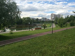
Ochakovo-Matveevskoe is an administrative district (raion) of Western Administrative Okrug, and one of the 125 raions of Moscow, Russia. The area of the district is 17.5436 square kilometers (6.7736 sq mi). Population: 124,580.
Sín Chải is a commune (xã) and village of the Tủa Chùa District of Điện Biên Province, northwestern Vietnam.
Deveci is a village in the District of Haymana, Ankara Province, Turkey.

The Gornjak Monastery, formerly known as Ždrelo (Ждрело), is a 14th-century Serbian Orthodox monastery located in the vicinity of today's city of Petrovac na Mlavi, Serbia.
Marijan is a village in Behrestagh Rural District, in the Central District of Amol County, Mazandaran Province, Iran. At the 2006 census, its population was 28, in 7 families.
Tishanovo is a village in Nevestino Municipality, Kyustendil Province, south-western Bulgaria.
Grančarevo is a village in Bijelo Polje Municipality, in northern Montenegro. According to the 2003 census, the village had a population of 242 people.
Stožer is a village in Bijelo Polje Municipality, in northern Montenegro. By the 2003 census, the village had a population of 257 people.

Nørrebrohallen is a Danish sports complex in Nørrebro, Copenhagen. It was formerly known as Nørrebro Remise because it worked as a roundhouse for the now defunkt Copenhagen Tram until 1972 when all tram activities stopped. The facility is owned and run by the Copenhagen Municipality. The oldest part of the facility was drawned by architect Thorvald Sørensen and was constructed by Siemens & Halske-Bahnabteilung in 1896. Nørrebrohallen was expanded several times since; amongst others by Vilhelm Friederichsen from 1900–1902. Furthermore, the professional Danish Basketball club Stevnsgade Basketball play their home matches in Hal 3 in Nørrebrohallen. Hal 3 has a capacity of approx. 600 people.
Moore Township is an inactive township in Oregon County, in the U.S. state of Missouri.

