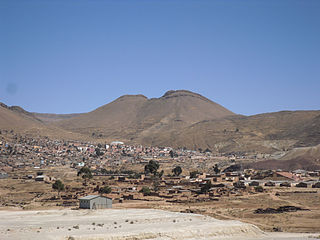
Llallagua or Llallawa is a town in the Potosí Department in Bolivia. It is the seat of the Llallagua Municipality, the third municipal section of the Rafael Bustillo Province.
Kachi Mayu is a Bolivian river east of Poopó Lake in the Oruro Department, Challapata Province, Challapata Municipality. Its source, the Jach'a Juqhu River, is considered the origin of the Pillku Mayu.

Wayna Potosí is a mountain in the Andes of Bolivia, about 4,969 metres (16,302 ft) high. It is located in the Oruro Department, Sajama Province, Turku Municipality, Turku Canton, northwest of Turku (Turco). The Turku River originates near the mountain. It is a left tributary of the Lauca River.

Wilca is an archaeological site in Peru. It is situated in the Amazonas Region, Utcubamba Province, in the east of the Cajaruro District, near the border with the Bongara Province.

Choquepirhua is a mountain in the Chila mountain range in the Andes of Peru, about 5,400 metres (17,717 ft) high. It lies in the Arequipa Region, Castilla Province, on the border of the districts of Chachas and Choco. Choquepirhua is situated south of Chila.
Qullpa is a mountain in the Andes of Peru, about 5,226.4 metres (17,147 ft) high. It is situated in the Arequipa Region, Castilla Province, on the border of the districts Ayo and Uñón. Qullpa lies south of the mountain Yanqha.
Chuquiananta is a mountain in the Andes of southern Peru, about 5,300 metres (17,388 ft) high. It is situated in the Moquegua Region, Mariscal Nieto Province, Torata District, and in the Tacna Region, Candarave Province, Camilaca District. Chuquiananta lies south-west of Tutupaca volcano, south-east of Pomani.
Pirca Pirca is an archaeological site in Peru. It is located in the Lima Region, Yauyos Province, Tanta District. Pirca Pirca was declared a National Cultural Heritage of Peru by Resolución Viceministerial No. 011-2013-VMPCIC-MC on February 7, 2013. It lies north of Lake Paucarcocha.

P'isqi P'isqi is a mountain in the Andes of Peru, about 4,600 metres (15,092 ft) high. It lies in the Arequipa Region, Castilla Province, Andagua District. P'isqi P'isqi is situated west of Wakapallqa and Llallawi.

Sirk'i is a 4,962-metre-high (16,280 ft) mountain in the Andes of Bolivia east of Poopó Lake. It is located in the Oruro Department, Sebastián Pagador Province, which is identical to the Santiago de Huari Municipality. Sirk'i lies northwest of Chullpiri and east of Wila Sirka.
Hatun Qurini is a mountain in the Peruvian Andes, about 5,000 metres (16,404 ft) high. It is situated in the Puno Region, Azángaro Province, San José District. Hatun Qurini lies northwest of the mountain Surupana.

Cuncapata is a mountain in the Vilcanota mountain range in the Andes of Peru, about 5,400 metres (17,717 ft) high. It is located in the Cusco Region, Canchis Province, Pitumarca District. Cuncapata lies southwest of the mountain Jatunñaño Punta, north of the lake Sibinacocha and southeast of Chumpe.
Waña is a mountain in the Wansu mountain range in the Andes of Peru, about 5,400 metres (17,717 ft) high. It is situated in the Cusco Region, Chumbivilcas Province, Santo Tomás District. Waña lies northwest of Wamanripa, northeast of Chankuwaña, east of Wayunka and southeast of Ikma.
Pisquioc is a mountain in the Vilcanota mountain range in the Andes of Peru, about 5,000 m (16,000 ft) high. It is located in the Cusco Region, Quispicanchi Province, Marcapata District, south of Aquichua.
Wallatiri is a mountain in the Andes of Bolivia, about 4,100 m (13,500 ft) high. It is situated in the Oruro Department, Poopó Province, Poopó Municipality. Wallatiri lies south of Qala Pirqata.
Chuqi Nasa is a mountain in the Andes of Bolivia, about 4,640-metre (15,220 ft) high. It is located in the Oruro Department, Poopó Province, Poopó Municipality.
Wallatiri is a mountain in the Andes in Bolivia, about 4,700 m (15,400 ft) high. It is located southeast of Poopó Lake in the Oruro Department, Challapata Province, Quillacas Municipality. It lies southwest of Jatun Wila Qullu.
Sondor (possibly from Aymara sunturu square without a ridge, Quechua suntur circular, is a mountain in the Andes of Peru, about 4,800 metres high. It is located in the Apurímac Region, Abancay Province, Circa District, and in the Antabamba Province, El Oro District. It lies southeast of a mountain named Sunturu.
Chuqi Pirwa is a mountain in the Andes of Peru, about 4,800 m (15,700 ft) high. It is located in the Arequipa Region, Caylloma Province, Tisco District, and in the Espinar Province, Yauri District. It lies northeast of Jañuma Pirwa and east of Pirwa.
Wanu Wanu is a mountain in the Andes of Peru, about 4,800 m (15,700 ft) high. It is located in the Cusco Region, Espinar Province, on the border of the districts of Condoroma and Ocoruro. It lies northeast of Atawallpa and southeast of Hatun Chhuka.


