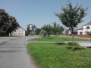
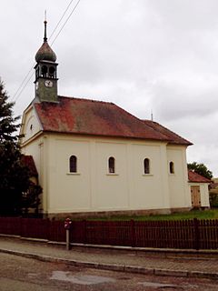
| Písek (Hradec Králové District) | ||
|---|---|---|
| Municipality and village | ||
 | ||
| ||
| Country | ||
| Region | Hradec Králové Region | |
| District | Hradec Králové District | |
| Area | ||
| • Total | 1.68 sq mi (4.34 km2) | |
| Elevation | 712 ft (217 m) | |
| Population (1.1.2013) | ||
| • Total | 234 | |
| • Density | 140/sq mi (54/km2) | |
| Time zone | CET (UTC+1) | |
| • Summer (DST) | CEST (UTC+2) | |

Písek (Hradec Králové District) is a village and municipality in Hradec Králové District in the Hradec Králové Region of the Czech Republic.

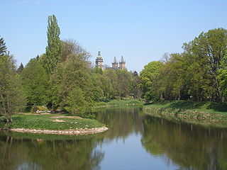
Hradec Králové District is a district (okres) within Hradec Králové Region of the Czech Republic. Its capital is city Hradec Králové.
Hradec Králové region is an administrative unit of the Czech Republic located in the north-eastern part of the historical region of Bohemia. It is named after its capital Hradec Králové. The region neighbours the Pardubice Region in the south, the Central Bohemian Region in the south-west, and the Liberec Region in the west. It also shares a 208 km long international border with Polish Lower Silesian Voivodship in the north and the east.
The Czech Republic, also known by its short-form name, Czechia, is a landlocked country in Central Europe bordered by Germany to the west, Austria to the south, Slovakia to the east and Poland to the northeast. The Czech Republic covers an area of 78,866 square kilometres (30,450 sq mi) with a mostly temperate continental climate and oceanic climate. It is a unitary parliamentary republic, with 10.6 million inhabitants; its capital and largest city is Prague, with 1.3 million residents. Other major cities are Brno, Ostrava, Olomouc and Pilsen. The Czech Republic is a member of the European Union (EU), NATO, the OECD, the United Nations, the OSCE, and the Council of Europe.