Southern California is a geographic and cultural region that generally comprises the southern portion of the U.S. state of California. It includes the Los Angeles metropolitan area and also the Inland Empire. The region generally contains ten of California's 58 counties: Imperial, Kern, Los Angeles, Orange, Riverside, San Bernardino, San Diego, Santa Barbara, San Luis Obispo and Ventura counties.

Los Angeles County, officially the County of Los Angeles, and sometimes abbreviated as L.A. County, is the most populous county in the United States, with 9,861,224 residents estimated in 2022. Its population is greater than that of 40 individual U.S. states. Comprising 88 incorporated cities and many unincorporated areas within a total area of 4,083 square miles (10,570 km2), it is home to more than a quarter of Californians and is one of the most ethnically diverse U.S. counties. The county's seat, Los Angeles, is the second most populous city in the United States, with about 3.9 million residents. Being the home of the U.S. motion-picture industry, since its inception in the early 20th century, has given the county global prominence.

Westlake Village is a city in Los Angeles County on its western border with Ventura County. It incorporated in 1981 becoming the 82nd municipality of Los Angeles County. The population of the city was 8,029 at the 2020 census, down from 8,270 at the 2010 census.

The San Fernando Valley, known locally as the Valley, is an urbanized valley in Los Angeles County, California. Situated to the north of the Los Angeles Basin, it contains a large portion of the City of Los Angeles, as well as unincorporated areas and the incorporated cities of Burbank, Calabasas, Glendale, Hidden Hills, and San Fernando. The valley is well known for its iconic film studios such as Warner Bros. Studio and Walt Disney Studios. In addition, it is home to the Universal Studios Hollywood theme park.

The Los Angeles Aqueduct system, comprising the Los Angeles Aqueduct and the Second Los Angeles Aqueduct, is a water conveyance system, built and operated by the Los Angeles Department of Water and Power. The Owens Valley aqueduct was designed and built by the city's water department, at the time named The Bureau of Los Angeles Aqueduct, under the supervision of the department's Chief Engineer William Mulholland. The system delivers water from the Owens River in the eastern Sierra Nevada mountains to Los Angeles.

The Governor Edmund G. Brown California Aqueduct is a system of canals, tunnels, and pipelines that conveys water collected from the Sierra Nevada Mountains and valleys of Northern and Central California to Southern California. Named after California Governor Edmund Gerald "Pat" Brown Sr., the over 400-mile (640 km) aqueduct is the principal feature of the California State Water Project.

The California quail, also known as the California valley quail or Valley quail, is a small ground-dwelling bird in the New World quail family. These birds have a curving crest or plume, made of six feathers, that droops forward: black in males and brown in females; the flanks are brown with white streaks. Males have a dark brown cap and a black face with a brown back, a grey-blue chest and a light brown belly. Females and immature birds are mainly grey-brown with a light-colored belly. Their closest relative is Gambel's quail, which has a more southerly distribution and a longer crest at 2.5 in (6.4 cm), a brighter head and lacks the scaly appearance of the California quail. The two species separated about 1–2 million years ago, during the Late Pliocene or Early Pleistocene. It was selected as the state bird of California in 1931.

The Little San Bernardino Mountains are a short mountain range of the Transverse Ranges, located in southern California in the United States. They extend for approximately 40 mi (64 km) southeast from the San Bernardino Mountains through San Bernardino and Riverside Counties to near the northeast edge of the Salton Sink and Salton Sea.

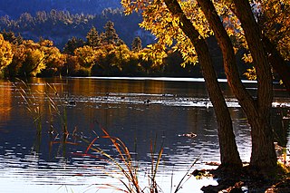
Lake Hughes is an unincorporated community in northern Los Angeles County, California. It is in the Sierra Pelona Mountains, northwest of Palmdale and north of the Santa Clarita Valley, in the Angeles National Forest. It is on the sag pond waters of Lake Hughes and Elizabeth Lake. The community is rural in character, with a population of 649 in 2010, but also has a strong recreational element centered on the three lakes in the vicinity. The community of Elizabeth Lake is located just east of Lake Hughes, sharing the same ZIP code.

Anthony Charles Beilenson was an American lawyer and politician who served as a Democratic Congressman from Southern California. He served ten terms in the United States House of Representatives from 1977 until 1997.

Bouquet Reservoir is an artificial lake in the Angeles National Forest of Los Angeles County, California about 15 miles (24 km) west from Palmdale.
Lake Perris is an artificial lake completed in 1973. It is the southern terminus of the California State Water Project, situated in a mountain-rimmed valley between Moreno Valley and Perris, in what is now the Lake Perris State Recreation Area. The park offers a variety of recreational activities. Because of this and the lake's proximity to major population centers, it is very crowded during the summer months.

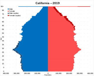
California is the most populated U.S. state, with an estimated population of 38.9 million as of 2023. It has people from a wide variety of ethnic, racial, national, and religious backgrounds.

Lake Arrowhead is an artificial lake located in the San Bernardino Mountains on Little Bear Creek, a tributary of Deep Creek and the Mojave River. It has a surface area of approximately 780 acres (320 ha) and a capacity of 48,000 acre⋅ft (59,000 dam3). It is surrounded by the unincorporated community of Lake Arrowhead in San Bernardino County, California.

Cerro Coso Community College is a public community college in the Eastern Sierra region of Southern California. It was established in 1973 as a separate college within the Kern Community College District. The college offers traditional and online courses and two-year degrees. The college serves an area of approximately 18,000-square-miles. Cerro Coso has five instructional sites: Eastern Sierra Center Bishop and Mammoth Lakes, Indian Wells Valley, Kern River Valley, and South Kern. The college also has an Incarcerated Student Education Program in two locations, the California City Correctional Facility and Tehachapi California Correctional Institution.

There are 9 routes assigned to the "N" zone of the California Route Marker Program, which designates county routes in California. The "N" zone includes county highways lying in Los Angeles and Orange counties.

Castaic Power Plant, also known as the Castaic Pumped-Storage Plant, is a seven unit pumped-storage hydroelectric plant, operated by the Los Angeles Department of Water and Power, which provides peak load power from the falling water on the West Branch of the California State Aqueduct. It is a cooperative venture between the LADWP and the Department of Water Resources of the State of California. An agreement between the two organizations was signed on September 2, 1966, for construction of the project.

Norco College is a public community college in Norco, California. Norco College is part of the Riverside Community College District (RCCD), which is part of the larger California Community Colleges System.
Centennial, California is a proposed 12,323-acre (49.87 km2) master-planned community on Tejon Ranch in northwestern Los Angeles County between Bakersfield and Los Angeles. It is situated in the far western Antelope Valley at the foothills of the Sierra Pelona and Tehachapi Mountains. It would be built along California State Route 138 east of Interstate 5 and northeast of Quail Lake.


