Related Research Articles

The Dominican Republic is a country located in the island of Hispaniola, in the Greater Antilles archipelago of the Caribbean region. It occupies the eastern five-eighths of the island, which it shares with the nation of Haiti, making Hispaniola one of two Caribbean islands, along with Saint Martin, that are shared by two sovereign states. The Dominican Republic is the second-largest Caribbean nation by area at 48,671 square kilometers (18,792 sq mi), and third by population with approximately 10 million people, of which approximately three million live in the metropolitan area of Santo Domingo, the capital city.

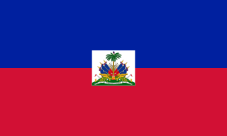
Haiti, officially the Republic of Haiti and formerly called Hayti, is a country located on the island of Hispaniola, east of Cuba in the Greater Antilles archipelago of the Caribbean Sea. It occupies the western three-eighths of the island, which it shares with the Dominican Republic. Haiti is 27,750 square kilometres (10,714 sq mi) in size and has an estimated 10.8 million people, making it the most populous country in the Caribbean Community (CARICOM) and the second-most populous country in the Caribbean as a whole.

The Republic of Haiti comprises the western three-eighths of the island of Hispaniola, west of the Dominican Republic. Haiti is positioned east of the neighboring island of Cuba, between the Caribbean Sea and the North Atlantic Ocean. Haiti's geographic coordinates are at a longitude of 72° 25′ west and a latitude of 19° 00′ north.

Hispaniola is an island in the Caribbean island group known as the Greater Antilles. It is the second largest island in the Caribbean after Cuba, and the most populous island in the Caribbean; it is also the eleventh most populous island in the world.

Nel Ust Wyclef Jean is a Haitian rapper, musician and actor. At the age of nine, Jean emigrated to the United States with his family. He first achieved fame as a member of the New Jersey hip hop group the Fugees. Jean has won three Grammy Awards for his musical work.

Centre is one of the ten departments of Haiti, located in the center of the country along the border with the Dominican Republic. As of 2015, its estimated population was 746,236. Its capital is Hinche. It borders the Dominican Republic to the east and is the only landlocked department in Haiti.

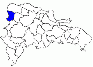
Dajabón is a province of the Dominican Republic, on the border with Haiti. Its capital city is also called Dajabón.

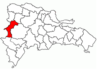
Elías Piña is one of the 32 provinces of the Dominican Republic. It is located in the western part of the country, on the border with Haiti. Its capital city is Comendador.

Little Haiti, is a neighborhood of Miami, Florida, United States. It is known historically as Lemon City, Little River and Edison. It is home to many Haitian immigrant residents, as well as many residents from the rest of the Caribbean. The fastest growing group in the area is Hispanic.

Jérémie is a commune and capital city of the Grand'Anse department in Haiti. It had a population of about 31,000 at the 2003 census. It is relatively isolated from the rest of the country. The Grande-Anse River flows near the city.

Carrefour is a largely residential commune in the Port-au-Prince Arrondissement, in the Ouest department of Haiti. The commune had a population of 373,916 at the 2003 Census, and was officially estimated to have grown to 511,345 inhabitants in 2015. It is mostly a bedroom community for those who work in central Port-au-Prince.

The Artibonite River is a 320 km long river in Haiti. It is the longest as well as the most important river in Haiti and the longest on the island of Hispaniola. Forming part of the international border between Haiti and the Dominican Republic, the river's sources are in the Cordillera Central in the Dominican Republic, however most of its length lies in Haiti. The river empties into the Gulf of Gonâve.

Dajabón is the capital city of the Dajabón province in the Dominican Republic, located on the border with Haiti. It is a market town with a population of about 40,000, north of the Cordillera Central mountain range.

San Francisco de Bánica, or simply Bánica, is a municipality of the Elías Piña province, on the border with Haiti and near the Artibonite river. The name Bánica comes from the Taíno name of the region, Banique.

Haiti has a sizable diaspora, present chiefly in the Dominican Republic, the United States, Canada, Cuba, the Bahamas, and France. They also live in other countries like Belgium, Jamaica, Turks and Caicos, Mexico, U.S. Virgin Islands, Brazil and Chile, among others.

The Parsley Massacre, took place in October 1937 against Haitians living in the Dominican Republic's northwestern frontier and in certain parts of the contiguous Cibao region. Dominican Army troops, who came from different areas of the country, carried out the massacre on the direct orders of the Dominican dictator Rafael Trujillo. Haitian President Élie Lescot put the death toll at 12,168; in 1953, the Haitian historian Jean Price-Mars cited 12,136 deaths and 2,419 injuries. In 1975, Joaquín Balaguer, the Dominican Republic's interim Foreign Minister at the time of the massacre, put the number of dead at 17,000. Other estimates compiled by the Dominican historian Bernardo Vega went as high as 35,000.

Baraderes is a commune in the Nippes department in the southwest part of Haiti. The town has a picturesque market square with a large church. There are few shops and no hotels. The area economy is based on subsistence agriculture, although a small association of subsistence farmers, Kafe Devlopman Barade, began exporting coffee to the U.S. in 2008. The town is vulnerable to flooding and is accessible via a rocky dirt road. The road is periodically improved, but remains passable only by lorries or high-clearance, four-wheel-drive vehicles. Baradères is also accessible by boat from Petite Trou de Nippes, but sedimentation has made the Bay of Baradères very shallow in places and difficult to navigate—even by canoe. The river mouth is increasingly being blocked by sediment. This sediment is a result of severe soil erosion upstream. Primary causes of the erosion probably are riverbank scouring during heavy rainstorms, along with deforestation and cropping of hillsides in the Baradères River valley.

Boucan-Carré is a commune in the Mirebalais Arrondissement, in the Centre department of Haiti. It has 48,700 inhabitants.

The 2010 Haiti earthquake was a catastrophic magnitude 7.0 Mw earthquake, with an epicenter near the town of Léogâne (Ouest), approximately 25 kilometres (16 mi) west of Port-au-Prince, Haiti's capital. The earthquake occurred at 16:53 local time on Tuesday, 12 January 2010.
The 2010 Haitian cholera outbreak was the first modern large-scale outbreak of cholera – a disease once considered beaten back largely due to the invention of modern sanitation. Since its reintroduction to Haiti in October 2010, cholera has spread across the country and has become endemic, causing high levels of both morbidity and mortality. Since its reintroduction to Haiti following the 2010 Haitian earthquake, nearly 800,000 Haitians have been infected by cholera, and more than 9,000 have died, according to the United Nations (UN). Cholera transmission in Haiti today is largely a function of eradication efforts including WASH, education, and oral vaccination, and climate variability. Early efforts were made to cover up the source of the epidemic, but thanks largely to the investigations of journalist Jonathan M. Katz and epidemiologist Renaud Piarroux, today it is widely believed to be the result of contamination by infected United Nations peacekeepers deployed from Nepal. In terms of total infections, the outbreak has since been surpassed by the war-fueled 2016–17 Yemen cholera outbreak, although the Haiti outbreak is still the most deadly modern outbreak.
References
| This article related to a river in Haiti is a stub. You can help Wikipedia by expanding it. |