The Delaware River Region refers to an area in western New Jersey (USA) along the Delaware River border with Pennsylvania. It encompasses Burlington County, Camden County, Gloucester County, Mercer County, and Salem County. The area is primarily part of Greater Philadelphia with the exception of Mercer County, which is part of the New York City Metropolitan Area. It is one of six officially recognized tourism regions by the New Jersey Department of Tourism, the others being the Greater Atlantic City Region, the Skylands Region, the Southern Shore Region, the Shore Region and the Gateway Region.

Chitose-Funabashi Station is a stop on the Odawara Line by Odakyu Electric Railway and is located in Setagaya, Tokyo, Japan.

San Lorenzo is a town and municipality in the Nariño Department, Colombia.
Wolica is a village in the administrative district of Gmina Brześć Kujawski, within Włocławek County, Kuyavian-Pomeranian Voivodeship, in north-central Poland.

Paramekkavu Bagavathi Temple is one of the largest Bagavathi temples in Kerala located in Thrissur City. Thiruvambadi Sri Krishna Temple is one of the two rival groups participating in Thrissur Pooram, which is the biggest festival in South India and Kerala. The Paramekkavu temple devaswom have a school known as Paramekkavu Vidya Mandir at MLA road near Kutoor and one KG section near to the temple itself.
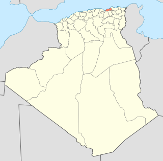
Sidi Maârouf is a district in Jijel Province, Algeria. It was named after its capital, Sidi Maârouf.
Greek Islands is a restaurant in Chicago, Illinois, founded by Anastasios Koloios and located at 200 S. Halsted Street in the Greektown neighborhood to the immediate west of downtown Chicago. It was founded in 1971, and does a thriving business to good reviews. Similar to other Greek restaurants in Chicago, it serves saganaki, but has above-average seafood. In January 2008 it was featured on the Food Network's The Hungry Detective. They have a second location in Lombard, Illinois.
Probable ribosome biogenesis protein RLP24 is a protein that in humans is encoded by the RSL24D1 gene.
Kostry-Noski is a village in the administrative district of Gmina Nowe Piekuty, within Wysokie Mazowieckie County, Podlaskie Voivodeship, in north-eastern Poland.

Stare Wądołki is a village in the administrative district of Gmina Zambrów, within Zambrów County, Podlaskie Voivodeship, in north-eastern Poland.
Żrekie is a village in the administrative district of Gmina Kramsk, within Konin County, Greater Poland Voivodeship, in west-central Poland.
Przysieka is a village in the administrative district of Gmina Stare Miasto, within Konin County, Greater Poland Voivodeship, in west-central Poland.
Kuczaba is a mountain in the Owl Mountains, part of Central Sudetes. Its height is 654 meters. It lies in Owl Mountains Landscape Park.

Birkenstein is a railway station located in Birkenstein, in the Märkisch-Oderland district of Brandenburg. It is served by the S-Bahn line S 5.
Ibitiara is a municipality in the state of Bahia in the North-East region of Brazil.

Bir El Hafey is a town and commune located at 34°55′48″N 9°12′00″E in the Sidi Bouzid Governorate, in Tunisia. As of 2004 it had a population of 36,405.

Vojkovići is a village in the municipality of Tomislavgrad, Bosnia and Herzegovina.
Molmanatti is a village in Belgaum district of Karnataka, India.
Kışlak is a village in the District of Gercüş, Batman Province, Turkey. As of 2011 it had a population of 37 people.

Migdal HaEmek–Kfar Baruch railway station is an Israel Railways passenger station situated on the Jezreel Valley railway. It is served by one to two trains per hour in each direction.


