
The Maryland Transit Administration (MTA) is a state-operated mass transit administration in Maryland, and is part of the Maryland Department of Transportation. It is better known as MTA Maryland to avoid confusion with other cities' transit agencies who share the initials MTA. The MTA operates a comprehensive transit system throughout the Baltimore-Washington Metropolitan Area. There are 80 bus lines serving Baltimore's public transportation needs, along with other services that include the Light Rail, Metro Subway, and MARC Train. With nearly half the population of Baltimore residents lacking access to a car, the MTA is an important part of the regional transit picture. The system has many connections to other transit agencies of Central Maryland, Washington, D.C., Northern Virginia, and south-central Pennsylvania : WMATA, Charm City Circulator, Regional Transportation Agency of Central Maryland, Annapolis Transit, Rabbit Transit, Ride-On, and TransIT.

U.S. Route 13 is a U.S. Highway running from Fayetteville, North Carolina north to Morrisville, Pennsylvania. In the U.S. state of Maryland, the route runs 42.48 mi (68.36 km) from the Virginia border south of Pocomoke City in Worcester County north to the Delaware border in Delmar, Wicomico County, where the route intersects Route 54, which runs along the state line. The majority of the route within Maryland is a four-lane divided highway that passes through rural areas of woodland and farmland. The route also runs through a few municipalities including Pocomoke City and Princess Anne and it bypasses Salisbury and Fruitland to the east on the Salisbury Bypass, which is a freeway. US 13 intersects many major roads including the southern terminus of US 113 in Pocomoke City, Maryland Route 413 in Westover, and MD 12 and US 50 where the route is on the Salisbury Bypass. The route shares a concurrency with US 50 along a portion of the Salisbury Bypass.
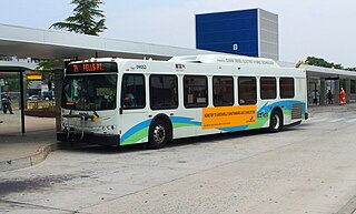
Route 51 is a bus route operated by the Maryland Transit Administration in Baltimore and its suburbs. The line currently runs from the center of Towson to the Inner Harbor in Downtown Baltimore, serving the Charles Street corridor. Route 51 replaced Route 11 on June 18, 2017 due to the BaltimoreLink bus system overhaul.
Mondawmin station is a Metro SubwayLink station in Baltimore, Maryland. It is located under the intersection of Reisterstown Road and Liberty Heights Avenue in the Mondawmin neighborhood, adjacent to the Mondawmin Mall. It is the northernmost underground station on the line, and a major transfer point to many bus routes.

The Maryland Transit Administration was originally known as the Baltimore Metropolitan Transit Authority, then the Maryland Mass Transit Administration before it changed to its current name in October 2001. The MTA took over the operations of the old Baltimore Transit Company on April 30, 1970.
TransIT Services of Frederick County is a public transportation agency in Frederick County, Maryland, that is operated by the county government. The agency currently operates 9 Connector bus routes, mostly in the city of Frederick, 5 shuttles, and demand-response for seniors and persons with disabilities. TransIT provides connections to other public transportation services in the region, including the MTA Maryland's routes 204 and 515 commuter bus and MARC Train service. According to the agency's homepage, the service had approximately 909,800 boardings in FY 2012.

The Maryland Transit Administration provides the primary public bus service for the Baltimore Metropolitan Area and commuter bus service in other parts of the state of Maryland. There are currently 76 bus routes, which include 43 LocalLink routes, 12 High Frequency CityLink Routes routes, 9 express bus routes, 19 commuter bus routes, and 5 Intercounty Connector or "ICC" routes. The local and commuter bus routes operate in conjunction with one subway line, three light rail lines, MARC train service, and various connections to other transit agencies.

Patapsco station is a Baltimore Light Rail station in Halethorpe, Maryland. The stop is located along Patapsco Avenue from which its name is derived. The station serves as a hub for several MTA bus routes. Patapsco was the final stop along the line for a period from September 1992 until April 1993, when the line was extended to Linthicum.
Walbrook is a neighborhood in West Baltimore, located along West North Avenue. Coppin State College is located in Walbrook.
U.S. Route 40 has at least nine extant special routes.

Baltimore Highlands is a neighborhood in the Southeast District of Baltimore, located between the neighborhoods of Patterson Park and Kresson. Its boundaries are drawn by Pulaski Highway (north), East Baltimore Street (south), Haven Street (east) and North Clinton Street (west).
Greenspring is a neighborhood in the North District of Baltimore, located between the neighborhoods of Woodberry (east) and Central Park Heights (west). Its boundaries are marked by West Cold Spring Lane (north), Greenspring Avenue (east), and Springhill Avenue (south). The western edge of the neighborhood runs along Pimlico Road from West Cold Spring Lane to Park Heights Avenue, then along Park Heights Avenue to Springhill Avenue.

Beverly Hills is a neighborhood in the Northeast District of Baltimore, located between the neighborhoods of Moravia-Walther, Arcadia and Lauraville. Its boundaries are drawn by Harford Road (west), Weaver Avenue (south), Harcourt Road (east), Moravia Road (northeast) and Grindon Avenue (north).
Hanlon Longwood is a neighborhood in the Northwest District of Baltimore, located between the neighborhoods of Garwyn Oaks (west) and Burleigh–Leighton (east). It is bounded by North Dukeland Street (east), Garrison Boulevard (west) and the Gwynns Falls Parkway (south). The neighborhood's north boundary is marked by North Longwood Street, North Hilton Street and Liberty Heights Avenue.
Westgate is a neighborhood in the Southwest District of Baltimore, located between Baltimore County (west) and the city neighborhood of Ten Hills (east). Its boundaries are marked by Baltimore National Pike (north), Frederick Avenue (south), Rock Glen Avenue and Edmondson Avenue (east) and the city line (west).
Better Waverly is a neighborhood in the North District of Baltimore, located between the neighborhoods of Charles Village (west) and Coldstream-Homestead-Montebello (east). Its boundaries are marked by East 33rd Street (north), Exeter Hall Avenue (south), Greenmount Avenue (west) and Loch Raven Road (east).
Martz Group is an apportioned bus company headquartered in Wilkes-Barre, Pennsylvania, operating intercity commuter buses, charter buses, and tours. The company operates Martz Trailways, which is a part of the Trailways Transportation System. Martz Trailways provides intercity commuter bus service from the Wyoming Valley cities of Wilkes-Barre and Scranton and the Pocono Mountains in Northeastern Pennsylvania to New York City and Philadelphia. The company also runs buses connecting Northeastern Pennsylvania to the casinos in Atlantic City, New Jersey and Sands Casino Resort Bethlehem. Martz Group also operates the Gold Line commuter service and Gray Line sightseeing service in Washington, D.C., the National Coach Works in Fredericksburg, Virginia, and the First Class Coach Company Trailways serving Tampa and St. Petersburg in Florida.


