Rural Municipality of Lipton No. 217

Last updated

Lipton No. 217
Rural Municipality of Lipton No. 217
SK RM 217 Lipton.svg
Location of the RM of Lipton No. 217 in Saskatchewan
Coordinates: 50°57′07″N103°53′24″W / 50.952°N 103.890°W / 50.952; -103.890 [1]
Country Canada
Province Saskatchewan
Census division 6
SARM division 1
Formed [2] December 11, 1911
Government
[3]
   Reeve Corey Senft
  Governing bodyRM of Lipton No. 217 Council
  AdministratorFrank Kosa
  Office location Lipton
Area
 (2016) [4]
  Land813.69 km2 (314.17 sq mi)
Population
 (2016) [4]
  Total381
  Density0.5/km2 (1/sq mi)
Time zone CST
  Summer (DST) CST
Area code(s) 306 and 639

The Rural Municipality of Lipton No. 217 (2016 population: 381) is a rural municipality (RM) in the Canadian province of Saskatchewan within Census Division No. 6 and SARM Division No. 1.

Contents

History

The RM of Lipton No. 217 incorporated as a rural municipality on December 11, 1911. [2]

Heritage properties

There are three historical sites located within the RM.

Fort Qu'Appelle-Touchwood Hills Trail

A section of the Carlton Trail [8] from the Touchwood Hills [9] to the Fishing Lakes in Qu'Appelle Valley was called the Fort Qu'Appelle-Touchwood Hills Trail [10] and a portion of it passed through the RM of Lipton No. 217. The route was used regularly by traders, settlers, Métis, and First Nations from the 1850s until 1890 when the railway came through the area. The Dominion Telegraph line was built alongside the trail. In 1885 General Frederick Middleton used this trail with his column of militia en route to Batoche, Saskatchewan during the North-West Rebellion. After the completion of the railway, the trail continued to be used by locals. Eventually, though, with the introduction of the automobile, the trail, and many others like it, fell into disuse and were often ploughed over. [11]

A section of the Fort Qu'Appelle-Touchwood Hills Trail is commemorated as a historic site alongside Highway 35 north of the town of Fort Qu'Appelle in the RM of Lipton No. 217. The site has a cairn and is .13 ha (0.32 acres) in size. Ruts from the Red River carts can still be seen in the prairie grass by the site. [12]

Geography

Communities and localities

The following urban municipalities are surrounded by the RM.

Villages

It also surrounds the Village of Dysart.

Demographics

Population history
(1981–2016)
YearPop.±%
1981686    
1986661−3.6%
1991607−8.2%
1996 533−12.2%
2001 512−3.9%
2006 427−16.6%
2011 424−0.7%
2016 381−10.1%
Source: Statistics Canada via Saskatchewan Bureau of Statistics [13] [14]

In the 2021 Census of Population conducted by Statistics Canada, the RM of Lipton No. 217 had a population of 388 living in 168 of its 191 total private dwellings, a change of

In the 2016 Census of Population, the RM of Lipton No. 217 recorded a population of 381 living in 158 of its 189 total private dwellings, a

Government

The RM of Lipton No. 217 is governed by an elected municipal council and an appointed administrator that meets on the first Tuesday of every month. [3] The reeve of the RM is Corey Senft while its administrator is Frank Kosa. [3] The RM's office is located in Lipton. [3]

See also

Related Research Articles

<span class="mw-page-title-main">Rural Municipality of Abernethy No. 186</span> Rural municipality in Saskatchewan, Canada

The Rural Municipality of Abernethy No. 186 is a rural municipality (RM) in the Canadian province of Saskatchewan within Census Division No. 6 and SARM Division No. 1. It is located on the Qu'Appelle River.

<span class="mw-page-title-main">Rural Municipality of North Qu'Appelle No. 187</span> Rural municipality in Saskatchewan, Canada

The Rural Municipality of North Qu'Appelle No. 187 is a rural municipality (RM) in the Canadian province of Saskatchewan within Census Division No. 6 and SARM Division No. 1. It is located in the south-east portion of the province.

<span class="mw-page-title-main">Rural Municipality of South Qu'Appelle No. 157</span> Rural municipality in Saskatchewan, Canada

The Rural Municipality of South Qu'Appelle No. 157 is a rural municipality (RM) in the Canadian province of Saskatchewan within Census Division No. 6 and SARM Division No. 1. It is located in the southeast portion of the province.

<span class="mw-page-title-main">Rural Municipality of Happy Valley No. 10</span> Rural municipality in Saskatchewan, Canada

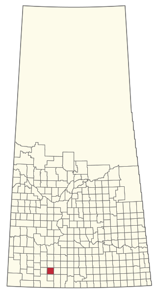
The Rural Municipality of Happy Valley No. 10 is a rural municipality (RM) in the Canadian province of Saskatchewan within Census Division No. 2 and SARM Division No. 2. Located in the southeast portion of the province, it is adjacent to the United States border, neighbouring Daniels County and Sheridan County in Montana.

<span class="mw-page-title-main">Rural Municipality of Auvergne No. 76</span> Rural municipality in Saskatchewan, Canada

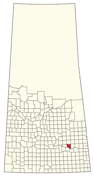
The Rural Municipality of Auvergne No. 76 is a rural municipality (RM) in the Canadian province of Saskatchewan within Census Division No. 3 and SARM Division No. 3.

<span class="mw-page-title-main">Rural Municipality of Rocanville No. 151</span> Rural municipality in Saskatchewan, Canada

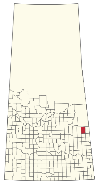
The Rural Municipality of Rocanville No. 151 is a rural municipality (RM) in the Canadian province of Saskatchewan within Census Division No. 5 and SARM Division No. 1. It is located in the southeast portion of the province.

<span class="mw-page-title-main">Rural Municipality of Rosthern No. 403</span> Rural municipality in Saskatchewan, Canada

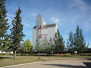
The Rural Municipality of Rosthern No. 403 is a rural municipality (RM) in the Canadian province of Saskatchewan within Census Division No. 15 and SARM Division No. 5. It is located in the central portion of the province north of the City of Saskatoon.

<span class="mw-page-title-main">Rural Municipality of Cana No. 214</span> Rural municipality in Saskatchewan, Canada

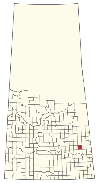
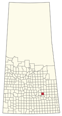
The Rural Municipality of Cana No. 214 is a rural municipality (RM) in the Canadian province of Saskatchewan within Census Division No. 5 and SARM Division No. 1. It is located in the southeast portion of the province.

<span class="mw-page-title-main">Rural Municipality of Tullymet No. 216</span> Rural municipality in Saskatchewan, Canada

The Rural Municipality of Tullymet No. 216 is a rural municipality (RM) in the Canadian province of Saskatchewan within Census Division No. 6 and SARM Division No. 1.

<span class="mw-page-title-main">Rural Municipality of Emerald No. 277</span> Rural municipality in Saskatchewan, Canada

The Rural Municipality of Emerald No. 277 is a rural municipality (RM) in the Canadian province of Saskatchewan within Census Division No. 10 and SARM Division No. 4.

<span class="mw-page-title-main">Rural Municipality of Clayton No. 333</span> Rural municipality in Saskatchewan, Canada

The Rural Municipality of Clayton No. 333 is a rural municipality (RM) in the Canadian province of Saskatchewan within Census Division No. 9 and SARM Division No. 4.

<span class="mw-page-title-main">Rural Municipality of Coteau No. 255</span> Rural municipality in Saskatchewan, Canada

The Rural Municipality of Coteau No. 255 is a rural municipality (RM) in the Canadian province of Saskatchewan within Census Division No. 7 and SARM Division No. 3.

<span class="mw-page-title-main">Rural Municipality of Duck Lake No. 463</span> Rural municipality in Saskatchewan, Canada

The Rural Municipality of Duck Lake No. 463 is a rural municipality (RM) in the Canadian province of Saskatchewan within Census Division No. 15 and SARM Division No. 5.

<span class="mw-page-title-main">Rural Municipality of Kellross No. 247</span> Rural municipality in Saskatchewan, Canada

The Rural Municipality of Kellross No. 247 is a rural municipality (RM) in the Canadian province of Saskatchewan within Census Division No. 10 and SARM Division No. 4.

<span class="mw-page-title-main">Rural Municipality of King George No. 256</span> Rural municipality in Saskatchewan, Canada

The Rural Municipality of King George No. 256 is a rural municipality (RM) in the Canadian province of Saskatchewan within Census Division No. 7 and SARM Division No. 3.

<span class="mw-page-title-main">Rural Municipality of Kinistino No. 459</span> Rural municipality in Saskatchewan, Canada

The Rural Municipality of Kinistino No. 459 is a rural municipality (RM) in the Canadian province of Saskatchewan within Census Division No. 15 and SARM Division No. 5.

<span class="mw-page-title-main">Rural Municipality of Touchwood No. 248</span> Rural municipality in Saskatchewan, Canada

The Rural Municipality of Touchwood No. 248 is a rural municipality (RM) in the Canadian province of Saskatchewan within Census Division No. 10 and SARM Division No. 4.

<span class="mw-page-title-main">Rural Municipality of Livingston No. 331</span> Rural municipality in Saskatchewan, Canada

The Rural Municipality of Livingston No. 331 is a rural municipality (RM) in the Canadian province of Saskatchewan within Census Division No. 9 and SARM Division No. 4.

<span class="mw-page-title-main">Rural Municipality of Loon Lake No. 561</span> Rural municipality in Saskatchewan, Canada

The Rural Municipality of Loon Lake No. 561 is a rural municipality (RM) in the Canadian province of Saskatchewan within Census Division No. 17 and SARM Division No. 6.

<span class="mw-page-title-main">Rural Municipality of Sliding Hills No. 273</span> Rural municipality in Saskatchewan, Canada

The Rural Municipality of Sliding Hills No. 273 is a rural municipality (RM) in the Canadian province of Saskatchewan within Census Division No. 9 and SARM Division No. 4.

References

  1. "Pre-packaged CSV files - CGN, Canada/Province/Territory (cgn_sk_csv_eng.zip)". Government of Canada. July 24, 2019. Retrieved May 23, 2020.
  2. 1 2 "Rural Municipality Incorporations (Alphabetical)". Saskatchewan Ministry of Municipal Affairs. Archived from the original on April 21, 2011. Retrieved May 9, 2020.
  3. 1 2 3 4 "Municipality Details: RM of Lipton No. 217". Government of Saskatchewan. Retrieved May 21, 2020.
  4. 1 2 3 "Population and dwelling counts, for Canada, provinces and territories, and census subdivisions (municipalities), 2016 and 2011 censuses – 100% data (Saskatchewan)". Statistics Canada. February 8, 2017. Retrieved May 1, 2020.
  5. Hayward School
  6. Jewish Cemetery
  7. Tomecko House
  8. Hall, Frank. "Carlton Trail—First Western Highway". Manitoba Historical Society. Retrieved April 29, 2022.
  9. "Touchwood Uplands". Canadian Geographical Names Database. Government of Canada. Retrieved April 29, 2022.
  10. "Fort Qu'Appelle-Touchwood Hills Trail Historic Site". Canadian Geographical Names Database. Government of Canada. Retrieved April 29, 2022.
  11. "Fort Qu'Appelle - Touchwood Hills Trail Provincial Historic Site". Canada's Historic Places. Parks Canada. Retrieved April 29, 2022.
  12. "Fort Qu'Appelle-Touchwood Hills Trail - Saskatchewan Historical Markers". Waymarking. Groundspeak, Inc. Retrieved April 29, 2022.
  13. "Saskatchewan Census Population" (PDF). Saskatchewan Bureau of Statistics. Archived from the original (PDF) on September 24, 2015. Retrieved May 9, 2020.
  14. "Saskatchewan Census Population". Saskatchewan Bureau of Statistics. Retrieved May 9, 2020.
  15. "Population and dwelling counts: Canada, provinces and territories, census divisions and census subdivisions (municipalities), Saskatchewan". Statistics Canada. February 9, 2022. Retrieved April 13, 2022.