Saint-Victor-et-Melvieu

Last updated
Saint-Victor-et-Melvieu
Saint-Victor 0931.JPG
A general view of Saint-Victor-et-Melvieu
Blason ville fr Saint-Victor-et-Melvieu (Aveyron).svg
Location of Saint-Victor-et-Melvieu
Saint-Victor-et-Melvieu
France location map-Regions and departements-2016.svg
Red pog.svg
Saint-Victor-et-Melvieu
Languedoc-Roussillon-Midi-Pyrenees region location map.svg
Red pog.svg
Saint-Victor-et-Melvieu
Coordinates: 44°03′07″N2°49′58″E / 44.0519°N 2.8328°E / 44.0519; 2.8328 Coordinates: 44°03′07″N2°49′58″E / 44.0519°N 2.8328°E / 44.0519; 2.8328
Country France
Region Occitanie
Department Aveyron
Arrondissement Millau
Canton Raspes et Lévezou
Government
  Mayor (20202026) Jean Capel [1]
Area
1
17.91 km2 (6.92 sq mi)
Population
 (Jan. 2018) [2]
351
  Density20/km2 (51/sq mi)
Time zone UTC+01:00 (CET)
  Summer (DST) UTC+02:00 (CEST)
INSEE/Postal code
12251 /12400
Elevation262–689 m (860–2,260 ft)
(avg. 632 m or 2,073 ft)
1 French Land Register data, which excludes lakes, ponds, glaciers > 1 km2 (0.386 sq mi or 247 acres) and river estuaries.

Saint-Victor-et-Melvieu (Languedocien: Sant Victor e Malviu) is a commune in the Aveyron department in southern France.

Contents

Geography

The reservoir of the Pinet dam on the Tarn, between Saint-Victor-et-Melvieu (to the left) and Viala-du-Tarn (on the opposite bank). Tarn Saint-Rome-de-Tarn belvedere Puech Gazal (vue sur mont Redon et barrage Pinet).jpg
The reservoir of the Pinet dam on the Tarn, between Saint-Victor-et-Melvieu (to the left) and Viala-du-Tarn (on the opposite bank).

Generalities

In the south of the Massif Central, in the southern half of the department of Aveyron, the commune of Saint-Victor-et-Melvieu is situated in the interior of natural regional park of the Grands Causses  [ fr ]. The communal territory, which extends for 17.91 km^2, is constituted of landscapes of avant-causses , characterized by hills. It is bordered on the north and northwest by the Tarn in the gorges called the Raspes  [ fr ], where the hydroelectric dams of Pinet  [ fr ] and of Truel  [ fr ] (or Pouget) are implanted.

The minimal altitude, with 262 meters, is localized at the extreme west, near the place called the May d'Entraygues, where the Tarn leaves the commune and enters that of Le Truel. The maximal altitude with 689 or 694 meters [note 1] is a kilometer and a half to the northwest of the village of Saint-Victor, at the Puech de Luargues. [3] [ verification needed ]

Hydrography

Hydrographic network

Hydrographic network and roads of Saint-Victor-et-Melvieu. 12251-Saint-Victor-et-Melvieu-Hydro.png
Hydrographic network and roads of Saint-Victor-et-Melvieu.

The commune is drained by the Tarn, the stream of Geneve, the stream of the Valade, an arm of Tarn[ clarification needed ], the stream of Pourquairol, the stream of Ricardel, and by several small courses of water. [4] [ verification needed ]

The Tarn, of a total length of 380.2km, has its source in the commune of Pont-de-Montvert-Sud-Mont-Lozère and ejects[ clarification needed ] in the Garonne at Saint-Nicolas-de-la-Grave, after having watered 99 communes. [5] [ verification needed ]

The Lac de Pinet completes the hydrographic network. It is related to a very wild lake on its part downstream[ clarification needed ], of a maximum depth of 25 meters and a superficial one of 130 ha. It is open to fishing at the upstream part up to Mas de Lanauq. It is in the territories and communes of Saint-Rome-de-Tarn, Saint-Victor-et-Melvieu, and Viala-du-Tarn. [6]

Management of courses of water

Administration of courses of water in the Aveyron basin is assured by the public establishment of management and administration of water  [ fr ] Aveyron upstream, created on 1 January 2017, replacing the mixed syndicate of basin slope Aveyron upstream. [7] [8] [ verification needed ]

Population

Historical population
YearPop.±%
1962278    
1968367+32.0%
1975296−19.3%
1982305+3.0%
1990299−2.0%
1999329+10.0%
2008374+13.7%

See also

Notes

  1. Two different values for the IGN, 694 meters on the chart and 689 on its ancient site.

Related Research Articles

Aveyron Department of France in Occitanie

Aveyron is a department in the Occitanie region of Southern France. Named after the Aveyron River, it had a population of 278,697 in 2016. Its inhabitants are known as Aveyronnais (masculine) or Aveyronnaises (feminine) in French. The inhabitants of Aveyron's prefecture, Rodez, are called Ruthénois, based upon the first Celtic settlers in the area, the Ruteni.

Communes of the Aveyron department Wikimedia list article

The following is a list of the 285 communes of the Aveyron department of France.

Tarn (river) River in southern France

The Tarn is a 380.2-kilometre (236.2 mi) long river in the administrative region of Occitanie in southern France. It is a right tributary of the Garonne.

Aveyron (river)

The Aveyron is a 291 km long river in southern France, right tributary of the Tarn. It rises in the southern Massif Central, near Sévérac-le-Château.

Viala-du-Tarn Commune in Occitanie, France

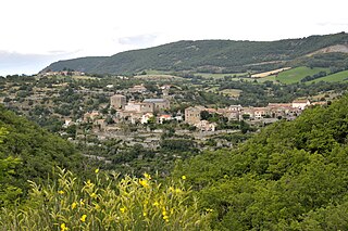
Viala-du-Tarn is a commune in the Aveyron department in southern France.

Arrondissement of Millau Arrondissement in Occitanie, France

The arrondissement of Millau is an arrondissement of France in the Aveyron department in the Occitanie region. It has 110 communes. Its population is 79,346 (2016), and its area is 3,741.7 km2 (1,444.7 sq mi).

Viaur River in southern France

The Viaur is a 168-kilometre-long (104 mi) river in south-western France. It is a left tributary of the Aveyron. Its source is in the southern Massif Central, north of Millau. It flows generally west through the following departments and towns:

Aguessac Commune in Occitanie, France

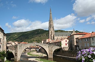
Aguessac is a commune in the Aveyron department in the Occitanie region of southern France.

La Bastide-Pradines Commune in Occitanie, France

La Bastide-Pradines is a commune in the Aveyron department in the Occitanie region of southern France.

La Bastide-Solages Commune in Occitanie, France

La Bastide-Solages is a commune in the Aveyron department in the Occitanie region of southern France.

Le Truel Commune in Occitanie, France

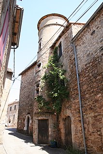
Le Truel is a commune in the Aveyron department in southern France. The village was in the ancient province of Rouergue where they spoke in the rouergat patois of Occitan.

Jonte (river) River in southern France

The Jonte is a 38.6 km (24.0 mi) river in southern France. It flows through the departments of Lozère and Aveyron. It is a tributary of the Tarn, which it joins in Le Rozier.

Dourbie River in southern France

The Dourbie is a 72 km (45 mi) long river in southern France. It is a left tributary of the Tarn. Its source is north of Le Vigan, in the Cévennes. It flows generally west through the following departments and towns:

Cérou River in southern France

The Cérou is an 87.1 km (54.1 mi) long river in the Aveyron and Tarn departments in southern France. Its source is at Saint-Jean-Delnous, 1.8 km (1.1 mi) northwest of the village. It flows generally west-northwest. It is a left tributary of the Aveyron, into which it flows at Milhars, 1.4 km (0.87 mi) north of the village.

Dourdou de Camarès River in southern France

The Dourdou de Camarès is an 86.8 km (53.9 mi) long river in the Tarn, Hérault and Aveyron departments in southern France. Its source is in the Parc naturel régional du Haut-Languedoc, in the commune of Murat-sur-Vèbre, 5.5 km (3.4 mi) southeast of the village. It flows generally northwest. It is a left tributary of the Tarn into which it flows at Broquiès, 1.2 km (0.75 mi) southwest of the village.

Sorgues (river) River in Southern France

The Sorgues is a 46.4-kilometre-long (28.8 mi) river in the Aveyron department in Southern France. Its source is a karstic spring at Cornus, on the Causse du Larzac. It flows generally west-northwest. It is a right tributary of the Dourdou de Camarès, into which it flows at Vabres-l'Abbaye.

Vère River in southern France

The Vère is a 53.2-kilometre-long (33.1 mi) river in the Tarn and Tarn-et-Garonne departments in southern France. Its source is at Taïx. It flows generally west-northwest. It is a left tributary of the Aveyron, into which it flows at Bruniquel.

Pinet (power station) Dam in St Victor et Melvieu, Aveyron

Pinet is a dam and hydroelectric power station on the River Tarn in Saint-Victor-et-Melvieu in Aveyron, southern France.

Lévézou

The Lévézou is a geographical region in the Aveyron department in southern France. It is an impervious crystalline plateau with an average altitude of around 900m. Its highest point is Mont Seigne. Though its borders are not strictly defined, it is bounded in the south and east by the River Tarn and to the north by the Viaur. To the west it merges into the Ségala.

The canton of Tarn et Causses is an administrative division of the Aveyron department, southern France. It was created at the French canton reorganisation which came into effect in March 2015. Its seat is in Sévérac-d'Aveyron.

References

  1. "Répertoire national des élus: les maires". data.gouv.fr, Plateforme ouverte des données publiques françaises (in French). 9 August 2021.
  2. "Populations légales 2018". The National Institute of Statistics and Economic Studies. 28 December 2020.
  3. "Géoportail". www.geoportail.gouv.fr. Retrieved 2021-07-20.
  4. "Fiche Ma Commune - SIGES Occitanie - ©2021". sigesocc.brgm.fr. Retrieved 2021-07-20.
  5. Sandre. "Le tarn [O---0100] - Cours d'eau". www.sandre.eaufrance.fr (in French). Retrieved 2021-07-20.
  6. "Lac de Pinet, Viala-du-Tarn". Tourisme Aveyron (in French). Retrieved 2021-07-20.
  7. "BANATIC, la base nationale sur l'intercommunalité". www.banatic.interieur.gouv.fr. Retrieved 2021-07-20.
  8. "Aveyron amont | Gest'eau". www.gesteau.fr. Retrieved 2021-07-20.