Related Research Articles

Cuautitlán Izcalli is a city and municipality in the north of State of Mexico, Mexico. The name comes from Náhuatl and means 'your house among the trees.'

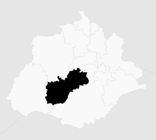
Linares is a small city in the state of Nuevo León, Mexico. The city serves as the administrative centre for the surrounding municipality of the same name and it is the largest urban centre of the so-called "orange belt" region. The city had a 2005 census population of 56,065, while the municipality's population was 71,061. The city and the municipality both rank tenth in population in the state. The municipality has an area of 2,445.2 km² and lies in the east-southeast part of the state on the border with the state of Tamaulipas. The municipality of Hualahuises is an enclave of Linares municipality.

La Paz is a municipality in the State of Mexico, Mexico, with its seat at the town of Los Reyes Acaquilpan. It is located on the dividing line between Mexico State and the eastern edge of the Federal District and is part of the Greater Mexico City area. The area was part of a region called "Atlicpac" which in Náhuatl means 'above or at the edge of water.' The current city's/municipality's glyph symbolizes water.

Cuautitlán is a city and municipality in the State of Mexico, just north of the northern tip of the Federal District within the Greater Mexico City urban area. The city has engulfed most of the municipality, making the two synonymous. The name comes from Nahuatl and means 'between the trees.'

Coacalco de Berriozábal is a city and municipality in the State of Mexico, Mexico. The municipality lies in the Greater Mexico City conurbation, north of Mexico City. The municipal seat is San Francisco Coacalco and the municipality is named after Felipe Berriozábal (1829–1900), a Mexican politician and military leader.
San Pablo de las Salinas is the second-largest town in Tultitlán Municipality in the State of Mexico, Mexico. The town is part of the Mexico City metropolitan area and had a 2010 census population of 189,453 inhabitants, or 36.15% of the municipal population. The town lies near the northern tip of the Federal District. It is the third-largest locality in Mexico that is not a municipal seat.
Buenavista is the largest town in Tultitlán Municipality in State of Mexico, Mexico. The town is part of the Mexico City metropolitan area and had a 2010 census population of 206,081 inhabitants, or 39.32% of its municipal population of 524,074. The town lies near the northern tip of the Federal District. It is the second-largest locality in Mexico that is not a municipal seat. Tultitlán Municipality's seat lies in the town of Tultitlán de Mariano Escobedo, with a population of 31,936.

Fuentes del Valle is the third-largest town in Tultitlán Municipality in Mexico State, Mexico. The town is part of the Mexico City metropolitan area and had a 2010 census population of 74,087 inhabitants. The town lies near the northern tip of the Federal District, and between the larger Buenavista and San Pablo de las Salinas.
Ojo de Agua is the largest town in the municipality of Tecámac in State of Mexico, [[Mexico], also known as “Tierra de heroes”. It is located in the northeastern part of the state, northeast of the Federal District and within the Greater Mexico City urban area. It had a 2010 census population of 242,272 inhabitants, or 66.45 percent of its municipality's total of 364,579. Ojo de Agua is the largest locality in Mexico that is not a municipal seat. Ojo de Agua lies at an elevation of 2,248 m above sea level.
Atarjea is a Mexican city and municipality located in the easternmost region of the state of Guanajuato, within the Sierra Gorda range. The municipality has an area of 318 square kilometres and is bordered to the north by the state of San Luis Potosí, to the east and south by the state of Querétaro, and to the west by Xichú. The municipality had a population of 5,198 according to the 2005 census.
Susupuato is a municipality in the eastern part of the Mexican state of Michoacán. The municipality has an area of 273.33 square kilometres and is bordered to the north by the municipality of Juárez, to the east and south by the state of México, and to the west by Tuzantla. The municipality had a population of 7,703 inhabitants according to the 2005 census. Its municipal seat is the city of Susupuato de Guerrero.
Taretan is a municipality located in the central part of the Mexican state of Michoacán. The municipality has an area of 185.23 square kilometres and is bordered to the north by the municipality of Ziracuaretiro, to the east by Salvador Escalante and Ario, to the south by Gabriel Zamora and Nuevo Urecho, and to the west by Uruapan The municipality had a population of 12,294 inhabitants according to the 2005 census. Its municipal seat is the city of the same name.
Peribán is a municipality located in the western part of the Mexican state of Michoacán. The municipality has an area of 331.87 square kilometres and is bordered to the north by the municipality of Los Reyes, to the east by Uruapan, to the southeast by Tancítaro, to the south by Buenavista, and to the west by the state of Jalisco. The municipality had a population of 20,965 inhabitants according to the 2005 census. Its municipal seat is the city of Peribán de Ramos.
Charapan is a municipality located in the north-western part of the Mexican state of Michoacán. The municipality has an area of 233.16 square kilometres and is bordered to the north by the municipalities of Tangancícuaro and Chilchota, to the east by Paracho, to the south by Uruapan, and to the west by Los Reyes. The municipality had a population of 10,867 inhabitants according to the 2005 census. Its municipal seat is the city of the same name.
Zumpuhuacán is a municipality in the State of Mexico. Its municipal seat is also called Zumpahuacán: The area was settled by Mexicas in 1220.
Jesús María is a municipality in the Mexican state of Aguascalientes. It stands at 21°58′N102°21′W. As of 2010, the municipality had a total population of 99,590.
San Agustín Tlaxiaca is a town and one of the 84 municipalities of Hidalgo, in central-eastern Mexico. The municipality covers an area of 354.6 km².

Ocoyoacac is a town and municipality in the State of Mexico in Mexico. The municipality covers an area of 134.71 km². It is one of the 17 municipalities that border Mexico City. It borders the Distrito Federal's western borough of Cuajimalpa.

Hueypoxtla is the municipality located in Zumpango Region, the northeastern part of the state of Mexico in Mexico. The municipality is located at a northern pass leading out of the Valley of Mexico and Mezquital Valley to—kilometers north of Mexico City and about km northeast of the state capital of Toluca. The name comes from Nahuatl and means "place of great merchants".
References
- Link to tables of population data from Census of 2005 INEGI: Instituto Nacional de Estadística, Geografía e Informática