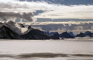
New Swabia is a cartographic name sometimes given to an area of Antarctica between 20°E and 10°W in Queen Maud Land, which is claimed as a Norwegian dependent territory under the Antarctic Treaty System. New Swabia was explored by Germany in early 1939 and named after that expedition's ship, Schwabenland, itself named after the German region of Swabia.
Høgfonna Mountain is a high, flat, snow-topped mountain with sheer rock sides, standing 3 miles (5 km) southeast of Hogskavlen Mountain in the Borg Massif, Queen Maud Land, Antarctica. It was mapped by Norwegian cartographers from surveys and air photos by the Norwegian–British–Swedish Antarctic Expedition (1949–1952), led by John Schjelderup Giæver, and named Høgfonna.
Istind Peak is a partly ice-covered peak 1.5 km (1 mi) south of Tindeklypa, on the east side of Ahlmann Ridge in Queen Maud Land, Antarctica. It was photographed from the air by the Third German Antarctic Expedition (1938–39). It was mapped by Norwegian cartographers from air photos by the Norwegian–British–Swedish Antarctic Expedition (1949–1952), led by John Schjelderup Giæver, and from air photos by the Norwegian expedition (1958–59) and named "Istind".

Gessner Peak (German: Geßnerspitze, is, at 3,020 metres, the highest peak of Storkvarvet Mountain, standing 3 nautical miles north of Habermehl Peak in the northeast part of the Mühlig-Hofmann Mountains of Queen Maud Land, Antarctica. It was discovered by the Third German Antarctic Expedition, led by Captain Alfred Ritscher, and named for the manager of the German Hansa-Luftbild, an aerial photographic corporation.
Sloknuten Peak A peak, 2,765 m, rising just SW of Slokstallen Mountain in the Mühlig-Hofmann Mountains, Queen Maud Land. Mapped by Norwegian cartographers from surveys and air photos by the Sixth Norwegian Antarctic Expedition (1956–60) and named Sloknuten.
Terningen Peak is a small rock peak marking the summit of Terningskarvet Mountain in the Gjelsvik Mountains, Queen Maud Land. It was photographed from the air by the Third German Antarctic Expedition (1938–1939), led by Capt. Alfred Ritscher. It was mapped by Norwegian cartographers from surveys and air photos by the Norwegian-British-Swedish Antarctic Expedition (NBSAE) (1949–1952), led by John Schjelderup Giæver, and later by air photos by the Norwegian expedition (1958–59) and named Terningen.
The Mühlig-Hofmann Mountains is a major group of associated mountain features extending east to west for 100 km (62 mi) between the Gjelsvik Mountains and the Orvin Mountains in Queen Maud Land, East Antarctica. With its summit at 3,148 metres (10,328 ft), the massive Jøkulkyrkja Mountain forms the highest point in the Mühlig-Hofmann Mountains.
Südliche Petermann Range is one of the Petermann Ranges, trending NE-SW for 35 km (22 mi) from Svarthausane Crags to Gneiskopf Peak, in the Wohlthat Mountains, Queen Maud Land. Mount Neustruyev is a 2,900 meter peak standing 8 km (5.0 mi) NNE of Gneiskopf Peak.
Nupskammen Ridge is a ridge of jagged peaks 8 nautical miles (15 km) long, standing north of Von Essen Mountain in the Gjelsvik Mountains, Queen Maud Land. Photographed from the air by the German Antarctic Expedition (1938–39). Mapped by Norwegian cartographers from surveys and air photos by Norwegian-British-Swedish Antarctic Expedition (NBSAE) (1949–52) and air photos by the Norwegian expedition (1958–59) and named Nupskammen.

The Kurze Mountains are a range of mainly bare rock peaks, ridges and mountains about 20 nautical miles (40 km) long and 6 nautical miles (11 km) wide in the Orvin Mountains of Queen Maud Land, Antarctica. The feature stands between the Drygalski Mountains on the west and the Gagarin Mountains and Conrad Mountains on the east.
Jutulhogget, also known as Jutulhogget Peak, is a high peak in the eastern ridge of Jutulsessen Mountain, in the Gjelsvik Mountains of Queen Maud Land. It was photographed from the air by the Third German Antarctic Expedition (1938–39). It was mapped by Norwegian cartographers from surveys and air photos by the Norwegian–British–Swedish Antarctic Expedition (1958–59) and named after Jutulhogget, Norway's largest canyon.
Dekefjellet Mountain is an elongated mountain, about 3 nautical miles (6 km) long and surmounted by Kamskaya Peak, standing 1.5 nautical miles (3 km) west of Skavlrimen Ridge in the Weyprecht Mountains, Queen Maud Land. The feature is partly rock and partly covered with snow. It was discovered and plotted from air photos by the Third German Antarctic Expedition, 1938–39. The mountain was replotted from air photos and surveys by the Sixth Norwegian Antarctic Expedition, 1956–60, and named Dekefjellet.
Kvithovden Peak is a peak at the north end of Kvitkjolen Ridge in the Sverdrup Mountains of Queen Maud Land, Antarctica. It was photographed from the air by the Third German Antarctic Expedition (1938–39). The peak was mapped by Norwegian cartographers from surveys and air photos by the Norwegian–British–Swedish Antarctic Expedition (1949–52) and air photos by the Norwegian expedition (1958–59) and named Kvithovden.
Kvithø Peak is an isolated peak rising above the ice 7 nautical miles (13 km) southeast of Kvitkjolen Ridge, in the Sverdrup Mountains of Queen Maud Land, Antarctica. It was photographed from the air by the Third German Antarctic Expedition (1938–39). The peak was mapped by Norwegian cartographers from surveys and air photos by the Norwegian–British–Swedish Antarctic Expedition (1949–52) and air photos by the Norwegian expedition (1958–59) and named Kvithø.
Kubbestolen Peak is a bare rock peak, 2,070 metres (6,800 ft) high, at the northwest end of Vinten-Johansen Ridge in the Kurze Mountains of Queen Maud Land, Antarctica. It was mapped from surveys and air photos by the Sixth Norwegian Antarctic Expedition (1956–60) and named Kubbestolen.
Snønutryggen is a broad, ice-covered ridge rising southeast of Snønutane Peaks in the Mühlig-Hofmann Mountains of Queen Maud Land. It was mapped by Norwegian cartographers from surveys and air photos by the Norwegian Antarctic Expedition (1956–60) and named Snønutryggen.
Vaughan Glacier is a tributary glacier, 10 nautical miles (18 km) long, draining eastward from Mount Vaughan to enter Scott Glacier just south of Taylor Ridge, in the Hays Mountains of the Queen Maud Mountains. It was mapped by the United States Geological Survey (USGS) from surveys and U.S. Navy air photos, 1960–64, and was named by the Advisory Committee on Antarctic Names (US-ACAN) in association with Mount Vaughan.